From Surf Wiki (app.surf) — the open knowledge base
Bedford, New Hampshire
| Field | Value |
|---|---|
| official_name | Bedford, New Hampshire |
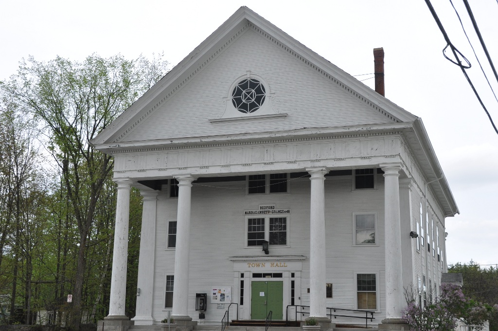
| image_skyline | Presbyterian Church, Bedford NH.jpg |
| image_seal | Bedford Town Seal.png |
| image_caption | Bedford Presbyterian Church |
| image_map | Hillsborough-Bedford-NH.png |
| mapsize | 250px |
| map_caption | Location in Hillsborough County, New Hampshire |
| settlement_type | Town |
| subdivision_type | Country |
| subdivision_name | United States |
| subdivision_type1 | State |
| subdivision_name1 | New Hampshire |
| subdivision_type2 | County |
| subdivision_name2 | Hillsborough |
| leader_title | Town Council |
| leader_name | |
| leader_title1 | Town Manager |
| leader_name1 | Rick Sawyer |
| established_title | Incorporated |
| established_date | 1750 |
| area_footnotes | |
| area_total_km2 | 85.6 |
| area_land_km2 | 84.9 |
| area_water_km2 | 0.7 |
| area_water_percent | 0.85 |
| population_as_of | 2020 |
| population_footnotes | |
| population_total | 23322 |
| population_density_km2 | 274.7 |
| timezone | Eastern |
| utc_offset | −5 |
| timezone_DST | Eastern |
| utc_offset_DST | −4 |
| coordinates | |
| elevation_ft | 308 |
| website | |
| postal_code_type | ZIP code |
| postal_code | 03110 |
| area_code | 603 |
| area_code_type | Area code |
| blank_name | FIPS code |
| blank_info | 33-011-04500 |
| blank1_name | GNIS feature ID |
| blank1_info | 0873541 |
| named_for | John Russell, 4th Duke of Bedford |
Bedford is a town in Hillsborough County, New Hampshire, United States. At the 2020 census, the population was 23,322, reflecting a growth of 10% from 2010. Bedford is a suburb of Manchester, New Hampshire's largest city.
History
In 1733, the Province of Massachusetts Bay established Bedford as "Narragansett, No. 5" for the benefit of soldiers who fought against the Narragansett people in Rhode Island. The area was also known as "Souhegan East". The settlement was incorporated as "Bedford" in 1750, and was named for John Russell, 4th Duke of Bedford. Lord Russell, a close friend of Governor Benning Wentworth, was the Secretary of State for the Southern Department from 1748 to 1751, and his first wife, Diana Spencer, was cousin of the influential Duke of Marlborough.
The first English settlers in Bedford were Robert and James Walker III. [//upload.wikimedia.org/wikipedia/commons/7/7e/SettlementMarker.JPG A monument] dated 1737 stands on what is now known as Station Road (adjacent to Hawthorne Drive), marking the first settlement. Bedford's first moderator was Mayor John Goffe, son of the Colonel John Goffe after whom Goffstown was named.
In 1874, Bedford was served by the Concord Railroad, and service by the Manchester and Ashburnham Railroad was being planned.
Bedford grew rapidly in the second half of the 20th century. The 2000 population of 18,274 was over eight times the population in 1950 of 2,176. Every decade in that period had a substantial rate of growth, ranging from 33 percent between 1980 and 1990 to a 67 percent increase between 1950 and 1960. As of the 2020 census, Bedford was the 11th largest municipality in the state, with a population of 23,322.
Geography
According to the United States Census Bureau, the town has a total area of 85.6 km2, of which 84.9 sqkm are land and 0.7 sqkm are water, comprising 0.85% of the town. The largest body of water other than the Merrimack River is Sebbins Pond, which is connected to smaller, neighboring bodies of water by Sebbins Brook.
A rock formation called Pulpit Rock (originally the Devil's Pulpit) is located in the northwestern part of the town on New Boston Road and is the feature of the town-owned Pulpit Rock Conservation Area. The highest point in Bedford is Holbrook Hill, at 845 ft above sea level, located in the extreme northwestern corner of town. Bedford lies fully within the Merrimack River watershed.
Transportation
Two major highways run through Bedford. The Everett Turnpike runs north-south, and Route 101 runs east-west. The segment of the Everett Turnpike north of NH 101 and the segment of NH 101 east of the Everett Turnpike are designated Interstate 293; I-293 turns at this interchange. The portion of Route 101 in eastern Bedford from New Hampshire Route 114 to the Manchester border is a freeway, while the remainder of the route through the town is a surface road. US 3 also runs through Bedford.
Manchester–Boston Regional Airport is one town away, in Manchester.
A proposed extension of the MBTA Commuter Rail's Lowell Line would see trains being extended to the neighboring city of Manchester, making stops at Nashua and Bedford along the way. The proposed Bedford/MHT station stop would be located in Bedford underneath the Raymond Wieczorek Drive Bridge, and is intended to serve both the town of Bedford and Manchester-Boston Regional Airport.
Government and politics
Bedford is part of New Hampshire's 1st congressional district, currently represented by Democrat Chris Pappas. Bedford is part of the Executive Council of New Hampshire's 4th district, currently represented by Republican Ted Gatsas. In the State Senate, Bedford is part of New Hampshire's 9th State Senate district, currently represented by Republican Denise Ricciardi. Bedford is currently represented in the New Hampshire House of Representatives by Ted Gorski, Linda Gould, Kristin Noble, Brian Labrie, Loren Foxx, John Schneller, and Catherine Rombeau.
Bedford has long been a Republican stronghold in New Hampshire, voting for the GOP presidential nominee as far back as records are available. In 2020, the Republican winning streak in Bedford was finally broken as Democrat Joe Biden won the town with approximately 51.5% of the vote. The Democratic trend continued when Kamala Harris, the Democratic nominee in the 2024 United States presidential election, won the town with just under 51% of the vote.
Bedford was one of only four towns in New Hampshire where Democrats backed Hillary Rodham Clinton when she sought the Democratic nomination for president in both 2008 and 2016.
| Year | Democratic | Republican | Third parties |
|---|---|---|---|
| 2024 | 50.7% 7,444 | 47.4% 6,963 | 1.9% 275 |
| 2020 | 51.0% 7,521 | 47.8% 7,052 | 1.1% 166 |
| 2016 | 44.1% 5,851 | 51.4% 6,816 | 4.4% 600 |
| 2012 | 36.7% 4,713 | 62.3% 7,990 | 0.9% 114 |
| 2008 | 40.5% 5,115 | 59.2% 7,442 | 0.6% 61 |
| 2004 | 37.1% 4,047 | 62.6% 6,836 | 0.3% 37 |
| 2000 | 35.3% 3,624 | 62.2% 6,381 | 2.5% 256 |
| 1996 | 37.8% 3,064 | 55.1% 4,467 | 6.7% 573 |
| 1992 | 27.8% 2,251 | 51.3% 4,145 | 20.8% 1,685 |
| 1988 | 22.0% 1,499 | 77.0% 5,237 | 1.0% 69 |
| 1984 | 19.4% 1,034 | 80.4% 4,294 | 0.3% 13 |
| 1980 | 17.9% 853 | 71.3% 3,400 | 10.8% 513 |
| 1976 | 31.7% 1,059 | 67.1% 2,240 | 1.0% 34 |
| 1972 | 21.1% 655 | 75.9% 2,360 | 3.1% 96 |
| Year | Office | Results |
|---|---|---|
| 2010 | Senator | Ayotte 73–25% |
| House | Guinta 65–31% | |
| Governor | Stephen 52–46% | |
| 2012 | President | Romney 62–37% |
| House | Guinta 60–37% | |
| Governor | Lamontagne 59–39% | |
| 2014 | Senator | Brown 62–38% |
| House | Guinta 63–37% | |
| Governor | Havenstein 61–39% | |
| 2016 | President | Trump 51–44% |
| Senator | Ayotte 59–38% | |
| House | Guinta 50–37% | |
| Governor | Sununu 59–38% | |
| 2018 | House | Pappas 50–49% |
| Governor | Sununu 62–37% | |
| 2020 | President | Biden 51–48% |
| Senator | Shaheen 54–45% | |
| House | Mowers 49–49% | |
| Governor | Sununu 71–28% | |
| 2022 | Senator | Hassan 51–47% |
| House | Pappas 52–48% | |
| Governor | Sununu 63–36% | |
| 2024 | President | Harris 51–47% |
| House | Pappas 54–46% | |
| Governor | Ayotte 58–41% |
Demographics
|align-fn=center
| Race | Percentage |
|---|---|
| White, not Hispanic or Latino | 86% |
| Asian | 7% |
| Hispanic or Latino | 3% |
| Black or African American | 2% |
As of the 2020 census, there were 23,322 people residing in the town. The population density was 707 people per square mile. The racial makeup of the town was 86.1% White, 1.5% African American, 1.2% Native American, 7.2% Asian, 0.1% Pacific Islander, 0.4% from some other race, and 1.4% from two or more races. Hispanic or Latino of any race were 3.2% of the population.
As of the 2010 census, There were 7,364 households, out of which 40.9% had children under the age of 18 living with them, 69.8% were headed by married couples living together, 6.5% had a female householder with no husband present, and 20.8% were non-families. 16.5% of all households were made up of individuals, and 7.6% were someone living alone who was 65 years of age or older. The average household size was 2.81 and the average family size was 3.19.
In the town, the age distribution of the population shows 28.6% under the age of 18, 4.7% from 18 to 24, 21.4% from 25 to 44, 31.7% from 45 to 64, and 13.5% who were 65 years of age or older. The median age was 42.3 years. For every 100 females, there were 95.7 males. For every 100 females aged 18 and over, there were 92.1 males.
For the period 2006–2010, the median income for a household in the town was $116,299 (in 2010 dollars), and the median income for a family was $127,589. Full-time male workers had median earnings of $99,366 versus $53,286 for females. The per capita income for the town was $50,952. About 2.7% of families and 3.4% of the population were below the poverty line, including 4.2% of those under age 18 and 1.0% of those age 65 or over. Bedford had the fifth highest average personal income in the state between 2006 and 2010.
Education
The school district is the Bedford School District. There are six schools in Bedford: Memorial Elementary School (National Blue Ribbon School awardee in 2012), Peter Woodbury Elementary School, and Riddle Brook Elementary (National Blue Ribbon School awardee in 2017 and 2023) are neighborhood elementary schools that serve grades K through 4. McKelvie Intermediate School accommodates grades 5 and 6. Ross A. Lurgio Middle School and Bedford High School have served grades 7–8 and 9–12, respectively, since their establishment in 2007.
Ross A. Lurgio Middle School and Bedford High School comprise one 300000 sqft building. The unified construction aimed to take advantage of economies of scale by allowing the schools to share a kitchen, an auditorium, and security guards, but they operate as separate schools with different entrances, bus schedules, start times and end times. Additionally, key-controlled access is required to move between schools.
A portion of Saint Anselm College is located in Bedford. This includes some athletic fields.
Previously Bedford had an agreement with the Manchester School District so that students were sent to Manchester West High School. In 2005 about 900 high school aged residents of Bedford attended Manchester West. Beginning in fall 2007 Bedford stopped sending new students to Manchester West, so it could instead send them to Bedford High. By fall 2009 Bedford no longer sent any levels to Manchester West.
Notable people
· Only people who already have a Wikipedia article may appear here. This establishes notability. · The article must mention how they are associated with Bedford, whether born, raised, or residing. · The fact of their association should have a reliable source cited. · Alphabetical by last name please. · All others will be deleted.
- Silas Aiken (1799–1869), minister, author
- David Atwood (1815–1889), newspaperman, U.S. congressman from Wisconsin; born in Bedford
- Josh Bauer (born 1998), soccer player
- Chris Carpenter (born 1975), pitcher with the St. Louis Cardinals
- Zachariah Chandler (1813–1879), U.S. Secretary of the Interior 1875–1877, U.S. senator from Michigan; born in Bedford
- John Goffe (1701–1786), colonial soldier, other names, "Hunter John"
- Carrie Jones (born 1982), bestselling author of young adult novels; born in Bedford
- Dean Kamen (born 1951), inventor of the Segway HT and the iBOT; owner of Manchester-based DEKA Corporation
- Grant Lavigne (born 1999), minor-league baseball player in the Colorado Rockies system
- Josh Meyers (born 1976), actor, comedian
- Seth Meyers (born 1973), comedian, talk-show host (Saturday Night Live, Late Night with Seth Meyers)
- Mace Moulton (1796–1867), U.S. congressman 1845–1847 (D, NH-AL)
- Rand Pecknold (born 1967), Quinnipiac men's ice hockey coach, 500-game winner in NCAA ice hockey
- Patricia Racette (born 1965), opera singer
- Laura Silverman (born 1966), actress, older sister of actress and comedian Sarah Silverman
- Sarah Silverman (born 1970), comedian, voice actress, writer
- Alex Steeves (born 1999), hockey player for the Toronto Maple Leafs
- John E. Sununu (born 1964), Republican U.S. senator (2003–2009); older brother of former New Hampshire governor Chris Sununu
- Peter Woodbury (1899–1970), judge of the United States Court of Appeals for the First Circuit
- Triple H (born 1969), WWE wrestler
References
References
- "Town Manager". Town of Bedford.
- "2021 U.S. Gazetteer Files – New Hampshire". United States Census Bureau.
- "Bedford town, Hillsborough County, New Hampshire: 2020 DEC Redistricting Data (PL 94-171)". U.S. Census Bureau.
- "Bedford". Statistics and Gazetteer of New-Hampshire, 1875.
- Town of Bedford (N.H.). (1903). "History of Bedford, New Hampshire, from 1737, being statistics compiled on the occasion of the one hundred and fiftieth anniversary of the incorporation of the town, May 15, 1900". Rumford Printing Company.
- "Profile for Bedford, New Hampshire, NH". ePodunk.
- Laybourn, Keith. (2001). "British Political Leaders: A Biographical Dictionary". Keith.
- (1859). "A History and Description of New England, General and Local". A.J. Coolidge.
- (1995). "Water Use in New Hampshire: An Activities Guide for Teachers". U.S. Department of the Interior and U.S. Geological Survey.
- "Nashua - Manchester 40818 {{!}} Project Specific Information {{!}} Project Center {{!}} NH Department of Transportation".
- (November 17, 2021). "Nashua–Manchester (Capitol Corridor) Project Development Phase Public Information Meeting". New Hampshire DOT.
- "Election Results".
- "Decennial Census P.L. 94-171 Redistricting Data Summary Files".
- "Profile of General Population and Housing Characteristics: 2010 Demographic Profile Data, Bedford town, Hillsborough County, New Hampshire (DP-1)". U.S. Census Bureau.
- "SELECTED ECONOMIC CHARACTERISTICS: 2006–2010 American Community Survey 5-Year Estimates (DP-3) – Bedford town, Hillsborough County, New Hampshire (DP-3)". U.S. Census Bureau.
- "SELECTED ECONOMIC CHARACTERISTICS: 2006–2010 American Community Survey 5-Year Estimates (DP-3) – All Towns, New Hampshire". U.S. Census Bureau.
- "2020 CENSUS - SCHOOL DISTRICT REFERENCE MAP: Hillsborough County, NH". [[U.S. Census Bureau]].
- "2020 CENSUS - CENSUS BLOCK MAP: Bedford town, NH". [[U.S. Census Bureau]].
- (2023-12-04). "TOWN OF BEDFORD CONSERVATION COMMISSION MINUTES SITE WALK AT SAINT ANSELM COLLEGE – TRACK AND FIELD STADIUM". Town of Bedford Conservation Commission.
- (January 11, 2005). "20-year tuition pact between Bedford, city taken". [[New Hampshire Union Leader]].
- (January 10, 2006). "Bedford withdrawal from West approved". [[New Hampshire Union Leader]].
- Kingsbury, John Dennison. (1870). "Sketch of Rev. Silas Aiken". Welch, Bigelow and Company.
- "ATWOOD, David (1815 - 1889)". United States Congress.
- "Joshua Bauer".
- "Chris Carpenter". New Hampshire.com.
- "Zachariah Chandler - American politician".
- Daughters of the American Revolution. (1905). "Lineage Book – National Society of the Daughters of the American Revolution, Volume 19". Daughters of the American Revolution.
- (September 25, 2008). "An Interview with Carrie Jones". The Fictionistas.
- "Dean Kamen's House Rivals Best Industrial Museums". Design News.
- "For Seth Meyers, you can go home again". Bedford Journal.
- Dobbs, Katelyn. "For Seth Meyers, you can go home again". Bedford Journal.
- "Biography of HON. MACE MOULTON of Manchester NH". GENEALOGY AND HISTORY OF MANCHESTER NEW HAMPSHIRE TRANSCRIBED BY JANICE BROWN.
- (November 11, 2009). "A Soprano's Hat Trick: Puccini Triple Bill".
- "Hollywood sisters say farewell to Granite State roots - New Hampshire".
- (2010). "Screen World 2006". Hal Leonard Corporation.
- "Candidate Profile from Congressional Quarterly: John E. Sununu (R) of Bedford". CNN.com.
- "Woodbury, Peter". Federal Judicial Center.
This article was imported from Wikipedia and is available under the Creative Commons Attribution-ShareAlike 4.0 License. Content has been adapted to SurfDoc format. Original contributors can be found on the article history page.
Ask Mako anything about Bedford, New Hampshire — get instant answers, deeper analysis, and related topics.
Research with MakoFree with your Surf account
Create a free account to save articles, ask Mako questions, and organize your research.
Sign up freeThis content may have been generated or modified by AI. CloudSurf Software LLC is not responsible for the accuracy, completeness, or reliability of AI-generated content. Always verify important information from primary sources.
Report