From Surf Wiki (app.surf) — the open knowledge base
Sultan Bathery
Town in Kerala, India

Town in Kerala, India
| Field | Value |
|---|---|
| name | Sulthan Bathery |
| settlement_type | Municipal town |
| image_skyline | Jaina2.jpg |
| pushpin_map | India Kerala#India |
| pushpin_label_position | right |
| pushpin_map_caption | Location in Kerala, India |
| coordinates | |
| subdivision_type | Country |
| subdivision_name | India |
| subdivision_type1 | State |
| subdivision_name1 | Kerala |
| subdivision_type2 | District |
| subdivision_name2 | Wayanad |
| established_title | |
| named_for | artillery battery of Tipu Sultan |
| leader_title | Municipal Chairperson |
| leader_name | Raseena Abdulkhadar |
| unit_pref | Metric |
| area_total_km2 | 155.01 |
| elevation_m | 901 |
| population_total | 45,417 |
| population_as_of | 2011 |
| population_density_km2 | auto |
| blank1_name_sec1 | Sex ratio |
| blank1_info_sec1 | 1,029 male/female |
| blank2_name_sec1 | Literacy |
| blank2_info_sec1 | 89.36% |
| demographics_type1 | Languages |
| demographics1_title1 | Official |
| demographics1_info1 | Malayalam, English |
| timezone1 | IST |
| utc_offset1 | +5:30 |
| postal_code_type | PIN |
| postal_code | 673592 |
| area_code | 91 4936 |
| registration_plate | KL-73 |
| iso_code | IN-KL |
| footnotes |
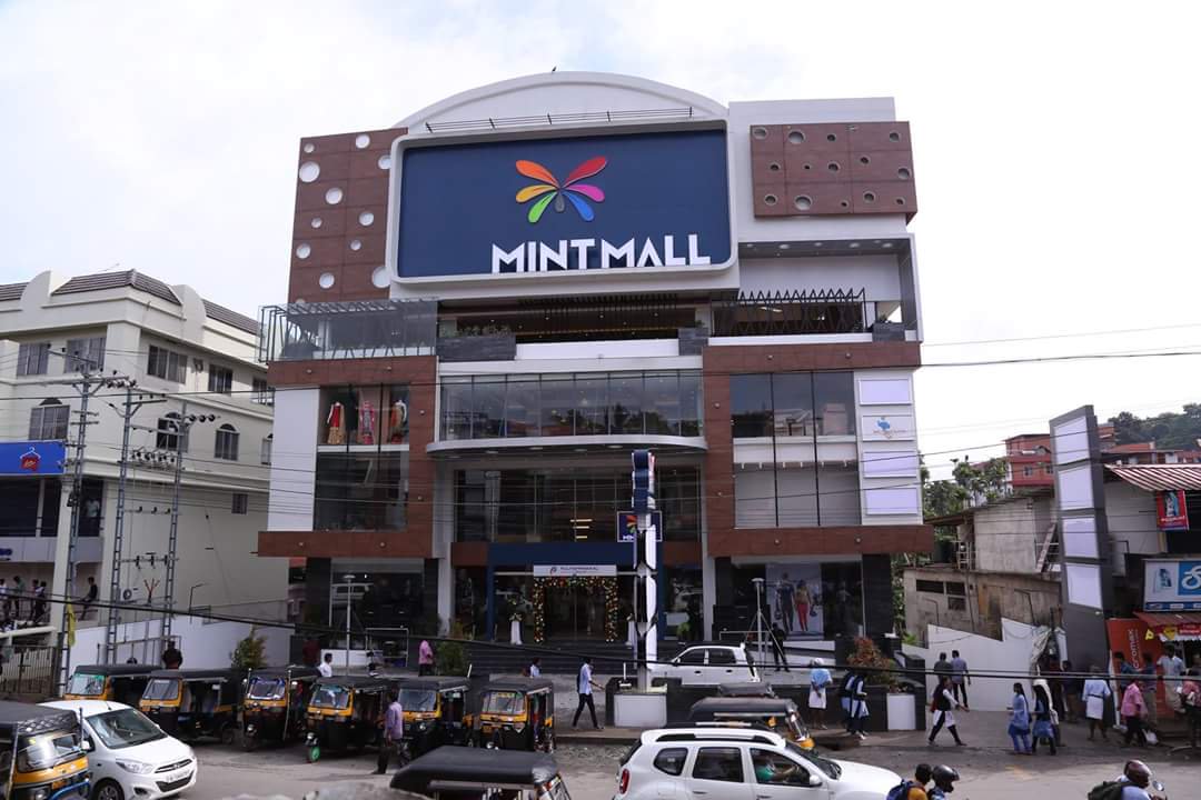
Sulthan Bathery is a major municipal town in the Wayanad district of Kerala, India. It serves as the administrative headquarters of Sulthan Bathery taluk and is the most commercially active urban center in the district.
Etymology
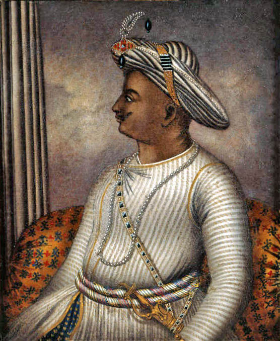
The modern town was part of Kidanganad village, so-called because of the presence of the Kidangan tribe. During the invasion of Malabar by Mysore ruler Tipu Sultan, the town was used by the Mysore army as the storeroom or battery for its ammunition and used a 13th-century Ganapathi Temple located here as a battery. Thus the town known as "Sultan's Battery" was later referred to in British records as "Sultan Bathery".
History
Main article: History of Wayanad
The recorded history of Sultan Bathery, commensurate with that of Wayanad, begins in the 10th century. In 930 AD, Emperor Erayappa of the Ganga dynasty led his troops to what would later become the district in the south-west of Mysore and, after conquering it, called it Bayalnad, meaning the land of swamps. After Erayappa died, his sons Rachamalla and Battunga fought each other for the new kingdom of their father's legacy. Rachamalla was killed and Battunga became the undisputed ruler of Bayalnad.
In the 12th century AD, the Gangas were dethroned by the Kadamba dynasty of North Canara. In 1104 AD, Vishnuvardhana of Hoysala invaded Bayalnad followed by the Vijayanagara dynasty in the 16th century. In 1610 AD, Udaiyar Raja Wadiyar of Mysore drove out Vijayanagara and became the ruler of Bayalnad and the Nilgiris. When Wayanad was under Hyder Ali's rule, the ghat road from Vythiri to Thamarassery was constructed. Later, the British rulers developed this route into Carter Road.
British rule began at the start of the 19th century after the East India Company seized Wayanad from the hands of Pazhassi Raja and administered the district until it was superseded by the British Raj in 1858. Until 1947, Wayanad was under the rule of the Malabar collector. History has it that Wayanad has a rich folk culture that gave way to the British domination of Wayanad. The British named the village Sultan's Battery, which in later history means the Sultan's Armory.
The Edakkal Caves have evidence of the existence of a Neolithic civilisation in Wayanad. According to H. S. Graeme, the Thalassery Sub-Collector T. H. Balan was the first to start a revenue settlement in Wayanad. For administrative convenience, the area was divided into Munnadu, Muthoornadu, Ilangkornadu, Nallurnadu, Edanashankur, Poronnur, Kurumbala, Wayanad, Nambikkoli and Ganapathivattam (Ganapati). The importance and relevance of Ganapati has been mentioned often in the reports. History records that Sultan Bathery later became the place of Ganapati on the roadside during the battle of Hyder Ali and Tipu Sultan.
Ganapati grew as the medieval cities flourished, the four-way street, the main highway, and the center of worship. In 1934, the Kidanganad Panchayat was established. From the administration of the Malabar District Board, Ganapati became the administrative centre of the Kidanganad panchayat. The Niluppuzha Panchayat was formed in 1968 by the division of Kidanganad Panchayat, Nenmeni Panchayat in 1974 and Sultanbathery Panchayat in 1968.
New places of worship and educational institutions have emerged in different parts of the panchayat with the support of Hindu, Muslim and Christian communities. The Ganapati Temple, the Jain Temple and the Malankara Mosque are examples of the ancient history of Sultan Bathery. There is evidence that Sultan Bathery and other parts of Wayanad had been in contact through Tamil, Karnataka and Kodagu villages since medieval times.
Geography
Location
Sultan Bathery is located at , on the Kozhikode–Kollegal National Highway (NH 766) 97 kilometers from Kozhikode. It is 114 km from Mysore and about 100 km from Ooty (Udagamandalam). It is also connected with Nilambur. It has an average elevation of 907 m.
Climate
Sultan Bathery has a humid climate. The mean average rainfall in this area is 2,322 mm. Lakkidi, Vythiri and Meppadi are the high rainfall areas in Wayanad. The annual rainfall in these areas ranges from 3,000 to 4,000 mm. High-velocity winds are common during the southwest monsoon season and dry winds blow in March and April. High altitude regions experience severe cold. In Wayanad (Ambalavayal) the mean maximum and minimum temperature for the last five years were 29 °C and 18 °C respectively. This place experiences high relative humidity, which can rise to 95 per cent during the southwest monsoon period. Generally the year is classified into four seasons, namely, the cold weather (December–February), hot weather (March–May), southwest monsoon (June–September), and northeast monsoon (October–November) seasons.
| 26.3|28.3|30.0|30.1|29.1|25.7|24.2|24.8|25.7|26.1|25.8|25.7 | 15.6|16.8|18.5|19.9|20.1|19.1|18.8|18.7|18.5|18.6|17.6|16.1 | 3|8|14|89|171|451|903|497|225|220|79|21
Religion and worship
In ancient times, the region was home to the native tribes of Chettiars, Paniyar, Kurumar and Urali Nayakkar. Although there are many ethnic groups among the people, their main occupation is agriculture. The panchayath has 26 temples, 15 churches and 15 mosques. Sultan Bathery has a Jain temple that is about 2,000 years old. The center, which is in the possession of the Department of Archeology, has no festivals other than temple rituals. The festival at Sultan Bathery Mariamman Kovil is one of the festivals celebrated here. It is considered to be the national festival of Bathery. Similar festivals are celebrated in the Bathery Mahaganapathi Temple, Kuppadi Devi Temple and Karivallikkunnu Temple.
Notable landmarks
Main article: Tourist attractions in Wayanad

- Saint Mary Orthodox Cathedral and Pilgrim Centre is the oldest church in Sultan Bathery, established in 1944. The church has the holy relics of three saints and is the headquarters of Sultan Bathery Diocese of the Malankara Orthodox Syrian Church the administrative head of the 48 orthodox parishes in the area. There is also the Nirmalagiri Aramana where the diocesan metropolitan resides in Poomala.
- Edakkal caves are located 10 km from Sultan Bathery and are noted for anthropological research. The caves are two natural rock formations believed to have been formed by a large split in a huge rock.
- Sultan Bathery Jain Temple is one of the prominent Jain temples in Kerala, believed to have been built in the 13th century. This Mahavir stone temple at Kidanganad in Sultan Bathery is also known as Digambara Jain Temple and Kidanganad Basti. The temple architecture, inscriptions and drawings on the pillars and walls are strongly influenced by the architectural style of the Vijayanagara dynasty. An inscription on one of the pillars depicts Dharnendra Bandanam, in the form of a coiled snake.
- Krishnagiri Stadium is a cricket stadium located in Krishnagiri village in Wayanad. It holds up to 20,000 people and at 2,100 feet above sea level is the highest-altitude stadium used exclusively for cricket.
- Thovarimala Ezhuthupara
- Wayanad Heritage Museum, Ambalavayal
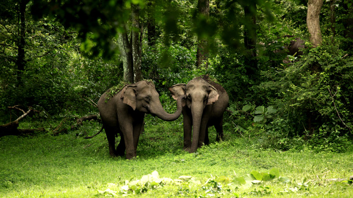
- Wayanad Wildlife Sanctuary houses a wide range of mammals, birds and other fauna. The mammals include elephants, tigers, panthers, jungle cats, civet cats, monkeys, wild dogs, bison, deer, and bears. More than 200 species of birds, including peacocks, babblers, cuckoos, owls, woodpeckers and jungle fowl, and 45 species of reptiles like monitor lizard and a variety of snakes and tortoises reside there.
Transport

Sultan Bathery has very good road connectivity with south Indian states. The major road is NH 766 which connects to Mysore, Bangalore and Kozhikode, two state highways connected to Ooty and Coimbatore and a state highway connected to Mangalore, Kannur, Thalassery and Kasaragod. Sultan Bathery is the biggest transport hub of Wayanad district. It is located near the border with the Karnataka state.
There is a major Kerala Transport Depot in Sultan Bathery. Most of the long-distance buses to Kozhikode, Ooty and Bangalore start from this depot. The town also has two smaller bus stations for local travellers. The Periya ghat road connects Mananthavady to Kannur and Thalassery. The Thamarassery mountain road connects Calicut with Kalpetta. The Kuttiady mountain road connects Vatakara with Kalpetta and Mananthavady. The Palchuram mountain road connects Kannur and Iritty with Mananthavady. The road from Nilambur to Ooty is also connected to Wayanad through the village of Meppadi.
The nearest railway stations are at Mysore and Calicut. The nearest airports are at Mysore, Calicut and Kannur.
Politics
The Sultan Bathery assembly constituency is part of the Wayanad Lok Sabha constituency. Its member of parliament is Priyanka Gandhi of the Indian National Congress (INC) party,{{cite web |access-date = 19 October 2008 |url-status = dead |archive-url = https://web.archive.org/web/20090304011026/http://archive.eci.gov.in/se2001/background/S11/KL_Dist_PC_AC.pdf |archive-date = 4 March 2009
The Sultan Bathery Municipality was governed by the Left Democratic Front (LDF) since 2015. On general election 2025 UDF came to power for the first time after formation of municipality .
- Chairperson: Raseena Abdulkhader (IUML )
- Vice Chairperson: Indrajith M G (INC)
Since its establishment in 1962, the Bathery panchayat (council) has mainly been held by the INC-led United Democratic Front (UDF). P. C. Ahmed Haji of the Indian Union Muslim League was the first president and held office for three decades. The LDF was in power for only eight months in 2005 with the help of the Democratic Indira Congress (Kerala) party. The president was CK Sahadevan, who later became the first chairman when it was converted to a municipality in 2015.
Municipality Chairperson
Source:
| No: | Name | Party | colspan="2" | Year | Division | 1 | 2 | 3 | 4 | |
|---|---|---|---|---|---|---|---|---|---|---|
| C. K. Sahadevan | CPI(M) | 18 November 201503/04/2018 | 1st | Beenachi | ||||||
| T. L. Sabu | Kerala Congress (M) | 26 April 201811 November 2020 | Kattayad | |||||||
| T. K. Ramesh | CPI(M) | 28 December 2020 20 December 2025 | 2nd | Dottappankulam | ||||||
| Raseena Abdulkhadar | IUML | 26 December 2025 incumbent | 3rd | C Kunnu |
Members of Legislative Assembly
Source:
| Election | Niyama Sabha | Member | Party | Tenure | |
|---|---|---|---|---|---|
| 1977 | 5th | K. Raghavan Master | INC | Indian National Congress}}" | |
| 1980 | 6th | K. K. Ramachandran Master | 1980–1982 | ||
| 1982 | 7th | 1982–1987 | |||
| 1987 | 8th | 1987–1991 | |||
| 1991 | 9th | K. C. Rosakutty | 1991–1996 | ||
| 1996 | 10th | P. V. Varghese Vaidyar | CPI(M) | Communist Party of India (Marxist)}}" | |
| 2001 | 11th | N. D. Appachan | INC | Indian National Congress}}" | |
| 2006 | 12th | P. Krishna Prasad | CPI(M) | Communist Party of India (Marxist)}}" | |
| 2011 | 13th | I. C. Balakrishnan | INC | Indian National Congress}}" | |
| 2016 | 14th | 2016–2021 | |||
| 2021 | 15th | 2021–2026 |
Municipality Vice Chairperson
Source:
| No: | Name | Party | colspan="2" | Year | Division | 1 | 2 | 3 | |
|---|---|---|---|---|---|---|---|---|---|
| Jisha Shaji | CPI(M) | 18/11/2015–11 November 2020 | 1st | Kuppady | |||||
| Elsy Paulose | CPI(M) | 28/12/2020–20/12/2025 | 2nd | Sultan Bathery | |||||
| Indrajith M G | INC | 26/12/2020–incumbent | 3rd | Cheroorkunnu |
Grama Panchayat President
Source:
| No: | Name | Party | Year | 1 | 2 | 3 | 4 | 5 | 6 | 7 | 8 | 9 | 10 | 11 | 12 | 13 | 14 |
|---|---|---|---|---|---|---|---|---|---|---|---|---|---|---|---|---|---|
| P. C. Ahamad Haji | IUML | 1969-1978 | |||||||||||||||
| Special Officer | – | 1978–1980 | |||||||||||||||
| P. C. Ahamad Haji | IUML | 1980–1985 | |||||||||||||||
| Special Officer | – | 1985-1988 | |||||||||||||||
| P. C. Ahamad Haji | IUML | 1988-1995 | |||||||||||||||
| P. C. Ahamad Haji | IUML | 1995-1998 | |||||||||||||||
| N. M. Vijayan | INC | 1998–2000 | |||||||||||||||
| Nafeeza Ahamad koya | IUML | 2000–2005 | |||||||||||||||
| C. K. Sahadevan | CPI(M) | 2005–2006 | |||||||||||||||
| Babu Pazhupathoor | INC | 2006-2006 | |||||||||||||||
| Radha Raveendran | INC | 2006–2009 | |||||||||||||||
| O. M. George | INC | 2009–2010 | |||||||||||||||
| P. P. Ayyoob | IUML | 2010–2012 | |||||||||||||||
| O. M. George | INC | 2012–2015 |
Municipality
Notable residents
- Basil Joseph, director and actor in the Malayalam film industry
References
References
- "Archaeological Survey of India".
- Nair, Susheela. (2023-08-28). "Sulthan Bathery: The journey from an ammunition depot to Kerala's cleanest town".
- (11 April 2024). "History of Sulthan Bathery, which Kerala BJP chief wants renamed as Ganapathyvattam".
- Moraes, George M.. (1931). "The Kadamba Kula". B. X. Furtado & Sons.
- ''Madras District Gazetteers – the Nilgiris'' by W. Francic, pages 90–104. Madras, 1908.
- Report of the Administration of Mysore, 1863–64. British Parliament Library.
- "Maps, Weather, and Airports for Sultans Battery, India".
- "Mysore to Sulthan Bathery". mysore.ind.in.
- "Sulthan Bathery climate: Average Temperature, weather by month, Sulthan Bathery weather averages - Climate-Data.org".
- "ചരിത്രം | Sulthanbatherymunicipality.gov.in".
- "Sultan Bathery Diocese".
- "Diocese of Sultan Bathery". MOSC Publications.
- (11 April 2024). "Road from Meppadi to Nilambur-Ooty Highway".
- "Members of Kerala Legislative Assembly: Sulthan Bathery". Maps of India.
- S, Harikumar J.. (10 October 2018). "Basil Joseph on his side-splitting act and Thiruvananthapuram dialect in 'Padayottam'". The Hindu.
This article was imported from Wikipedia and is available under the Creative Commons Attribution-ShareAlike 4.0 License. Content has been adapted to SurfDoc format. Original contributors can be found on the article history page.
Ask Mako anything about Sultan Bathery — get instant answers, deeper analysis, and related topics.
Research with MakoFree with your Surf account
Create a free account to save articles, ask Mako questions, and organize your research.
Sign up freeThis content may have been generated or modified by AI. CloudSurf Software LLC is not responsible for the accuracy, completeness, or reliability of AI-generated content. Always verify important information from primary sources.
Report