From Surf Wiki (app.surf) — the open knowledge base
Eastern Shore of Virginia
Region of Accomack and Northampton counties, Virginia, United States

Region of Accomack and Northampton counties, Virginia, United States
| Field | Value |
|---|---|
| official_name | Eastern Shore of Virginia |
| image_map | Eastern Shore of Virginia - Location.svg |
| map_caption | Eastern Shore of Virginia |
| subdivision_type | Country |
| subdivision_name | United States |
| subdivision_type1 | State |
| subdivision_name1 | Virginia |
| subdivision_type2 | Largest city |
| subdivision_name2 | Chincoteague |
| subdivision_type3 | Counties |
| subdivision_name3 | {{Collapsible list |
| established_title | |
| unit_pref | |
| area_total_sq_mi | 2105 |
| elevation_ft | |
| population_total | 45,695 |
| population_as_of | 2020 Census |
| population_density_sq_mi | auto |
| timezone | EST |
| utc_offset | −5 |
| timezone_DST | EDT |
| utc_offset_DST | −4 |
| postal_code_type |
|Accomack |Northampton
The Eastern Shore of Virginia is the easternmost region of the Commonwealth of Virginia in the United States. It consists of two counties (Accomack and Northampton) on the Atlantic coast. It is detached from the mainland of Virginia by the Chesapeake Bay. The 70 mi region is part of the Delmarva Peninsula. Its population was 45,695 as of 2020.
History
Accomac Shire was established in the Virginia Colony by the House of Burgesses in 1634 under the direction of King Charles I. It was one of the original eight shires of Virginia, and consisted of the whole of Virginia's Delmarva territory. The shire's name comes from the Native American word Accawmack, which means, "the other shore".
In 1642, the name was changed to Northampton County. (In England, "shires" and "counties" are the same thing.) In 1663, Northampton County was split into two counties. The northern two thirds took the original Accomac name, while the southern third remained as Northampton.
In 1670, the Virginia Colony's Royal Governor William Berkeley abolished Accomac County, but the Virginia General Assembly re-created it in 1671. In 1940, the General Assembly officially added a "k" to the end of the county's name to arrive at its current spelling, which is Accomack.{{Cite web |access-date=September 23, 2012 |url-status=dead |archive-url=https://web.archive.org/web/20121028092711/http://usgwarchives.org/va/accomack.htm |archive-date=October 28, 2012 | access-date = September 23, 2012
Geography
The terrain is overall very flat, ranging from sea level to just 50 ft above sea level. It is characterized by sandy and deep soil. The weather in the area has temperate summers and winters, significantly affected by the Chesapeake Bay and the Atlantic Ocean. The rural area has long been devoted to cotton, soybean, vegetable and truck farming, and large-scale chicken farms. Since the late 20th century, vineyards have been developed in both counties, and the Eastern Shore has received recognition as an American Viticultural Area (AVA).
The region has more than 78,000 acres of preserved parks, refuges, preserves and a national seashore and is a popular outdoor recreation destination for fishing, boating, hiking and kayaking. It is also an important birding hotspot along the Atlantic Flyway at the southernmost tip of the Delmarva Peninsula. There are public beaches at Cape Charles, Kiptopeke State Park, Savage Neck Dunes Natural Area Preserve, Tangier Island and the Chincoteague National Wildlife Refuge abutting the Assateague Island National Seashore.
.jpg)
The area includes 70 miles of barrier islands, the longest chain of undeveloped barrier islands in the global temperate zone and a United Nations International Biosphere Reserve. At the northern end of the Atlantic side is the beach community of Chincoteague, famous for its annual wild pony roundup, gathered from Assateague Island. Wallops Flight Facility, a NASA space launch base, is located near Chincoteague. At the southern end of the Chesapeake Bay coast, the beach community of Cape Charles, a historic railroad town, is home to the Cape Charles Yacht Center, a super yacht service center. The town of Wachapreague on the Atlantic coast is a popular destination for fishing and guided trips out to the wild barrier islands. Onancock, a harbor town on the Chesapeake Bay, has a ferry service to Tangier Island, off the western shore in the Chesapeake Bay, during spring, summer and fall.
Culture
Some maps of Virginia do not include the Eastern Shore. Encyclopedia Virginias logo began depicting the region in 2018, after the inauguration of Ralph Northam, the second Governor of Virginia from the Eastern Shore. Geographically removed from the rest of Virginia, it has had a unique history of settlement and development influenced by agriculture, fishing, tourism, and the Pennsylvania Railroad. William G. Thomas describes the Eastern Shore during the late 19th and early 20th century as "a highly complex and interdependent landscape". He continues:
It was a liminal place, a zone of interpenetration, where the settlement patterns, speech, demography, and political outcomes defined its place in the South but its engagement with technology and rapid transformation of the landscape betrayed other allegiances, motives, forces, and effects.
Transportation
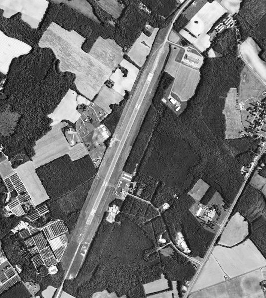
Airports
- Accomack County Airport, in Melfa
- Campbell Field Airport, in Weirwood
- Tangier Island Airport, on Tangier Island
Highway
The 17.6 mi Chesapeake Bay Bridge–Tunnel, which is part of U.S. Route 13, spans the mouth of the Bay and connects the Eastern Shore to South Hampton Roads and the rest of Virginia. Before the Chesapeake Bay Bridge–Tunnel was built in 1964, the Little Creek-Cape Charles Ferry provided the continuation of U.S. 13 across this stretch of water.
U.S Highways
- (Accomac)
- (Cape Charles)
State Routes
Public transportation
STAR Transit provides public transit services for both Accomack and Northampton counties, serving both with fixed-route bus and paratransit operations.
Railroads
- Delmarva Central Railroad (former)
Trails
- Eastern Shore of Virginia Rail Trail (under construction)
Media
Newspapers
The area is served by the locally owned and operated weekly Eastern Shore Post and the monthly publication Eastern Shore First. Radio stations WESR (AM) and WESR-FM operate the local news website ShoreDailyNews.com.
Radio stations
The region has a number of radio stations with broadcasting towers located on the Eastern Shore. In addition to the ones listed below, the southern portion of Northampton County can receive stations from Hampton Roads reliably. Also, localities in the north of Accomack County can receive stations from the Salisbury/Ocean City, Maryland area.
| Call sign | Frequency | Band | City of license | Format | Notes | WESR (AM) | WMVA | WHAR | WHRX | WZLV | W218CQ | WHRE | WROX | WCCZ | WHRF | WOWZ | WVES | WESR-FM | W289CE |
|---|---|---|---|---|---|---|---|---|---|---|---|---|---|---|---|---|---|---|---|
| 1330 | AM | Onley-Onancock | Country music | ||||||||||||||||
| 88.9 | FM | Painter | Gospel music | ||||||||||||||||
| 89.1 | FM | Cheriton | Contemporary Christian | Air1 | |||||||||||||||
| 90.1 | FM | Nassawadox | NPR/Variety | rebroadcasts WHRV | |||||||||||||||
| 90.7 | FM | Cape Charles | Contemporary Christian | K-Love | |||||||||||||||
| 91.5 | FM | Accomac | Christian radio | Bible Broadcasting Network | |||||||||||||||
| 91.9 | FM | Eastville | NPR/Variety | rebroadcasts WHRV | |||||||||||||||
| 96.1 | FM | Exmore | Alternative rock | ||||||||||||||||
| 96.9 | FM | Nassawadox | Classic hits | ||||||||||||||||
| 98.3 | FM | Belle Haven | Classical music | rebroadcasts WHRO-FM | |||||||||||||||
| 99.3 | FM | Accomac | Classic Country | ||||||||||||||||
| 101.5 | FM | Chincoteague | Adult hits | rebroadcasts WCTG | |||||||||||||||
| 103.3 | FM | Onley-Onancock | Adult contemporary | ||||||||||||||||
| 105.7 | FM | Onley-Onancock | Country music | rebroadcasts WESR (AM) |
Demographics
20102020
| Race / Ethnicity (NH = Non Hispanic) | Pop 2010 | % 2010 |
|---|---|---|
| White alone (NH) | 27,021 | 26,757 |
| Black alone (NH) | 13,744 | 12,395 |
| Hispanic (any race) | 3,724 | 4,498 |
| Asian alone (NH) | 258 | 329 |
| American Indian and | 123 | 123 |
| Pacific Islander alone (NH) | 36 | 9 |
| Some other race alone (NH) | 59 | 129 |
| Mixed Race or Multiracial (NH) | 588 | 1,455 |
| Total | 45,553 | 45,695 |
Politics
| Year | Democratic | Republican | Others |
|---|---|---|---|
| 2024 | 45.7% 10,977 | 53.4% 12,842 | 0.9% 213 |
| 2020 | 47.5% 11,245 | 51.2% 12,127 | 1.4% 322 |
| 2016 | 45.5% 9,995 | 51.3% 11,269 | 3.3% 722 |
| 2012 | 50.6% 11,396 | 48.3% 10,889 | 1.1% 257 |
| 2008 | 51.4% 11,407 | 47.5% 10,546 | 1.2% 256 |
| 2004 | 44.0% 8,293 | 55.1% 10,395 | 0.9% 167 |
| 2000 | 44.2% 7,432 | 51.4% 8,651 | 4.4% 734 |
| 1996 | 46.9% 7,789 | 40.8% 6,776 | 12.3% 2,037 |
| 1992 | 40.1% 7,518 | 41.4% 7,754 | 18.5% 3,471 |
| 1988 | 40.6% 6,685 | 57.6% 9,488 | 1.8% 296 |
| 1984 | 37.2% 6,581 | 62.0% 10,953 | 0.8% 139 |
| 1980 | 46.9% 7,235 | 48.8% 7,546 | 4.3% 670 |
| 1976 | 50.9% 7,266 | 45.8% 6,537 | 3.3% 468 |
| 1972 | 28.3% 3,652 | 70.3% 9,083 | 1.4% 184 |
| 1968 | 29.5% 3,885 | 35.3% 4,641 | 35.2% 4,629 |
| 1964 | 51.5% 5,044 | 48.3% 4,731 | 0.1% 11 |
| 1960 | 53.6% 4,731 | 46.0% 3,671 | 0.4% 31 |
The Eastern Shore is politically divided, with Accomack County generally voting for the Republican Party and Northampton County generally voting for the Democratic Party. As a whole, the Shore is generally a competitive region, but also leans Republican owing to Accomack's larger share of the population.
It voted against the presidential winner in 2020 and 1992. Also, Democrats won Virginia in 2016, 2020, and 2024, but lost the Eastern Shore each time. In the 2017 gubernatorial election, it gave 50.5% of the vote to Republican Ed Gillespie and 49.0% of the vote to Democrat Ralph Northam, with Northam winning the election statewide. In the 2025 gubernatorial election, it also voted against Democrat Abigail Spanberger, despite Spanberger winning statewide by 15%.
It is represented in the U.S. House of Representatives by Republican Jen Kiggans, in the Virginia Senate by Republican Bill DeSteph, and in the Virginia House of Delegates by Republican Robert Bloxom Jr.
References
References
- "QuickFacts: Virginia, United States". United States Census Bureau.
- "About the County". Accomack County.
- [http://wine.appellationamerica.com/wine-region/Virginia's-Eastern-Shore.html "Virginia's Eastern Shore (AVA): Appellation Description"], ''Appellation America'', 2007, Retrieved January 31, 2008
- "What's At the Corners of Virginia?".
- [http://southernspaces.org/2007/countryside-transformed-eastern-shore-virginia-pennsylvania-railroad-and-creation-modern-landsc William G. Thomas, "The Countryside Transformed: The Eastern Shore of Virginia, the Pennsylvania Railroad, and the Creation of a Modern Landscape"] {{webarchive. link. (2011-01-10 , ''Southern Spaces'', 31 July 2007)
- "Population and Housing Unit Count, Virginia: 2000". [[US Census Bureau]].
- "Accomack Profile of General Demographic Characteristics: 2000". [[US Census Bureau]].
- "Northampton Profile of General Demographic Characteristics: 2000". [[US Census Bureau]].
- "Accomack Census Data". [[US Census Bureau]].
- "Northampton Census Data". [[US Census Bureau]].
- "Northampton Quick Facts". [[US Census Bureau]].
- "Accomack Quick Facts". [[US Census Bureau]].
- "Accomack 2010 Census Race Data".
- "Northampton 2010 Census Race Data".
- "Accomack 2020 Census Race Data".
- "Northampton 2020 Census Race Data".
- "Our Campaigns".
- "VA Governor". Our Campaigns.
- "Democrat Abigail Spanberger wins Virginia governor's race".
- "Senate of Virginia".
- "Virginia House of Delegates Member Listings".
- "{{!}} house.gov".
This article was imported from Wikipedia and is available under the Creative Commons Attribution-ShareAlike 4.0 License. Content has been adapted to SurfDoc format. Original contributors can be found on the article history page.
Ask Mako anything about Eastern Shore of Virginia — get instant answers, deeper analysis, and related topics.
Research with MakoFree with your Surf account
Create a free account to save articles, ask Mako questions, and organize your research.
Sign up freeThis content may have been generated or modified by AI. CloudSurf Software LLC is not responsible for the accuracy, completeness, or reliability of AI-generated content. Always verify important information from primary sources.
Report