From Surf Wiki (app.surf) — the open knowledge base
Dallas County, Texas
County in Texas, United States
_UTA.jpg)
County in Texas, United States
| Field | Value |
|---|---|
| county | Dallas County |
| state | Texas |
| ex image | |
| type | County |
| flag | Flag of Dallas County, Texas.svg |
| seal | Dallas County, TX seal.png |
| coordinates | |
| founded year | 1846 |
| founded date | March 30 |
| named for | George M. Dallas |
| seat wl | Dallas |
| largest city wl | Dallas |
| leader_title | County judge |
| leader_name | Clay Jenkins |
| area_total_sq_mi | 908.644 |
| area_land_sq_mi | 873.160 |
| area_water_sq_mi | 35.484 |
| area percentage | 3.91% |
| population_as_of | 2020 |
| population_total | 2613539 |
| pop_est_as_of | 2024 |
| population_est | 2656028 |
| density_sq_mi | 3043.236 |
| time zone | Central |
| district | 5th |
| district2 | 6th |
| district3 | 24th |
| district4 | 30th |
| district5 | 32nd |
| district6 | 33rd |
| website |
Dallas County is a county located in the U.S. state of Texas. As of the 2020 census, the population was 2,613,539, and was estimated to be 2,656,028 in 2024, making it the second-most populous county in Texas and the eighth-most populous county in the United States. Its county seat is Dallas, the third-most populous city in Texas and the ninth-most populous city in the United States. The county was founded on March 30, 1846 and was possibly named for George Mifflin Dallas, the 11th Vice President of the United States under U.S. President James K. Polk. Dallas County is included in the eleven-county Dallas–Fort Worth–Arlington metropolitan statistical area, which is the fourth-most populous metropolitan area in the United States.
Municipal expansion within Dallas County has blurred the geographic lines between cities and between neighboring counties.
Geography
According to the United States Census Bureau, the county has a total area of 908.644 sqmi, of which 873.160 sqmi is land and 35.484 sqmi (3.91%) is water. It is the 177th largest county in Texas by total area. 3519 acre of the county are contained within 21 county-owned nature preserves, which were acquired through the county's Open Space Program.
Lakes
- Lake Ray Hubbard
- White Rock Lake
Adjacent counties
- Denton County (northwest)
- Collin County (northeast)
- Rockwall County (east)
- Kaufman County (southeast)
- Ellis County (south)
- Tarrant County (west)
Climate
| {{climate chart | Dallas County | 4 | 13 | 107 | 5 | 18 | 53 | 8 | 22 | 91 | 14 | 27 | 88 | 20 | 31 | 126 | 24 | 32 | 68 | 25 | 34 | 47 | 27 | 35 | 62 | 21 | 32 | 107 | 15 | 28 | 95 | 11 | 21 | 62 | 5 | 15 | 66 | float=left | clear=left | title=NASA Earth Observations Data Set Index | url=http://neo.sci.gsfc.nasa.gov/dataset_index.php | publisher=NASA | access-date=January 30, 2016 | archive-url=https://web.archive.org/web/20130806035941/http://neo.sci.gsfc.nasa.gov/dataset_index.php | archive-date=August 6, 2013 | url-status=dead}} |
|---|
Communities
Cities (multiple counties)
- Carrollton (partly in Denton County and a small part in Collin County)
- Cedar Hill (small part in Ellis County)
- Combine (partly in Kaufman County)
- Coppell (small part in Denton County)
- Dallas (county seat) (small parts in Collin, Denton, Kaufman and Rockwall counties)
- Ferris (mostly in Ellis County)
- Garland (small parts in Collin and Rockwall counties)
- Glenn Heights (partly in Ellis County)
- Grand Prairie (partly in Tarrant County and a small part in Ellis County)
- Grapevine (mostly in Tarrant County and a small part in Denton County)
- Lewisville (mostly in Denton County)
- Mesquite (small part in Kaufman County)
- Ovilla (mostly in Ellis County)
- Richardson (small part in Collin County)
- Rowlett (small part in Rockwall County)
- Sachse (small part in Collin County)
- Seagoville (small part in Kaufman County)
- Wylie (mostly in Collin County and a small part in Rockwall County)
Cities
- Balch Springs
- Cockrell Hill
- DeSoto
- Duncanville
- Farmers Branch
- Hutchins
- Irving
- Lancaster
- University Park
- Wilmer
Towns
- Addison
- Highland Park
- Sunnyvale
Unincorporated areas
Census-designated places
- Bear Creek Ranch
Other communities
- Sand Branch
Historical communities
- Alpha (not incorporated)
- Buckingham (Annexed by Richardson in 1996)
- Cedar Springs (First settled in February 1841. In 1929 the community was annexed by the city of Dallas.)
- Duck Creek (merged into Garland in 1887)
- East Dallas (annexed by the city of Dallas in 1890 but was once a city of its own)
- Embree (merged into Garland in 1887)
- Fruitdale (annexed by Dallas in 1964)
- Hatterville (Merged into Sunnyvale in 1953)
- Hord's Ridge (Merged into Oak Cliff in 1887)
- Kleberg (Absorbed by City of Dallas in 1978)
- La Reunion (Absorbed by City of Dallas in 1860)
- Letot (Northwest Dallas County, annexed by Dallas)
- Liberty Grove
- Lisbon (Absorbed by City of Dallas in 1929)
- Little Egypt
- Long Creek (Merged into Sunnyvale in 1953)
- Meaders
- New Hope (Merged into Sunnyvale in 1953 - not to be confused with the Collin County town of the same name)
- Noel Junction (not incorporated, Addison/Dallas)
- Oak Cliff (Annexed by Dallas in 1903)
- Penn Springs (Annexed by Duncanville in 1947)
- Pleasant Grove (Annexed by Dallas by 1962)
- Preston Hollow (Annexed by Dallas in 1945)
- Renner (annexed by Dallas in 1977)
- Rylie (annexed by Dallas in 1978)
- Scyene
- Trinity Mills (Annexed by Carrollton)
- Tripp (Merged into Sunnyvale in 1953)
Demographics
|align-fn=center 1790–1960 1900–1990 1990–2000 2010–2020
As of the third quarter of 2024, the median home value in Dallas County was $325,980.
As of the 2023 American Community Survey, there are 971,690 estimated households in Dallas County with an average of 2.65 persons per household. The county has a median household income of $74,149. Approximately 13.8% of the county's population lives at or below the poverty line. Dallas County has an estimated 68.9% employment rate, with 34.8% of the population holding a bachelor's degree or higher and 81.7% holding a high school diploma.
The top five reported ancestries (people were allowed to report up to two ancestries, thus the figures will generally add to more than 100%) were English (56.8%), Spanish (34.0%), Indo-European (3.0%), Asian and Pacific Islander (4.3%), and Other (1.9%).
Racial and ethnic composition
Note: the US Census treats Hispanic/Latino as an ethnic category. This table excludes Latinos from the racial categories and assigns them to a separate category. Hispanics/Latinos may be of any race.
| Race / ethnicity (NH = non-Hispanic) | title=Dallas County, Texas — Population by Race | url=https://censusscope.org/us/s48/c113/chart_race.html | publisher=CensusScope | access-date=April 7, 2025}} | Pop. 1990 | title=P004: Hispanic or Latino, and Not Hispanic or Latino by Race – 2000: DEC Summary File 1 – Dallas County, Texas | url=https://data.census.gov/table/DECENNIALSF12000.P004?g=050XX00US48113 | publisher=United States Census Bureau | access-date=April 7, 2025}} | title=P2: Hispanic or Latino, and Not Hispanic or Latino by Race – 2010: DEC Redistricting Data (PL 94-171) – Dallas County, Texas | url=https://data.census.gov/table?q=p2&g=050XX00US48113&tid=DECENNIALPL2010.P2 | publisher=United States Census Bureau | access-date=April 7, 2025}} |
|---|---|---|---|---|---|---|---|---|---|---|---|---|---|
| White alone (NH) | 1,089,655 | ||||||||||||
| (70.01%) | 1,115,096 | ||||||||||||
| (60.18%) | 983,317 | ||||||||||||
| (44.32%) | 784,693 | ||||||||||||
| (33.14%) | |||||||||||||
| Black or African American alone (NH) | 285,787 | ||||||||||||
| (18.36%) | 362,130 | ||||||||||||
| (19.54%) | 445,716 | ||||||||||||
| (20.09%) | 518,732 | ||||||||||||
| (21.90%) | |||||||||||||
| Native American or Alaska Native alone (NH) | 6,487 | ||||||||||||
| (0.42%) | 7,644 | ||||||||||||
| (0.41%) | 8,106 | ||||||||||||
| (0.37%) | 7,330 | ||||||||||||
| (0.31%) | |||||||||||||
| Asian alone (NH) | 15,034 | ||||||||||||
| (0.97%) | 49,928 | ||||||||||||
| (2.69%) | 87,495 | ||||||||||||
| (3.94%) | 117,797 | ||||||||||||
| (4.97%) | |||||||||||||
| Pacific Islander alone (NH) | — | — | 926 | ||||||||||
| (0.04%) | 874 | ||||||||||||
| (0.04%) | |||||||||||||
| Other race alone (NH) | 4,866 | ||||||||||||
| (0.31%) | 2,382 | ||||||||||||
| (0.13%) | 2,388 | ||||||||||||
| (0.11%) | 3,346 | ||||||||||||
| (0.14%) | |||||||||||||
| Mixed race or multiracial (NH) | — | — | 28,222 | ||||||||||
| (1.27%) | 29,427 | ||||||||||||
| (1.24%) | |||||||||||||
| Hispanic or Latino (any race) | 154,561 | ||||||||||||
| (9.93%) | 315,630 | ||||||||||||
| (17.04%) | 662,729 | ||||||||||||
| (29.87%) | 905,940 | ||||||||||||
| (38.26%) | |||||||||||||
| Total | **1,556,390 | ||||||||||||
| (100.00%)** | **1,852,810 | ||||||||||||
| (100.00%)** | **2,218,899 | ||||||||||||
| (100.00%)** | **2,368,139 | ||||||||||||
| (100.00%)** |
2023 estimate


As of the 2023 estimate, there were 2,606,358 people and 971,690 households residing in the county. There were 1,079,120 housing units. The racial makeup of the county was 65.2% White (692,400 or 26.6% NH White), 24.1% African American (600,055 or 23.0% NH Black), 1.1% Native American (7,089 or 0.3% NH Native), 7.4% Asian (186,730 or 7.2% NH Asian), 0.1% Pacific Islander (1,220 or 0.1% NH Pacific Islander), _% from some other races and 2.1% from two or more races (41,011 or 1.6% NH Multiracial). Hispanic or Latino people of any race were 1,077,853 or 41.4% of the population.
2020 census
As of the 2020 census, there were 2,613,539 people, 965,537 households, and 616,554 families residing in the county. The median age was 34.2 years. 24.5% of residents were under the age of 18 and 11.4% of residents were 65 years of age or older. For every 100 females there were 97.6 males, and for every 100 females age 18 and over there were 95.5 males age 18 and over.
The population density was 2993.6 PD/sqmi. There were 1,038,656 housing units at an average density of 1189.5 /sqmi, of which 7.0% were vacant. Among occupied housing units, 48.8% were owner-occupied and 51.2% were renter-occupied; the homeowner vacancy rate was 1.4% and the rental vacancy rate was 8.4%.
The racial makeup of the county was 35.4% White, 22.0% Black or African American, 1.2% American Indian and Alaska Native, 7.0% Asian, 0.1% Native Hawaiian and Pacific Islander, 18.3% from some other race, and 16.1% from two or more races. Hispanic or Latino residents of any race comprised 40.5% of the population.
99.4% of residents lived in urban areas, while 0.6% lived in rural areas.
Of those households, 33.9% had children under the age of 18 living in them. Of all households, 41.3% were married-couple households, 21.3% were households with a male householder and no spouse or partner present, and 30.7% were households with a female householder and no spouse or partner present. About 28.9% of all households were made up of individuals and 7.7% had someone living alone who was 65 years of age or older.
The increase among people of color reflected nationwide demographic trends of greater diversification.
2010 census
As of the 2010 census, there were 2,368,139 people, 856,290 households, and _ families residing in the county. The population density was 2718.0 PD/sqmi. There were 943,622 housing units at an average density of 1083.0 /sqmi. The racial makeup of the county was 53.55% White, 22.31% African American, 0.72% Native American, 5.04% Asian, 0.05% Pacific Islander, 15.53% from some other races and 2.82% from two or more races. Hispanic or Latino people of any race were 38.26% of the population.
2000 census
As of the 2000 census, there were 2,218,899 people, 807,621 households, and 533,837 families residing in the county. The population density was 2523.0 PD/sqmi. There were 854,119 housing units at an average density of 971.0 /sqmi. The racial makeup of the county was 58.35% White, 20.31% African American, 0.56% Native American, 3.98% Asian, 0.06% Pacific Islander, 14.04% from some other races and 2.70% from two or more races. Hispanic or Latino people of any race were 29.87% of the population.
There were 807,621 households out of which 35.10% had children under the age of 18 living with them, 46.90% were married couples living together, 14.10% had a female householder with no husband present, and 33.90% were non-families. 27.30% of all households were made up of individuals and 5.90% had someone living alone who was 65 years of age or older. The average household size was 2.71 and the average family size was 3.34.
In the county, the population was spread out with 27.90% under the age of 18, 10.70% from 18 to 24, 34.40% from 25 to 44, 18.90% from 45 to 64, and 8.10% who were 65 years of age or older. The median age was 31 years. For every 100 females there were 99.80 males. For every 100 females age 18 and over, there were 98.00 males.
The median income for a household in the county was $43,324, and the median income for a family was $49,062. Males had a median income of $34,988 versus $29,539 for females. The per capita income for the county was $22,603. About 10.60% of families and 13.40% of the population were below the poverty line, including 18.00% of those under age 18 and 10.50% of those age 65 or over.
Government and politics
Government
Dallas County, like all counties in Texas, is governed by a commissioners' court. This court consists of the county judge (the chairperson of the court), who is elected county-wide, and four commissioners who are elected by the voters in each of four precincts.
The Commissioners' Court is the policy-making body for the county; in addition, the county judge is the senior executive and administrative position in the county. The Commissioners' Court sets the county tax rate, adopts the budget, appoints boards and commissions, approves grants and personnel actions, and oversees the administration of county government. Each commissioner supervises a Road and Bridge District. The Commissioners' Court approves the budget and sets the tax rate for the hospital district, which is charged with the responsibility for providing acute medical care for citizens who otherwise would not receive adequate medical services.
County Commissioners
| Office | Name | Party |
|---|---|---|
| County Judge | Clay Jenkins | |
| Commissioner, Precinct 1 | Theresa Daniel | |
| Commissioner, Precinct 2 | Andrew Sommerman | |
| Commissioner, Precinct 3 | John Wiley Price | |
| Commissioner, Precinct 4 | Elba Garcia |
County Officials
| Office | Name | Party |
|---|---|---|
| Criminal District Attorney | John Creuzot | |
| District Clerk | Felicia Pitre | |
| County Clerk | John Warren | |
| Sheriff | Marian Brown | |
| Tax Assessor-Collector | John Ames | |
| Treasurer | Pauline Medrano |
Constables
| Office | Name | Party |
|---|---|---|
| Constable, Precinct 1 | Tracey Gulley | |
| Constable, Precinct 2 | Deanna Hammond | |
| Constable, Precinct 3 | Ben Adamcik | |
| Constable, Precinct 4 | Edward Wright | |
| Constable, Precinct 5 | Michael Orozco |
Justices of the Peace
| Office | Name | Party |
|---|---|---|
| Justice of the Peace, Precinct 1, Place 1 | Thomas G. Jones | |
| Justice of the Peace, Precinct 1, Place 2 | Valencia Nash | |
| Justice of the Peace, Precinct 2, Place 1 | Margaret O’Brien | |
| Justice of the Peace, Precinct 2, Place 2 | Katina Whitfield | |
| Justice of the Peace, Precinct 3, Place 1 | Adam M. Swartz | |
| Justice of the Peace, Precinct 3, Place 2 | Steven L. Seider | |
| Justice of the Peace, Precinct 4, Place 1 | Mike Jones | |
| Justice of the Peace, Precinct 4, Place 2 | Sasha Moreno | |
| Justice of the Peace, Precinct 5, Place 1 | Sara Martinez | |
| Justice of the Peace, Precinct 5, Place 2 | Juan Jasso |
Courts
County Criminal Courts
| Office | Name | Party |
|---|---|---|
| County Criminal Court No. 1 | Dan Patterson | |
| County Criminal Court No. 2 | Julia Hayes | |
| County Criminal Court No. 3 | Audrey Moorehead | |
| County Criminal Court No. 4 | Nancy Mulder | |
| County Criminal Court No. 5 | Lisa Green | |
| County Criminal Court No. 6 | Angela M. King | |
| County Criminal Court No. 7 | Remeko T. Edwards | |
| County Criminal Court No. 8 | Carmen P. White | |
| County Criminal Court No. 9 | Peggy Hoffman | |
| County Criminal Court No. 10 | Etta J. Mullin | |
| County Criminal Court No. 11 | Shequitta Kelly |
County Criminal Courts of Appeals
| Office | Name | Party |
|---|---|---|
| County Criminal Court of Appeals No. 1 | Kristin Wade | |
| County Criminal Court of Appeals No. 2 | Pamela Luther |
County Civil Courts
| Office | Name | Party |
|---|---|---|
| County Court at Law No. 1 | D'Metria Benson | |
| County Court at Law No. 2 | Melissa Bellan | |
| County Court at Law No. 3 | Sally Montgomery | |
| County Court at Law No. 4 | Paula Rosales | |
| County Court at Law No. 5 | Mark Greenberg |
County Probate Courts
| Office | Name | Party |
|---|---|---|
| County Probate Court No. 1 | Brenda Hull Thompson | |
| County Probate Court No. 2 | Ingrid Michelle Warren | |
| County Probate Court No. 3 | Margaret Jones-Johnson |
Criminal District Courts
| Office | Name | Party |
|---|---|---|
| Criminal District Court No. 1 | Jennifer Balido | |
| Criminal District Court No. 2 | Elizabeth D. Frizzell | |
| Criminal District Court No. 3 | Audra Riley | |
| Criminal District Court No. 4 | Dominique Collins | |
| Criminal District Court No. 5 | Carter Thompson | |
| Criminal District Court No. 6 | Nancy Mulder | |
| Criminal District Court No. 7 | Chika Anyiam | |
| 194th District Court | Ernest White III | |
| 195th District Court | Hector Garza | |
| 203rd District Court | Raquel Jones | |
| 204th District Court | Tammy Kemp | |
| 265th District Court | Jennifer Bennett | |
| 282nd District Court | Amber Givens | |
| 283rd District Court | Lela Lawrence Mays | |
| 291st District Court | Stephanie Huff | |
| 292nd District Court | Brandon Birmingham | |
| 363rd District Court | Tracy Holmes |
Civil District Courts
| Office | Name | Party |
|---|---|---|
| 14th District Court | Eric Moyé | |
| 44th District Court | Veretta Frazier | |
| 68th District Court | Martin Hoffman | |
| 95th District Court | Monica Purdy | |
| 101st District Court | Staci Williams | |
| 116th District Court | Tonya Parker | |
| 134th District Court | Dale Tillery | |
| 160th District Court | Aiesha Redmond | |
| 162nd District Court | Kim Bailey | |
| 191st District Court | Gena Slaughter | |
| 192nd District Court | Maria Aceves | |
| 193rd District Court | Bridgett Whitmore | |
| 298th District Court | Emily Tobolowsky |
Family District Courts
| Office | Name | Party |
|---|---|---|
| 254th District Court | Kimberly Brown | |
| 255th District Court | Vonda Bailey | |
| 256th District Court | Sandre M. Streete | |
| 301st District Court | Mary Brown | |
| 302nd District Court | Sandra Jackson | |
| 303rd District Court | LaDeitra Adkins | |
| 330th District Court | Andrea Plumlee |
Juvenile District Courts
| Office | Name | Party |
|---|---|---|
| 304th District Court | Andrea Martin | |
| 305th District Court | Cheryl Lee Shannon |
County services

The Parkland Health & Hospital System (Dallas County Hospital District) operates the Parkland Memorial Hospital and various health centers.
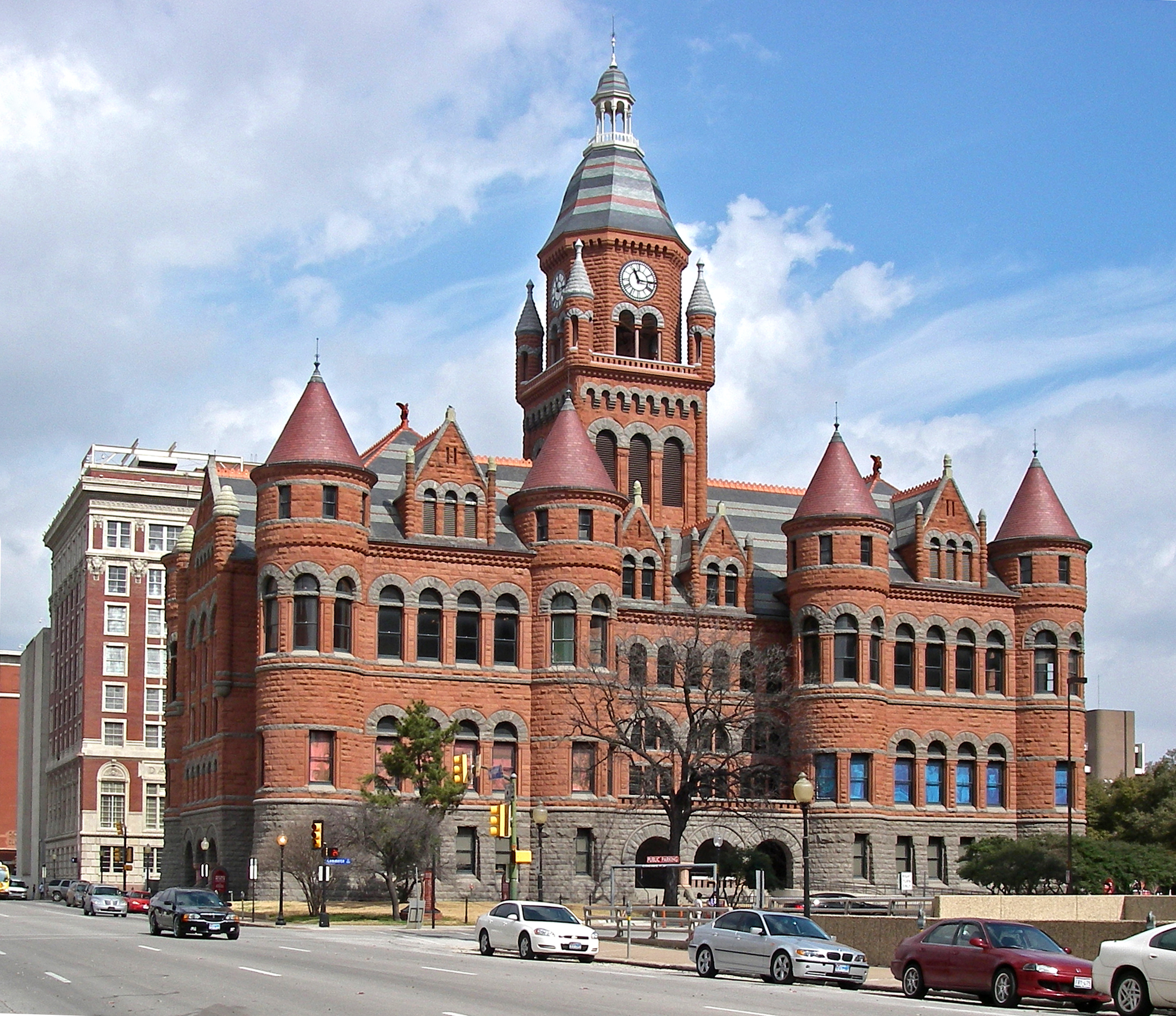
The Commissioners' Court meets the first and third Tuesday at the Commissioners' Courtroom located in the Dallas County Administration Building at 411 Elm St., corner of Elm and Houston streets. The building was the headquarters of the Texas School Book Depository Company until 1970. In 1963 assassin Lee Harvey Oswald shot President John F. Kennedy from a window located on the sixth floor which today houses the Sixth Floor Museum dedicated to the late president's memory.
Acts of the commissioners court are known as 'court orders'. These orders include setting county policies and procedures, issuing contracts, authorizing expenditures, and managing county resources and departments. Most importantly, the commissioners court sets the annual tax rate and the budget for Dallas County government and the courts. The commissioners also set the tax rate and budget for the Dallas County Hospital District which operates Parkland Hospital.
The commissioners court has direct control over all county offices and departments not otherwise administered by a county elected official. Those departments include Dallas County Elections, Health and Human Services, Facilities Management, Parks and Open Space Program, I.T. Services, Homeland Security and Emergency Services, among others. Through their budget making powers, the commissioners exercise indirect control over the District Attorney's office, Sheriff, District Clerk, County Clerk and County Treasurer. The commissioners also set the budget for each of the District, County, and Justice courts.
Dallas County employs a commissioners court administrator who is responsible for the day-to-day management of the commissioners court and implementing the Dallas County Master Plan and the directives of the commissioners court. The current commissioners court administrator is Darryl Martin who was hired by the commissioners in 2008.

Dallas County operates several jail facilities. They include:
- 111 Riverfront Blvd (Dallas)
- North Tower Jail
- South Tower Jail - also known as the "Suzanne Kays Tower"
- West Tower Jail
- Government Center Jail - 600 Commerce Street (Dallas)
- Decker Detention Center - 899 North Stemmons Freeway (Dallas)
- (formerly) Suzanne Kays Jail - 521 North Industrial Boulevard (Dallas) - population integrated into the South Tower; demolished to clear way for the Trinity River Project
The Texas Department of Criminal Justice operates the Hutchins State Jail for men in an unincorporated area adjacent to Hutchins. Corrections Corporation of America operates the Dawson Unit, a co-gender state jail in Downtown Dallas, under contract.
Federal Correctional Institution, Seagoville, is located in Seagoville.
Politics
Dallas County was one of the first areas of the South to break away from a Solid South voting pattern. This coincided with the county's explosive postwar growth. It swung from a 13-point win for Democrat Harry Truman in 1948 to a 23-point win for Republican Dwight Eisenhower in 1952. For most of the second half of the 20th century, it would be one of the most conservative urban counties in the nation, voting for the GOP in every presidential election until 2008. The lone exception was when Texas native Lyndon B. Johnson successfully ran for a full term as president on the Democratic ticket in 1964.
In the 2004 election, Democrats won their first countywide administrative office since 1986 by electing Lupe Valdez to the office of Dallas County Sheriff. The last Democratic countywide administrator was D. Connally elected County Surveyor prior to the office's abolition. Democrats also won three district court benches in 2004. Two years later, Democrats swept every contested countywide race, including those for County Judge, District Clerk, County Clerk, District Attorney, County Treasurer, as well as every contested judicial seat.
Since the 1990s, Dallas County has voted more Democratic than the state of Texas as a whole. It swung from an 18-point win for George H. W. Bush in 1988 to only a two-point win in 1992. In 1996, Bill Clinton became only the fourth Democrat since Truman to win 40 percent of the vote. Former Governor of Texas George W. Bush earned relatively narrow wins in 2000 and 2004, even as he easily carried the state. This trend amplified in 2008 when the county swung dramatically to Barack Obama, whose coattails allowed Democrats to win the remaining Republican-held judicial seats.
Since the 2010s, Dallas County has been one of the most Democratic-leaning counties in Texas. In 2012, Obama won Dallas County by virtually the same margin as he had done in 2008. In 2016, Hillary Clinton increased the Democratic margin of victory even further. She became the first Democrat to win 60% of the county's vote since Franklin D. Roosevelt in 1944, while Donald Trump became the first Republican not to win 40% of the vote in the county since 1992. Joe Biden managed an even larger win in 2020.
In 2024, though Trump did not carry the county, he received his best-ever vote share, with 38%. This was likely due to his increase in Hispanic support, which was 55% in the state of Texas compared to Kamala Harris’s 44%. Dallas County has had three openly LGBT elected county officials: Lupe Valdez, elected Sheriff in 2004 and serving until 2017; Jim Foster, elected county judge in 2006, serving one term before defeat in the Democratic primary in 2010; and Gary Fitzsimmons, elected District Clerk in 2006.
State Board of Education members
| District | Name | Party |
|---|---|---|
| District 11 | Patricia Hardy | |
| District 12 | Geraldine Miller | |
| District 13 | Erika Beltran |
Texas state representatives
| District | Name | Party | Residence |
|---|---|---|---|
| District 100 | Venton Jones | Democratic | |
| District 102 | Ana-Maria Ramos | Democratic | |
| District 103 | Rafael Anchia | Democratic | |
| District 104 | Jessica González | Democratic | |
| District 105 | Terry Meza | Democratic | |
| District 107 | Victoria Neave | Democratic | |
| District 108 | Morgan Meyer | Republican | |
| District 109 | Carl Sherman Sr. | Democratic | |
| District 110 | Toni Rose | Democratic | |
| District 111 | Yvonne Davis | Democratic | |
| District 112 | Angie Chen Button | Republican | |
| District 113 | Rhetta Andrews Bowers | Democratic | |
| District 114 | John Turner | Democratic | |
| District 115 | Cassandra Hernandez | Democratic |
Texas state senators
| District | Name | Party | Residence |
|---|---|---|---|
| District 2 | Bob Hall | Republican | |
| District 8 | Angela Paxton | Republican | |
| District 9 | Kelly Hancock | Republican | |
| District 16 | Nathan Johnson | Democratic | |
| District 23 | Royce West | Democratic |
United States representatives
| District | Name | Party | Residence |
|---|---|---|---|
| Texas's 5th congressional district | Lance Gooden | Republican | |
| Texas's 6th congressional district | Jake Ellzey | Republican | |
| Texas's 24th congressional district | Beth Van Duyne | Republican | |
| Texas's 30th congressional district | Jasmine Crockett | Democratic | |
| Texas's 32nd congressional district | Julie Johnson | Democratic | |
| Texas's 33rd congressional district | Marc Veasey | Democratic |
Education
Primary and secondary schools
The following school districts serve Dallas County:
- Carrollton-Farmers Branch ISD (partly in Denton County)
- Cedar Hill ISD
- Coppell ISD
- Dallas ISD
- DeSoto ISD
- Duncanville ISD
- Ferris ISD (mostly in Ellis County)
- Garland ISD
- Grand Prairie ISD
- Grapevine-Colleyville ISD (mostly in Tarrant County)
- Highland Park ISD
- Irving ISD
- Lancaster ISD
- Mesquite ISD
- Richardson ISD
- Sunnyvale ISD
White flight meant the decrease of non-Hispanic white students in Dallas County K-12 school districts from 1997 until the 2014–2015 school year. The number was 138,760 in the former and 61,538 in the latter; during 2014–2015 county charter schools had about 5,000 non-Hispanic white students. In 2016 Eric Nicholson of the Dallas Observer wrote that the bulk of white K-12 enrollment is shifting to more distant suburban areas beyond Dallas County, and that "Teasing out causation is tricky" but that the perception of poverty, which many white families wish to avoid, is tied with race.
Wilmer-Hutchins Independent School District formerly served a part of the county. In 2006 WHISD officially merged into DISD.
Higher education
Community colleges
Dallas County is served by the Dallas College system of seven community colleges. Dallas College is the designated community college for the entire county.
Public universities
There are two public universities in Dallas County: the University of North Texas at Dallas and the University of Texas at Dallas, of which the latter is also partially located in Collin County.
Private universities
- Dallas Baptist University, located in Dallas
- University of Dallas, located in Irving
- Southern Methodist University, located in University Park
Transportation
Dallas Area Rapid Transit provides bus and rail service to many cities in Dallas County, with Dallas being the largest.
The Trinity Railway Express, operated jointly by Dallas Area Rapid Transit and Trinity Metro, provides commuter rail service to both Dallas County and Tarrant County, connecting downtown Fort Worth with Downtown Dallas.
Major highways
Airports
Commercial Airports
- Love Field, located in Dallas, serves only domestic passengers.
- Dallas/Fort Worth International Airport is partially located in the city of Irving in Dallas County, and Grapevine and Euless in Tarrant County.
General Aviation Airports
- Addison Airport is located in and owned by the city of Addison.
- Dallas Executive Airport is located in and owned by the city of Dallas.
- Mesquite Metro Airport is located in and owned by the city of Mesquite.
References
References
- "Explore Census Data". [[United States Census Bureau]].
- "Find a County". [[National Association of Counties]].
- Maxwell, Lisa C.. (June 18, 2021). "Dallas County". [[Texas State Historical Association]].
- "Dallas County". [[Texas Almanac]].
- (2014). "Dallas County: A 21st Century Mosaic". HPNbooks.
- "2024 County Gazetteer Files – Texas". [[United States Census Bureau]].
- (October 27, 2015). "Parks & Open Space Program". Dallas County, Texas.
- Pratt, James. "Dallas County Parks and Open Space Board Collection James Pratt, Board Papers". Texas Archival Resources Online.
- "NASA Earth Observations Data Set Index". NASA.
- "TSHA | Cedar Springs, TX (Dallas County)".
- "TSHA | Hord's Ridge, TX".
- Rose-Mary Rumbley, "LETOT, CLEMENT" [https://tshaonline.org/handbook/online/articles/fle81 ''Handbook of Texas'' Online], accessed December 26, 2010.
- [https://tshaonline.org/handbook/online/articles/hrlsk "Little Egypt, TX"] in the ''[[Handbook of Texas]] Online'', by Lisa C. Maxwell; accessed December 5, 2015.
- {{Handbook of Texas
- "County Population Totals and Components of Change: 2020-2024".
- "U.S. Decennial Census". United States Census Bureau.
- (2007). "Historical Census Browser". University of Virginia Library.
- Forstall, Richard L.. (March 27, 1995). "Population of Counties by Decennial Census: 1900 to 1990". United States Census Bureau.
- "Census 2000 PHC-T-4. Ranking Tables for Counties: 1990 and 2000". United States Census Bureau.
- "County Median Home Price". [[National Association of Realtors]].
- "U.S. Census Bureau QuickFacts: Dallas County, Texas".
- "Dallas County, Texas — Population by Race". CensusScope.
- "P004: Hispanic or Latino, and Not Hispanic or Latino by Race – 2000: DEC Summary File 1 – Dallas County, Texas". [[United States Census Bureau]].
- "P2: Hispanic or Latino, and Not Hispanic or Latino by Race – 2010: DEC Redistricting Data (PL 94-171) – Dallas County, Texas". [[United States Census Bureau]].
- "P2: Hispanic or Latino, and Not Hispanic or Latino by Race – 2020: DEC Redistricting Data (PL 94-171) – Dallas County, Texas". [[United States Census Bureau]].
- "County Population by Characteristics: 2020-2023". United States Census Bureau.
- (2021). "2020 Decennial Census Demographic Profile (DP1)".
- (2021). "2020 Decennial Census Redistricting Data (Public Law 94-171)".
- (2023). "2020 Decennial Census Demographic and Housing Characteristics (DHC)".
- (August 12, 2021). "People of color make up 95% of Texas’ population growth, and cities and suburbs are booming, 2020 census shows". The Texas Tribune.
- "Dallas County".
- "Dallas County Elections Department".
- "[http://www.dallassheriffsoffice.com/intro/main/detentions/jail_information.html Jail Information]." ''Dallas County Sheriff's Office''. Accessed September 14, 2008.
- Krause, Kevin. [http://crimeblog.dallasnews.com/archives/2009/04/suzanne-kays-jail-to-close-in.html Suzanne Kays jail to close in Dallas this week] {{Webarchive. link. (March 1, 2012." ''[[The Dallas Morning News]]''. April 14, 2009. Retrieved on June 3, 2013.)
- "[http://www.tdcj.state.tx.us/stat/unitdirectory/hj.htm HUTCHINS (HJ)] {{webarchive. link. (September 23, 2008." ''[[Texas Department of Criminal Justice]]''. Accessed September 14, 2008.)
- "[http://www.tdcj.state.tx.us/unit_directory/jd.html DAWSON (JD)] {{webarchive. link. (June 3, 2013." ''[[Texas Department of Criminal Justice]]''. Retrieved on June 3, 2013.)
- "Texas election results 2024 {{!}} Dallas County Votes". Dallas County Votes.
- "Exit poll results 2024 {{!}} CNN Politics". CNN.
- Leip, David. "Dave Leip's Atlas of U.S. Presidential Elections".
- (November 5, 2024). "2024 Senate Election (Official Returns)".
- (May 20, 2007). "The Lavender Heart of Texas".
- Geography Division. (December 22, 2020). "2020 census - School District reference map: Dallas County, TX". [[United States Census Bureau]].
- Nicholson, Eric. (May 3, 2016). "In Dallas, White Flight Never Ends". [[Dallas Observer]].
- [[Texas Education Agency]]: See map of [https://web.archive.org/web/20040611085020/http://penick.tea.state.tx.us/SchoolDistrictLocator/adobe/counties/dallas.pdf Dallas County]. Retrieved on July 3, 2022.
- "Consolidations, Annexations and name changes for Texas Public Schools". [[Texas Education Agency]].
- "Maps and Locations". Dallas College.
- [https://statutes.capitol.texas.gov/Docs/ED/htm/ED.130.htm Texas Education Code, Section 130.176, "Dallas County Community College District Service Area"].
This article was imported from Wikipedia and is available under the Creative Commons Attribution-ShareAlike 4.0 License. Content has been adapted to SurfDoc format. Original contributors can be found on the article history page.
Ask Mako anything about Dallas County, Texas — get instant answers, deeper analysis, and related topics.
Research with MakoFree with your Surf account
Create a free account to save articles, ask Mako questions, and organize your research.
Sign up freeThis content may have been generated or modified by AI. CloudSurf Software LLC is not responsible for the accuracy, completeness, or reliability of AI-generated content. Always verify important information from primary sources.
Report