From Surf Wiki (app.surf) — the open knowledge base
Yavne'el
Town in northern Israel
Town in northern Israel
| Field | Value | |||
|---|---|---|---|---|
| name | Yavne'el | |||
| native_name | {{Hlist | |||
| rtl | yes}} | |||
| {{Lang | ar | يفنيئيل | rtl | yes}} |
| settlement_type | Local council (from 1951) | |||
| translit_lang1 | Hebrew | |||
| translit_lang1_type1 | ISO 259 | |||
| translit_lang1_info1 | Yabnˀel | |||
| image_skyline | Yavneel.JPG | |||
| image_caption | View of Yavne'el | |||
| pushpin_map | Israel northeast#Israel | |||
| pushpin_label_position | bottom | |||
| coordinates | ||||
| grid_name | Grid position | |||
| grid_position | 197/234 PAL | |||
| subdivision_type | Country | |||
| subdivision_name | ||||
| subdivision_type2 | District | |||
| subdivision_name2 | Northern | |||
| established_title | Founded | |||
| established_date | ||||
| leader_title | Head of Municipality | |||
| leader_name | Snir Arish | |||
| unit_pref | dunam | |||
| area_total_dunam | ||||
| population_footnotes | ||||
| population_total | ||||
| population_as_of | ||||
| population_density_km2 | auto |
| {{Script/Hebrew|יַבְנְאֵל}} | يفنيئيل
Yavne'el (, ) is a moshava and local council in the Northern District of Israel. Founded in 1901, it is one of the oldest rural Jewish communities in the country. According to the Israel Central Bureau of Statistics (CBS), in it had a population of .
History
Archaeology: Bronze Age to Mamluk period
Remains from the Late Bronze Age, Iron Age I–II, Persian, Hellenistic, Roman, Late Byzantine, Early Muslim and Mamluk periods have been found here.
At the northwestern edge of Yavne'el is an archaeological tell. Remains include a broken lintel decorated with pomegranates, grapevines, and meander patterns; a frieze carved with a grapevine; a lintel bearing a cross; mosaic floors; fourth-century coinage; and other architectural elements. Zvi Ilan records testimony from a local resident who reported seeing a stone carved with dates, a shofar, and a pomegranate, as well as another stone bearing half of a menorah. Both stones were reused as tombstones and had disappeared by the 1980s. A Greek inscription found at the site mentions a person named Mattathias.
A residential building constructed in the Umayyad period that continued to be inhabited during the Abbasid period (eighth–tenth centuries CE) has been excavated here.
Ottoman period
Arab village
During the Ottoman period, the Muslim village in the area was known as Yemma. The village was mentioned in the Ottoman defter for the year 1555-6, located in the Nahiya of Tabariyya of the Liwa of Safad, with its land designated as timar.
A map by Pierre Jacotin from Napoleon's invasion of 1799 noted the place.
In 1875, Victor Guérin visited and described the village as rather ruined and built of basaltic stone, situated in a fertile valley. In 1881, the PEF's Survey of Western Palestine (SWP) described Yemma as having basaltic stone houses, containing 100 Muslims, on an arable plain. There were no gardens or trees, but two springs were nearby, and the village had cisterns. To the south-west of this site there was a supply of water among the rocks of the valley.
Jewish settlement
The "Yamah" settlement was initially planned for 40 farms, each holding 300 dunams. What is now Yavne'el was established on October 7, 1901, by the Jewish Colonization Association (ICA) on lands bought from the Delaike (Al-Dalaika) Bedouin tribe by Baron Rothschild. The name "Yavne'el" was taken from a biblical city () in the allotment of the tribe of Naphtali, situated in this area. The first settlers came from the Hauran region (Jewish settlers of the Hauran or "Horan" as it was called, had been evicted from there in 1898 by the Ottoman authorities), joined in December 1901 by villagers from Metula. In 1914–15, immigrant families from Yemen settled in Yavne'el.
The new colony of Beit Gan was founded in 1904 as a moshav.
British Mandate
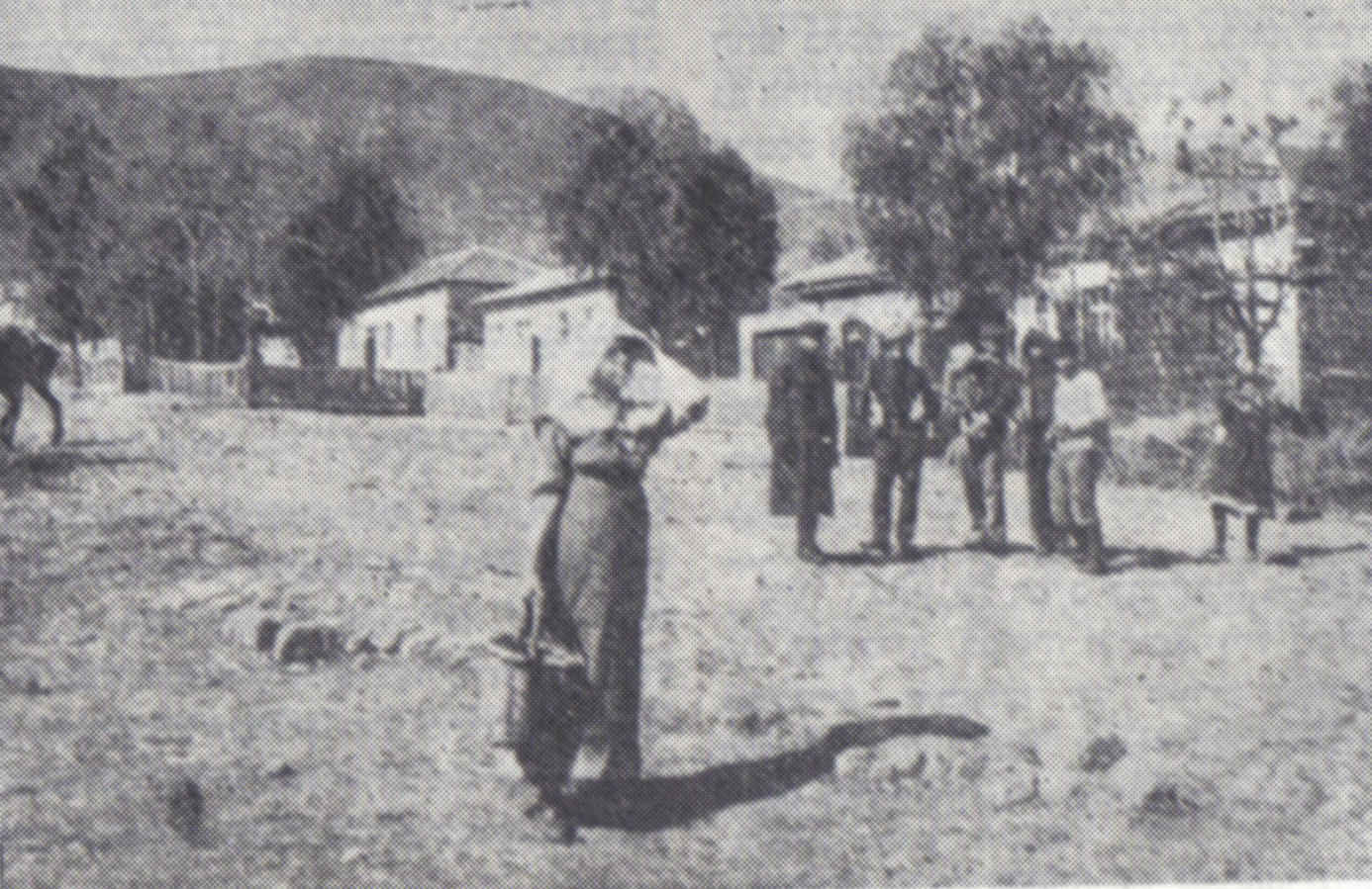
.jpg)
In the 1922 census of Palestine conducted by the British Mandate authorities, Yabnieh (Yamma) had a total population of 447; 82 Muslims and 365 Jews. At the time of the 1931 census, Yavneel still had exactly the same population of 447; but now it was 56 Muslims and 391 Jews, in a total of 102 houses.
Hitahdut HaMoshavot BeYehuda VeShomron ('Association of moshavot in Judea and Samaria'), the oldest settlement movement for private farmers in the Land of Israel, was founded in Yavne'el in 1920.
When three Jewish residents were murdered by Arab rioters on the road between Yavne'el and Beit Gan in 1937 during the country-wide Arab revolt, a new settlement named in their honour, the moshav Mishmar HaShlosha (lit. 'Guard of the Three'), was established nearby.

In the 1945 statistics, Yavneel was home to 590 people, all Jews.
In 1947 an improvised landing strip in the fields of the moshava was used for landing by a transport airplane bringing Jewish refugees, twice from Baghdad and once from Italy. The Galilee Squadron aerial unit was established in Yavne'el and participated in the 1948 Palestine war between April and November 1948, after which it was disbanded.
State of Israel

Located southwest of Tiberias, it was declared a local council in 1951.
Several organisations were established in Yavne'el, including the Israeli Farmers Union and the Golani Brigade.
Administration
The local council is jointly responsible for Yavne'el, Beit Gan, Mishmar HaShlosha, and Smadar. The first three were established as moshavot (early Zionist agricultural colonies) and are very close to each other, while Smadar, originally a moshav (communal village with more economic autonomy for the member families than a kibbutz), is slightly farther away.
Farmer community
In 1991, the authors of a book on Jewish identity in contemporary Israel noticed that, although in many ways typical for the processes Israeli society underwent since its inception, Yavne'el has a core group of farmers described as "rooted yeomanry", uncommon outside the few moshavot of the first hour of Zionist settlement that retained their initial rural character - no more than a dozen in the entire country. These farmers are deeply connected to the place, dedicated to working the land, and see themselves as spearheading the tremendously important task of returning the nation to a set of values long lost or ignored by Jews everywhere else, starting with different-minded neighbours from Yavne'el. They are compared to wheat farmers of the American Midwest or Sweden, in the way they both sound and look.
Breslov community
In 1986, Rabbi Eliezer Shlomo Schick founded a Breslov community largely consisting of baalei teshuvah (newly religious) adherents in Yavne'el. As of 2015 this community, which calls itself "Breslov City", numbers nearly 400 families, representing 30 percent of the town's population. The community has its own educational and civic organizations, including a Talmud Torah, girls' school, yeshiva ketana, yeshiva gedola, kollel, beis medrash (study/prayer hall), and charity and humanitarian organizations.
Notable residents
- Ruth Amiran (1914–2005), Israeli archaeologist
- Keren Peles (born 1979), Israeli singer-songwriter and pianist
- Eliezer Shlomo Schick (1940–2015), Hasidic rabbi
- Avraham Yoffe (1913-1983), General in the IDF
Twin towns – sister cities
- Érd, Hungary
References
Bibliography
References
- [https://books.google.com/books?id=OpBdpj520hwC&pg=PA27 Tradition, Innovation, Conflict: Jewishness and Judaism in Contemporary Israel, ed. Zvi Sobel and Benjamin Beit-Hallahmi]
- {{harvnb. Liebowitz. 1995, cited in {{harvnb. Hanna. 2017
- Leah Haber Gedalia. (2018). "Yavne'el, Israel: The First Century (1901-2001). A Timeline". JewishGen KehilaLinks.
- Marom, Roy. (January 2021). "The Abu Hameds of Mulabbis: An Oral History of a Palestinian Village Depopulated in the Late Ottoman Period". British Journal of Middle Eastern Studies.
- (2001). "Centenary of Yavne'el, Kefar Tavor & Menahamiya". Israel Philatelic Federation.
- (1991). "Immigration, proletarianization, and deproletarianization: A case study of the Jewish working class in Palestine, 1882-1914". Theory and Society.
- (1993). "Carta's Official Guide to Israel and Complete Gazetteer to all Sites in the Holy Land". Carta.
- [http://www.romgalil.org.il/cds/536/ Yavneel Local Council, Lower Galilee], Galilee Development Authority website, retrieved 6 December 2019
- {{harvnb. Department of Statistics. 1945. Quoted in {{harvnb. Hadawi. 1970
- "Operation 'Michaelberg': a Commando transport flown by two American pilots brings illegal Jewish immigrants from Iraq into Palestine.". Israeli Air Force.
- (1991). "Tradition, Innovation, Conflict: Jewishness and Judaism in Contemporary Israel". SUNY Press.
- (2023-05-31). "יבנאל – עיר ברסלב {{!}} כל מה שאתה רוצה לדעת!!!". Mivnal News Breslav City.
- (February 12, 2015). "Harav Eliezer Shlomo Shick, zt"l, of Yavne'el". Israel News.
- Tzoren, Moshe Michael. (23 December 2010). "Away From the Hustle and Bustle of the Big City: Investors from Israel and abroad are buying up large lots in Yavniel, a quiet village in the Galilee, with an eye on building hundreds of housing units for the chareidi public". Israel News.
- "Testvérvárosok - Twin Cities".
This article was imported from Wikipedia and is available under the Creative Commons Attribution-ShareAlike 4.0 License. Content has been adapted to SurfDoc format. Original contributors can be found on the article history page.
Ask Mako anything about Yavne'el — get instant answers, deeper analysis, and related topics.
Research with MakoFree with your Surf account
Create a free account to save articles, ask Mako questions, and organize your research.
Sign up freeThis content may have been generated or modified by AI. CloudSurf Software LLC is not responsible for the accuracy, completeness, or reliability of AI-generated content. Always verify important information from primary sources.
Report