From Surf Wiki (app.surf) — the open knowledge base
Yanling County, Henan

| Field | Value |
|---|---|
| name | Yanling County |
| native_name | |
| other_name | Yenling |
| settlement_type | County |
| image_map | ChinaXuchangYanling.png |
| map_caption | Yanling in Xuchang |
| image_map1 | ChinaHenanXuchang.png |
| map_caption1 | Xuchang in Henan |
| coordinates | |
| parts | 12 |
| parts_type | Towns |
| subdivision_type | Country |
| subdivision_name | People's Republic of China |
| subdivision_type1 | Province |
| subdivision_name1 | Henan |
| subdivision_type2 | Prefecture-level city |
| subdivision_name2 | Xuchang |
| area_total_km2 | 866 |
| area_footnotes | |
| population_total | 574100 |
| population_as_of | 2019 |
| population_footnotes | {{cite web |
| url | https://www.hongheiku.com/xianjirank/ |
| script-title | zh:最新人口信息 www.hongheiku.com |
| publisher | hongheiku |
| language | Chinese |
| access-date | 2021-01-12}} |
| population_density_km2 | auto |
| timezone | China Standard |
| utc_offset | +8 |
| postal_code_type | Postal code |
| postal_code | 461200 |
| website |
|script-title=zh:最新人口信息 www.hongheiku.com |access-date = 2021-01-12}} Yanling County () is a county in the central part of Henan province, China. It is the easternmost county-level division of the prefecture-level city of Xuchang.
History
Human habitation of the area began around 6000 BC.
In the early Zhou dynasty, the area became the state of Yan (鄢國).
In the Eastern Zhou dynasty, the area became known as Yan Yi (鄢邑) after the destruction of the state of Yan under Duke Wu of Zheng (鄭武公) in the early part of the reign of King Ping of Zhou (after 770 BC).
In the fifth month of 722 BC, Duke Zhuang of Zheng defeated his younger brother Gongshu Duan (共叔段) north of present-day Yanling County.
The famous Battle of Yanling (575 BC) took place in Yanling County.
Yanling County was established during the Western Han dynasty in the year 201 BC.
In 2014, six men in Yanling County were fined 2,000 yuan each for their roles in catching 1,689 wild geckos in Zhangqiao.
Administrative divisions
The county is made up of twelve towns:
| Town | Chinese name | Pinyin | Wade–Giles | |||||||
|---|---|---|---|---|---|---|---|---|---|---|
| 安陵镇 | Ānlíng zhèn | An-ling-chen | ||||||||
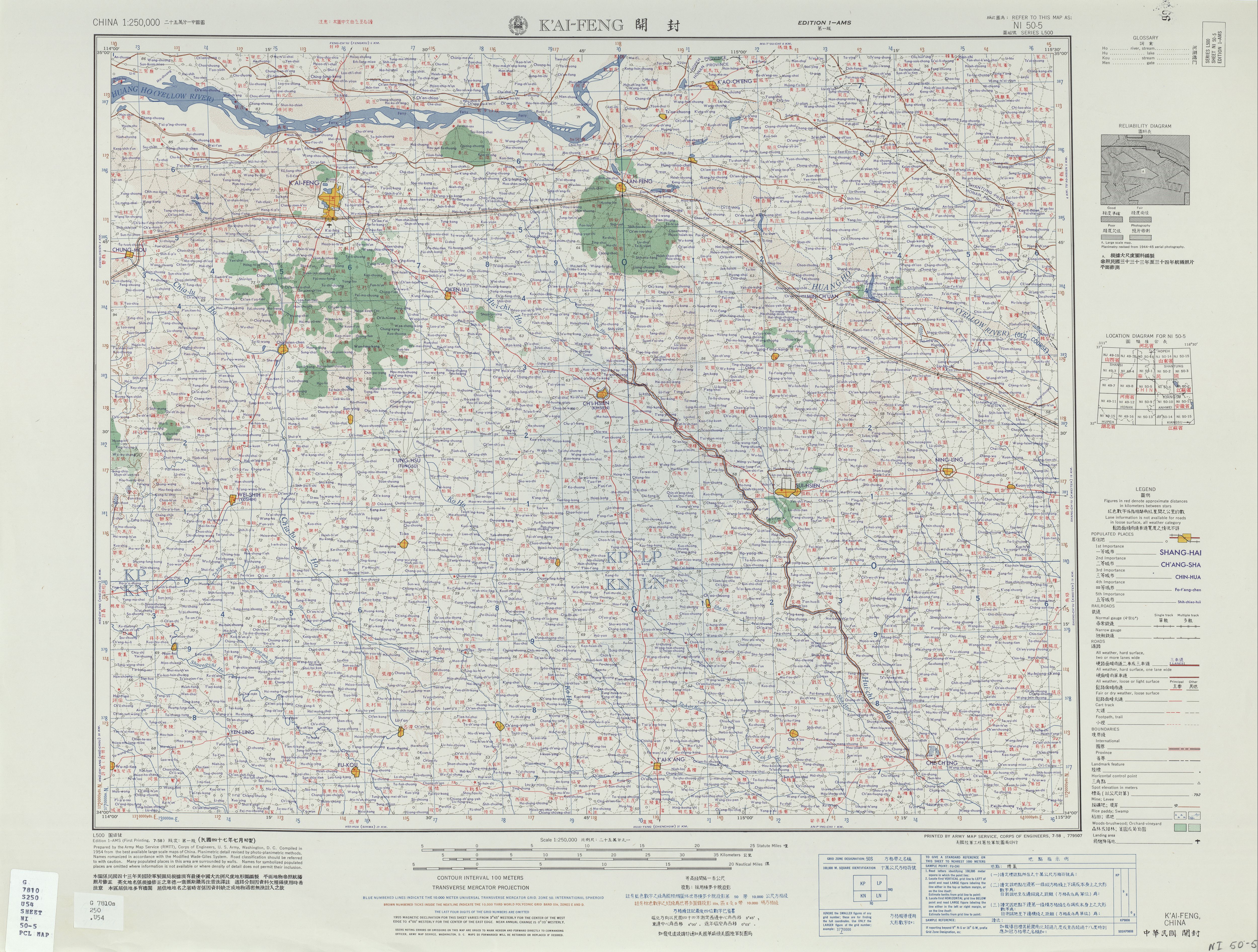
| 马栏镇 | Mǎlán zhèn | location=Washington, D. C. | url=http://legacy.lib.utexas.edu/maps/ams/china/txu-oclc-10552568-ni50-5.jpg | language=en,zh | title=NI 50-5 K'AI-FENG | date=July 1958 | via=Perry–Castañeda Library Map Collection | publisher=Army Map Service | quote=Ma-lan-chen}} | |
| 柏梁镇 | Bǎiliáng zhèn | Pai-liang-chen | ||||||||
| 陈化店镇 | Chénhuàdiàn zhèn | Ch'en-hua-tien-chen | ||||||||
| 望田镇 | Wàngtián zhèn | Wang-t'ien-chen | ||||||||
| 大马镇 | Dàmǎ zhèn | Ta-ma-chen | ||||||||
| 陶城镇 | Táochéng zhèn | location=Washington, D. C. | url=http://legacy.lib.utexas.edu/maps/ams/china/txu-oclc-10552568-ni50-9.jpg | language=en,zh | title=NI 50-9 HUAI-YANG | date=January 1965 | via=Perry–Castañeda Library Map Collection | publisher=Army Map Service | quote=Chih-lo-chi{...}Chang-ch'iao 張橋{...}T'ao-ch'eng 陶城}} | |
| 张桥镇 | Zhāngqiáo zhèn | Chang-ch'iao-chen | ||||||||
| 彭店镇 | Péngdiàn zhèn | P'eng-tien-chen | ||||||||
| 只乐镇 | Zhĭlè zhèn | Chih-le-chen | ||||||||
| 南坞镇 | Nánwù zhèn | Nan-wu-chen | ||||||||
| 马坊镇 | Măfăng zhèn | Ma-fang-chen |
Climate
|Jan record high C = 18.8 |Jan record low C = -17.7 |Feb record high C = 23.7 |Feb record low C = -17.9 |Mar record high C = 29.3 |Mar record low C = -8.4 |Apr record high C = 32.8 |Apr record low C = -1.9 |May record high C = 38.7 |May record low C = 2.2 |Jun record high C = 40.5 |Jun record low C = 11.1 |Jul record high C = 40.7 |Jul record low C = 16.8 |Aug record high C = 37.6 |Aug record low C = 12.1 |Sep record high C = 36.3 |Sep record low C = 6.4 |Oct record high C = 35.6 |Oct record low C = -1.6 |Nov record high C = 27.8 |Nov record low C = -16.4 |Dec record high C = 20.5 |Dec record low C = -15.4
Economy
The county's primary agricultural products include wheat, beans, sweet potatoes, cotton and tobacco among others. The county is known for growing flowers which began during the Tang dynasty and flourished during the Song dynasty. The county is therefore known as 'Flower County' (花县, or also 花都 and 花乡). Industries in the county include machinery manufacturing, fertilizer, concrete and wine making among others.
In 2017, the value of the county's output in the flower and plant industry reached 7.1 billion yuan (1.03 billion U.S. dollars).
Demographics
|2000|564477 |2010|551611 |}} The population of the county decreased between the 2000 census and 2010 census.
Transportation
- China National Highway 311
People from Yanling County
- Lü Debin (1953–2005), executed politician
References
References
- link. (19 December 2016). zh-hans. 1996年,鄢陵县面积871.6平方千米{...}2000年第五次人口普查,许昌市常住总人口4124086人,其中,魏都区373387人,许昌县737384人,鄢陵县564477人,襄城县679863人,禹州市1122669人,长葛市646306人。{...}2010年第六次人口普查,许昌市常住总人口4307488人,其中,魏都区498087人,许昌县767449人,鄢陵县551611人,襄城县671315人,禹州市1131896人,长葛市687130人。. XZQH.org
- link. Republic]] (1936) Chapter 00-15.pdf. zh-hant. 靳蓉鏡. (1936). zh-hant. 平王初鄭武功滅鄢
- link. (2 May 2018). zh-hans. 鄢陵人民政府网. zh-hans. 鄢陵县隶属河南省许昌市,现辖12个镇,386个行政村(社区),总人口66.7万人,总面积866平方公里(耕地99.6万亩)。{...}早在8000年前,先民们便开始在此繁衍生息,周初封为鄢国,东周改称鄢邑,汉初置县。郑伯克段于鄢、晋楚鄢陵之战、唐雎不辱使命等事件均发生于此。{...}鄢陵是“南花北移、北花南迁”的天然驯化基地,花木栽培始于唐、兴于宋,素有“花都”“花乡”的美称,享有“鄢陵蜡梅冠天下”的盛誉。
- (September 2009). 上海辞书出版社. [[Shanghai Lexicographical Publishing House]].. zh-hans. 鄢(yān)1古国名、邑名。西周封国。妘姓,在今河南鄢陵西北。春秋初被郑武公灭后为郑邑。《春秋》隐公元年(公元前722年):“郑伯克段于鄢。”即此。后改称鄢陵。{...}面积866平方千米。{...}西汉置县。{...}农产以小麦、大豆、甘薯、棉花、烟草等为主,并产花卉,有“花县”之称。工业有机械、化肥、水泥、酿酒等。
- (2012). zh-tw. 張孝裕). [[:zh:三民書局. San Min Book Co., Ltd.]]. zh-tw. 鄭伯克段于鄢{...}鄢,鄭國邑名,在今河南鄢陵北。
- Stephen Durrant, Wai-yee Li, David Schaberg. (2016). "Zuo Tradition / Zuozhuan: Commentary on the "Spring and Autumn Annals"". [[University of Washington Press]].
- Zhuang Pinghui. (22 December 2014). "Chinese men fined for catching almost 1,700 protected wild geckos in one night".
- link. XZQH.org. (20 August 2013). zh-hans. 西汉高祖六年(公元前201)置鄢陵县。{...}2000年第五次人口普查,鄢陵县总人口564477人,{...}2012年,大马乡、陶城乡、张桥乡撤乡设镇。调整后,全县辖8个镇、4个乡:安陵镇、马栏镇、柏梁镇、陈化店镇、望田镇、大马镇、陶城镇、张桥镇、南坞乡、只乐乡、彭店乡、马坊乡。
- link. zh-hans. 鄢陵人民政府网
- link. [[National Bureau of Statistics of the People's Republic of China]]. (2018). zh-hans. 统计用区划代码 名称 411024100000 安陵镇 411024101000 马栏镇 411024102000 柏梁镇 411024103000 陈化店镇 411024104000 望田镇 411024105000 大马镇 411024106000 陶城镇 411024107000 张桥镇 411024108000 彭店镇 411024109000 只乐镇 411024110000 南坞镇 411024111000 马坊镇
- (July 1958). "NI 50-5 K'AI-FENG". [[Army Map Service]].
- (January 1965). "NI 50-9 HUAI-YANG". [[Army Map Service]].
- link. [[China Meteorological Administration]]
- link. (15 August 2019). {{lang. zh. 王玉燕. zh-tw. 許昌是大陸花木之鄉,有1千多年的種花歷史;其轄下鄢陵縣,素有「花都」美譽,花木產業歷史悠久,古有「鄢陵蠟梅冠天下」,今有「江北花卉數鄢陵」。
- (5 October 2018). "Flower and plant industry boosts rural economy in China's Henan".
This article was imported from Wikipedia and is available under the Creative Commons Attribution-ShareAlike 4.0 License. Content has been adapted to SurfDoc format. Original contributors can be found on the article history page.
Ask Mako anything about Yanling County, Henan — get instant answers, deeper analysis, and related topics.
Research with MakoFree with your Surf account
Create a free account to save articles, ask Mako questions, and organize your research.
Sign up freeThis content may have been generated or modified by AI. CloudSurf Software LLC is not responsible for the accuracy, completeness, or reliability of AI-generated content. Always verify important information from primary sources.
Report