From Surf Wiki (app.surf) — the open knowledge base
Wuwei, Gansu

| Field | Value | |
|---|---|---|
| <!-- Basic info ----------------> | name | Wuwei |
| official_name | ||
| native_name | 武威市 | |
| native_name_lang | zh | |
| settlement_type | Prefecture-level city | |
| total_type | ||
| motto | ||
| image_skyline | {{multiple image | |
| border | infobox | |
| total_width | 290 | |
| image_style | border:1; | |
| perrow | 1/2/2 | |
| image1 | Wuwei Nan Chengmen 2013.12.30 10-56-33.jpg | |
| image2 | Tianzhu, Wuwei, Gansu, China - panoramio.jpg | |
| image3 | Gulang 2013.12.30 09-58-25.jpg | |
| image4 | 紅崖山水庫-3.JPG | |
| image5 | Wuwei Railway Station (Gansu).jpg | |
| image_caption | Clockwise from top: South Gate of Wuwei, seat of Gulang County, Wuwei railway station, Hongyashan Reservoir in Minqin County, rock formation in Tianzhu County. | |
| image_map | Location of Wuwei Prefecture within Gansu (China).png | |
| map_caption | Location of Wuwei City jurisdiction in Gansu | |
| dot_y | ||
| pushpin_map | China | |
| pushpin_map_caption | Location in China | |
| <!-- Location ------------------> | subdivision_type | Country |
| subdivision_name | People's Republic of China | |
| subdivision_type1 | Province | |
| subdivision_name1 | Gansu | |
| seat_type | Municipal seat | |
| seat | Liangzhou District | |
| parts_style | ||
| parts | ||
| p2 | ||
| leader_title1 | ||
| established_title | ||
| established_title1 | ||
| established_title2 | ||
| named_for | ||
| area_magnitude | ||
| unit_pref | ||
| area_total_km2 | 33000 | |
| area_land_km2 | ||
| area_blank1_km2 | ||
| elevation_footnotes | tags-- | |
| elevation_min_ft | ||
| population_as_of | 2020 | |
| population_total | 1,464,955 | |
| population_density_km2 | auto | |
| population_urban | 688,697 | |
| demographics_type2 | GDP | |
| demographics2_title1 | Prefecture-level city | |
| demographics2_info1 | CN¥ 41.6 billion | |
| US$ 6.7 billion | ||
| demographics2_title2 | Per capita | |
| demographics2_info2 | CN¥ 22,930 | |
| US$ 3,682 | ||
| timezone | CST | |
| utc_offset | +8 | |
| coor_pinpoint | Wuwei municipal government | |
| coordinates | ||
| <!-- Area/postal codes & others --------> | postal_code_type | |
| iso_code | CN-GS-06 | |
| website | ||
| pushpin_map | Gansu#China |
-- Default is list if up to 5 items, coll if more than 5-- US$ 6.7 billion US$ 3,682
Wuwei () is a prefecture-level city in northwest central Gansu province. In the north it borders Inner Mongolia, in the southwest, Qinghai. Its central location between three western capitals, Lanzhou, Xining, and Yinchuan makes it an important business and transportation hub for the area. Because of its position along the Hexi Corridor, historically the only route from central China to western China and the rest of Central Asia, many major railroads and national highways pass through Wuwei.
History
In ancient times, Wuwei was called Liangzhou (涼州—the name retained by today's Wuwei's central urban district) and is the eastern terminus of the Hexi Corridor. People began settling here about 5,000 years ago. It was a key link for the Northern Silk Road, and a number of important archaeological finds were uncovered from Wuwei, including ancient copper carts with stone animals. The motifs and types of objects in the Wuwei graves, as well as their earthenware, lacquer, and bronze composition, constitute typical examples of the Han Chinese burial style that can be found all over China. Other graves found along the Hexi Corridor show Xiongnu and other minority influence, which are used to trace regimes such as the Northern Liang. It became an important provincial capital during the Former Han dynasty as the Hou Hanshu makes clear:
"In the third year [170 CE], Meng Tuo, the Inspector of Liangzhou (modern Wuwei), sent the Assistant Officer Ren She, commanding five hundred soldiers from Dunhuang. He, with the Wuji Major Cao Kuan, and Chief Clerk of the Western Regions, Zhang Yan, brought troops from Yanqi (Karashahr), Qiuci (Kucha), and the Nearer and Further Kingdoms of Jushi (Turfan and Jimasa), altogether numbering more than 30,000, to punish Shule (Kashgar). They attacked the town of Zhenzhong (Arach) but, having stayed for more than forty days without being able to subdue it, they withdrew. Following this, the kings of Shule (Kashgar) killed one another repeatedly and, for its part, the Imperial Government was unable to prevent it."
In 121 BC Han emperor Wudi brought his cavalry here to defend the Hexi Corridor against the Xiongnu Huns. His military success allowed him to expand the corridor westward. Its importance as a stop along the Silk Road made it a crossroads of cultures and ethnic groups from all over central Asia. Numerous Buddhist grottoes and temples in the area attest to its role as a path for bringing Buddhism from India and Afghanistan to China.
During the Three Kingdoms period (184-280), Liangzhou was governed by Ma Teng. After the death of Ma Teng, Ma Chao assumed the post and governed the province for a short time before it fell into the hands of Cao Cao, ruler of Cao Wei.
Liangzhou was briefly (from 400 to 421) a state during the Sixteen Kingdoms period.
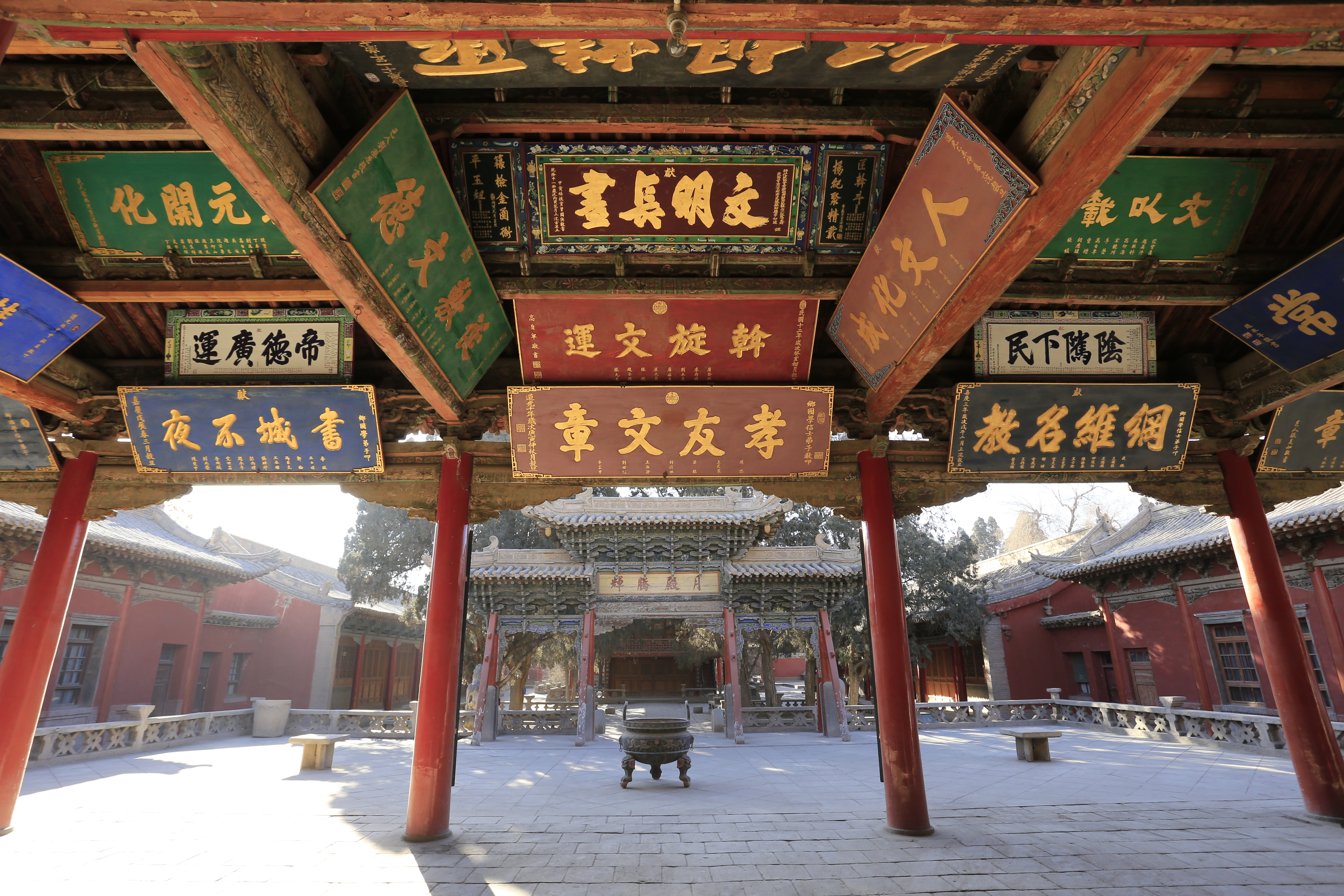
Famous cultural relics from Wuwei include the Galloping Bronze Horse (铜奔马), Western Xia mausoleums (西夏碑), Wuwei White Towers Temple (白塔寺), Tianti Mountain Grotto (天梯山石窟), the Luoshi (Kumārajīva) Temple (罗什寺塔), and the Confucian temple (文庙).
Geography and climate
Wuwei is located in the Hexi Corridor between the Tibetan Plateau and Mongolian Plateau. The south of Wuwei is higher than the north, with an elevation ranging from 1020 to above sea-level. Its area is 33000 km2. Average annual temperature is 7.8 C. The climate is a cold desert climate (Köppen BWk), with precipitation between 60 and. Evaporation is from 1400 to, creating a net loss of water each year. There are 2200–3000 sunlight hours each year and 85–165 frost free days. Summer temperatures can be in excess of 45.0 C, in the shade are by no means unheard of.
Southwest of Wuwei, there is a 230 m thick Tianzhu Formation made of clastics intercalated with sandy shale and shale.Chih-i Chou, William Thornton Dean, Phanerozoic Geology of Northwest China, 1996, 316 pages Minerals deposits occurring in the vicinity of Wuwei include graphite, iron, titanium, and limestone.
|Jan record high C = 15.5 |Jan record low C = -25.3 |Feb record high C = 22.3 |Feb record low C = -25.0 |Mar record high C = 28.1 |Mar record low C = -19.3 |Apr record high C = 32.7 |Apr record low C = -7.7 |May record high C = 34.2 |May record low C = -3.0 |Jun record high C = 35.0 |Jun record low C = 2.8 |Jul record high C = 40.8 |Jul record low C = 7.2 |Aug record high C = 37.3 |Aug record low C = 4.3 |Sep record high C = 34.9 |Sep record low C = -0.8 |Oct record high C = 27.8 |Oct record low C = -14.4 |Nov record high C = 22.8 |Nov record low C = -22.7 |Dec record high C = 17.9 |Dec record low C = -32.0
A species of stone loach, Triplophysa wuweiensis, is named after Wuwei where it was first discovered.
Administration

1 urban district, 2 counties, 1 autonomous county, 116 towns, and 41 townships
| Map | Name | Hanzi | Hanyu Pinyin | Population | ||
|---|---|---|---|---|---|---|
| (2010) | Area | |||||
| (km2) | Density | |||||
| (/km2) | ||||||
| Liangzhou District | 凉州区 | Liángzhōu Qū | 1,010,295 | 5,081 | 207.29 | |
| Minqin County | 民勤县 | Mínqín Xiàn | 241,251 | 16,016 | 15.2 | |
| Gulang County | 古浪县 | Gǔlàng Xiàn | 388,720 | 5,287 | 78.13 | |
| Tianzhu Tibetan | ||||||
| Autonomous County | 天祝藏族自治县 | Tiānzhù Zàngzú | ||||
| Zìzhìxiàn | 174,793 | 6,865 | 25.71 |
Demographics
Population Overview
By 2020, the population reached 1,464,955 with 38 ethnic groups represented including Han, Hui, Mongol, Tu, Tibetan, etc.
| Census | 1st Census (1953) | 2nd Census (1964) | 3rd Census (1982) | 4th Census (1990) | 5th Census (2000) | County/District | Population | % | Population | % | Population | % | Population | % | Population | % | Wuwei/Liangzhou | Minqin | Gulang | Tianzhu | Jingtai | Yongchang | Yongdeng | Zhangye | Minle | Shandan | Total | 1,810,588 | 1,534,010 | 1,646,766 | 1,669,319 | 1,836,923 |
|---|---|---|---|---|---|---|---|---|---|---|---|---|---|---|---|---|---|---|---|---|---|---|---|---|---|---|---|---|---|---|---|---|
| 510,241 | 28.18 | 520,094 | 33.90 | 763,719 | 46.38 | 876,020 | 52.48 | 946,506 | 51.52 | |||||||||||||||||||||||
| 220,022 | 12.15 | 179,061 | 11.67 | 241,510 | 14.67 | 258,947 | 15.51 | 302,085 | 16.45 | |||||||||||||||||||||||
| 139,238 | 7.69 | 186,267 | 12.14 | 287,269 | 17.44 | 323,507 | 19.38 | 367,048 | 19.98 | |||||||||||||||||||||||
| 58,731 | 3.24 | 118,625 | 7.73 | 184,410 | 11.20 | 210,845 | 12.63 | 221,347 | 12.05 | |||||||||||||||||||||||
| 65,518 | 3.62 | 93,862 | 6.12 | 169,858 | 10.31 | *Placed under Baiyin since 1985* | ||||||||||||||||||||||||||
| 125,578 | 6.94 | 174,221 | 11.36 | *Placed under Jinchang since 1981* | ||||||||||||||||||||||||||||
| 264,787 | 14.62 | 261,880 | 17.07 | *Placed under Lanzhou since 1970* | ||||||||||||||||||||||||||||
| 254,900 | 14.08 | *Now as Ganzhou District, placed under Zhangye since 1955* | ||||||||||||||||||||||||||||||
| 106,675 | 5.89 | *Placed under Zhangye since 1955* | ||||||||||||||||||||||||||||||
| 64,898 | 3.58 | *Placed under Zhangye since 1955* |
| Census | 6th Census(2010) | 7th Census(2020) | County/District | Population | % | Population | % | Liangzhou | Minqin | Gulang | Tianzhu | Total | 1,815,054 | 1,464,955 |
|---|---|---|---|---|---|---|---|---|---|---|---|---|---|---|
| 174,790 | 9.63 | 885,277 | 60.43 | |||||||||||
| 1,010,295 | 55.67 | 178,470 | 12.18 | |||||||||||
| 241,251 | 13.29 | 250,177 | 17.07 | |||||||||||
| 388,718 | 21.41 | 151,031 | 10.32 |
Urbanization and Gender Structure
| National Census | |||||||||||||||||||
|---|---|---|---|---|---|---|---|---|---|---|---|---|---|---|---|---|---|---|---|
| Urban Population | Male | Female | Sex | Total | Urbanization | Total | % | Total | % | 5th | 6th | 7th | Observation | ||||||
| date=2023-07-15 | title=武威市人口普查数据 第五、六、七次人口普查武威市人口-59城市迷 | url=https://www.csm59.com/a/168170215439681.html | access-date=2024-01-02 | archive-url=https://web.archive.org/web/20230715055759/https://www.csm59.com/a/168170215439681.html | archive-date=2023-07-15 }} | 20.14% | 949,435# | 51.69% | 887,488# | 48.31% | 106.98 | ||||||||
| 500,528 | 27.56% | 933,482 | 51.43% | 881,572 | 48.57% | 105.89 | |||||||||||||
| 688,697 | 47.01% | 740,306 | 50.53% | 724,649 | 49.47% | 102.16 | |||||||||||||
| #No data, estimated based on the published sex ratio |
Education Level
| National Census | University Education (including associate degree) | High School Education | Secondary Education | Primary Education | illiteracy | Total | % | Total | % | Total | % | Total | % | Total | % | 5th | 6th | 7th | Observation |
|---|---|---|---|---|---|---|---|---|---|---|---|---|---|---|---|---|---|---|---|
| 33,927* | 2.08% | 182,774* | 11.22% | 504,999* | 31.01% | 738,388* | 45.34% | 168,499 | 10.35% | ||||||||||
| 98,932 | 5.84% | 257,772 | 15.23% | 681,562 | 40.26% | 540,193 | 31.91% | 114,475 | 6.76% | ||||||||||
| 184,994 | 13.69% | 207,940 | 15.38% | 456,779 | 33.79% | 418,200 | 30.94% | 83,812 | 6.20% | ||||||||||
| *Estimation, the original data is the number of people educated per 100,000 people. The number of people educated per 100,000 people in universities, high schools, junior high schools, and primary schools is 1847, 9950, 27491, and 40197, respectively |
Age Distribution and Population Pyramid
| National Census | 7th | 6th | 5th | Age Group(years) | Male | Female | Male | Female | Male | Female | 0-4 | 5-9 | 10-14 | 15-19 | 20-24 | 25-29 | 30-34 | 35-39 | 40-44 | 45-49 | 50-54 | 55-59 | 60-64 | 65-69 | 70-74 | 75 or above |
|---|---|---|---|---|---|---|---|---|---|---|---|---|---|---|---|---|---|---|---|---|---|---|---|---|---|---|
| 44,485 | 40,263 | 48,981 | 39,046 | 70,504 | 48,496 | |||||||||||||||||||||
| 46,339 | 40,519 | 53,974 | 41,208 | 100,743 | 84,294 | |||||||||||||||||||||
| 47,440 | 39,429 | 73,286 | 56,878 | 109,253 | 100,793 | |||||||||||||||||||||
| 42,418 | 33,600 | 98,852 | 86,983 | 75,924 | 72,156 | |||||||||||||||||||||
| 31,309 | 29,028 | 81,607 | 82,949 | 50,148 | 50,967 | |||||||||||||||||||||
| 42,722 | 42,670 | 58,238 | 58,222 | 90,740 | 90,367 | |||||||||||||||||||||
| 50,031 | 52,066 | 50,724 | 47,871 | 107,026 | 108,502 | |||||||||||||||||||||
| 42,347 | 42,627 | 86,543 | 86,548 | 85,427 | 86,072 | |||||||||||||||||||||
| 39,740 | 38,369 | 100,781 | 102,535 | 52,819 | 48,012 | |||||||||||||||||||||
| 70,821 | 74,010 | 78,779 | 81,645 | 56,282 | 51,909 | |||||||||||||||||||||
| 83,149 | 87,007 | 48,773 | 44,674 | 42,428 | 41,012 | |||||||||||||||||||||
| 64,464 | 67,021 | 50,627 | 48,153 | 35,440 | 33,260 | |||||||||||||||||||||
| 38,398 | 35,821 | 35,973 | 36,379 | 30,846 | 29,633 | |||||||||||||||||||||
| 40,668 | 40,442 | 28,436 | 28,213 | 22,239 | 22,436 | |||||||||||||||||||||
| 26,799 | 28,670 | 20,116 | 20,960 | 10,766 | 10,577 | |||||||||||||||||||||
| 29,176 | 33,107 | 17,797 | 19,308 | 8,466 | 9,449 |
| The following pictures are based on The 5th, 6th, and 7th National Census of Wuwei - Gender and Age Structure |
|---|
No. of Household
| National Census | No. of Household | Population | No. of ppls/household | 5th | 6th | 7th |
|---|---|---|---|---|---|---|
| No Data | No Data | 3.95 | ||||
| 467,040 | 1,748,588 | 3.74 | ||||
| 529,119 | 1,383,397 | 2.61 |
Wuwei Ethnic Population and Gender
Source:
Ethnic Population by County/District(2020)
| County/District | Han | % | Minorities | % | Liangzhou District | Minqin County | Gulang County | Tianzhu Tibetan | |||||
|---|---|---|---|---|---|---|---|---|---|---|---|---|---|
| Autonomous County | Wuwei | 1,383,664 | 94.5% | 81,291 | 5.5% | ||||||||
| 870,610 | 98.3% | 14,667 | 1.7% | ||||||||||
| 176,789 | 99.1% | 1,681 | 0.9% | ||||||||||
| 246,503 | 98.5% | 3,674 | 1.5% | ||||||||||
| 89,762 | 59.4% | 61,269 | 40.6% |
Gender Data by Ethnicity(2020)
| County/District | Male (Han) | Female (Han) | Sex Ratio (Han) | Male (Minorities) | Female (Minorities) | Sex Ratio (Minorities) | Liangzhou District | Minqin County | Gulang County | Tianzhu Tibetan | |||||||
|---|---|---|---|---|---|---|---|---|---|---|---|---|---|---|---|---|---|
| Autonomous County | Wuwei | 699,411 | 684,253 | 102.2 | 40,895 | 40,396 | 101.2 | ||||||||||
| 438,898 | 431,712 | 101.7 | 7,620 | 7,047 | 108.1 | ||||||||||||
| 90,394 | 86,395 | 104.6 | 915 | 766 | 119.5 | ||||||||||||
| 123,481 | 123,022 | 100.4 | 1,706 | 1,968 | 86.7 | ||||||||||||
| 46,638 | 43,124 | 108.1 | 30,654 | 30,615 | 100.1 |
Birth Rate, Mortality Rate, and Natural Growth Rate in Wuwei
Sources:
| Legend |
|---|
| ↑Natural growth rate increased compared to the previous year |
| Year | Birth Rate(‰) | Mortality Rate(‰) | Natural Growth Rate(‰) | Trend of Three Rates | 2000 | [[File:武威市2012至2024人口出生率、死亡率及自然增长率.png | link=https://zh.wikipedia.org/wiki/File:%E6%AD%A6%E5%A8%81%E5%B8%822012%E8%87%B32024%E4%BA%BA%E5%8F%A3%E5%87%BA%E7%94%9F%E7%8E%87%E3%80%81%E6%AD%BB%E4%BA%A1%E7%8E%87%E5%8F%8A%E8%87%AA%E7%84%B6%E5%A2%9E%E9%95%BF%E7%8E%87.png | center | 400x400px]]Green Line: Birth Rate Red Line: Mortality Rate; | 2001 | 2002 | 2003 | 2004 | 2005 | 2006 | 2007 | 2008 | 2009 | 2010 | 2011 | 2012 | 2013 | 2014 | 2015 | 2016 | 2017 | 2018 | 2019 | 2020 | 2021 | 2022 | 2023(Expected) | 2028(Expected) |
|---|---|---|---|---|---|---|---|---|---|---|---|---|---|---|---|---|---|---|---|---|---|---|---|---|---|---|---|---|---|---|---|---|---|
| 13.33 | 5.57 | 7.76 | |||||||||||||||||||||||||||||||
| 11.97 | 5.21 | 6.76↓ | |||||||||||||||||||||||||||||||
| * | * | 6.28↓ | |||||||||||||||||||||||||||||||
| * | * | 5.59↓ | |||||||||||||||||||||||||||||||
| * | * | 5.61↓ | |||||||||||||||||||||||||||||||
| * | * | 5.81↑ | |||||||||||||||||||||||||||||||
| * | * | 6.29↑ | |||||||||||||||||||||||||||||||
| * | * | 6.43↑ | |||||||||||||||||||||||||||||||
| * | * | 6.69↑ | |||||||||||||||||||||||||||||||
| * | * | 6.69 | |||||||||||||||||||||||||||||||
| * | * | 5.36↓ | |||||||||||||||||||||||||||||||
| * | * | 5.28↓ | |||||||||||||||||||||||||||||||
| 10.52 | 5.23 | 5.29↓ | |||||||||||||||||||||||||||||||
| 10.57 | 5.26 | 5.31↑ | |||||||||||||||||||||||||||||||
| 10.61 | 5.28 | 5.33↑ | |||||||||||||||||||||||||||||||
| 10.81 | 5.31 | 5.50↑ | |||||||||||||||||||||||||||||||
| 10.83 | 5.81 | 5.02↓ | |||||||||||||||||||||||||||||||
| 11.38 | 6.22 | 5.16↑ | |||||||||||||||||||||||||||||||
| 9.42 | 6.18 | 3.24↓ | |||||||||||||||||||||||||||||||
| 9.21 | 6.32 | 2.89↓ | |||||||||||||||||||||||||||||||
| * | * | -2.12↓ | |||||||||||||||||||||||||||||||
| 8.93 | 10.21 | -1.98↑ | |||||||||||||||||||||||||||||||
| 7.84 | 10.55 | -2.72↓ | |||||||||||||||||||||||||||||||
| 8.09 | 10.43 | -2.35↑ | |||||||||||||||||||||||||||||||
| 6.63 | 13.32 | -6.70 |
Economy
Consistent sunlight and fertile soil make agriculture one of Wuwei's biggest industries. Other important industries are textiles, metallurgy, and construction materials. Melons, vegetables, wine and livestock are all major agricultural products. Organic farming is a trend with more land being set aside for “green farming” each year. Land use can be broken down into the following:
- 790 km2 of water
- 34800 km2 of forest
- 355300 km2 of grassland.
- 247000 km2 of “undeveloped” land.
- 39100 km2 of farmland.
- 8000 km2 of corn
- 4000 km2 of vegetables
- 3000 km2 of melons
- 5000 km2 for livestock
- 800 km2 of vineyards
Transport
Railway
Source:
There are two railway lines that pass through Wuwei, namely the Lanzhou-Xinjiang Railway and the Gantang-Wuwei Railway. Both are east–west railway lines. Since there are no north–south railway lines crossing Wuwei, there are no railway lines passing through Minqin County which lies in the northern part of Wuwei, therefore, there are no railway stations in Minqin.
There exist various railway stations in Liangzhou District, Gulang County and Tianzhu Tibetan Autonomous County. Wuwei Railway Station (second-class station) is the largest train station in terms of passenger traffic in Wuwei. It is located 303 kilometers east of Lanzhou Station and 1,589 kilometers west of Ürümqi Railway Station.
Railway Stations in Wuwei
| Major Railway Stations in Wuwei | Station | County/District | Station Class | Railways | Available for | Wuwei Railway Station | Wuwei S. Railway Station | Wuwei E. Railway Station (High Speed Railway) | Gulang Railway Station | Gulang N. Railway Station (High Speed Railway) | Tianzhu Railway Station | Tianzhu W. Railway Station (High Speed Railway) |
|---|---|---|---|---|---|---|---|---|---|---|---|---|
| Liangzhou | Second | Lanzhou-Xinjiang Railway, Gantang-Wuwei Railway | Passenger, Package, Luggage | |||||||||
| Liangzhou | First | Lanzhou-Xinjiang Railway, Gantang-Wuwei Railway | Passenger | |||||||||
| Liangzhou | Second | Lanzhou-Zhangye High Speed Railway | Passenger | |||||||||
| Gulang | Fourth | Lanzhou-Xinjiang Railway | Passenger | |||||||||
| Gulang | - | Lanzhou-Zhangye High Speed Railway | Passenger | |||||||||
| Tianzhu | Third | Lanzhou-Xinjiang Railway | Passenger | |||||||||
| Tianzhu | - | Lanzhou-Zhangye High Speed Railway | Passenger |
|}
Highway
| Category | English name | Code | Service Level | National Freeway | Province Freeway | National Highway | ||||
|---|---|---|---|---|---|---|---|---|---|---|
| Lianhuo Freeway | [[File:China_Expwy_G30_sign_no_name.svg | link=https://zh.wikipedia.org/wiki/File:China_Expwy_G30_sign_no_name.svg | alt=G30连霍高速标志 | frameless | 60x60px]] | In Service | ||||
| Wujin Freeway | [[File:China_Expwy_G3017_sign_no_name.svg | link=https://zh.wikipedia.org/wiki/File:China_Expwy_G3017_sign_no_name.svg | alt=G3017武威至金昌高速标志 | frameless | 60x60px]] | In Service | ||||
| Dingwu Freeway | [[File:China_Expwy_G2012_sign_no_name.svg | link=https://zh.wikipedia.org/wiki/File:China_Expwy_G2012_sign_no_name.svg | frameless | 60x60px]] | In Service | |||||
| Wuwei Ring Freeway | [[File:Gansu_Expwy_S04_sign_no_name.svg | link=https://zh.wikipedia.org/wiki/File:Gansu_Expwy_S04_sign_no_name.svg | frameless | 60x60px]] | In Service | |||||
| Beixian Freeway | [[File:Gansu_Expwy_S55_sign_no_name.svg | link=https://zh.wikipedia.org/wiki/File:Gansu_Expwy_S55_sign_no_name.svg | frameless | 60x60px]] | In Service | |||||
| Minhong Freeway | [[File:Gansu_Expwy_S48_sign_no_name.svg | link=https://zh.wikipedia.org/wiki/File:Gansu_Expwy_S48_sign_no_name.svg | frameless | 60x60px]] | In Service | |||||
| Leixi Freeway | [[File:Gansu_Expwy_S61_sign_no_name.svg | link=https://zh.wikipedia.org/wiki/File:Gansu_Expwy_S61_sign_no_name.svg | frameless | 60x60px]] | Under Construction | |||||
| G312 National Highway | G312 | In Service | ||||||||
| Manda Highway | G569 | Under Construction | ||||||||
| Dingwu Highway | G667 | In Service |
Footnotes
References
- Hill, John E. (2015) Through the Jade Gate to Rome - China to Rome. CreateSpace, Charleston, South Carolina. .
References
- 甘肃省统计局、国家统计局甘肃调查总队. (November 2016). ["《甘肃发展年鉴-2016》"](http://www.gstj.gov.cn/tjnj/2016/index.html }}{{Dead link). [[China Statistics Press]].
- [http://www.megalithic.co.uk/article.php?sid=18006 ''Silk Road, North China'', C Michael Hogan, The Megalithic Portal, ed. A Burnham]
- Zhang Yiping. (2005). "Story of the Silk Road". [[:zh:五洲传播出版社.
- Juhl, Susanne. (1998). "Post-Soviet Central Asia". Tauris Academic Studies.
- Hill (2015), p. 45.
- link. [[China Meteorological Administration]]
- link. Weather China
- (3 December 2015). "Catalog of Fishes". California Academy of Sciences.
- "武威市人民政府 普查数据 武威市第七次全国人口普查公报[1]".
- (1996). "景泰县志". 景泰县志编纂委员会.
- (1993). "永昌县志". 永昌县志编纂委员会.
- (1997). "永登县志". 永登县地方史志编纂委员.
- (1993). "张掖市志". 甘肃省张掖市志编修委员会.
- (1996). "民乐县志". 民乐县志编纂委员会.
- (1993). "山丹县志". 山丹县地方志编纂委员会.
- (August 2025). "武威市2010年第六次全国人口普查主要数据公报_中国统计信息网".
- "武威市第七次全国人口普查公报".
- (2023-07-15). "武威市人口普查数据 第五、六、七次人口普查武威市人口-59城市迷".
- (August 2025). "《甘肃发展年鉴2021》使用方法".
- "武威市人民政府 统计年鉴".
- "甘肃省统计年鉴".
- "中国铁路12306网站".
- "铁路客户服务中心--".
This article was imported from Wikipedia and is available under the Creative Commons Attribution-ShareAlike 4.0 License. Content has been adapted to SurfDoc format. Original contributors can be found on the article history page.
Ask Mako anything about Wuwei, Gansu — get instant answers, deeper analysis, and related topics.
Research with MakoFree with your Surf account
Create a free account to save articles, ask Mako questions, and organize your research.
Sign up freeThis content may have been generated or modified by AI. CloudSurf Software LLC is not responsible for the accuracy, completeness, or reliability of AI-generated content. Always verify important information from primary sources.
Report