From Surf Wiki (app.surf) — the open knowledge base
Worcestershire
County of England

County of England
| Field | Value | |||
|---|---|---|---|---|
| official_name | Worcestershire | |||
| image_main | {{multiple images | border=infobox | perrow=1 2 | total_width=270 |
| image1 | River Severn, Central Worcester - geograph.org.uk - 3185511 (cropped).jpg | |||
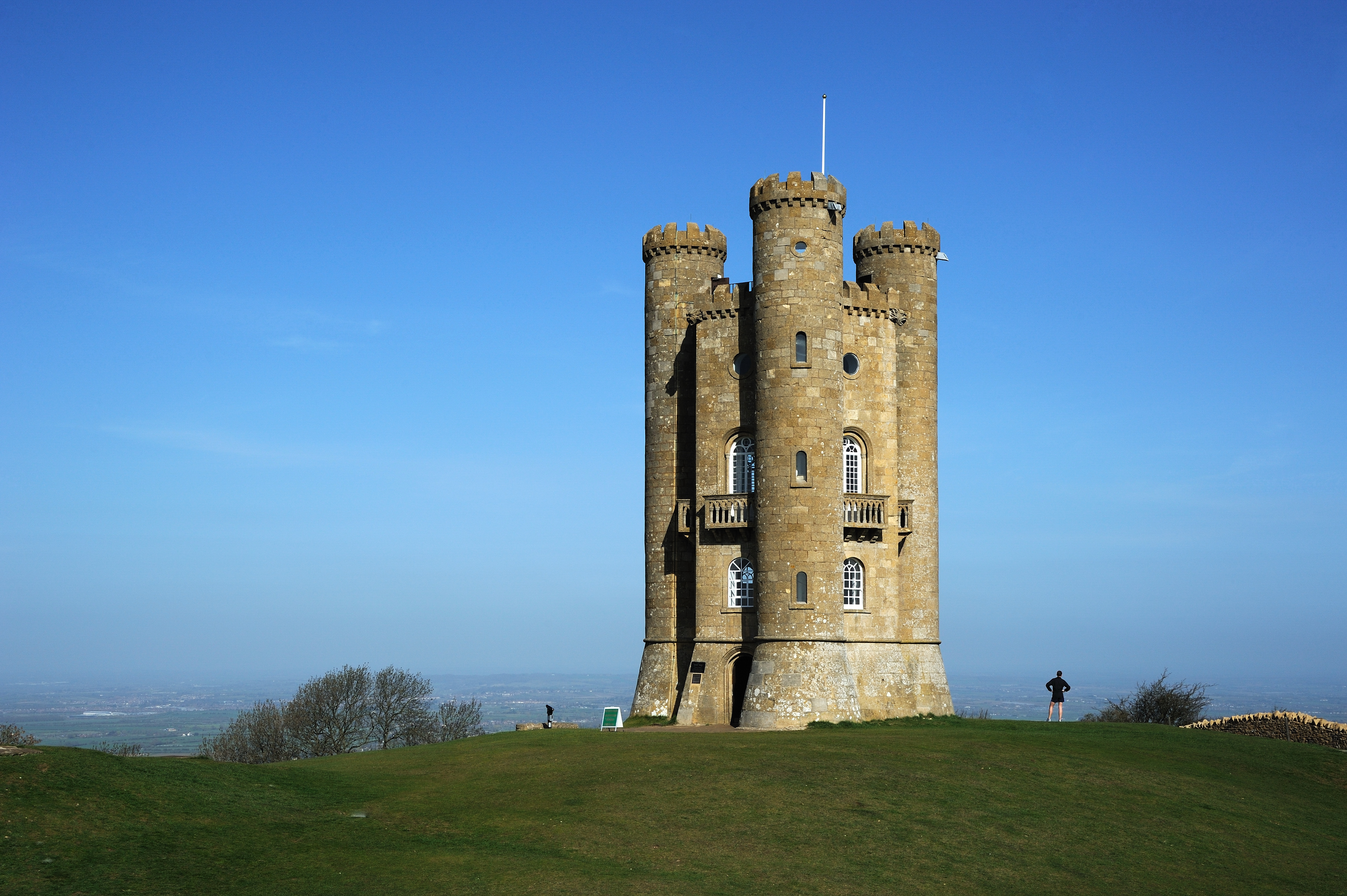
| image2 | Broadway Tower (cropped).jpg | |||
| image3 | Malvern Hills in June 2005.JPG | |||
| image_caption | Worcester; Broadway Tower in the Cotswolds, and the Malvern Hills on the Worcestershire–Herefordshire border | |||
| locator_map | Worcestershire UK locator map 2010.svg | |||
| map_caption | Worcestershire within England | |||
| region | West Midlands | |||
| established_date | 1 April 1998 | |||
| established_by | Local Government Commission for England | |||
| preceded_by | Hereford and Worcester | |||
| origin | Ancient | |||
| lord_lieutenant_office | Lord Lieutenant of Worcestershire | |||
| lord_lieutenant_name | Beatrice Grant | |||
| high_sheriff_office | High Sheriff of Worcestershire | |||
| high_sheriff_name | Ian James Crockatt Smith | |||
| area_total_km2 | 1741 | |||
| area_total_rank | 34th | |||
| ethnicity | ||||
| county_council | Worcestershire County Council | |||
| admin_hq | Worcester | |||
| area_council_km2 | 1,741 | |||
| area_council_rank | 23rd | |||
| iso_code | GB-WOR | |||
| gss_code | E10000034 | |||
| nuts_code | TLG12 | |||
| districts_map | [[File:Worcestershire numbered districts.svg | 200px]] | ||
| districts_list | # Worcester | |||
| MPs | 6 MPs | |||
| police | West Mercia Police | |||
| website |
- Malvern Hills
- Wyre Forest
- Bromsgrove
- Redditch
- Wychavon
Worcestershire ( , ; written abbreviation: Worcs) is a ceremonial county in the West Midlands of England. It is bordered by Shropshire, Staffordshire, and the West Midlands county to the north, Warwickshire to the east, Gloucestershire to the south, and Herefordshire to the west. The city of Worcester is the largest settlement.
The county is largely rural, and has an area of 1741 km2 and an estimated population of in . Worcester is located on the River Severn near the centre; Kidderminster lies in the north, Redditch and Bromsgrove in the north-east, Evesham in the south-east, and the spa town of Malvern in the south-west. For local government purposes Worcestershire is a non-metropolitan county with six districts. The county historically has complex boundaries, and included Dudley, Stourbridge, Halesowen, Oldbury, and the southwestern suburbs of Birmingham.
The River Severn flows through the centre of the county from north to south, forming a wide plain. The southwest of the county contains part of the Malvern Hills, a National Landscape which contains Worcestershire Beacon, at 425 m the county's highest point. The southeast contains a small part of the Cotswolds, and in the northwest is part of the Wyre Forest, a national nature reserve.
There is some evidence of Roman occupation in Worcestershire; the area later became part of the Anglo-Saxon kingdom of Hwicce, and then Mercia. Worcestershire was constituted as a county around 927, as the Kingdom of England formed. During the High Middle Ages the county was the site of the Battle of Evesham, in which Simon de Montfort was defeated, and in 1651 the Battle of Worcester was the last major engagement of the Wars of the Three Kingdoms. During the Industrial Revolution the north of the county was part of the Black Country, a major manufacturing centre, Kidderminster became famous for carpet production, and Worcester for porcelain.
Location
The county borders Herefordshire to the west, Shropshire to the north-west, Staffordshire only just to the north, West Midlands to the north and north-east, Warwickshire to the east and Gloucestershire to the south. The western border with Herefordshire includes a stretch along the top of the Malvern Hills. At the southern border with Gloucestershire, Worcestershire meets the northern edge of the Cotswolds. Two major rivers flow through the county: the Severn and the Avon.
History
Main article: History of Worcestershire, History of Worcester
The geographical area now known as Worcestershire was first populated at least 700,000 years ago. The area became predominantly agricultural in the Bronze Age, leading to population growth and more evidence of settlement. By the Iron Age, hill forts dominated the landscape. Settlement of these swiftly ended with the Roman occupation of Britain.
The Roman period saw establishment of the villa system in the Cotswolds and Vale of Evesham. Droitwich (Salinae) was probably the most important settlement in the county in this period, due to its product of salt. There is also evidence for Roman settlement and industrial activity around Worcester and King's Norton.
Anglo-Saxon Worcestershire
Main article: History of Worcestershire#Anglo-Saxon
The area which became Worcestershire formed the heartland of the Anglo-Saxon kingdom of the Hwicce. It was absorbed by the Kingdom of Mercia during the 7th century and became part of the unified Kingdom of England in 927. Worcestershire was established as an administrative and defensive unit in the early tenth century. Its purpose was to take into account and defend the estates within the northern area of the historic See of Worcester, held by the Episcopus Hwicciorum and Worcester Priory, along with the Abbots of Pershore, Westminster and Evesham. The shires and its sub-divisions known as hundreds, formed a framework for administering the resources of each burhs' outlying estates. It was a separate ealdormanship briefly in the 10th century before forming part of the Earldom of Mercia in the 11th century. The last known Anglo-Saxon Sheriff of Worcestershire was Cyneweard of Laughern.
Norman Conquest
Main article: History of Worcestershire#Medieval
During the Middle Ages, much of the county's economy was based on the wool trade. Many areas of its dense forests, such as Feckenham Forest, Horewell Forest and Malvern Chase, were royal hunting grounds subject to forest law.
After the Norman conquest of England; the Domesday Book noted in 1086 that in seven of the twelve hundreds covering Worcestershire, the Crown had no authority. The Crown's authority was replaced by the Bishop of Worcester and the Abbots at Pershore, Westminster and Evesham.
William the Conqueror gave to his allies and friends manors and parishes captured from the Anglo-Saxons. Despite the Norman Conquest, the rest of the county was still held by the Abbeys of Pershore and Evesham, the Bishop of Worcester and Priory.
The first Norman Sheriff Urse d'Abetot, built the castle of Worcester and seized much church land, some of which became part of the Crown's hundreds in Worcestershire. and was in dispute with the Bishop of Worcester over the rights of the sheriff.
Bishop Wulfstan was the last Anglo-Saxon bishop in England, and remained in post until his death in 1095. Under his tenure Worcester Cathedral began major reconstruction, and he opposed political interventions against William and the Normans. He was later made a saint.
High Medieval
During Henry III's disputes and wars with his Barons, in 1263 Worcester's Jewish residents were attacked by a baronial force led by Robert Earl Ferrers and Henry de Montfort. Most were killed. The massacre in Worcester was part of a wider campaign by the De Montforts and their allies in the run-up to the Second Barons' War, aimed at undermining Henry III. Worcestershire was the site of the Battle of Evesham in which Simon de Montfort was killed on 4 August 1265. A few years later, in 1275, the Jews that were still living in Worcester were forced to move to Hereford, as they were expelled from all towns under the jurisdiction of the queen mother.

Civil War
Main article: Worcestershire in the English Civil War, History of Worcestershire#Civil War, History of Worcester#Civil War

In 1642, the Battle of Powick Bridge was the first major skirmish of the English Civil War. The county suffered from being on the Royalist front line, as it was subject to heavy taxation and the pressing of men into the Royalist army, which also reduced its productive capacity. The northern part of the county, which was already a centre of iron production, was important for military supplies. Parliamentarian raids and Royalist requisitioning both placed a great strain on the county.
There were tensions from the participation of prominent Catholic recusants in the military and civilian organisation of the county. Combined with the opposition to requisitioning from both sides, bands of Clubmen formed to keep the war away from their localities.
The Battle of Worcester in 1651 effectively ended the third civil war. There was little enthusiasm or local participation in the mostly Scottish Royalist army, whose defeat was widely welcomed. Nevertheless, Parliamentarian forces ransacked the city of Worcester, causing heavy damage, looting and destruction of property. Around 10,000 mostly Scottish prisoners were sent into forced labour in the New World or fen drainage schemes. The small bands of Scots that fled into Worcestershire's countryside were attacked by local forces and killed.
Nineteenth century
Main article: History of Worcestershire#Victorian and Edwardian Worcestershire: 1830–1914

In the 19th century, Worcester was a centre for the manufacture of gloves; the town of Kidderminster became a centre for carpet manufacture, and Redditch specialised in the manufacture of needles, springs and hooks. Droitwich Spa, situated on large deposits of salt, was a centre of salt production from Roman times, with one of the principal Roman roads running through the town. These old industries have since declined, to be replaced by other, more varied light industry. The county is also home to the world's oldest continually published newspaper, the Berrow's Journal, established in 1690. Malvern was one of the centres of the 19th-century rise in English spa towns due to Malvern water being believed to be very pure, containing "nothing at all".
Demographics
The 2011 census found the population of Worcestershire to be 566,169, an increase of 4.4% from the 2001 population of 542,107.
Ethnicity
Though the total number of people in every ethnic group increased between 2001 and 2011, the White British share of Worcestershire's population decreased from 95.5% to 92.4%, as did the share of White ethnic groups as whole, which went from 97.5% to 95.7%. Worcestershire is still much more ethnically homogeneous than the national average. In 2011, 79.8% of the population of England identified as White British; much lower than Worcestershire's figure of 92.4%.
| Ethnic group | 2001 | |
|---|---|---|
| population | 2001 | |
| % | 2011 | |
| population | 2011 | |
| % | ||
| White: British | ||
| White: Irish | ||
| White: Irish Traveller/GypsyIn 2001 part of the White Other category. New category created for the 2011 census | ||
| White: Other | ||
| White: Total | ||
| Asian or Asian British: Indian | ||
| Asian or Asian British: Pakistani | ||
| Asian or Asian British: Bangladeshi | ||
| Asian or Asian British: Chinese | ||
| Asian or Asian British: Asian Other | ||
| Asian or Asian British: Total | ||
| Black or Black British: Caribbean | ||
| Black or Black British: African | ||
| Black or Black British: Other | ||
| Black or Black British: Total | ||
| Mixed: White and Caribbean | ||
| Mixed: White and African | ||
| Mixed: White and Asian Other | ||
| Mixed: Other Mixed | ||
| British Mixed: Total | ||
| Other: ArabIn 2001 part of the 'Other' category. New category created for the 2011 census | ||
| Other: Any other ethnic group | ||
| Other: Total | ||
| Total |
Economy

In Redditch are Halfords, to the south in Washford, and GKN (it has the second largest turnover in the West Midlands) is in Riverside. Mettis Aerospace are in Enfield, north Redditch, and make light metal components ( former High Duty Alloys, which made most of the forged pistons for Britain's aircraft engines in WWII). Phoenix Group (non-public life assurance schemes) is in the north-east of the county near the Warwickshire boundary, at Wythall, and has a large turnover; nearby to west Metalrax, headquartered in Alvechurch, make (via subsidiaries) most of the bakeware sold in the UK.
Roger Dyson Group manufactures auto-recovery vehicles in north Droitwich. South of Bromsgrove, L.G. Harris & Co make paintbrushes. Lea & Perrins is in Worcester. Joy Mining Machinery are in the west of Worcester. Worcester, Bosch Group make 1,200 boilers a day. Mazak UK have the parent company's European manufacturing facility (for CNC machine tools) in the north of Worcester. Nearby on the Blackpole Ind Est, Froude Hofmann have their world headquarters, who make dynamometers.
Roxel UK develops solid-fuel rockets for missiles south of Kidderminster and in Hartlebury. The West Midlands Safari Park is in Bewdley, west of Kidderminster. Morgan Technical Ceramics is headquartered at Lickhill in Stourport-on-Severn. Egbert H. Taylor in Elmley Lovett, near Hartlebury is a manufacturer of metal bins.

Liquid crystal displays were developed in 1972 in conjunction with the Royal Radar Establishment, where Geoffrey Dummer invented the idea of the integrated circuit in 1952. It was based in Malvern, and became the Royal Signals and Radar Establishment, which developed thermal imaging and pyroelectric infrared detectors, and is now a large site owned by QinetiQ. Morgan Motor Company is in Malvern Link. Commsoft RMS is in Evesham. For many years Group 4 Security, which was the largest security company in Europe, had its headquarters in Broadway, on the edge of the Cotswolds; G4S Integrated Services now has its HQ there.
Local government
Main article: Evolution of Worcestershire county boundaries, List of Worcestershire boundary changes
Local government in Worcestershire has changed several times since the middle of the 19th century.
1844–1911

Worcestershire contained numerous exclaves, which were areas of land cut off from the main geographical area of Worcestershire and completely surrounded by the nearby counties of Warwickshire, Staffordshire, Gloucestershire, Herefordshire and Oxfordshire. The most notable islands were Dudley, Evenlode, Blockley and the area around Shipston-on-Stour. Herefordshire, Staffordshire, Warwickshire and Shropshire had their own exclaves within the main part of Worcestershire at Rochford, Broome, Clent, Tardebigge (Tutnall and Cobley) and Halesowen respectively. Tardebigge's history outside the county is even more colourful, changing hands from Worcestershire to Staffordshire and Warwickshire, before returning to Worcestershire at differing times over the centuries. The southern boundary of the county was also complex, with parish boundaries penetrating deep into Gloucestershire and vice versa.
Worcestershire County Council came into existence following the Local Government Act 1888 and covered the historic traditional county, except for two designated county boroughs at Dudley and Worcester.
Birmingham's continuous expansion has been a major cause of Worcestershire's fluid boundary changes and associated housing issues. The district of Balsall Heath, which had originally constituted the most northerly part of the parish of King's Norton, was the first area of the county to be added to the County Borough of Birmingham, on 1 October 1891. This was followed by Quinton Urban District, which was ceded to Birmingham in November 1909, and then by the Rural District of Yardley and the greater part of the Urban District of King's Norton and Northfield, which were absorbed into Birmingham under the Greater Birmingham Scheme on 9 November 1911. Thus these areas were transferred from Worcestershire to Warwickshire. Dudley's historical status within the Diocese of Worcester and through its aristocratic links ensured that the exclave was governed on a largely autonomous basis. Worcester was designated a county corporate, and thus became separate from the rest of Worcestershire.
1926 boundary changes
In 1926, Dudley County Borough council purchased several square miles of land to the north of the town centre, mostly in Sedgley (Staffordshire), including Dudley Castle. This was to build the Priory Estate, a large new council estate on which construction began in 1929. The boundaries of Worcestershire were altered to include all of the proposed new housing estate in Dudley.
1966–1974
1974–1998
From 1974, the central and southern parts of the county were amalgamated with Herefordshire and with Worcester County Borough to form a single non-metropolitan county of Hereford and Worcester. The County Boroughs of Dudley and Warley, along with Stourbridge and Halesowen, were incorporated into the new West Midlands Metropolitan county. The West Midlands County Council existed for only a few years before abolition in April 1986, although the West Midlands still exists as a ceremonial county.
1998–present

In the 1990s UK local government reform, the county of Hereford & Worcester was abolished, and the non-metropolitan county or shire county of Worcestershire regained its historic border with Herefordshire. The recreated County of Worcestershire came into existence on 1 April 1998 as an administrative and ceremonial county, although this excluded the Black Country towns of Dudley, Halesowen, Oldbury and Stourbridge (which remained part of the West Midlands). Worcestershire County Council was reformed, although some services are shared with the newly formed Herefordshire Council, including waste management and the youth offending service.
The former Hereford and Worcester districts of Redditch, Worcester, Bromsgrove, Wychavon and Wyre Forest were retained with little or no change. However the former Hereford and Worcester districts of Leominster and Malvern Hills straddled the reinstated border with Herefordshire, so a new Malvern Hills district was constituted which aligned with the Worcestershire's boundary to the west, south-west and north-west. The remaining parts of the former districts of Leominster and Malvern Hills returned to Herefordshire.
Summary of main changes
These settlements were historically part of the county as noted above, that now fall under the counties of Warwickshire, West Midlands or Gloucestershire.
| Warwickshire | West Midlands (County) | Gloucestershire | |
|---|---|---|---|
| {{flatlist | |||
| {{flatlist | * Certain areas of Birmingham (such as Bournville, Quinton and Yardley) | ||
| {{flatlist |
| auto-caption = 14 | map-data-inverse = Q23135
| mini-file=Worcestershire UK locator map 2010.svg | mini-width= 111 | mini-height= 135
| shape-colorD = red | label-colorD = dark blue | shape-outlineD = white | label-sizeD = 12 | label-posD = left | mark-sizeD = 14
| mark-coord1 = | mark-title1 = Worcester | label-pos1 = top
| mark-coord2 = | mark-title2 = Redditch | label-pos2 = right
| mark-coord3 = | mark-title3 = Kidderminster | label-pos3 = top
| mark-coord4 = | mark-title4 = Bromsgrove | label-pos4 = left
| mark-coord5 = | mark-title5 = Great Malvern | label-pos5 = bottom
| shape-color6 = orange | mark-coord6 = | mark-title6 = Tewkesbury#Expansion | label-pos6 = bottom
| shape-color7 = orange | mark-coord7 = | mark-title7 = Birmingham | label-pos7 = right
| shape-color8 = orange | mark-coord8 = | mark-title8 = Dudley | label-pos8 = left|ldy8=-3
| shape-color9 = orange | mark-coord9 = | mark-title9 = West Bromwich#20th century | label-pos9 = northeast|ldx9=-3
| shape-color10 = orange | mark-coord10 = | mark-title10 = Oldbury | label-pos10 = top, with-line,2|ldy10=-12| ldx10=-20
| shape-color11 = orange | mark-coord11 = | mark-title11 = Stourbridge | label-pos11 = left|ldy11=4
| shape-color12 = orange | mark-coord12 = | mark-title12 = Rowley Regis | label-pos12 = right,with-line,2|ldx12=8|ldy12=14
| shape-color13 = orange | mark-coord13 = | mark-title13 = Halesowen | label-pos13 = southeast |ldy13=4
| shape-color14 = orange | mark-coord14 = | mark-title14 = Smethwick | label-pos14 = right|ldy14=-7|ldx14=1
| shape-color15 = orange | mark-coord15 = | mark-title15 = Netherton | label-pos15 = left
| shape-color16 = orange | mark-coord16 = | mark-title16 = Quarry Bank#History | label-pos16 = left
Physical geography
The Malvern Hills, which run from the south of the county into Herefordshire, are made up mainly of volcanic igneous rocks and metamorphic rocks, some of which date from more than 1,200 million years ago. They are designated as an Area of Outstanding Natural Beauty (AONB). The Worcestershire Beacon, which at 425 metres is the highest point in the county, lies in this range.
The rest of the county consists of undulating hills and farmland stretching either side of the Severn valley. The Severn is the United Kingdom's longest river and flows through Bewdley, Stourport-on-Severn and Worcester. The River Avon flows through the Worcestershire town of Evesham and joins the Severn at Tewkesbury, Gloucestershire.
Several coniferous and deciduous woodlands are located in the north of the county. The Vale of Evesham runs through the south of the county and to its south are the Cotswolds AONB.

Green belt
Worcestershire contains a broad expanse of green belt area, widening to over 16 km in places. It is part of the larger belt surrounding the West Midlands county, and first drawn up from the 1950s. All of the county's districts other than Malvern Hills contain some portion of the belt.
Sport
The largest and most successful football club in the county is Kidderminster Harriers. Founded in 1877 as a running club and doubling as a rugby club from 1880, the football club was founded in 1886. In 1987, the club won the FA Trophy for the first time, and seven years later reached the fifth round of the FA Cup, also winning the GM Vauxhall Conference title in 1994 but being denied Football League status as their Aggborough Stadium did not meet capacity requirements. However, when the club next won the Conference title six years later, their stadium had been upgraded and promotion was granted, giving the county its first (and thus far only) Football League members. However, the club's Football League membership was short-lived, as Harriers were relegated back to the Conference in 2005 after just five years in the Football League, and have yet to reclaim their status.
The county is also represented by Alvechurch, Bromsgrove Sporting and Redditch United of the Southern Premier League, and Worcester City of the Northern Premier League.
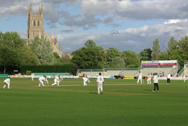
The county is home to Worcestershire County Cricket Club, traditionally the first stop on any touring national side's schedule in England. Formed officially in 1865, the Club initially played in Boughton Park, before moving to its current New Road ground, which today can host 5,500 spectators, in 1895. The club has won five County Championships in its history, most recently in 1989.
Worcester Rugby Football Club, the Worcester Warriors, are the county's largest and most successful Rugby Union team, having been promoted to the Premiership in 2004. The Warriors were relegated to the RFU Championship in 2010 but rebounded back to the Premiership in 2011. Worcester Warriors play at the Sixways Stadium on the outskirts of Worcester, holding over 12,000 spectators, thus making it the largest stadium in the county. Sixways has hosted the final of the LV Cup on three occasions.
Culture

The village of Broadheath, about 10 km northwest of the city of Worcester, is the birthplace of the composer Edward Elgar.
It is claimed that the county was the inspiration for the Shire, a region of J. R. R. Tolkien's fictional Middle-earth, described in The Hobbit and The Lord of the Rings. Tolkien was thought to have named Bilbo Baggins' house "Bag End" after his Aunt Jane's Worcestershire farm. Tolkien wrote of Worcestershire, "Any corner of that county (however fair or squalid) is in an indefinable way 'home' to me, as no other part of the world is." Humphrey, C. 1977 Tolkien: A Biography New York: Ballantine Books.
Worcestershire is one of the three counties associated with the Border Morris style of English folk dancing. Worcestershire Monkey is a popular Border Morris dance; although normally performed as a group of eight, it is sometimes danced en masse with multiple Border Morris sides performing the dance together. Worcestershire Monkey , Wicket Brood website
Worcestershire appeared as one of the main settings in the DreamWorks Animation animated film Shrek the Third. The director Chris Miller said they chose Worcestershire because it is always being mispronounced. "It just made us laugh. Plus we love the sauce, it's hugely popular in the States." The film makes multiple references to the real Worcestershire in the film, even commenting on the famous Worcestershire Sauce.
Media
Worcestershire has a long history in radio broadcasting. The county is home to the Droitwich Transmitting Station near Wychbold, currently broadcasting BBC Radio 5 Live and commercial radio services - Absolute Radio and Talksport on Medium Wave/AM and BBC Radio 4 on Long Wave. The site is the location of the British Broadcasting Corporation's most powerful long-wave transmitter, which during World War II, coded messages read during normal programme broadcasts, were received by the French Resistance. Lying close to the county's north western border is the Woofferton Transmitting Station, which was used during the Cold War to broadcast the Voice of America's Short Wave transmissions into the Eastern Bloc countries of Europe. These sets of transmitters are still in use today.
In 1939, the BBC bought the historic Wood Norton site near Evesham, and equipped the premises with a dozen temporary studios. These were to be used in the event of an evacuation of the BBC's operations in London and other urban areas. By 1940; Wood Norton was one of the largest broadcasting centres in Europe with an average output of 1,300 radio programmes a week. The BBC monitoring service were also based at Wood Norton, where linguists, many of them foreign nationals, were hired to listen in to broadcasts from Europe until they were relocated to Caversham Park in early 1943. The move was made to release space at Wood Norton so that it could become the BBC's main broadcasting centre, should London have to be evacuated because of the threat from Nazi Germany's V-weapons. The site was also prepared for use during the Cold War, as an emergency broadcast centre. The site is still in use for the BBC's engineering and technical training.
Television
The county's television news is covered by BBC West Midlands and ITV Central from its studios in Birmingham. Television signals are received from either the Ridge Hill or Sutton Coldfield TV transmitters.
Radio
BBC Hereford & Worcester and Hits Radio Herefordshire & Worcestershire broadcast to both Herefordshire and Worcestershire on analogue and digital radio platforms, whilst Greatest Hits Radio Midlands broadcasts to Kidderminster, Stourport-on-Severn, Bewdley and Droitwich. A community radio station - Radio Wyvern, is licensed to serve the Worcester area. Meanwhile, Capital Mid-Counties, Sunshine Radio and Like Radio, broadcast to the county on VHF/FM and/or DAB Digital Radio. Historically; West Midlands-based radio stations such as BBC Radio WM, Hits Radio Birmingham and Beacon Radio have considered parts of Worcestershire as their broadcast areas. However what were known as Wyvern, Beacon, BRMB along with Mercia are now known collectively as 'Hits Radio' and under the same Bauer Radio ownership. Other regional stations, such as Heart West Midlands and Smooth West Midlands also cover the county.
In 2007 the Office of Communications (Ofcom) awarded a DAB Digital Radio multiplex licence for Herefordshire & Worcestershire to MuxCo Ltd. MuxCo proposed new stations and a digital radio platform for Wyvern FM, Sunshine Radio and BBC Hereford & Worcester, who were initially licensed to broadcast on VHF/FM and/or AM. MuxCo eventually launched in December 2013 following changes in legislation through the Digital Economy Act 2010, and utilises existing transmitter locations at Great Malvern, Ridge Hill and Bromsgrove. The multiplex continues to uses the same transmission sites, albeit with an additional transmitter at Kidderminster and broadcasts a combination of local and national services. In 2008, MXR, who owned and operated the West Midlands regional DAB multiplex licence, improved coverage of DAB Digital Radio across other parts of the county to include Worcester and Malvern. This regional multiplex closed on 27 August 2013, partially replaced by CE Digital's Birmingham DAB Multiplex, who opened new transmitters at Lickey Hills and Headless Cross. Ofcom has earmarked two potential 'Small Scale DAB' digital radio multiplexes within Worcestershire - one at Worcester, and the other within Bromsgrove, Kidderminster and Redditch. The legal framework for the potential new multiplexes come under 'The Small-Scale Radio Multiplex and Community Digital Radio Order 2019'.
Economy
This is a chart of trend of regional gross value added of Worcestershire at current basic prices published (pp. 240–253) by Office for National Statistics with figures in millions of British Pounds Sterling.
| Year | Regional Gross Value Added | Agriculture | Industry | Services | ||||
|---|---|---|---|---|---|---|---|---|
| 1995 | ||||||||
| 2000 | ||||||||
| 2003 |
Industry and agriculture

Fruit farming and the cultivation of hops were traditional agricultural activities in much of the county. During the latter half of the 20th century, this has largely declined with the exception southern area of the county around the Vale of Evesham, where orchards are still worked on a commercial scale. Worcester City's coat of arms includes three black pears, representing a now rare local pear variety, the Worcester Black Pear. The county's coat of arms follows this theme, having a pear tree with black pears. The apple variety known as Worcester Pearmain originates from Worcestershire, and the Pershore plum comes from the small Worcestershire town of that name, and is widely grown in that area.
Worcestershire is also famous for a number of its non-agricultural products. The original Worcestershire sauce, a savoury condiment made by Lea & Perrins, is made in Worcester, and the now-closed Royal Porcelain works was based in the city. The town of Malvern is the home of the Morgan traditional sports car.
Education
Worcestershire has a comprehensive school system with over thirty-five independent schools including the RGS Worcester, The King's School, Worcester, Malvern St James and Malvern College. State schools in Worcester, the Wyre Forest District, and the Malvern Hills District are two-tier primary schools and secondary schools whilst Redditch and Bromsgrove have a three-tier system of first, middle and high schools. Several schools in the county provide Sixth-form education including two in the city of Worcester. Several vocational colleges provide GCSE and A-level courses and adult education, such as South Worcestershire College, and an agricultural campus of Warwickshire College in Pershore. There is also the University of Worcester, which is located in the city itself and is home to the National Pollen and Aerobiology Research Unit and five other national research centres.
Towns and villages

The county town and only city is Worcester. The other major settlements are Kidderminster, Bromsgrove and Redditch. There are also several market towns: Malvern, Bewdley, Evesham, Droitwich Spa, Pershore, Tenbury Wells, Stourport-on-Severn and Upton-upon-Severn. The village of Hartlebury housed the Bishop of Worcester from the 13th century until 2007.
Places of interest
- Almonry Museum - Evesham
- Avoncroft Museum of Historic Buildings [[File:Museum icon (red).svg]]
- Bewdley – riverside historic Tudor town
- Broadway – a picturesque Cotswold village
- Croome Court [[File:HH icon.svg]] [[File:NTE icon.svg]]
- Elgar Birthplace Museum [[File:Museum icon (red).svg]]
- Evesham Bell Tower
- Forge Mill Needle Museum at Redditch, the only remaining working needle mill in the world. [[File:Museum icon (red).svg]]
- Great Malvern Priory [[File:AP Icon.svg|16px]]
- Greyfriars' House and Garden [[File:Museum icon (red).svg]] [[File:NTE icon.svg]]
- Hanbury Hall [[File:HH icon.svg]] [[File:NTE icon.svg]]
- Hartlebury Castle [[File:HH icon.svg]]
- Harvington Hall [[File:HH icon.svg]]
- Kemerton Court [[File:HH icon.svg]]
- Malvern Hills – Area of Outstanding Natural Beauty [[File:UKAL icon.svg]]
- Middle Littleton Tithe Barn – a restored 13th-century tithe barn [[File:Museum icon (red).svg]]
- Morgan Cars – visitors centre and museum [[File:Museum icon (red).svg]]
- Pershore Abbey [[File:AP Icon.svg|16px]]
- River Severn at Worcester and Bewdley, River Avon at Pershore or Evesham
- River Teme and valley [[File:UKAL icon.svg]]
- Severn Valley Railway at Kidderminster. [[File:HR icon.svg]]
- Tenbury Wells with its unique Pump Rooms.
- The Commandery [[File:Museum icon (red).svg]]
- The Fleece Inn – an ancient public house, now owned by the National Trust[[File:NTE icon.svg]]
- The Hive, Worcester – the new University and public library (opened in 2012)
- Wadborough
- Walton Hill and the Clent Hills [[File:UKAL icon.svg]]
- West Midlands Safari Park near Bewdley.
- Witley Court at Great Witley – a burnt-out shell of a large English stately home, famous for its gigantic fountain, now restored to working order. Currently run by English Heritage. [[File:HH icon.svg]] [[File:EH icon.svg]]
- Worcester and Birmingham Canal [[File:UKAL icon.svg]]
- Worcester Cathedral [[File:AP Icon.svg|16px]]
- Worcestershire County Museum [[File:Museum icon (red).svg]]
- Worcester City Art Gallery & Museum
- Worcester Porcelain Museum [[File:Museum icon (red).svg]]
Local groups
- Worcestershire Wildlife Trust
- 29th Regiment of Foot
- West Midland Bird Club
Notes
References
Sources
- "Spa Towns: Malvern" 27 October, retrieved 24 June 2006
References
- [https://www.gov.uk/government/news/appointment-of-lord-lieutenant-of-worcestershire-15-december-2022 Number 10 website Accessed 2-3-2024].
- {{London Gazette. (14 March 2025)
- "Census 2011:KS201EW Ethnic group, local authorities in England and Wales". Office of National Statistics.
- Brooks N, Cubitt C (1996). "St. Oswald of Worcester - Life and Influence". The administrative landscape of the Diocese of Worcester in the tenth century. p147
- (2007). "Worcestershire". Yale University Press.
- James BSc(Hons) MSc PhD FIAP, K. (11 April 2018). "Stourbridge's Western Boundary: A cornerstone of the historical landscape".
- Tinti F.(2010) Sustaining Belief: The Church of Worcester from c.870 to c.1100
- Carter, W.F. "Additions to Grazebrook's 'The Barons of Dudley'". Chetwynd Papers.
- "The Domesday Book Online - Worcestershire E-L".
- Laird, "A Topographical and Historical Description of the County of Worcester" c. 1814; http://www.british-history.ac.uk/vch/worcs/vol3/pp1-4 British History Online: ''The hundred of Halfshire: Introduction and map'', Pages 1-4. A History of the County of Worcester: Volume 3. Originally published by Victoria County History, London, 1913.
- Brooks "Introduction" ''St Wulfstan and His World'' p. 3; Williams "Cunning of the Dove" ''St Wulfstan and His World'' pp. 33–35
- {{harvnb. Mundill. 2002
- [http://www.finewaters.com/Water_Spas/British_Spa_Towns/Malvern.asp Bottled Waters of the World] {{webarchive. link. (27 April 2009 . Retrieved 9 August 2009)
- Richardson, Eric (2000) The Black Country as Seen through Antique Maps, The Black Country Society {{ISBN. 0-904015-60-2
- [http://www.visionofbritain.org.uk A Vision of Britain through Time] [http://www.visionofbritain.org.uk/place/9874 Evenlode, Worcestershire] – Retrieved 7 May 2020
- [http://www.visionofbritain.org.uk A Vision of Britain through Time] [http://www.visionofbritain.org.uk/place/9726 Blockley, Worcestershire] – Retrieved 7 August 2014
- [http://www.worcesterbmsgh.co.uk/ Worcester Branch of the Birmingham & Midland Society for Genealogy and Heraldry] [http://www.worcesterbmsgh.co.uk/ShipstonOnStour.html Shipston-upon-Stour] {{Webarchive. link. (10 August 2011 – Retrieved 7 May 2020)
- [http://www.worcesterbmsgh.co.uk/ Worcester Branch of the Birmingham & Midland Society for Genealogy and Heraldry] [http://www.worcesterbmsgh.co.uk/Rochford.html Rochford, Herefordshire] {{Webarchive. link. (10 August 2011 – Retrieved 7 May 2020)
- [http://www.worcesterbmsgh.co.uk/ Worcester Branch of the Birmingham & Midland Society for Genealogy and Heraldry] [http://www.worcesterbmsgh.co.uk/Broom.html Broome, Staffordshire] {{Webarchive. link. (10 August 2011 – Retrieved 7 May 2020)
- Harbach M, [https://web.archive.org/web/20010417052052/http://www.genuki.org.uk/big/eng/STS/Boundaries.html Genealogy UK & Ireland] – Retrieved 29 July 2011
- [http://www.visionofbritain.org.uk/index.jsp A Vision of Britain through Time] [http://www.visionofbritain.org.uk/place/place_page.jsp?p_id=21106 Tardebigge, Warwickshire] – Retrieved 27 May 2020
- [http://www.worcesterbmsgh.co.uk/ Worcester Branch of the Birmingham & Midland Society for Genealogy and Heraldry] [http://www.worcesterbmsgh.co.uk/Tardebigge.html Tardebigge] {{Webarchive. link. (6 September 2011 – Retrieved 7 May 2020)
- (1906). "English Local Government from the Revolution to the Municipal Corporations Act". [[Longman.
- [http://www.legislation.gov.uk/ HM Government Legislation] [http://www.legislation.gov.uk/ukpga/Vict/51-52/41 Local Government Act 1888] – Retrieved 7 May 2020
- link. (30 September 2007 – Retrieved 7 May 2020)
- [http://www.british-history.ac.uk British History Online] [http://www.british-history.ac.uk/report.aspx?compid=22958 A History of the County of Warwick: Volume 7: The City of Birmingham] – Retrieved 27 May 2020
- "celtic-casimir.com".
- {{Cite EB1911
- "A History of Dudley". Localhistories.org.
- [[Staffordshire County Council]] [http://www.staffordshire.gov.uk/leisure/archives/history/placeguide/SPGSedgley.aspx Staffordshire Place Guide – Sedgley] {{Webarchive. link. (5 April 2019 – Retrieved 7 May 2020)
- [[Staffordshire County Council]] [http://www.staffordshire.gov.uk/leisure/archives/history/placeguide/SPGAmblecote.aspx Staffordshire Place Guide – Amblecote] {{Webarchive. link. (5 April 2019 – Retrieved 7 May 2020)
- "Warley County Borough". Vision of Britain.
- HM Government Legislation – The West Midland Counties Order 1965
- [http://www.legislation.co.uk HM Government Legislation] [http://www.legislation.gov.uk/ukpga/1952/54/pdfs/ukpga_19520054_en.pdf Town Development Act 1952] – Retrieved 15 August 2014
- Local Government in England: Government Proposals for Reorganisation (Cmnd. 4584) Circular 8/71 map
- [http://www.legislation.gov.uk H.M. Government] [http://www.legislation.gov.uk/ukpga/1972/70 Local Government Act 1972] – Retrieved 7 May 2020; [https://api.parliament.uk/historic-hansard/index.html Hansard 1803–2005] {{Webarchive. link. (1 August 2023 [https://api.parliament.uk/historic-hansard/commons/1965/dec/02/local-government-west-midlands-order Local Government (West Midlands Order) Debate] {{Webarchive). link. (28 September 2020 – Retrieved 7 May 2020)
- [http://www.legislation.gov.uk HM Government Legislation] [http://www.legislation.gov.uk/ukpga/1985/51/contents Local Government Act 1985] – Retrieved 7 May 2020
- [http://www.legislation.gov.uk/ HM Government Legislation] [http://www.legislation.gov.uk/uksi/1996/1867/contents/made The Hereford and Worcester (Structural, Boundary and Electoral Changes) Order 1996] – Retrieved 7 May 2020
- [[Hansard. House of Commons Debates]] – [https://publications.parliament.uk/pa/cm199596/cmhansrd/vo960402/text/60402w22.htm Parliamentary Business] – Retrieved 7 May 2020
- [https://web.archive.org/web/20150721204542/https://www.lgbce.org.uk/__data/assets/pdf_file/0007/9079/str-hereford-and-worcester-final-recs-dec1994.pdf Final Recommendations for the Future Local Government of Hereford and Worcester. December 1994] – Retrieved 16 May 2013
- [https://www.sandwelltrends.info/wp-content/uploads/sites/5/2022/09/Rowley-Regis-Town-Profile-September-2022.pdf?fbclid=IwY2xjawIoXYBleHRuA2FlbQIxMAABHYp9i-BmM4tb5zStMH-Q55nKbkoGedrWHpQpD9dY2WvQJ3uMfjXB7nLQCg_aem_iyF1MG2LvNe69QCZEO1r0g] – Retrieved 23 February 2025
- "Worcester Built Up Area - Population 107,545".
- "Redditch Built Up Area - Population 85,277".
- "Kidderminster Civil Parish - Population 57,414".
- "Bromsgrove Built Up Area - Population 36,537".
- "Malvern Civil Parish - Population 30,472".
- "The borough of Tewkesbury: Introduction".
- "Stourbridge Registration District, Worcestershire (including Stourbridge, Halesowen, Quinton area of Birmingham)".
- "Warley East, Worcestershire (including Oldbury, Smethwick, West Bromwich, areas of Birmingham Registration District)".
- "Warley West, Worcestershire (including Oldbury, Rowley Regis, Dudley)".
- "Warley County Borough through time: 1 acre of Brierly Hill Urban District granted to Warley Borough, 1st April 1966".
- "Netherton, Worcestershire".
- "Birmingham Built Up Area - Population 1,091,741 excluding Chelmsley Wood, Castle Bromwich, Smith's Wood, Fordbridge, Kingshurst, Bickenhill and Marston Green (see next sources)".
- "Chelmsley Wood Civil Parish - Population 13,734".
- "Castle Bromwich Civil Parish - Population 11,459".
- "Smith's Wood Civil Parish - Population 10,637".
- "Fordbridge Civil Parish - Population 8,690".
- "Kingshurst Civil Parish - Population 8,350".
- "Bickenhill and Marston Green Civil Parish - Population 7,438".
- "West Bromwich Built Up Area - Population 111,959".
- "Smethwick Built Up Area - Population 65,644".
- "Halesowen Built Up Area - Population 64,414".
- "Rowley Regis Built Up Area (excludes Cradley Heath, Old Hill, see next source) - Population 45,865".
- "Cradley Heath and Old Hill (Rowley Regis) Electoral Ward - Population 14,965".
- "Dudley Built Up Area - Population 57,932 excluding Netherton, Dudley Wood (see next sources)".
- "Netherton Middle layer Super Output Area - Population 8,071".
- "Netherton Middle layer Super Output Area 2 (Dudley Wood & Saltwells) - Total population 7,798. No individual population count for the Saltwells suburb of Netherton excluding Dudley Wood village available, but confirms that Netherton's population was between 8,071-15,869.".
- "Oldbury Built Up Area - Population 54,766".
- "Stourbridge Built Up Area - Population approximately 47,000 excluding Amblecote, Lye (see next sources)".
- "Lye & Wynall Middle layer Super Output Area - No individual population count for Lye available, but confirms that its population was somewhere below 6,670.".
- "Amblecote West & Stambermill Middle layer Super Output Area - Population 6,814".
- "Quarry Bank Middle layer Super Output Area - Population 8,738".
- "Amblecote East - Despite its name is a combination of areas of Quarry Bank and Withymoor Village. No individual population count for the Quarry Bank part available, but confirms that its total population was between 8,738-15,521.".
- "Tewkesbury Civil Parish - Population 10,662".
- Bathurst, David. (2012). "Walking the county high points of England". Summersdale.
- (1 January 1970). "Learning Zone Class Clips - The course of the River Severn - from source to sea - Geography Video". BBC.
- "NAAONB Website". Aonb.org.uk.
- "Kidderminster Harriers Home Page".
- "Archived copy".
- "Archived copy".
- "Worcester Warriors - Official website of Worcester Warriors Rugby Club".
- (29 June 2007). "Worcester News, Worcestershire in Shrek 3".
- [https://www.bbc.co.uk/herefordandworcester/content/articles/2005/10/21/droitwich_transmitter_feature.shtml BBC Feature] Retrieved 7 May 2020
- [http://www.bbceng.info/ BBC Engineering] [http://www.bbceng.info/Operations/transmitter_ops/Reminiscences/Droitwich/droitwich_calling.htm Droitwich Calling (Archive)] - Retrieved 7 May 2020
- "London Video Content Delivery Solutions".
- Pawley, E. (1972), Cutmore, N. (Ed.), Laven, P (Ed.) [https://www.bbc.com/historyofthebbc/buildings/wood-norton History of the BBC - Wood Norton]
- [https://www.subbrit.org.uk/ Subterranea Britannica] [https://www.subbrit.org.uk/sites/bbc-wood-norton/ Wood Norton] - Retrieved 7 May 2020
- (1 May 2004). "Full Freeview on the Ridge Hill (County of Herefordshire, England) transmitter".
- (1 May 2004). "Sutton Coldfield (Birmingham, England) Full Freeview transmitter".
- [http://ofcom.org.uk Ofcom] {{Webarchive. link. (8 May 2020 [https://www.ofcom.org.uk/__data/assets/pdf_file/0026/96191/BBC000022WT.pdf BBC Hereford & Worcester licence] - Retrieved 7 May 2020; [http://ofcom.org.uk Ofcom] [http://static.ofcom.org.uk/static/radiolicensing/html/radio-stations/analogue/al000061ba5freeradio.htm Free Radio (Hereford/Worcester)] - Retrieved 7 May 2020)
- [http://ofcom.org.uk Ofcom] {{Webarchive. link. (8 May 2020 [http://static.ofcom.org.uk/static/radiolicensing/html/radio-stations/analogue/al000294ba1signal107.htm Signal 107]{{Dead link). (May 2023)
- [http://ofcom.org.uk Ofcom] {{Webarchive. link. (8 May 2020 [http://static.ofcom.org.uk/static/radiolicensing/html/radio-stations/community/cr000053ba2youthcommradio.htm Youthcomm Radio] {{Webarchive). link. (31 May 2020 - Retrieved 7 May 2020)
- "Ofcom | Analogue Radio Stations".
- Allen, D.P. (2011) [https://eprints.worc.ac.uk/1430/1/Independent_Local_Radio_%28ILR%29_in_the_West_Midlands%2C_1972-198.pdf Independent Local Radio (ILR) in the West Midlands, 1972-1984: a comparative study of BRMB Radio and Beacon Radio.]- Retrieved 7 May 2020
- [https://www.bauermedia.co.uk/ Bauer Media] [https://www.bauermedia.co.uk/brands/free-radio Free Radio Brand] {{Webarchive. link. (18 February 2020 Retrieved 7 May 2020)
- [http://ofcom.org.uk Ofcom] {{Webarchive. link. (8 May 2020 [https://www.ofcom.org.uk/about-ofcom/latest/media/media-releases/2007/ofcom-awards-new-local-digital-radio-multiplex-licence-for-herefordshire-and-worcestershire Ofcom awards new local digital radio multiplex licence for Herefordshire and Worcestershire] {{Webarchive). link. (30 September 2020 - Retrieved 7 May 2020)
- [http://www.legislation.gov.uk HM Government] [http://www.legislation.gov.uk/ukpga/2010/24/section/35 Digital Economy Act - Section 35] - Retrieved 7 May 2020
- [http://ofcom.org.uk Ofcom] {{Webarchive. link. (8 May 2020 [http://static.ofcom.org.uk/static/radiolicensing/html/radio-stations/digital/dl000050ba3herefordshireandworcestershire.htm Herefordshire and Worcestershire DAB Multiplex Ownership] - Retrieved 7 May 2020)
- [http://ofcom.org.uk Ofcom] {{Webarchive. link. (8 May 2020 [http://static.ofcom.org.uk/static/radiolicensing/mcamaps/dl000050.pdf Herefordshire and Worcestershire] - Retrieved 7 May 2020)
- [http://www.muxco.com/ MuxCo] [http://www.muxco.com/multiplexes/herefordshireandworcestershire/ Digital Broadcast Radio Predicted On-Air Coverage Herefordshire & Worcestershire Block 12A Local DAB Multiplex] - Retrieved 7 May 2020
- [http://ofcom.org.uk Ofcom] {{Webarchive. link. (8 May 2020 [http://static.ofcom.org.uk/static/radiolicensing/mcamaps/dl000001.pdf Digital Broadcast Radio Predicted On-Air Coverage Birmingham Block 11C Local DAB Multiplex] - retrieved 7 May 2020)
- [https://www.ofcom.org.uk/ Ofcom] [https://www.ofcom.org.uk/consultations-and-statements/category-1/licensing-small-scale-dab-new-powers-and-duties-proposed-by-government under new licensing guidelines Licensing small-scale DAB New powers and duties proposed by government under new licensing guidelines] - Retrieved 8 May 2020
- [https://www.ofcom.org.uk/ Ofcom] [https://www.ofcom.org.uk/__data/assets/pdf_file/0027/193662/statement-licensing-small-scale-dab.pdf Statement licensing Small-Scale DAB] - Retrieved 6 May 2020
- [https://www.legislation.gov.uk/ HM Government] [https://www.legislation.gov.uk/ukdsi/2019/9780111187784/contents The Small-scale Radio Multiplex and Community Digital Radio Order 2019 - Contents] - Retrieved 8 May 2020; [http://www.legislation.gov.uk/ HM Government] [http://www.legislation.gov.uk/ukdsi/2019/9780111187784/pdfs/ukdsiem_9780111187784_en.pdf The Small-scale Radio Multiplex and Community Digital Radio Order 2019 - Explanation Guide] - Retrieved 8 May 2020
- Components may not sum to totals due to rounding
- includes hunting and forestry
- includes energy and construction
- includes financial intermediation services indirectly measured
- "Welcome to Worcestershire County Council {{!}} Worcestershire County Council".
This article was imported from Wikipedia and is available under the Creative Commons Attribution-ShareAlike 4.0 License. Content has been adapted to SurfDoc format. Original contributors can be found on the article history page.
Ask Mako anything about Worcestershire — get instant answers, deeper analysis, and related topics.
Research with MakoFree with your Surf account
Create a free account to save articles, ask Mako questions, and organize your research.
Sign up freeThis content may have been generated or modified by AI. CloudSurf Software LLC is not responsible for the accuracy, completeness, or reliability of AI-generated content. Always verify important information from primary sources.
Report