From Surf Wiki (app.surf) — the open knowledge base
Woodmancote, Horsham District
Village and parish in West Sussex, England
.jpg)
Village and parish in West Sussex, England
| Field | Value |
|---|---|
| official_name | Woodmancote |
| country | England |
| civil_parish | Woodmancote |
| region | South East England |
| static_image | St Peter's church, Woodmancote.JPG |
| static_image_width | 240px |
| static_image_caption | Church of St. Peter |
| area_footnotes | |
| area_total_km2 | 8.49 |
| population | 478 |
| population_ref | 2001 Census |
| 543 (2011 Census) | |
| population_density | 56 /km2 |
| os_grid_reference | TQ235147 |
| coordinates | |
| post_town | HENFIELD |
| postcode_area | BN |
| postcode_district | BN5 |
| dial_code | 01273 |
| constituency_westminster | Arundel and South Downs |
| london_distance | 41 mi N |
| shire_district | Horsham |
| shire_county | West Sussex |
543 (2011 Census) Woodmancote is a village and civil parish in the Horsham District of West Sussex, England. The village is 1 mi south-east of Henfield on the A281 road. It should not be confused with the other West Sussex village of Woodmancote near Chichester.
This scattered community has no village centre. The parish includes the hamlet of Blackstone. The Anglican parish church, St Peter's, which stands alone beside the A281 road, dates to the thirteenth century, and was largely rebuilt in 1868. Close to the church is Woodmancote Place, a large house used as a country club. There is also a parish hall.
Woodmancote is recorded in the Domesday Book of 1086 as "Odemancote". Two of the Lewes martyrs, burnt at the stake in the Marian Persecutions of 1556, Thomas Harland and John Oswald, came from Woodmancote.
The parish has a land area of 849 ha. In the 2001 census 478 people lived in 189 households, of whom 248 were economically active. At the 2011 Census the population was 543.
Blackstone
Main article: Blackstone, West Sussex
The hamlet of Blackstone () has many ancient houses and barns, in a still largely farmed landscape. To its north, Blackstone Lane widens to a linear green for much of its length to Blackstone Gate. There was a little triangular common at the Gate that was enclosed around 150 years ago.:172
Notable buildings and areas
|frame-align=left In early medieval times this was a lonely countryside of commons, marshes and woods. The Saxons commonly noted thorn bushes as boundary marks between estates and many of the boundary mark names survive here such as Eaton Thom () (a half-timbered 'gingerbread' house), which may be a corruption of'Heathen Thorn'), Wodesmansthorne (the old alternative name for Woodmancote) and Paythorne (Paga's thorn). It is now largely farmland with three notable woods and some big houses.:172
Woodmancote church
Woodmancote church () is dedicated to St. Peter. It was originally built in the 13th century. In about 1228 the church was given to the Knights Templar, and in 1312 it passed to the Knights of St John. It was largely rebuilt in 1869 and very little remains from the earlier periods of the church history. The bowl, drum and pillars of the font are Norman and the remainder dates back to the 14th century. It has some fossil winklestone in its south wall.
Woodmancote Place

Woodmancote Place () sits next to the church and its surrounding outbuildings, are of many periods, right back to Chaucerian times. It was owned by Countess Guda at the times of the Domesday Book and then the notorious Sir Edward Seymour, otherwise known as Edward the Protector.
Bylsborough
Just north of Furners's Lane is Bylsborough (). It was once a hamlet, but is now reduced to a big house, outbuildings and an old cottage. It is a Grade II listed building. In front of the house is a giant sweet chestnut pollard.
Streams
There are two notable streams in the parish. The Cutler's Brook runs through the parish to its north. It is a tributary of the River Adur that rises near Clayton. It then runs through Hurstpierpoint, south of Albourne and north of Woodhouse Wood, north of Henfield and joins the Adur at Betley Bridge.
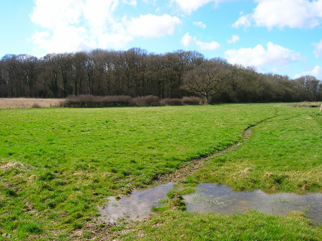
The Pokerlee Stream runs through the south of parish. It then runs into Henfield and into the Beeding Brooks where it joins the River Adur. It runs through an area called the Moors (), which is a low plain with some unimproved wet rush pastures. There is gorse and birch in the fence lines and bog pondweed in two ditches. To the north of the Moors is a pony-grazed western fields behind the Swains Farm Shop hold a large and well-managed population of the rare meadow thistle in Sussex, with a fine display of heath spotted orchid, lousewort, tormentil, ragged robin, marsh pennywort and at least six sedges.
Woodhouse Wood
Woodhouse Wood () is a remote and quiet wood west of Blackstone Bridge. It is carpeted with bluebells and has stand of oak maidens. It benefits from Cutler's Brook and in spring is busy with bumblebees, beetles, nibbling caterpillars and banded demoiselles flying in from the water. There is the impressive cotton wool gall, Andricus quercus ramuli, on the oaks there, accompanied by the metallic green gall wasps which are scarcely 2 mm long.:172
The Alders

The Alders woods (), known locally as the "Bluebell Wood", are mostly wet carr, but are carpeted by Bluebells on the northern rising ground. On the east side of The Alders was a small marsh () with heath spotted orchid, marsh cinquefoil, narrow buckler-fern and water purslane. More recently it has become overgrown with bramble and young saplings and the Rampion Wind Farm cable runs along its eastern edge.:173
West Wood
West Wood () is an ancient woodland. Its coppice is largely unmanaged and many of its Oaks are thin poles. It had had butterfly orchid, along with classic clay woods plants like wood millet and midland hawthorn.:172
References
References
- "2001 Census: West Sussex – Population by Parish". West Sussex County Council.
- "Civil Parish population 2011". Office for National Statistics.
- (11 May 1901). "The Lewes Martyrs' Memorial". Sussex Agricultural Express.
- "Civil Parish population 2011". ''Neighbourhood Statistics''. Office for National Statistics. Retrieved 4 October 2016.
- Bangs, David. (2018). "Land of the Brighton line : a field guide to the Middle Sussex and South East Surrey Weald".
- (2019-12-04). "St Peter's Church Woodmancote".
- Kirkwood, Holly. (2013-08-22). "Idyllic houses under an hour from London".
This article was imported from Wikipedia and is available under the Creative Commons Attribution-ShareAlike 4.0 License. Content has been adapted to SurfDoc format. Original contributors can be found on the article history page.
Ask Mako anything about Woodmancote, Horsham District — get instant answers, deeper analysis, and related topics.
Research with MakoFree with your Surf account
Create a free account to save articles, ask Mako questions, and organize your research.
Sign up freeThis content may have been generated or modified by AI. CloudSurf Software LLC is not responsible for the accuracy, completeness, or reliability of AI-generated content. Always verify important information from primary sources.
Report