From Surf Wiki (app.surf) — the open knowledge base
Wiler

| Field | Value | ||
|---|---|---|---|
| subject_name | Wiler (Lötschen) | ||
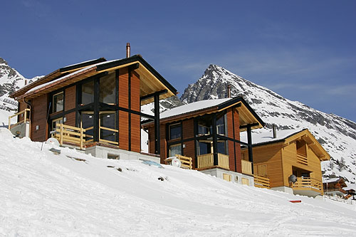
| image_photo | Wiler k.jpg | ||
| municipality_type | municipality | ||
| imagepath_coa | CHE Wiler COA.svg | ||
| imagepath_flag | CHE Wiler Flag.svg | ||
| canton | Valais | ||
| iso-code-region | CH-VS | ||
| district | Raron | ||
| coordinates | |||
| postal_code | 3918 | ||
| municipality_code | 6202 | ||
| area | 14.68 | ||
| elevation | 1421 | elevation_description= | |
| population | 538 | populationof = December 2002 | popofyear = 2002 |
| mayor | mayor_asof= | mayor_party= | |
| mayor_title | list_of_mayors = | ||
| neighboring_municipalities | Blatten (Lötschen), Kandersteg (BE), Kippel, Niedergesteln, Raron |
| iso-code-region = CH-VS |}} Wiler (Lötschen) is a municipality in the district of Raron in the canton of Valais in Switzerland.
Geography
Wiler has an area, , of 14.7 km2. Of this area, 2.83 km2 or 19.3% is used for agricultural purposes, while 3.4 km2 or 23.2% is forested. Of the rest of the land, 0.37 km2 or 2.5% is settled (buildings or roads), 0.14 km2 or 1.0% is either rivers or lakes and 7.95 km2 or 54.2% is unproductive land.
Of the built up area, housing and buildings made up 1.4% and transportation infrastructure made up 0.9%. Out of the forested land, 19.6% of the total land area is heavily forested and 2.5% is covered with orchards or small clusters of trees. Of the agricultural land, 0% is used for growing crops, 5.2% is pastures and 14.1% is used for alpine pastures. All the water in the municipality is flowing water. Of the unproductive areas, 13.6% is unproductive vegetation, 36.5% is too rocky for vegetation and 4.2% of the land is covered by glaciers.
Coat of arms
The blazon of the municipal coat of arms is Argent, four Cynorrhodon Flowers Gules conjoined Or surrounded by a Garland and in base Coupeaux Vert.
Demographics
Wiler has a population () of . , 5.1% of the population are resident foreign nationals. Over the last 10 years (2000–2010), the population has changed at a rate of 9.3%. It has changed at a rate of 2% due to migration and at a rate of 8.3% due to births and deaths.
Most of the population () speaks German (479 or 98.2%) as their first language, Serbo-Croatian is the second most common (4 or 0.8%) and Danish is the third (3 or 0.6%).
, the population was made up of 522 Swiss citizens and 28 non-citizen residents (5.09% of the population). Of the population in the municipality, 355 or about 72.7% were born in Wiler and lived there in 2000. There were 97 or 19.9% who were born in the same canton, while 24 or 4.9% were born somewhere else in Switzerland, and 11 or 2.3% were born outside of Switzerland.
, children and teenagers (0–19 years old) make up 21.5% of the population, while adults (20–64 years old) make up 65% and seniors (over 64 years old) make up 13.5%.
, there were 229 people who were single and never married in the municipality. There were 224 married individuals, 28 widows or widowers and 7 individuals who are divorced.
, there were 175 private households in the municipality, and an average of 2.8 persons per household. , the construction rate of new housing units was 16.3 new units per 1000 residents.
The historical population is given in the following chart: Colors= id:lightgrey value:gray(0.9) id:darkgrey value:gray(0.8) ImageSize = width:960 height:210 PlotArea = height:150 left:100 bottom:50 right:100 AlignBars = justify DateFormat = x.y Period = from:0 till:490 TimeAxis = orientation:vertical AlignBars = justify ScaleMajor = gridcolor:darkgrey increment:100 start:0 ScaleMinor = gridcolor:lightgrey increment:20 start:0 PlotData= color:yellowgreen width:40 mark:(line,white) align:center bar:1850 from:start till:181 text:"181" bar:1860 from:start till:221 text:"221" bar:1870 from:start till:223 text:"223" bar:1880 from:start till:233 text:"233" bar:1888 from:start till:225 text:"225" bar:1900 from:start till:228 text:"228" bar:1910 from:start till:272 text:"272" bar:1920 from:start till:291 text:"291" bar:1930 from:start till:287 text:"287" bar:1941 from:start till:305 text:"305" bar:1950 from:start till:338 text:"338" bar:1960 from:start till:357 text:"357" bar:1970 from:start till:410 text:"410" bar:1980 from:start till:420 text:"420" bar:1990 from:start till:428 text:"428" bar:2000 from:start till:488 text:"488"
Politics
In the 2007 federal election, the most popular party was the CVP which received 71.3% of the vote. The next three most popular parties were the SVP (16.64%), the Green Party (5.29%) and the SP (4.16%). In the federal election, a total of 206 votes were cast, and the voter turnout was 52.0%.
Economy

, Wiler had an unemployment rate of 1.3%. , there were 54 people employed in the primary economic sector and about 19 businesses involved in this sector. 28 people were employed in the secondary sector and there were 8 businesses in this sector. 113 people were employed in the tertiary sector, with 28 businesses in this sector. There were 255 residents of the municipality who were employed in some capacity, of which females made up 34.9% of the workforce.
In 2008, the total number of full-time equivalent jobs was 141. The number of jobs in the primary sector was 28, of which 19 were in agriculture and 9 were in forestry or lumber production. The number of jobs in the secondary sector was 26 of which 3 or (11.5%) were in manufacturing and 23 (88.5%) were in construction. The number of jobs in the tertiary sector was 87. In the tertiary sector; 14 or 16.1% were in wholesale or retail sales or the repair of motor vehicles, 18 or 20.7% were in the movement and storage of goods, 30 or 34.5% were in a hotel or restaurant, 2 or 2.3% were the insurance or financial industry, 2 or 2.3% were technical professionals or scientists, 6 or 6.9% were in education and 2 or 2.3% were in health care.
, there were 46 workers who commuted into the municipality and 141 workers who commuted away. The municipality is a net exporter of workers, with about 3.1 workers leaving the municipality for every one entering. Of the working population, 23.1% used public transportation to get to work, and 42.4% used a private car.
Transport
Wiler lies on the road up the Lötschental valley from Steg and Goppenstein. The road passes through Wiler village and reaches its end at Fafleralp. A PostAuto bus service runs along the road, connecting the municipality to Goppenstein railway station, with some buses continuing to Steg.
Religion
From the , 472 or 96.7% were Roman Catholic, while 13 or 2.7% belonged to the Swiss Reformed Church. 1 (or about 0.20% of the population) belonged to no church, are agnostic or atheist, and 2 individuals (or about 0.41% of the population) did not answer the question.
Education
In Wiler about 216 or (44.3%) of the population have completed non-mandatory upper secondary education, and 26 or (5.3%) have completed additional higher education (either university or a Fachhochschule). Of the 26 who completed tertiary schooling, 88.5% were Swiss men, 11.5% were Swiss women.
, there were 10 students in Wiler who came from another municipality, while 22 residents attended schools outside the municipality.
References
References
- [http://www.bfs.admin.ch/bfs/portal/de/index/themen/02/03/blank/data/gemeindedaten.html Swiss Federal Statistical Office-Land Use Statistics] 2009 data {{in lang. de accessed 25 March 2010
- [http://www.crwflags.com/fotw/flags/ch-vs168.html Flags of the World.com] accessed 13-October-2011
- [http://www.bfs.admin.ch/bfs/portal/de/index/infothek/onlinedb/superweb/login.html Swiss Federal Statistical Office - Superweb database - Gemeinde Statistics 1981-2008] {{in lang. de accessed 19 June 2010
- [http://www.bfs.admin.ch/bfs/portal/en/index/regionen/02/key.html Swiss Federal Statistical Office] accessed 13-October-2011
- link. (2013-08-09 {{in lang). de accessed 2 February 2011
- There were 36 households that consist of only one person and 20 households with five or more people. {{as of. 2000. link. (2014-09-07 {{in lang). de accessed 28 January 2011
- link. (2014-09-30 {{in lang). de accessed 29 January 2011
- [http://www.bfs.admin.ch/bfs/portal/de/index/themen/17/02/blank/data/04/03.html Swiss Federal Statistical Office, ''Nationalratswahlen 2007: Stärke der Parteien und Wahlbeteiligung, nach Gemeinden/Bezirk/Canton''] {{in lang. de accessed 28 May 2010
- link. (2014-12-25 {{in lang). de accessed 28 January 2011
- [http://www.media-stat.admin.ch/stat/pendler/pop.php Swiss Federal Statistical Office - Statweb] {{Webarchive. link. (2007-08-04 {{in lang). de accessed 24 June 2010
- "Gampel-Steg–Hohtenn–Goppenstein–Blatten (Lötschen)–Fafleralp". Bundesamt für Verkehr.
This article was imported from Wikipedia and is available under the Creative Commons Attribution-ShareAlike 4.0 License. Content has been adapted to SurfDoc format. Original contributors can be found on the article history page.
Ask Mako anything about Wiler — get instant answers, deeper analysis, and related topics.
Research with MakoFree with your Surf account
Create a free account to save articles, ask Mako questions, and organize your research.
Sign up freeThis content may have been generated or modified by AI. CloudSurf Software LLC is not responsible for the accuracy, completeness, or reliability of AI-generated content. Always verify important information from primary sources.
Report