From Surf Wiki (app.surf) — the open knowledge base
Weston, Hertfordshire
Village in Hertfordshire, England
Village in Hertfordshire, England
| Field | Value |
|---|---|
| country | England |
| static_image_name | Village pond and willow tree, Weston - geograph.org.uk - 3386969.jpg |
| static_image_caption | Pond on the village green |
| coordinates | |
| official_name | Weston |
| population | 1,035 |
| population_ref | (Parish, 2021) |
| shire_district | North Hertfordshire |
| shire_county | Hertfordshire |
| region | East of England |
| constituency_westminster | North East Hertfordshire |
| post_town | HITCHIN |
| postcode_district | SG4 |
| postcode_area | SG |
| dial_code | 01462 |
| os_grid_reference | TL260303 |
Weston is a village and civil parish in the North Hertfordshire district of Hertfordshire, England. The village stands on a plateau of high ground, about 2 miles south of Baldock, its nearest town, although Weston's post town is Hitchin, 5 miles to the west. The parish includes extensive rural areas as well as the village itself, including the hamlet of Hall's Green to the south-east of the village. At the northern end of the parish are the Weston Hills, where the plateau drops down to the southern edges of Baldock. The Weston Hills Tunnel carries the A505 Baldock bypass under the hills. The parish had a population of 1,035 at the 2021 census.
History
Weston appears in the Domesday Book of 1086, when it was described as having 75 households. Two priests were mentioned, suggesting Weston was already a parish. At that time Weston included the site where the Knights Templar would later develop the town of Baldock in the 12th century. The northern tip of Weston parish was ceded to become the new parish of Baldock around that time. The concession was modest; the parish of Baldock originally had an area of just 158 acres, whereas the remainder of Weston parish had an area of 4555 acres.
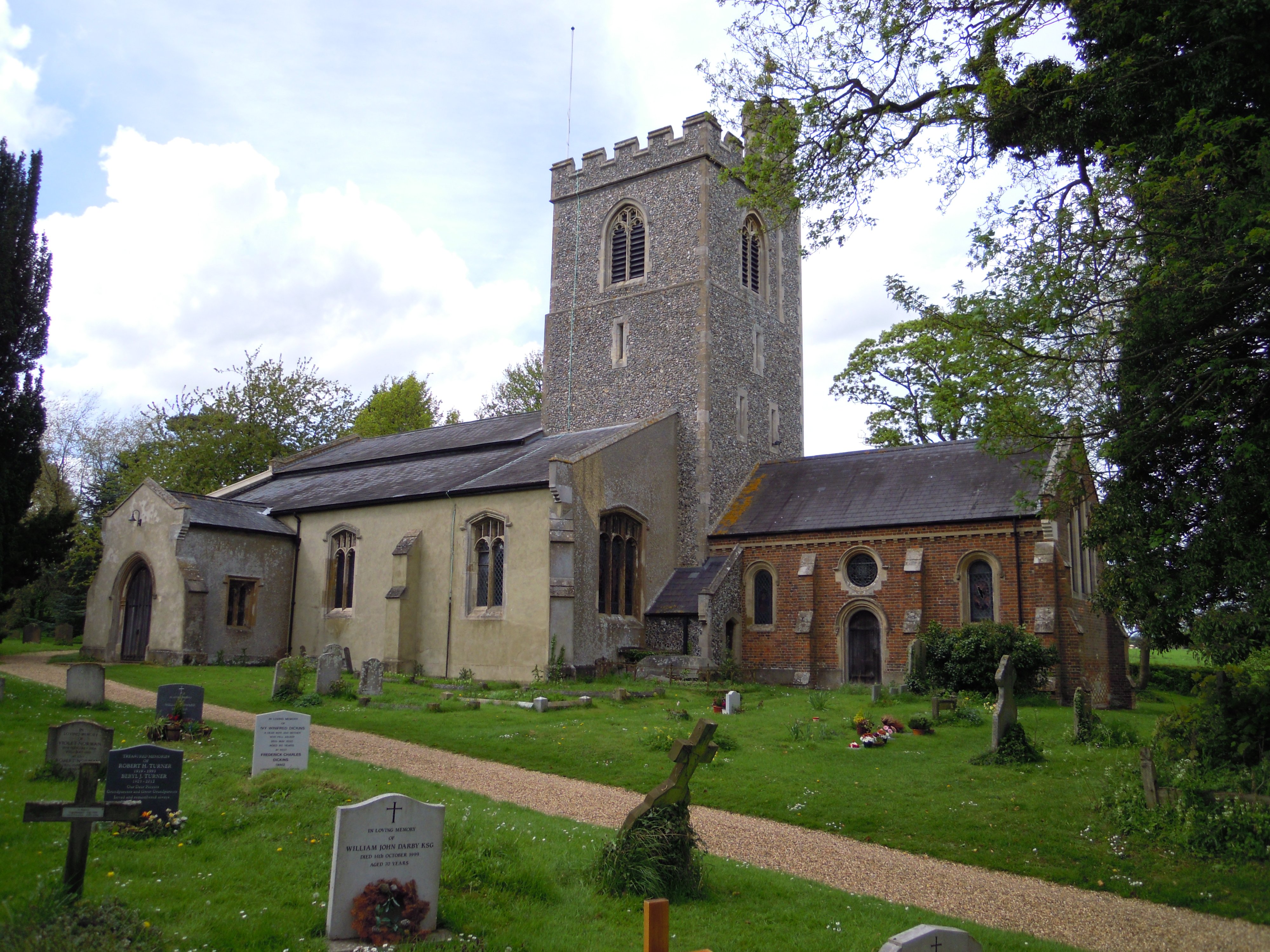
Holy Trinity Church stands on the south-eastern edge of the village and dates back to the 12th century. The main part of the village subsequently developed along Fore Street, Maiden Street and Damask Green Road, which meet at a small village green with a pond, about half a mile west of the church.

There is a local legend of a giant called Jack o'Legs, who is said to have lived in a cave in the area and stole from the shopkeepers in Baldock to give to the poor in Weston. On being caught and either mortally wounded or sentenced to death (versions differ) he asked to be allowed to shoot an arrow to indicate where he wanted to be buried. The arrow flew three miles to the churchyard at Weston. Stones and a sign in the churchyard still mark his supposed grave. The earliest documented reference to Jack o'Legs dates from 1521, but in a context suggesting it was already a well-known story.

Weston Windmill, also known as Lannock Mill, was built in 1860 to the west of the village. It is no longer operational, and has lost its cap, sails and machinery. The surviving tower has been converted to other uses.
Weston Road and the Village of Weston, both within Toronto, Canada, were named after this place.
Facilities
Weston village today has a primary school, village hall, a shop, and a pub, the Cricketers. There is another pub, the Rising Sun, in the hamlet of Hall's Green.
Governance

There are three tiers of local government covering Weston, at parish, district, and county level: Weston Parish Council, North Hertfordshire District Council, and Hertfordshire County Council. The parish council meets at the village hall on Maiden Street.
Population
At the 2021 census, the population of the parish was 1,035.
Gallery
File:Weston Primary School 2014.jpg|Weston (CofE) Primary School and Nursery Image:Weston Cottages.jpg|A row of cottages at Weston
References
References
- "2021 Census Parish Profiles". Office for National Statistics.
- "Weston".
- (1912). "A History of the County of Hertford: Volume 3". Victoria County History.
- (1912). "A History of the County of Hertford: Volume 3". Victoria County History.
- (1884). "Hertfordshire Sheet VII". Ordnance Survey.
- {{NHLE
- (2020). "Weston Conservation Area Character Statement". North Hertfordshire District Council.
- (5 September 2008). "Jack O'Legs: A tall tale!".
- {{NHLE
- "Election Maps". Ordnance Survey.
- "Weston PC Meeting Minutes".
- "Civil Parish population 2011". Office for National Statistics.
This article was imported from Wikipedia and is available under the Creative Commons Attribution-ShareAlike 4.0 License. Content has been adapted to SurfDoc format. Original contributors can be found on the article history page.
Ask Mako anything about Weston, Hertfordshire — get instant answers, deeper analysis, and related topics.
Research with MakoFree with your Surf account
Create a free account to save articles, ask Mako questions, and organize your research.
Sign up freeThis content may have been generated or modified by AI. CloudSurf Software LLC is not responsible for the accuracy, completeness, or reliability of AI-generated content. Always verify important information from primary sources.
Report