From Surf Wiki (app.surf) — the open knowledge base
West Elgin, Ontario
| Field | Value |
|---|---|
| name | West Elgin |
| official_name | Municipality of West Elgin |
| settlement_type | Municipality (lower-tier) |
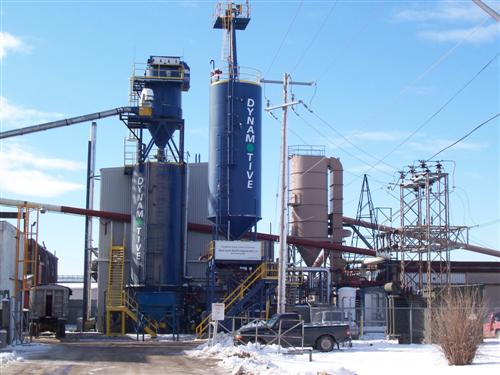
| image_skyline | West Elgin ON.JPG |
| image_caption | Municipal office & fire station in Rodney |
| flag_size | 120x100px |
| shield_size | 100x90px |
| mapsize | 200px |
| pushpin_map | Canada Southern Ontario |
| pushpin_map_caption | Location in southern Ontario |
| pushpin_label_position | top |
| coordinates | |
| subdivision_type | Country |
| subdivision_name | |
| subdivision_type1 | Province |
| subdivision_name1 | |
| subdivision_type2 | County |
| subdivision_name2 | Elgin |
| established_title | Settled |
| established_title2 | Formed |
| established_date2 | January 1, 1998 |
| leader_title | Mayor |
| leader_name | Richard Leatham |
| leader_title1 | Federal riding |
| leader_name1 | Elgin—St. Thomas—London South |
| leader_title2 | Prov. riding |
| leader_name2 | Elgin—Middlesex—London |
| area_land_km2 | 322.48 |
| area_footnotes | |
| population_as_of | 2016 |
| population_footnotes | |
| population_total | 4995 |
| population_density_km2 | 15.5 |
| timezone | EST |
| utc_offset | -5 |
| timezone_DST | EDT |
| utc_offset_DST | -4 |
| postal_code_type | Postal Code |
| postal_code | N0L |
| area_codes | 519 and 226 |
| website |
West Elgin is a municipality in Elgin County, Ontario, Canada. The township was created on January 1, 1998, through the amalgamation of the former township of Aldborough with the village of West Lorne.
Communities
The two main population centres within the township are Rodney and West Lorne. Additionally, it also includes the smaller communities of Churchville, Clachan, Ferndell, Crinan, Eagle, Kintyre, New Glasgow, Port Glasgow and Twin Valleys.
File:Rodney ON.JPG|Rodney File:West Lorne ON.JPG|West Lorne
History
The original township of Aldborough was named in 1792 after Aldeburgh, Suffolk, England.
The community of Rodney was originally named Stewart's Mills after the owner of the first sawmill in the community. From 1840 to 1865, it was called Centreville due to its central location at the intersection of Furnival Road and 7th Concession (now Downie Line). In 1865, the community was renamed Rodney after British naval officer George Brydges Rodney. The centre of the village was relocated three kilometres to the south when the Canada Southern Railway was built in the area in 1872.
The community of West Lorne also had its origins the Canada Southern Railway. Originally named Bismarck after the German chancellor, the community was renamed West Clayton, Dutton, Lorne and finally West Lorne. The name came from the Lorne Mills on the south side of the railway, themselves named for John Campbell, Marquess of Lorne. The station itself was renamed West Lorne in 1907 to avoid confusion with a community named Bismarck in Lincoln County.
The villages of Rodney and West Lorne were incorporated as municipalities in 1907 and 1908 respectively, and separated from the township. Subsequently, Aldborough remained a mainly rural municipality.
In 1994, Aldborough and Rodney amalgamated to form an expanded Township of Aldborough. In 1998, Aldborough amalgamated with West Lorne to form West Elgin.
Climate
|Jan record high C = 15.6 |Feb record high C = 19.5 |Mar record high C = 24.0 |Apr record high C = 28.5 |May record high C = 32.8 |Jun record high C = 39.0 |Jul record high C = 36.0 |Aug record high C = 36.0 |Sep record high C = 33.5 |Oct record high C = 31.5 |Nov record high C = 24.0 |Dec record high C = 18.0 |year record high C = 39.0 |Jan record low C = -29.0 |Feb record low C = -26.0 |Mar record low C = -24.0 |Apr record low C = -12.8 |May record low C = -3.9 |Jun record low C = -1.1 |Jul record low C = 5.0 |Aug record low C = 2.0 |Sep record low C = -2.5 |Oct record low C = -6.7 |Nov record low C = -16.7 |Dec record low C = -24.0 |year record low C = -29.0 | archive-url = | archive-date = | access-date = Mar 26, 2025}}
Demographics
In the 2021 Census of Population conducted by Statistics Canada, West Elgin had a population of living in of its total private dwellings, a change of from its 2016 population of . With a land area of 322.09 km2, it had a population density of in 2021.
|1996|5,573 |2001|5,464 |2006|5,349 |2011|5,157 |2016|4,995
Infrastructure
West Lorne is home to western Elgin County's only high school, West Elgin Secondary School.
West Elgin Secondary school draws in students from West Elgin as well as Middlesex County. The school's mascot is a wildcat and their official colours are white and purple.
West Lorne is linked by Elgin County Road 76 to the 401, a major arterial highway link in Ontario affording easy access to Windsor, Chatham, St. Thomas, London, Brantford, Toronto, and many other places.
Local agriculture includes dairy farming, mixed farming, fruit growing and a sizeable tobacco industry. The town of West Lorne was greatly influenced by the railroad that crossed through the heart of the village. The railroad provided jobs for the first residents of the area. There is also some light manufacturing in the town.
Notable attractions
- Ontario has had some historical claimants, by towns, for the smallest jailhouse in the province. These have included: Tweed, Coboconk and Creemore. However, the jailhouse in Rodney has proven to be smaller than all three, measuring in at 4.5 metres by 5.4 metres. Today, it serves as a part-time tourist information centre. Other villages in Ontario with similar jailhouse dimensions include Port Dalhousie, Providence Bay, and the ghost town of Berens River and Ray.
Notable people
- Bo Horvat, centre for the New York Islanders and former captain of the Vancouver Canucks
- Travis Konecny, centre for the Philadelphia Flyers
- Justin Azevedo, hockey player for Ak Bars Kazan (KHL)
References
References
- "Census Profile, 2016 Census: West Elgin, Municipality". [[Statistics Canada]].
- (February 9, 2022). "Population and dwelling counts: Canada, provinces and territories, census divisions and census subdivisions (municipalities), Ontario". [[Statistics Canada]].
- Statistics Canada: [[Canada 1996 Census. 1996]], [[Canada 2001 Census. 2001]], [[Canada 2006 Census. 2006]] census
- [https://www.tvdsb.ca/WestElgin.cfm Thames Valley District School Board]. Tvdsb.ca. Retrieved on 2013-10-05.
- "West Elgin, Ontario (Code 3534042) and Elgin, Ontario (Code 3534) (table)". Statistics Canada.
This article was imported from Wikipedia and is available under the Creative Commons Attribution-ShareAlike 4.0 License. Content has been adapted to SurfDoc format. Original contributors can be found on the article history page.
Ask Mako anything about West Elgin, Ontario — get instant answers, deeper analysis, and related topics.
Research with MakoFree with your Surf account
Create a free account to save articles, ask Mako questions, and organize your research.
Sign up freeThis content may have been generated or modified by AI. CloudSurf Software LLC is not responsible for the accuracy, completeness, or reliability of AI-generated content. Always verify important information from primary sources.
Report