From Surf Wiki (app.surf) — the open knowledge base
Wealden District
District in East Sussex, England
District in East Sussex, England
| Field | Value |
|---|---|
| official_name | Wealden District |
| settlement_type | Non-metropolitan district |
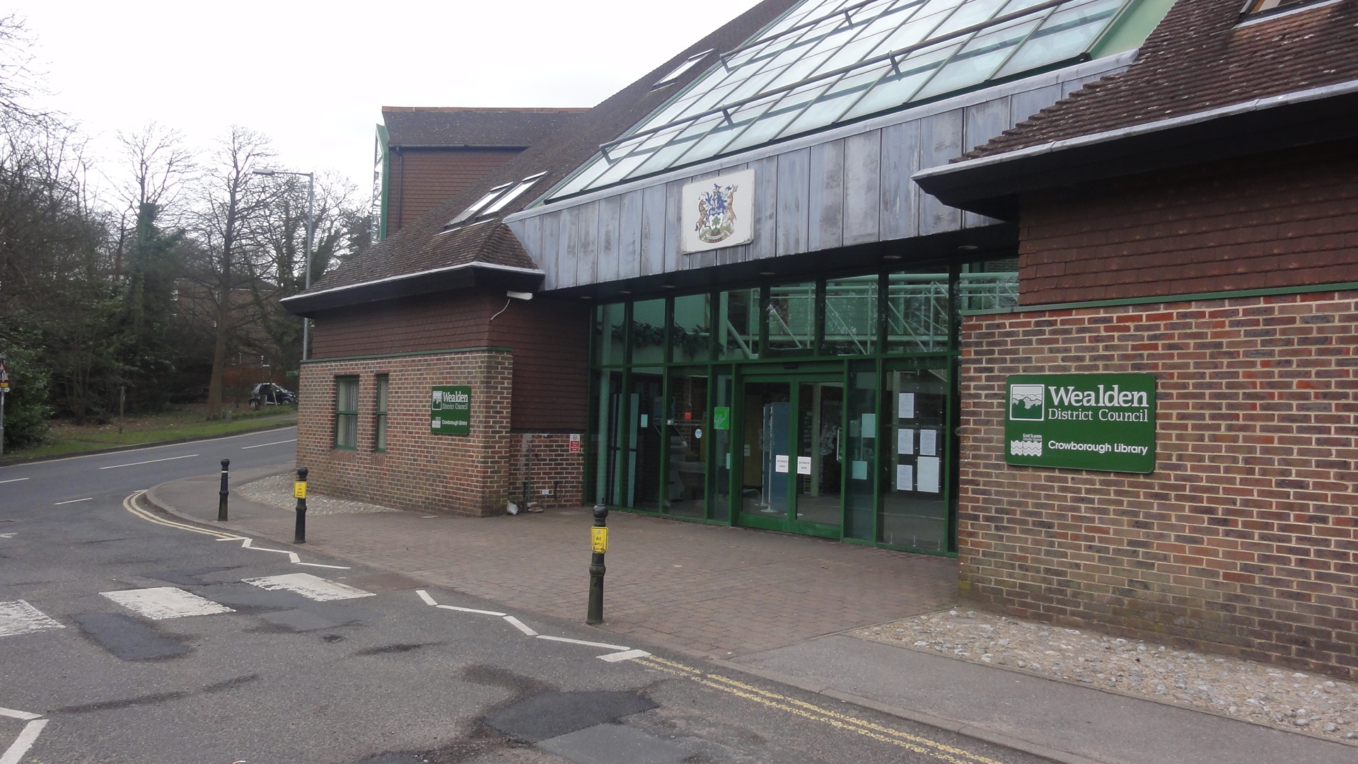
| image_caption | Library and Council headquarters, Crowborough |
| image_map | Wealden UK locator map.svg |
| mapsize | 150px |
| map_caption | Wealden shown within East Sussex |
| subdivision_type | Sovereign state |
| subdivision_name | United Kingdom |
| subdivision_type1 | Constituent country |
| subdivision_type2 | Region |
| subdivision_type3 | Non-metropolitan county |
| subdivision_type4 | Status |
| subdivision_type5 | Admin HQ |
| subdivision_name1 | England |
| subdivision_name2 | South East England |
| subdivision_name3 | East Sussex |
| subdivision_name4 | Non-metropolitan district |
| subdivision_name5 | Hailsham |
| established_title1 | Incorporated |
| established_date1 | 1 April 1974 |
| government_type | Non-metropolitan district council |
| governing_body | Wealden District Council |
| leader_title1 | MPs |
| leader_name1 | |
| James MacCleary (LD) | |
| Nusrat Ghani (C) | |
| Kieran Mullan (C) | |
| Mims Davies (C) | |
| area_total_km2 | 835.0 |
| area_rank | (of ) |
| population_total | |
| population_as_of | |
| population_density_km2 | auto |
| population_rank | (of ) |
| demographics_type1 | Ethnicity (2021) |
| demographics1_footnotes | |
| demographics1_title1 | Ethnic groups |
| demographics_type2 | Religion (2021) |
| demographics2_footnotes | |
| demographics2_title1 | Religion |
| timezone | GMT |
| utc_offset | 0 |
| timezone_DST | BST |
| utc_offset_DST | +1 |
| blank1_name | ONS code |
| blank2_name | OS grid reference |
| blank1_info | 21UH (ONS) |
| E07000065 (GSS) | |
| blank2_info |
James MacCleary (LD) Nusrat Ghani (C) Kieran Mullan (C) Mims Davies (C) | 96% White | 1.7% Mixed | 1.4% Asian | 0.5% other | 0.4% Black | 49.5% Christianity | 42.1% no religion | 6.3% not stated | 0.8% other | 0.5% Islam | 0.3% Buddhism | 0.2% Hinduism | 0.2% Judaism | 0.1% Sikhism
E07000065 (GSS) Wealden is a local government district in East Sussex, England. Its council is based in Hailsham, the district's second largest town. The district also includes the towns of Crowborough, Polegate and Uckfield, along with numerous villages and surrounding rural areas. The district's name comes from the Weald, the landscape and ancient woodland which occupies much of the centre and north of the area.
Much of the district's landscape is recognised for its beauty; the south of the district includes part of the South Downs National Park, and the north of the district includes part of the High Weald Area of Outstanding Natural Beauty. The district has two sections of coastline, lying east and west of the neighbouring authority of Eastbourne, with the western section of coastline including the cliffs known as the Seven Sisters.
The neighbouring districts are Eastbourne, Lewes, Mid Sussex, Tandridge, Sevenoaks, Tunbridge Wells and Rother.
History
The district was formed on 1 April 1974 under the Local Government Act 1972. It covered the area of two former districts, which were both abolished at the same time:
- Hailsham Rural District
- Uckfield Rural District The new district was named Wealden after the landscape and woodland.
Governance
Liberal Democrat Liberal Democrat ; Administration (24) : : : ; Other parties (21) : :
Wealden District Council provides district-level services. County-level services are provided by East Sussex County Council. The whole district is also covered by civil parishes, which form a third tier of local government.
In the parts of the district within the South Downs National Park, town planning is the responsibility of the South Downs National Park Authority. The district council appoints one of its councillors to serve on the 27-person National Park Authority.
Political control
The council has been under no overall control since the 2023 election, being led by a coalition of the Liberal Democrats and Greens. The two Labour councillors subsequently joined the coalition in November 2024.
The first election to the council was held in 1973, initially operating as a shadow authority alongside the outgoing authorities until the new arrangements took effect on 1 April 1974. Political control of the council since 1974 has been as follows:
| Party in control | Years | |
|---|---|---|
Leadership
The leaders of the council since 1999 have been:
| Councillor | Party | From | To |
|---|---|---|---|
| Rupert Thornely-Taylor | 1999 | May 2003 | |
| Nigel Coltman | 21 May 2003 | May 2007 | |
| Pam Doodes | 23 May 2007 | May 2010 | |
| Bob Standley | 19 May 2010 | May 2022 | |
| Ann Newton | 18 May 2022 | May 2023 | |
| James Partridge | 24 May 2023 | 15 May 2024 | |
| Rachel Millward | 15 May 2024 | 14 May 2025 | |
| James Partridge | 14 May 2025 |
Composition
Following the 2023 election and subsequent changes of allegiance up to June 2024, the composition of the council was:
| Party | Councillors | Total | 45 |
|---|---|---|---|
| 11 | |||
| 11 | |||
| 11 | |||
| 10 | |||
| 2 |
The Liberal Democrats, Greens and Labour sit together as the "Alliance for Wealden" group, which forms the council's administration. Of the independent councillors, five sit as the "Independent Group", four form the "Independent Democrats" and two do not belong to a group. The next election is due in 2027.
Premises
The council is based at the Council Offices on Vicarage Lane in Hailsham. The building was purpose-built for the council and opened in 1982.
When created in 1974 the council inherited two main offices from its predecessors:
- Cortlandt, 18 George Street, Hailsham, an eighteenth century house which had been bought by Hailsham Rural District Council in 1932.
- Starfield, Beacon Road, Crowborough, formerly the home and observatory of astronomer Isaac Roberts, which had been bought by Uckfield Rural District Council in 1928.
The council's staff were initially divided between the two buildings. The council moved its Hailsham office from Cortlandt to the new Council Offices on Vicarage Lane in 1982. The Crowborough office moved to a new building on Pine Grove in 1988, with Starfield subsequently being redeveloped for housing.
The council subsequently consolidated its offices at the Hailsham building and sold the Crowborough building to Crowborough Town Council in 2016.
Elections
Since the last boundary changes in 2019 the council has comprised 45 councillors representing 41 wards, with each ward electing one or two councillors. Elections are held every four years.
| Ward | Population |
|---|---|
| (2021 Census) | |
| Arlington | 2,963 |
| Buxted | 3,892 |
| Chiddingly, East Hoathly and Waldron | 3,309 |
| Crowborough Central | 4,125 |
| Crowborough Jarvis Brook | 4,305 |
| Crowborough North | 3,286 |
| Crowborough South East | 3,804 |
| Crowborough South West | 3,237 |
| Crowborough St. Johns | 2,935 |
| Danehill & Fletching | 3,886 |
| Forest Row | 4,135 |
| Framfield & Cross-in-Hand | 3,243 |
| Frant & Wadhurst (2 seats) | 6,941 |
| Hadlow Down & Rotherfield | 3,257 |
| Hailsham Central | 3,545 |
| Hailsham East | 4,785 |
| Hailsham East | 4,785 |
| Hailsham North | 2,914 |
| Hailsham North West | 3,738 |
| Hailsham South | 3,327 |
| Hailsham West | 4,232 |
| Hartfield | 3,284 |
| Heathfield North | 3,913 |
| Heathfield South | 4,163 |
| Hellingly | 5,011 |
| Herstmonceux & Pevensey Levels (2 seats) | 6,931 |
| Horam & Punnetts Town (2 seats) | 6,902 |
| Lower Willingdon | 3,314 |
| Maresfield | 3,659 |
| Mayfield & Five Ashes | 3,654 |
| Pevensey Bay | 2,890 |
| Polegate Central | 5,107 |
| Polegate North | 3,868 |
| Polegate South & Willingdon Watermill | 3,450 |
| South Downs | 2,977 |
| Stone Cross | 3,685 |
| Uckfield East | 3,225 |
| Uckfield New Town (2 seats) | 5,744 |
| Uckfield North | 3,131 |
| Uckfield Ridgewood & Little Horsted | 3,152 |
| Upper Willingdon | 3,266 |
| Withyham | 2,956 |
| Total Wealden | 160,151 |
Geography
Wealden District covers two main upland areas: the section of the High Weald within East Sussex; and the eastern end of the South Downs, between which lies the Vale of Sussex, the lowlands of which are named the Pevensey Levels. The River Ouse, some of the tributaries of which originate in the district, is the border with the Lewes District; and the River Cuckmere is wholly in Wealden. The district's coastline to the English Channel to the south is interrupted by Eastbourne. The River Rother rises on the Weald and flows easterly to the east of Rye Bay.
The Wealden basin contains significant reserves of shale oil, totalling 4.4 billion barrels of oil in Wealden and surrounding areas according to a 2014 study, which then Business and Energy Minister Michael Fallon said "will bring jobs and business opportunities" and significantly help with UK energy self-sufficiency. Fracking in the area has been opposed by environmental groups, due to concerns over sustainability, safety and economic viability.
At the 2011 census the district had the highest proportion of home ownership of the 37 local authorities in Surrey, Sussex and Kent.
Towns and parishes
This district is entirely divided into civil parishes. The parish councils for Crowborough, Hailsham, Polegate and Uckfield take the style "town council". Some of the smaller parishes have a parish meeting rather than a parish council.
| Parish | Type | Area | ||
|---|---|---|---|---|
| (sq mi) | Population | |||
| (2007) | Pop. density | |||
| (/sq mi) | ||||
| Alciston | Parish Meeting | 2.7 | 146 | 53.7 |
| Alfriston | Parish Council | 3.6 | 774 | 214.2 |
| Arlington | Parish Council | 7.1 | 490 | 69.2 |
| Berwick | Parish Council | 1.9 | 289 | 149.4 |
| Buxted | Parish Council | 8.4 | 3145 | 376.4 |
| Chalvington with Ripe | Parish Council | 4.3 | 1082 | 252.0 |
| Chiddingly | Parish Council | 6.8 | 1006 | 147.9 |
| Crowborough | Town Council | 5.2 | 19988 | 3812.1 |
| Cuckmere Valley | Parish Council | 6.8 | 197 | 28.9 |
| Danehill | Parish Council | 8.7 | 1927 | 220.3 |
| East Dean and Friston | Parish Council | 3.3 | 1577 | 474.9 |
| East Hoathly with Halland | Parish Council | 5.8 | 1343 | 229.9 |
| Fletching | Parish Council | 9.9 | 1041 | 104.7 |
| Forest Row | Parish Council | 12.6 | 5054 | 402.4 |
| Framfield | Parish Council | 7.6 | 1855 | 243.3 |
| Frant | Parish Council | 12.3 | 1367 | 110.9 |
| Hadlow Down | Parish Council | 6.6 | 715 | 109.1 |
| Hailsham | Town Council | 7.5 | 19836 | 2652.3 |
| Hartfield | Parish Council | 16.2 | 2157 | 132.9 |
| Heathfield and Waldron | Parish Council | 20.4 | 11514 | 564.5 |
| Hellingly | Parish Council | 7.6 | 1552 | 205.1 |
| Herstmonceux | Parish Council | 9.5 | 2598 | 272.8 |
| Hooe | Parish Council | 3.9 | 446 | 115.4 |
| Horam | Parish Council | 4.0 | 2583 | 643.3 |
| Isfield | Parish Council | 3.0 | 564 | 190.7 |
| Laughton | Parish Council | 7.3 | 585 | 79.7 |
| Little Horsted | Parish Meeting | 4.1 | 168 | 40.8 |
| Long Man | Parish Council | 6.2 | 412 | 66.2 |
| Maresfield | Parish Council | 10.1 | 3246 | 319.9 |
| Mayfield and Five Ashes | Parish Council | 16.4 | 3562 | 217.6 |
| Ninfield | Parish Council | 4.1 | 1520 | 371.7 |
| Pevensey | Parish Council | 6.8 | 3152 | 463.8 |
| Polegate | Town Council | 2.8 | 8021 | 2853.6 |
| Rotherfield | Parish Council | 17.8 | 3151 | 177.0 |
| Selmeston | Parish Meeting | 2.6 | 190 | 73.1 |
| Uckfield | Town Council | 2.9 | 13873 | 4810.0 |
| Wadhurst | Parish Council | 15.5 | 4818 | 311.0 |
| Warbleton | Parish Council | 11.2 | 1262 | 112.3 |
| Wartling | Parish Council | 4.3 | 396 | 92.7 |
| Westham | Parish Council | 5.5 | 5829 | 1066.9 |
| Willingdon and Jevington | Parish Council | 4.1 | 6156 | 1511.3 |
| Withyham | Parish Council | 14.2 | 2651 | 186.7 |
| Total Wealden | 321.7 | 142238 | 442.2 |
Transport
The major trunk road is the A22, London to Eastbourne; it is crossed by the A26 Maidstone–Lewes road at Uckfield; and the A267 Tunbridge Wells to Eastbourne road. There are also three west–east roads: the A259 coastal route; next inland is the A27 Pevensey–Brighton trunk road; and further to the north the A272 cross-country route to Winchester.
The East Coastway Line, serving Eastbourne and Hastings, uses the Vale of Sussex and has two station serving different sides of Pevensey in the district, which forms a generally suburban conurbation with Westham and a largely rural holiday and visitor coastline, Pevensey Bay. The other railway line is the Uckfield Branch Line from London Bridge.
Bus service is provided by Wealdlink.
Wealden is crossed by a number of National Cycle Network routes:
Route 2 (South Coast Cycle Route)
Route 21 (London to Eastbourne) which makes use of the Forest Way and Cuckoo Trail paths along disused railway lines
Long-distance footpaths include the South Downs Way, the Monarch's Way, the Sussex Border Path and the Wealdway.
Media
Wealden is served by BBC South East and ITV Meridian broadcasting from the Heathfield TV transmitter which is situated near Heathfield.
Radio stations for the area are:
- BBC Radio Sussex
- Heart South
- Ashdown Radio (serving Uckfield and Crowborough)
- Seahaven FM (covering Polegate)
- More Radio Eastbourne (covering Hailsham)
Landmarks
Major landmarks include the Seven Sisters and Cuckmere Haven along the coast; and the Long Man of Wilmington together with all of the paths over the South Downs National Park. Roman fortified hills can be found in the north of the area and Uckfield has a large architectural conservation area.
Sheffield Park Garden is an informal landscape garden now owned by the National Trust but laid out by Capability Brown. Near to this is the terminus of the Bluebell Railway, a heritage, steam railway line.
A late medieval castle construction, moated Herstmonceux Castle, was begun in 1440. It is open to visitors and there are organised tours on a few summer days.
The north of the district includes Ashdown Forest, which provided the inspiration for the Hundred Acre Wood in the Winnie the Pooh stories by A. A. Milne, who lived in Hartfield.
References
References
- "Wealden Local Authority".
- {{cite legislation UK. (1972)
- {{cite legislation UK. (1973)
- "New appointments made to council".
- "Council report, 3 December 2018".
- {{cite legislation UK. (1972)
- "Election maps". Ordnance Survey.
- "Members".
- (25 May 2023). "Lib Dem and Green coalition officially take up office at Wealden District Council after local election". Sussex World.
- "Compositions Calculator". University of Exeter.
- (10 May 2011). "England council elections". [[BBC News Online]].
- (16 April 2003). "Wealden Council". The Argus.
- "Council minutes, 21 May 2003".
- (4 May 2007). "Tories retain control of Wealden". BBC News.
- "Council minutes, 23 May 2007".
- "Council minutes, 19 May 2010".
- (5 April 2022). "Wealden council leader to step down after 12 years". Sussex World.
- "Council minutes, 18 May 2022".
- (24 May 2023). "Tories say new Council 'unravelling' before it has even started". Ashdown Radio.
- "Council minutes, 24 May 2023".
- (15 May 2024). "The Green Party takes its turn for the leadership of Wealden District Council". The Heathfield News.
- "Council minutes, 15 May 2024".
- "Council minutes, 14 May 2025".
- "Local elections 2023: live council results for England". The Guardian.
- "Wealden". Thorncliffe.
- "Wealden councillors by political grouping".
- (12 November 2024). "Change to Alliance for Wealden make up".
- "Find us".
- {{NHLE
- (10 June 1932). "New Council Offices at Hailsham". Sussex Express.
- (19 October 1928). "Crowborough: New council offices". Sevenoaks Chronicle.
- {{London Gazette. (26 March 1982)
- {{London Gazette. (15 October 1982)
- (17 March 1988). "WDC move offices". East Grinstead Observer.
- (1 May 2019). "Official opening of Pine Grove". Crowborough Life.
- {{cite legislation UK. (2016)
- Prynn, Jonathan. (23 May 2014). "Massive oil reserves lie under commuter belt in South, says report". [[London Evening Standard]].
- [http://neighbourhood.statistics.gov.uk Office for National Statistics 2011 Census Key Statistics: Tenure]
- "Town and Parish Councils".
- "East Sussex in Figures". East Sussex County Council.
- "Interactive map showing locations of parishes".
- "Route 2".
- "Route 21".
- (May 2004). "Full Freeview on the Heathfield (East Sussex, England) transmitter".
- [[Scheduled monument]]: {{National Heritage List for England
This article was imported from Wikipedia and is available under the Creative Commons Attribution-ShareAlike 4.0 License. Content has been adapted to SurfDoc format. Original contributors can be found on the article history page.
Ask Mako anything about Wealden District — get instant answers, deeper analysis, and related topics.
Research with MakoFree with your Surf account
Create a free account to save articles, ask Mako questions, and organize your research.
Sign up freeThis content may have been generated or modified by AI. CloudSurf Software LLC is not responsible for the accuracy, completeness, or reliability of AI-generated content. Always verify important information from primary sources.
Report