From Surf Wiki (app.surf) — the open knowledge base
Wauchula, Florida
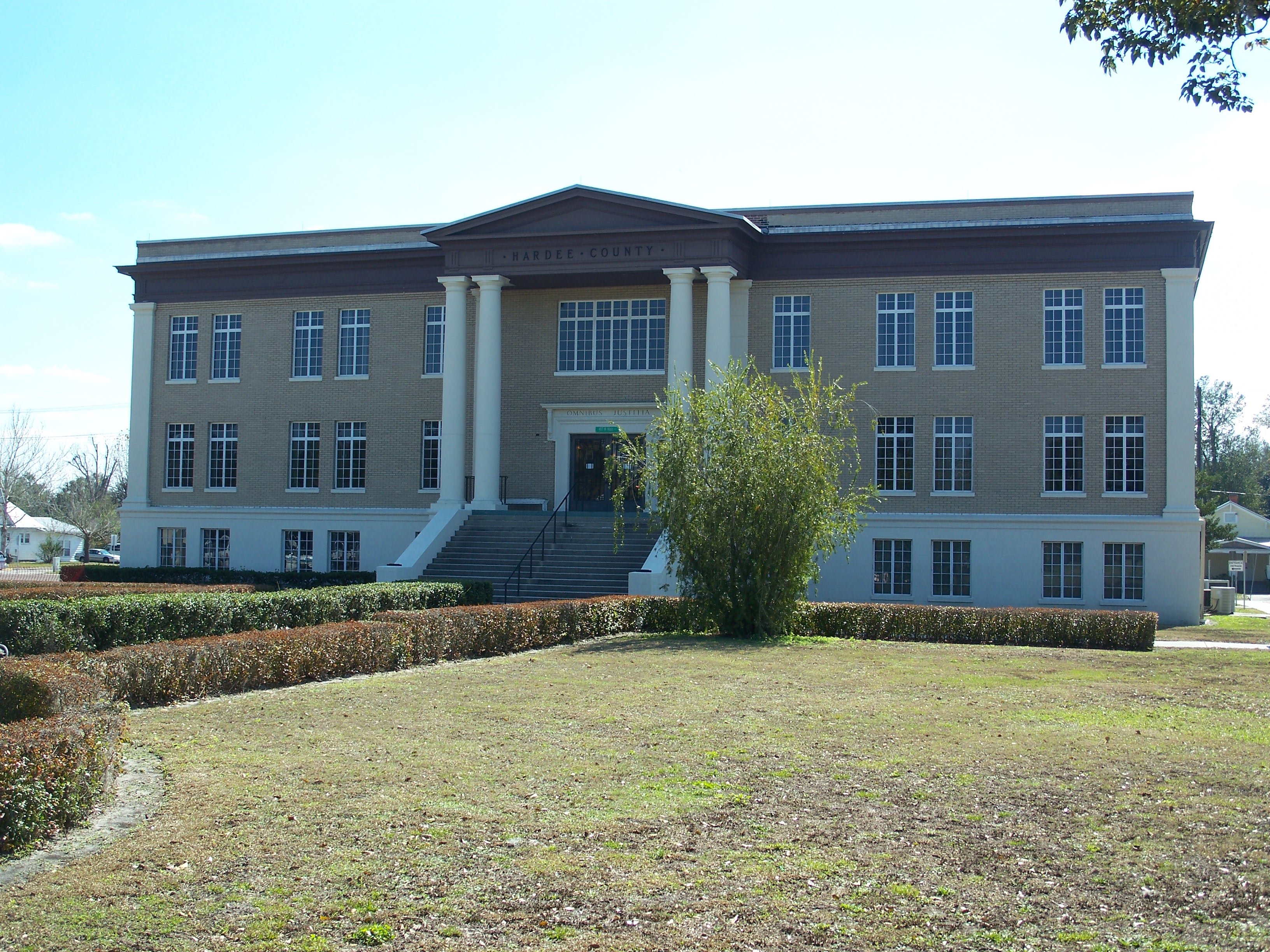
.jpg)
| Field | Value |
|---|---|
| name | Wauchula, Florida |
| settlement_type | City |
| official_name | City of Wauchula |
| mottoes | |
| "Cucumber Capital of the World" | |
| image_skyline | Wauchula City Hall old pano01.jpg |
| image_caption | Wauchula Chamber of Commerce in 2010 |
| image_seal | Seal of Wauchula, Florida.png |
| image_map | Hardee_County_Florida_Incorporated_and_Unincorporated_areas_Wauchula_Highlighted.svg |
| map_caption | Location in Hardee County and the state of Florida |
| subdivision_type | Country |
| subdivision_name | United States of America |
| subdivision_type1 | State |
| subdivision_name1 | Florida |
| subdivision_type2 | County |
| subdivision_name2 | |
| subdivision_name4 | |
| established_title | Incorporated |
| established_date | |
| government_type | Commission–Manager |
| leader_title | Mayor |
| leader_name | Keith Nadachay, Jr. |
| leader_title1 | Mayor Pro Tem |
| leader_name1 | Neda Cobb |
| leader_title2 | Commissioners |
| leader_name2 | Russell Graylin Smith, |
| Sherri Albritton, | |
| and Gary Smith | |
| leader_title3 | City Manager |
| leader_name3 | Olivia Minshew |
| leader_title4 | City Clerk |
| leader_name4 | Stephanie Camacho |
| unit_pref | Imperial |
| area_total_km2 | 8.46 |
| area_land_km2 | 8.46 |
| area_water_km2 | 0.00 |
| area_total_sq_mi | 3.27 |
| area_land_sq_mi | 3.27 |
| area_water_sq_mi | 0.00 |
| population_as_of | 2020 |
| population_total | 4900 |
| population_density_km2 | 579.13 |
| population_density_sq_mi | 1499.85 |
| timezone | Eastern (EST) |
| utc_offset | -5 |
| timezone_DST | EDT |
| utc_offset_DST | -4 |
| coordinates | |
| elevation_footnotes | tags-- |
| elevation_m | 34 |
| elevation_ft | 112 |
| postal_code_type | ZIP code |
| postal_code | 33873 |
| area_code | 863 |
| blank_name | FIPS code |
| blank_info | 12-75375 |
| blank1_name | GNIS feature ID |
| blank1_info | 0292949 |
| website | |
| area_footnotes |
"Cucumber Capital of the World" Sherri Albritton, and Gary Smith Wauchula is a city and the county seat of Hardee County, Florida, United States. As of the 2020 census, it had a population of 4,900.
Wauchula has been called the "cucumber capital of the world", although citrus has become a more important agricultural crop over the past few decades. It is home to the downtown's Wauchula Historic District and Albert Carlton Estate.
Geography
The exact coordinates for the City of Wauchula is located at .
Wauchula is located in north-central Hardee County. U.S. Route 17 passes through the city, leading north 25 mi to Bartow and south 24 mi to Arcadia. Within the county, Zolfo Springs is 4 mi to the south on US 17 and Bowling Green is 6 mi to the north.
According to the United States Census Bureau, Wauchula has an area of 8.6 km2, all land.
Hurricane Charley
Hurricane Charley hit Wauchula at on Friday, August 13, 2004, causing more than $750 million in damage. Sustained winds of 140 mph, with gusts of over 160 mph, were clocked in downtown Wauchula. The entire area had either no running water, or contaminated water for one week. Power was lost to many sections for nearly three weeks, with school canceled for two weeks. The area was declared a federal disaster area after 85% of its buildings were either damaged or destroyed. There was a curfew set for the area for weeks after from 8 pm to 7 am.
Climate
The climate in this area is characterized by hot, humid summers and warm winters. According to the Köppen climate classification system, Wauchula has a humid subtropical climate zone (Cfa).
|Jan record high F = 90 |Feb record high F = 93 |Mar record high F = 94 |Apr record high F = 99 |May record high F = 104 |Jun record high F = 103 |Jul record high F = 102 |Aug record high F = 99 |Sep record high F = 99 |Oct record high F = 97 |Nov record high F = 92 |Dec record high F = 92
|Jan avg record high F = 83.9 |Feb avg record high F = 86.0 |Mar avg record high F = 87.1 |Apr avg record high F = 91.2 |May avg record high F = 94.2 |Jun avg record high F = 95.8 |Jul avg record high F = 95.6 |Aug avg record high F = 95.7 |Sep avg record high F = 94.3 |Oct avg record high F = 91.5 |Nov avg record high F = 87.2 |Dec avg record high F = 84.6 |year avg record high F = 96.9
|Jan avg record low F = 31.1 |Feb avg record low F = 34.0 |Mar avg record low F = 37.9 |Apr avg record low F = 45.2 |May avg record low F = 54.4 |Jun avg record low F = 65.2 |Jul avg record low F = 68.6 |Aug avg record low F = 69.1 |Sep avg record low F = 66.1 |Oct avg record low F = 50.2 |Nov avg record low F = 41.4 |Dec avg record low F = 34.8 |year avg record low F = 29.5
|Jan record low F = 20 |Feb record low F = 24 |Mar record low F = 23 |Apr record low F = 34 |May record low F = 40 |Jun record low F = 51 |Jul record low F = 61 |Aug record low F = 61 |Sep record low F = 55 |Oct record low F = 37 |Nov record low F = 24 |Dec record low F = 21
| access-date = May 23, 2021 | archive-date = June 16, 2019 | archive-url = https://web.archive.org/web/20190616075146/https://w2.weather.gov/climate/xmacis.php?wfo=tbw | url-status = dead | access-date = May 23, 2021
Demographics
2010 and 2020 census
| Race | Pop 2010 | Pop 2020 | % 2010 | % 2020 |
|---|---|---|---|---|
| White (NH) | 2,179 | 2,008 | 43.57% | 40.98% |
| Black or African American (NH) | 281 | 358 | 5.62% | 7.31% |
| Native American or Alaska Native (NH) | 17 | 4 | 0.34% | 0.08% |
| Asian (NH) | 49 | 41 | 0.98% | 0.84% |
| Pacific Islander or Native Hawaiian (NH) | 1 | 2 | 0.02% | 0.04% |
| Some other race (NH) | 4 | 5 | 0.08% | 0.10% |
| Two or more races/Multiracial (NH) | 42 | 97 | 0.84% | 1.98% |
| Hispanic or Latino (any race) | 2,428 | 2,385 | 48.55% | 48.67% |
| Total | 5,001 | 4,900 | 100.00% | 100.00% |
As of the 2020 United States census, there were 4,900 people, 1,630 households, and 1,072 families residing in the city.
As of the 2010 United States census, there were 5,001 people, 1,574 households, and 1,035 families residing in the city.
2000 census
As of the census of 2000, there were 4,368 people, 1,431 households, and 985 families residing in the city. The population density was 1,669.6 PD/sqmi. There were 1,562 housing units at an average density of 597.0 /sqmi. The racial makeup of the city was 73.44% White, 4.17% African American, 0.57% Native American, 0.30% Asian, 18.84% from other races, and 2.68% from two or more races. Hispanic or Latino of any race were 39.42% of the population.
In 2000, there were 1,431 households, out of which 36.5% had children under the age of 18 living with them, 48.9% were married couples living together, 14.8% had a female householder with no husband present, and 31.1% were non-families. 26.5% of all households were made up of individuals, and 13.1% had someone living alone who was 65 years of age or older. The average household size was 2.97 and the average family size was 3.57.
In 2000, in the city, the population was spread out, with 30.7% under the age of 18, 11.6% from 18 to 24, 26.9% from 25 to 44, 17.1% from 45 to 64, and 13.7% who were 65 years of age or older. The median age was 30 years. For every 100 females, there were 98.5 males. For every 100 females age 18 and over, there were 96.7 males.
In 2000, the median income for a household in the city was $25,931, and the median income for a family was $29,943. Males had a median income of $19,129 versus $15,867 for females. The per capita income for the city was $10,665. About 19.9% of families and 25.0% of the population were below the poverty line, including 30.0% of those under age 18 and 12.8% of those age 65 or over.
Infrastructure
Wauchula Municipal Airport is a public-use airport located 5 mi southwest of the central business district.
Center for Great Apes is a permanent sanctuary for rescued orangutans and chimpanzees.
The only hospital in Wauchula is AdventHealth Wauchula.
Notable people
- Doyle E. Carlton (1885–1972), 25th governor of Florida
- Tom McEwen (1923–2011), sportswriter
- B. J. McLeod (born 1983), NASCAR driver
- Zeke Mowatt (born 1961), NFL football player and Super Bowl XXI champion
References
References
- "U.S. Census website". [[United States Census Bureau]].
- (2007-10-25). "US Board on Geographic Names". [[United States Geological Survey]].
- "2020 U.S. Gazetteer Files". United States Census Bureau.
- "NOAA Storm Tracker". Spikowski.
- "Trip Journal Florida". MyTripJournal.
- "Census of Population and Housing". Census.gov.
- "P2 HISPANIC OR LATINO, AND NOT HISPANIC OR LATINO BY RACE - 2010: DEC Redistricting Data (PL 94-171) - Wauchula city, Florida".
- "P2 HISPANIC OR LATINO, AND NOT HISPANIC OR LATINO BY RACE - 2020: DEC Redistricting Data (PL 94-171) - Wauchula city, Florida".
- "S1101 HOUSEHOLDS AND FAMILIES - 2020: Wauchula city, Florida".
- "S1101 HOUSEHOLDS AND FAMILIES - 2010: Wauchula city, Florida".
- (December 20, 2023). "AdventHealth Wauchula celebrates new mural, Wellness Trail and Prayer Garden". Highlands News-Sun.
This article was imported from Wikipedia and is available under the Creative Commons Attribution-ShareAlike 4.0 License. Content has been adapted to SurfDoc format. Original contributors can be found on the article history page.
Ask Mako anything about Wauchula, Florida — get instant answers, deeper analysis, and related topics.
Research with MakoFree with your Surf account
Create a free account to save articles, ask Mako questions, and organize your research.
Sign up freeThis content may have been generated or modified by AI. CloudSurf Software LLC is not responsible for the accuracy, completeness, or reliability of AI-generated content. Always verify important information from primary sources.
Report