From Surf Wiki (app.surf) — the open knowledge base
Watson Escarpment
Escarpment in the Queen Maud Mountains, Antarctica

Escarpment in the Queen Maud Mountains, Antarctica
| Field | Value |
|---|---|
| country_type | Continent |
| country | Antarctica |
| parent | Queen Maud Mountains |
| range_coordinates | |
| map | Antarctica |
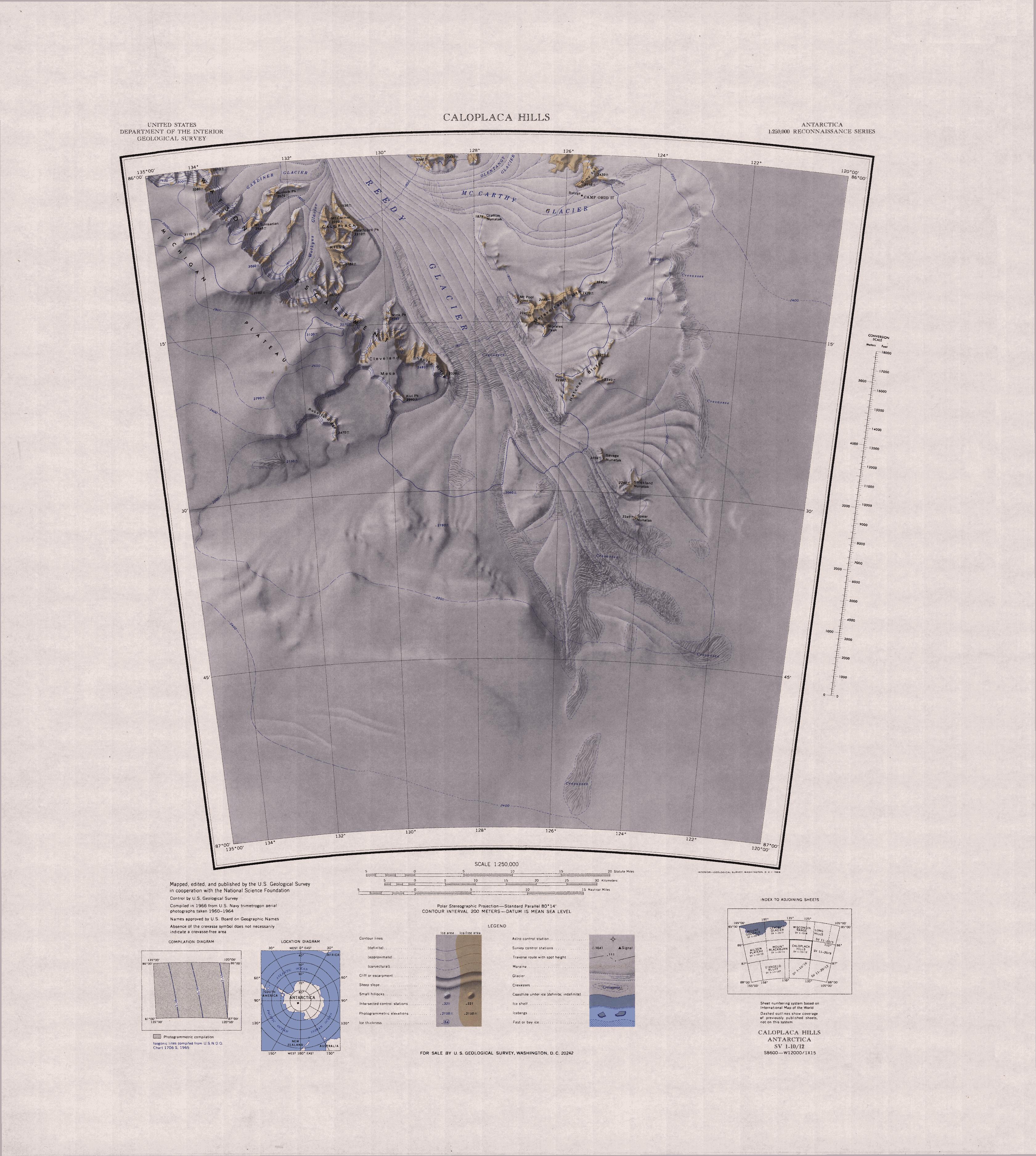
Watson Escarpment () is a major escarpment in the Queen Maud Mountains, trending northward along the east margin of Scott Glacier, then eastward to Reedy Glacier where it turns southward along the glacier's west side. Somewhat arcuate, the escarpment is nearly 100 nmi long, rises 3,550 m above sea level, and 1,000 to above the adjacent terrain.
Discovery and naming
The north-central part of the escarpment was observed from a vantage point on Supporting Party Mountain and was partially mapped in December 1929 by the Byrd Antarctic Expedition geological party under Laurence Gould. The escarpment was more closely observed in December 1934 by the Byrd Antarctic Expedition geological party under Quin Blackburn, and was named by Byrd for Thomas J. Watson, American business executive, a patron of this expedition. The escarpment and its related features was mapped in detail by United States Geological Survey (USGS) from surveys and United States Navy air photos, 1960–64.
Topology
The western end of the Watson Escarpment is a massif to the northeast of the point where the Van Reeth Glacier joins the Scott Glacier. The tip of the massif holds Mount Czegka, Acarospora Peak and Dunn Spur. To the north are Mount Russell, Mount Blackburn and Parker Bluff. To the north of Mount Blackburn the Long Valley leads to the head of Griffith Glacier, which is separated from Howe Glacier by Mount Meeks and Skilift Col. Mount Riley and Roaring Ridge are east of Long Valley.
The Watson Escarpment continues east along the rim of the California Plateau past Beacon Dome and Mount Warden. It continues below Maaske Dome and above Evans Butte. To the east of Mount Beazley there is a gap in the escarpment through which the Leverett Glacier flows north towards the Ross Ice Shelf. The escarpment continues east past McLean Peak along the north rim of Stanford Plateau. It passes Phleger Dome and Mount Doumani along the upper reaches of the Kansas Glacier, and passes Foreman Peak and Dzema Peak to the north of Johns Glacier. At its eastern end it passes Cole Peak to its south, and includes Mount Ratliff and Mount O'Neill.
Most of the features along the escarpment were mapped by the United States Geological Survey (USGS) from ground surveys and United States Navy air photos between 1960 and 1964.
Western massif features
Mount Czegka
Acarospora Peak
Dunn Spur
Mount Russell
Mount Blackburn
Parker Bluff
Schmidt Peak
Long Valley
Mount Meeks
Skilift Col
Mount Riley
Roaring Ridge
Central escarpment features

Features along the central escarpment, from west to east, are:
California Plateau
Beacon Dome
Mount Warden
Hunt Spur
Maaske Dome
Mount Beazley
McLean Peak
Stanford Plateau
Phleger Dome
Lowe Bluff
Mount Analogue
Mount Doumani
Foreman Peak
Dzema Peak
Cole Peak
Mount Ratliff
Mount O'Neil
Eastern end
Cleveland Mesa
Mink Peak
Shapley Ridge
Kivi Peak
Michigan Plateau
Teller Peak
Burlock Peak
Mount Simsarian
Roberts Ridge
References
Sources
- {{citation|url=https://pubs.usgs.gov/fedgov/70039167/report.pdf |accessdate=2023-12-03 |edition=2 |editor-last=Alberts |title=Geographic Names of the Antarctic |editor-first=Fred G.
- {{citation |url=https://commons.wikimedia.org/wiki/File:C85135s1_Ant.Map_Leverett_Glacier.jpg |accessdate=2023-12-28
- {{citation |url=https://commons.wikimedia.org/wiki/File:C86135s1_Ant.Map_Mount_Blackburn.jpg |accessdate=2023-12-27
This article was imported from Wikipedia and is available under the Creative Commons Attribution-ShareAlike 4.0 License. Content has been adapted to SurfDoc format. Original contributors can be found on the article history page.
Ask Mako anything about Watson Escarpment — get instant answers, deeper analysis, and related topics.
Research with MakoFree with your Surf account
Create a free account to save articles, ask Mako questions, and organize your research.
Sign up freeThis content may have been generated or modified by AI. CloudSurf Software LLC is not responsible for the accuracy, completeness, or reliability of AI-generated content. Always verify important information from primary sources.
Report