From Surf Wiki (app.surf) — the open knowledge base
Washington County, Rhode Island
County in Rhode Island, United States

County in Rhode Island, United States
| Field | Value |
|---|---|
| name | Washington County |
| settlement_type | County |
| image_skyline | Washington County Courthouse (Rhode Island).jpg |
| image_caption | Former Washington County Courthouse in West Kingston |
| image_map | {{maplink |
| frame | yes |
| plain | yes |
| frame-align | center |
| frame-width | 280 |
| frame-height | 280 |
| frame-coord | SWITCH:###### |
| zoom | SWITCH:9;8;4 |
| type | shape |
| stroke-width | 2 |
| stroke-color | #0096FF |
| fill | #0096FF |
| id2 | SWITCH:Q54258;Q1387;Q30 |
| type2 | shape-inverse |
| stroke-width2 | 2 |
| stroke-color2 | #5F5F5F |
| stroke-opacity2 | SWITCH:0;1;1 |
| fill2 | #000000 |
| fill-opacity2 | SWITCH:0;0.5;0.5 |
| switch | Washington County;Rhode Island;the United States |
| coordinates | |
| subdivision_type | Country |
| subdivision_name | United States |
| subdivision_type1 | State |
| subdivision_name1 | Rhode Island |
| subdivision_type2 | Region |
| subdivision_name2 | New England |
| subdivision_type3 | Metro area |
| subdivision_name3 | Providence |
| established_title | Formed |
| established_date | |
| named_for | George Washington |
| seat_type | County town |
| seat | South Kingstown |
| seat1_type | Largest town |
| seat1 | South Kingstown |
| parts_type | Incorporated municipalities |
| parts | 9 towns |
| unit_pref | US |
| area_total_sq_mi | 563 |
| area_land_sq_mi | 329 |
| area_water_sq_mi | 234 |
| area_water_percent | 41% |
| elevation_max_footnotes | |
| elevation_max_ft | 567 |
| elevation_min_footnotes | |
| elevation_min_ft | 0 |
| population_as_of | April 1, 2020 |
| population_total | 129839 |
| population_density_sq_mi | 230 |
| demographics_type2 | GDP |
| demographics2_footnotes | |
| demographics2_title1 | Total |
| demographics2_info1 | $8.636 billion (2022) |
| timezone | EST |
| utc_offset | −5 |
| timezone_DST | EDT |
| utc_offset_DST | −4 |
| postal_code_type | ZIP Code format |
| postal_code | 028xx |
| area_code_type | Area code |
| area_code | 401 |
| blank_name_sec1 | FIPS code |
| blank_info_sec1 | 44-009 |
| blank1_name_sec1 | GNIS feature ID |
| blank1_info_sec1 | |
| blank_name_sec2 | Congressional district |
| blank_info_sec2 | 2nd |
| frame-align = center | frame-width = 280 | frame-height = 280 | frame-coord = SWITCH:###### | stroke-width = 2 | stroke-color = #0096FF | stroke-width2 = 2 | stroke-color2 = #5F5F5F | stroke-opacity2 = SWITCH:0;1;1 | fill-opacity2 = SWITCH:0;0.5;0.5
Washington County, known locally as South County, is a county located in the U.S. state of Rhode Island. As of the 2020 census, the population was 129,839. Rhode Island counties have no governmental functions other than as court administrative boundaries, which are part of the state government.
History
The area today known as Washington County was part of the ancestral lands of the Narragansett Indian Tribe. During the second half of the 17th Century, about a dozen English colonists from Newport and Massachusetts colonies moved to the area to establish farms; the larger of these were known as "Narragansett Planters."
By the mid-18th century, there were 25 to 30 large plantations in the county, and their owners became very wealthy. The labor for these farms came from enslaved people; it is estimated that about 15% and 25% of Washington County’s population was enslaved.
Washington County was created as Kings County in 1729 within the Colony of Rhode Island and Providence Plantations. It was renamed Washington County on October 29, 1781, in honor of George Washington. At the earliest stage of colonial settlement, the area was called "The Narragansett Country", named after the Naragansett tribe and its tributary tribe the Niantics, both of whom lived in the area.
Early land purchases in the Narragansett Country were effected by settlers after the establishment of Indian trading posts at Fort Neck in Charlestown, and at Smith's Castle in Wickford. A series of conflicts involving the Manisseans on Block Island gave that island to the Massachusetts Bay Colony for a number of years, before being transferred to the Rhode Island Colony under Newport County, and then finally to Washington County in 1959.
The borders of the Narragansett country were disputed for nearly 100 years among the colonies of Rhode Island, Connecticut, and Massachusetts. The Narragansetts had pledged their fealty to King Charles, and the area was known as "The King's Province" and was placed under the authority of Rhode Island "until the King's pleasure was further known". In 1664, a royal commission under Charles II stepped in to adjudicate these conflicting claims. The commission extinguished the claims of Massachusetts, and Rhode Island was granted jurisdiction until the commission finished processing Connecticut's appeals, which were not ended until 1726. Settlements of King's Province were named to reflect the English Restoration, in honor of King Charles II. Towns reflecting this history include the two Kingstowns and Charlestown, as well as the villages of Kingston and West Kingston.
Washington County is also known in Rhode Island as "South County", though some definitions of South County include outside towns, such as East Greenwich in neighboring Kent County, and exclude towns within Washington County, such as New Shoreham.
Geography
According to the U.S. Census Bureau, the county has a total area of 563 sqmi, of which 329 sqmi is land and 234 sqmi (41%) is water. It is the largest county in Rhode Island by total area. The county's topography ranges from flat along the shoreline to gently rolling hills farther inland. The highest point is a large area approximately 560 ft above sea level in the Exeter neighborhood of Black Plain; the lowest point is sea level along the coast. The northern boundary west of Davisville is approximately 41.60°N. The western boundary north of Westerly is approximately 71.79°W.
National protected areas
- Block Island National Wildlife Refuge
- John H. Chafee National Wildlife Refuge
- Ninigret National Wildlife Refuge
- Trustom Pond National Wildlife Refuge
Major highways
Demographics
1790-1960 1900-1990 1990-2000 2010-2019 | align-fn = center
2020 census
As of the 2020 census, the county had a population of 129,839. Of the residents, 16.2% were under the age of 18 and 22.7% were 65 years of age or older; the median age was 46.9 years, with 93.0 males for every 100 females and 90.9 males for every 100 females age 18 and over. 66.4% of residents lived in urban areas and 33.6% lived in rural areas.
The racial makeup of the county was 89.5% White, 1.2% Black or African American, 0.8% American Indian and Alaska Native, 2.0% Asian, 1.5% from some other race, and 5.0% from two or more races. Hispanic or Latino residents of any race comprised 3.5% of the population.
There were 52,439 households in the county, of which 23.2% had children under the age of 18 living with them and 26.4% had a female householder with no spouse or partner present. About 29.0% of all households were made up of individuals and 14.4% had someone living alone who was 65 years of age or older.
There were 65,694 housing units, of which 20.2% were vacant. Among occupied housing units, 74.6% were owner-occupied and 25.4% were renter-occupied. The homeowner vacancy rate was 0.9% and the rental vacancy rate was 5.7%.
| Race / Ethnicity (NH = Non-Hispanic) | title=P004: Hispanic or Latino, and Not Hispanic or Latino by Race – 2000: DEC Summary File 1 – Washington County, Rhode Island | url=https://data.census.gov/table/DECENNIALSF12000.P004?q=P004:+HISPANIC+OR+LATINO,+AND+NOT+HISPANIC+OR+LATINO+BY+RACE+[73]&g=050XX00US44009 | publisher=United States Census Bureau | access-date= }} | title=P2 Hispanic or Latino, and Not Hispanic or Latino by Race – 2010: DEC Redistricting Data (PL 94-171) - Washington County, Rhode Island | url=https://data.census.gov/table/DECENNIALPL2010.P2?q=p2&g=050XX00US44009 | website=United States Census Bureau}} | % 2000 | % 2010 |
|---|---|---|---|---|---|---|---|---|---|
| White alone (NH) | 116,134 | 117,330 | 115,089 | 94.00% | |||||
| Black or African American alone (NH) | 1,074 | 1,347 | 1,468 | 0.86% | |||||
| Native American or Alaska Native alone (NH) | 1,087 | 1,007 | 917 | 0.87% | |||||
| Asian alone (NH) | 1,850 | 2,054 | 2,605 | 1.49% | |||||
| Pacific Islander alone (NH) | 23 | 23 | 48 | 0.01% | |||||
| Other race alone (NH) | 120 | 189 | 490 | 0.09% | |||||
| Mixed race or Multiracial (NH) | 1,478 | 2,003 | 4,644 | 1.19% | |||||
| Hispanic or Latino (any race) | 1,780 | 3,026 | 4,578 | 1.44% | |||||
| Total | 123,546 | 126,979 | 129,839 | 100.00% |
Communities
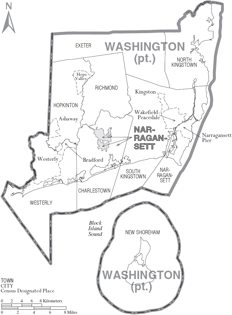
Towns
- Charlestown
- Exeter
- Hopkinton
- Narragansett
- New Shoreham
- North Kingstown
- Richmond
- South Kingstown (traditional county seat)
- Westerly
Census-designated places
- Ashaway
- Bradford
- Carolina
- Charlestown
- Hope Valley
- Hopkinton
- Kingston
- Misquamicut
- Narragansett Pier
- Quonochontaug
- Wakefield-Peacedale
- Watch Hill
- Weekapaug
- Westerly
- Wyoming
Other villages
- Alton
- Arcadia
- Ashaway
- Barberville
- Bethel
- Burdickville
- Canonchet
- Centerville
- Davisville
- Galilee
- Hamilton
- Hopkinton City
- Jerusalem
- Kenyon
- Lafayette
- Locustville
- Matunuck
- Moscow
- Peace Dale
- Point Judith
- Rockville
- Saunderstown
- Shannock
- Shelter Harbor
- Slocum
- Usquepaug
- Wakefield
- West Kingston
- White Rock
- Wickford
- Wood River Junction
- Woodville
Ghost towns
Napatree point
Politics
Similar to other counties in Rhode Island, Washington County votes Democratic in presidential elections, having last voted Republican in 1984.
References
References
- "Washington County High Point, Rhode Island".
- Sea level at the Atlantic Ocean.
- "Gross Domestic Product: All Industries in Washington County, RI".
- "Census - Geography Profile: Washington County, Rhode Island". [[United States Census Bureau]].
- "National Associations of Counties listing for Washington County, Rhode Island".
- "What did southern Rhode Island’s Colonial economy look like?". South County History Center.
- "South County isn't an official Rhode Island county. So why does everyone call it that?".
- "About South County".
- "Towns".
- (August 22, 2012). "2010 Census Gazetteer Files". United States Census Bureau.
- {{coord. 41. 35. 09. N. 71. 39. 16. W
- "U.S. Decennial Census". [[United States Census Bureau]].
- "Historical Census Browser". University of Virginia Library.
- (March 27, 1995). "Population of Counties by Decennial Census: 1900 to 1990". United States Census Bureau.
- (April 2, 2001). "Census 2000 PHC-T-4. Ranking Tables for Counties: 1990 and 2000". United States Census Bureau.
- "State & County QuickFacts". United States Census Bureau.
- (2021). "2020 Decennial Census Redistricting Data (Public Law 94-171)". United States Census Bureau.
- (2023). "2020 Decennial Census Demographic and Housing Characteristics (DHC)". United States Census Bureau.
- (2021). "2020 Decennial Census Demographic Profile (DP1)". United States Census Bureau.
- "P004: Hispanic or Latino, and Not Hispanic or Latino by Race – 2000: DEC Summary File 1 – Washington County, Rhode Island". [[United States Census Bureau]].
- "P2 Hispanic or Latino, and Not Hispanic or Latino by Race – 2010: DEC Redistricting Data (PL 94-171) - Washington County, Rhode Island".
- "P2 Hispanic or Latino, and Not Hispanic or Latino by Race – 2020: DEC Redistricting Data (PL 94-171) - Washington County, Rhode Island".
- Leip, David. "Dave Leip's Atlas of U.S. Presidential Elections".
- (November 7, 1848). "The Popular Vote of the United States, in the Presidential Election of 1844". New York Daily Herald.
- Leip, David. "Dave Leip's Atlas of U.S. Presidential Elections – Sate Data".
- Leip, David. "Dave Leip's Atlas of U.S. Presidential Elections – Sate Data".
- Leip, David. "Dave Leip's Atlas of U.S. Presidential Elections – Sate Data".
This article was imported from Wikipedia and is available under the Creative Commons Attribution-ShareAlike 4.0 License. Content has been adapted to SurfDoc format. Original contributors can be found on the article history page.
Ask Mako anything about Washington County, Rhode Island — get instant answers, deeper analysis, and related topics.
Research with MakoFree with your Surf account
Create a free account to save articles, ask Mako questions, and organize your research.
Sign up freeThis content may have been generated or modified by AI. CloudSurf Software LLC is not responsible for the accuracy, completeness, or reliability of AI-generated content. Always verify important information from primary sources.
Report