From Surf Wiki (app.surf) — the open knowledge base
Washington County, Maryland
County in Maryland, United States
.png)
County in Maryland, United States
| Field | Value |
|---|---|
| county | Washington County |
| state | Maryland |
| type | County |
| seal | Washington County md seal.png |
| flag | Washington County, Maryland.webp |
| founded date | September 6 |
| founded year | 1776 |
| seat wl | Hagerstown |
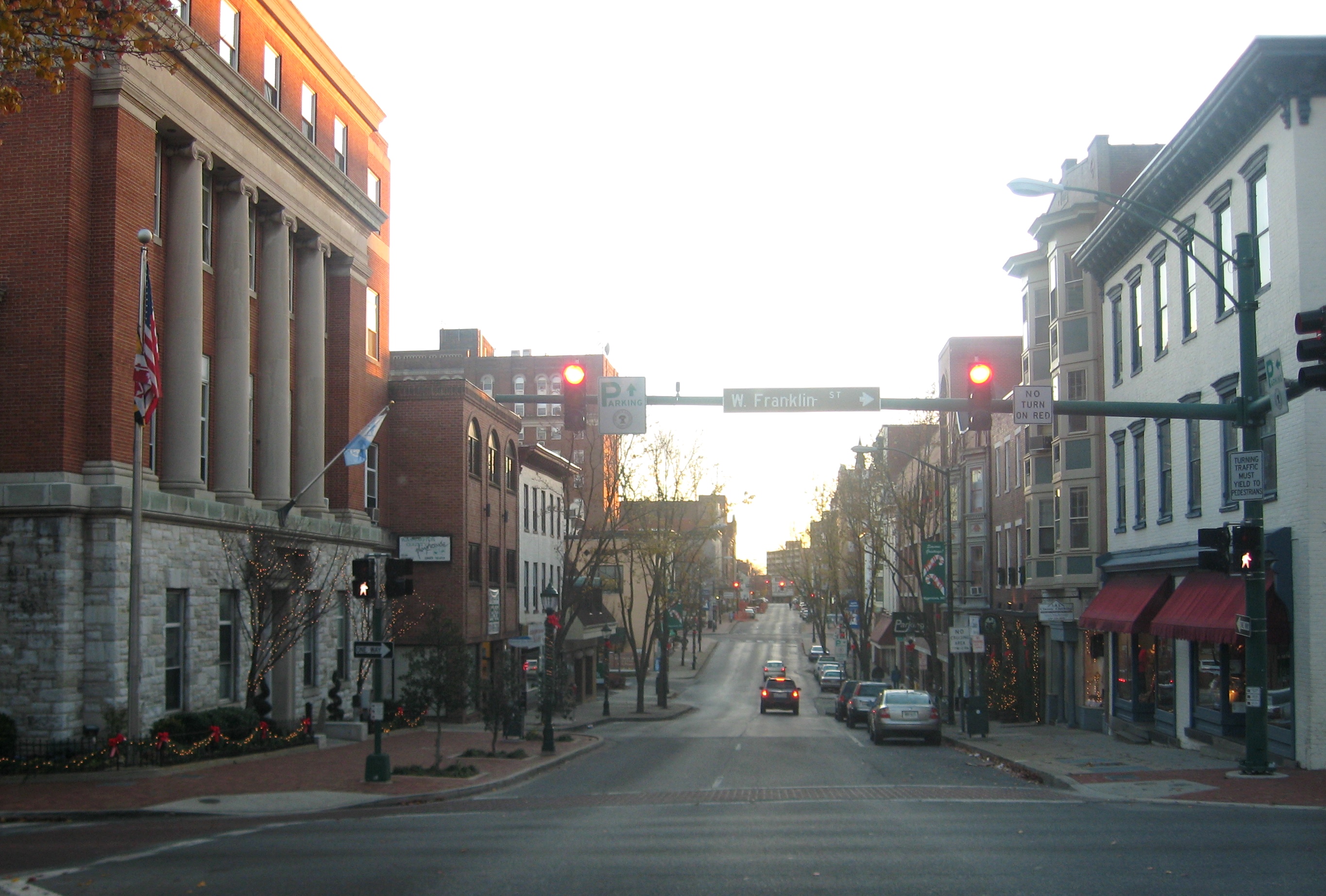
| largest city wl | Hagerstown |
| area_total_sq_mi | 467 |
| area_land_sq_mi | 458 |
| area_water_sq_mi | 9.6 |
| area percentage | 2.0 |
| population_as_of | 2020 |
| population_total | 154705 |
| pop_est_as_of | 2023 |
| population_est | 155813 |
| density_sq_mi | auto |
| web | http://www.washco-md.net/ |
| ex image | Burnsidebridge.jpg |
| ex image cap | Burnside's Bridge in Washington County, site of heavy combat during the Battle of Antietam |
| district | 6th |
| time zone | Eastern |
| named for | George Washington |
Washington County is a county located in the U.S. state of Maryland. The population was 154,705 as of the 2020 census. Its county seat and largest city is Hagerstown. The county is part of the Western Maryland region of the state.
Washington County was the first county in the United States to be named for the Revolutionary War general (and later President) George Washington. Washington County is one of three Maryland counties recognized by the Appalachian Regional Commission as being part of Appalachia. The county borders southern Pennsylvania to the north, Northern Virginia to the south, and the Martinsburg Panhandle of West Virginia to the south and west. Washington County is included in the Hagerstown metropolitan area, which is also included in the Washington metropolitan area.
History
For thousands of years, Native Americans inhabited the lands that would later form Washington County. Archaeological evidence suggests that an Iroquoian people known as the Susquehannock occupied this region around 1600. In the early 17th century, England began to settle lands on the Chesapeake Bay to the east of present-day Washington County. Contact between the Susquehannock and these English settlers was limited until English merchant William Claiborne from Virginia began trading with the Susquehannock in the 1630s.
In 1634, England established the Province of Maryland as an English colony with their founding of St. Mary's City to the southeast of present-day Washington County. English-Susquehannock relations then began to deteriorate, as Maryland formed an alliance with the Piscataway people, who were the frequent target of Susquehannock raids. The founding of the province also disrupted their trade alliance with Claiborne as he refused to acknowledge Maryland's authority. In 1641, the Governor of Maryland declared the Susquehannock "enemies of the province", and Susquehannock raids on Maryland and the Piscataway continued intermittently until 1652.
Acquisition by Maryland
In the winter of 1652, the Susquehannock were attacked by the Mohawk, and although the attack was repulsed, it led to the Susquehannock negotiating the Articles of Peace and Friendship with Maryland. The Susquehannock relinquished their claim to territory on either side of the Chesapeake Bay and reestablished their earlier trading relationship with the English. In 1696, the province incorporated its western portions (including its claims to present-day Washington County) into Prince George's County. In 1707, Maryland became a British colony as the result of the union of the Kingdoms of England and Scotland.
In the 1730s, European settlers arrived in present-day Washington County, and in 1748, Frederick County, which then included Washington County, separated from Prince George's County. During the French and Indian War, Marylanders constructed Fort Frederick in 1756. Later, Maryland was one of the colonies that revolted to form the Thirteen Colonies during the American Revolutionary War in 1775. On September 6, 1776, Maryland formed Washington County from a part of Frederick County. It was the first county in the United States named after George Washington. The State of Maryland ratified the United States Constitution and officially joined the United States in 1788. In 1789, part of Washington County was divided to form Allegany County, which itself was later divided in 1872 to form Garrett County.
Washington County has over 30 historical sites and is home to 3 National Parks, 7 State Parks, 14 County Parks, and numerous City and Town Parks. A number of properties in the county are listed on the National Register of Historic Places. The county's history includes riots during the Whiskey Rebellion, several Civil War battles including the Battle of Antietam, the site where the abolitionist John Brown planned his raid on Harpers Ferry, and the location of railroads that facilitated westward expansion of the United States.
Geography
According to the U.S. Census Bureau, the county has a total area of 467 sqmi, of which 458 sqmi is land and 9.6 sqmi (2.0%) is water.
Washington County is located in the Appalachian Mountains, stretching from the Ridge-and-Valley Country in the west to South Mountain in the east, which is an extension of the Blue Ridge. Much of the county lies in the broad Hagerstown Valley between these two zones; the valley is part of the Great Appalachian Valley that continues southward into Virginia and West Virginia as the Shenandoah Valley and northward into Pennsylvania as the Cumberland Valley.
The county is bordered to the north by the Mason–Dixon line with Pennsylvania, to the south by the Potomac River and the states of Virginia and West Virginia, to the west by Sideling Hill Creek and Allegany County, Maryland, and to the east by Frederick County and South Mountain.
Adjacent counties
- Fulton County, Pennsylvania (northwest)
- Franklin County, Pennsylvania (north)
- Frederick County (east)
- Loudoun County, Virginia (southeast)
- Jefferson County, West Virginia (south)
- Berkeley County, West Virginia (south)
- Morgan County, West Virginia (southwest)
- Allegany County (west)
Major highways

- [[File:I-68 (MD).svg|20px]] Interstate 68
- [[File:I-70 (MD).svg|20px]] Interstate 70
- [[File:I-81 (MD).svg|20px]] Interstate 81
- [[File:US 11.svg|20px]] U.S. Route 11
- [[File:US 40.svg|20px]] U.S. Route 40
- [[File:Alternate plate.svg|20px]]
- [[File:US 340.svg|25px]] U.S. Route 340
- [[File:US 522.svg|25px]] U.S. Route 522
- [[File:MD Route 34.svg|20px]] Maryland Route 34
- [[File:MD Route 56.svg|20px]] Maryland Route 56
- [[File:MD Route 57.svg|20px]] Maryland Route 57
- [[File:MD Route 58.svg|20px]] Maryland Route 58
- [[File:MD Route 60.svg|20px]] Maryland Route 60
- [[File:MD Route 62.svg|20px]] Maryland Route 62
- [[File:MD Route 63.svg|20px]] Maryland Route 63
- [[File:MD Route 64.svg|20px]] Maryland Route 64
- [[File:MD Route 65.svg|20px]] Maryland Route 65
- [[File:MD Route 66.svg|20px]] Maryland Route 66
- [[File:MD Route 67.svg|20px]] Maryland Route 67
- [[File:MD Route 68.svg|20px]] Maryland Route 68
- [[File:MD Route 77.svg|20px]] Maryland Route 77
- [[File:MD Route 144.svg|25px]] Maryland Route 144
- [[File:MD Route 180.svg|25px]] Maryland Route 180
- [[File:MD Route 418.svg|25px]] Maryland Route 418
- [[File:MD Route 491.svg|25px]] Maryland Route 491
- [[File:MD Route 494.svg|25px]] Maryland Route 494
- [[File:MD Route 550.svg|25px]] Maryland Route 550
- [[File:MD Route 615.svg|25px]] Maryland Route 615
- [[File:MD Route 632.svg|25px]] Maryland Route 632
Demographics
|align-fn=center 1790-1960 1900-1990 1990-2000 2010–2018
2020 census
As of the 2020 census, the county had a population of 154,705. The median age was 41.0 years. 21.7% of residents were under the age of 18 and 18.1% of residents were 65 years of age or older. For every 100 females there were 101.6 males, and for every 100 females age 18 and over there were 101.4 males age 18 and over. 67.8% of residents lived in urban areas, while 32.2% lived in rural areas.
The racial makeup of the county was 75.9% White, 11.4% Black or African American, 0.3% American Indian and Alaska Native, 2.0% Asian, 0.1% Native Hawaiian and Pacific Islander, 3.0% from some other race, and 7.3% from two or more races. Hispanic or Latino residents of any race comprised 6.7% of the population.
There were 58,640 households in the county, of which 30.0% had children under the age of 18 living with them and 27.1% had a female householder with no spouse or partner present. About 27.7% of all households were made up of individuals and 12.7% had someone living alone who was 65 years of age or older.
There were 63,790 housing units, of which 8.1% were vacant. Among occupied housing units, 64.3% were owner-occupied and 35.7% were renter-occupied. The homeowner vacancy rate was 1.7% and the rental vacancy rate was 7.8%.
2010 census
As of the 2010 United States census, there were 147,430 people, 55,687 households, and 37,506 families residing in the county.{{cite web |access-date=January 22, 2016 |archive-url=https://archive.today/20200213035041/http://factfinder.census.gov/bkmk/table/1.0/en/DEC/10_DP/DPDP1/0500000US24043 |archive-date=February 13, 2020 |url-status=dead |access-date=January 22, 2016 |archive-url=https://archive.today/20200213184131/http://factfinder.census.gov/bkmk/table/1.0/en/DEC/10_SF1/GCTPH1.CY07/0500000US24043 |archive-date=February 13, 2020 |url-status=dead |access-date=January 22, 2016 |archive-url=https://archive.today/20200213014204/http://factfinder.census.gov/bkmk/table/1.0/en/ACS/10_5YR/DP02/0500000US24043 |archive-date=February 13, 2020 |url-status=dead
Of the 55,687 households, 32.4% had children under the age of 18 living with them, 50.6% were married couples living together, 12.0% had a female householder with no husband present, 32.6% were non-families, and 26.6% of all households were made up of individuals. The average household size was 2.50 and the average family size was 3.01. The median age was 39.7 years.
The median income for a household in the county was $52,994 and the median income for a family was $65,811. Males had a median income of $47,622 versus $34,225 for females. The per capita income for the county was $26,588. About 7.7% of families and 10.4% of the population were below the poverty line, including 14.1% of those under age 18 and 8.8% of those age 65 or over.{{cite web |access-date=January 22, 2016 |archive-url=https://archive.today/20200213011450/http://factfinder.census.gov/bkmk/table/1.0/en/ACS/10_5YR/DP03/0500000US24043 |archive-date=February 13, 2020 |url-status=dead
2000 census
As of the census of 2010, there were 147,430 people, 49,726 households, and 34,112 families residing in the county. The population density was 315 PD/sqmi. There were 52,972 housing units at an average density of 116 /mi2. The racial makeup of the county was 89.71% White or Caucasian, 7.77% Black or African American, 0.18% Native American, 0.80% Asian, 0.04% Pacific Islander, 0.46% from other races, and 1.04% from two or more races. 1.19% of the population were Hispanic or Latino of any race, 32.1% identified as being of German ancestry, 21.4% American, 8.8% Irish, and 8.4% English ancestry.
There were 49,726 households, out of which 31.30% had children under the age of 18 living with them, 54.00% were married couples living together, 10.70% had a female householder with no husband present, and 31.40% were non-families. 26.00% of all households were made up of individuals, and 11.10% had someone living alone who was 65 years of age or older. The average household size was 2.46 and the average family size was 2.96.
In the county, the population was spread out, with 23.40% under the age of 18, 8.10% from 18 to 24, 31.30% from 25 to 44, 23.00% from 45 to 64, and 14.20% who were 65 years of age or older. The median age was 37 years. For every 100 females, there were 104.50 males. For every 100 females age 18 and over, there were 104.00 males.
Communities

City
- Hagerstown (county seat)
Towns
- Boonsboro
- Clear Spring
- Funkstown
- Hancock
- Keedysville
- Sharpsburg
- Smithsburg
- Williamsport
Census-designated places
The Census Bureau recognizes the following census-designated places in the county:
- Antietam
- Bagtown
- Bakersville
- Beaver Creek
- Big Pool
- Big Spring
- Breathedsville
- Brownsville
- Cavetown
- Cearfoss
- Charlton
- Chewsville
- Dargan
- Downsville
- Eakles Mill
- Edgemont
- Ernstville
- Fairplay
- Fairview
- Fort Ritchie
- Fountainhead-Orchard Hills
- Gapland
- Garretts Mill
- Greensburg
- Halfway
- Highfield-Cascade
- Indian Springs
- Jugtown
- Kemps Mill
- Leitersburg
- Mapleville
- Maugansville
- Mercersville
- Middleburg
- Mount Aetna
- Mount Briar
- Mount Lena
- Paramount-Long Meadow
- Pecktonville
- Pinesburg
- Pondsville
- Reid
- Ringgold
- Robinwood
- Rohrersville
- Saint James
- San Mar
- Sandy Hook
- Tilghmanton
- Trego-Rohrersville Station
- Wilson-Conococheague
- Yarrowsburg
Unincorporated communities

- Appletown
- Benevola
- Broadfording
- Burtner
- Huyett
- Pen Mar
- Samples Manor
- Spielman
- Trego
- Van Lear
- Weverton
- Woodmont
- Zittlestown
Politics and government
Federal representation
The county is located within Maryland's 6th congressional district. The representative of the district currently is April McClain Delaney (D).
Like most of Appalachia, German-influenced and Unionist Western Maryland, Washington County is solidly Republican. The last Democrat to carry Washington County at a Presidential level was Lyndon Johnson during his 1964 landslide win over Barry Goldwater, although between 1888 and 1940 the county was a consistent bellwether for all Presidential elections.
Voter registration
| Voter registration and party enrollment as of June 2025 | Total |
|---|---|
| Republican | |
| Democratic | |
| Unaffiliated | |
| Other parties |
|}
State representation
Washington County is represented by two senators in the Maryland State Senate. Member Mike McKay (R), serves the 1st district in Maryland and Paul D. Corderman (R), serves in the 2nd district. The county also is represented in Maryland General Assembly’s other primary division, the Maryland House of Delegates. Delegates who stand for Washington County include: Terry Baker (R) for District 1C, William Valentine (R) and William J. Wivell (R) for District 2A and Matthew Schindler (D) for District 2B.
County government
Washington County’s “leader” is known as the County Administrator. Currently, Michelle Gordon serves as the County Administrator. However, Washington County's County Commissioners exercise executive powers as they exist in the government of the county.
The County Commissioners in Washington County comprise the traditional form of county government in Maryland. Current members include: John Barr (President) (R), Jeffrey A. Cline (Vice President) (R), Randall Wagner (R), Derek Harvey (R), and Randy Leatherman (R). [[File:Downtown Boonsboro, Maryland.jpg|thumb|right|200px|Boonsboro]]
Economy
In 2000, the median income for a household in the county was $40,617, and the median income for a family was $48,962. Males had a median income of $34,917 versus $24,524 for females. The per capita income for the county was $20,062. About 7.00% of families and 9.50% of the population were below the poverty line, including 12.30% of those under age 18 and 9.50% of those age 65 or over.
According to the Maryland Department of Business and Economic Development, the following were the major employers in the county (excluding post offices, state government, and local governments, but including public institutions of higher education):
| Employer | Employees |
|---|---|
| (Nov. 2014) | |
| Meritus Health | 2,730 |
| Citi | 2,700 |
| First Data | 2,322 |
| Volvo Group | 1,350 |
| The Bowman Group | 718 |
| FedEx Ground | 648 |
| Staples Inc. | 597 |
| Hagerstown Community College | 594 |
| Merkle Response Management Group | 545 |
| Arc of Washington County | 500 |
| Direct Mail Processors | 500 |
| Walmart/Sam's Club | 500 |
| Sierra Nevada Corp. | 486 |
| Giant Food Stores/ | |
| Martin's Food Markets | 420 |
| Weis Markets | 400 |
| Brook Lane Health Services | 395 |
| Lehigh Phoenix | 360 |
| A.C.&T | 350 |
| Susquehanna Bancshares | 345 |
| Dot Foods | 312 |
| JLG Industries | 300 |
| Home Depot | 296 |
| Lowe's | 276 |
| Thompson's Gas & Electric Service | 275 |
| United Parcel Service (UPS) | 274 |
| CertainTeed | 250 |
| Darden Restaurants | 250 |
| Sheetz | 250 |
| Tractor Supply | 250 |
| Homewood Retirement Centers | 249 |
| NMS Healthcare of Hagerstown | 240 |
| Horizon Goodwill Industries | 229 |
| C. William Hetzer | 225 |
| FedEx Freight | 225 |
Washington County is top in the state for commercial production of fruits, tree nuts, and berries.
Parks and recreation
_from_the_Victor_Cushwa_Memorial_Bridge_as_it_passes_through_the_Sideling_Hill_Road_Cut_in_Forest_Park,_Washington_County,_Maryland.jpg)
National parks
- Antietam National Battlefield
- Appalachian National Scenic Trail
- Chesapeake and Ohio Canal National Historical Park
- Harpers Ferry National Historical Park
State parks
- Fort Frederick State Park
- Fort Tonoloway State Park
- Gathland State Park
- Greenbrier State Park
- South Mountain State Park
- Washington Monument State Park
Museums, historic sites, and other points of interest
- Bowman House, Boonsboro
- Crystal Grottoes, the only show caves in Maryland.
- Discovery Station, Hagerstown
- Hager House, Hagerstown
- Hagerstown Roundhouse Museum, Hagerstown
- Price-Miller House, Hagerstown
- Sideling Hill, man-made mountain pass on Interstate 68/U.S. Route 40 roughly 5 mi west of Hancock shows off 100 million years+ of rock formation with Information Center and walkways on the premises.
- Springfield Farm, Williamsport
- Stoney Creek Farm, Boonsboro
- Washington County Museum of Fine Arts, Hagerstown
- Washington County Rural Heritage Museum, Boonsboro
Education
Washington County Public Schools administers public schools in the county. See Washington County Public Schools – School Directory for a detailed listing of elementary, middle, high, and other schools.
High schools
Public high schools
- Antietam Academy, Hagerstown
- Barbara Ingram School for the Arts, Hagerstown
- Boonsboro High School, Boonsboro
- Clear Spring High School, Clear Spring
- Evening High School, Hagerstown
- Hancock High School, Hancock
- North Hagerstown High School, Hagerstown
- Smithsburg High School, Smithsburg
- South Hagerstown High School, Hagerstown
- Washington County Technical High School, Hagerstown
- Williamsport High School, Williamsport Private high schools
- Broadfording Academy, Hagerstown
- Emmanuel Christian School, Hagerstown
- Gateway Academy, Williamsport
- Grace Academy, Hagerstown
- Heritage Academy, Hagerstown
- Highland View Academy, Hagerstown
- St. James School, Saint James
- St. Maria Goretti High School, Hagerstown
- Truth Christian Academy, Hagerstown
Colleges and universities
- Antietam Bible College, Biblical Seminary, and Graduate School
- Hagerstown Community College, two-year public community college
- Kaplan College (formerly Hagerstown Business College)
- Mount Saint Mary's University, Hagerstown Campus, offers Master of Business Administration (MBA) program.
- University System of Maryland at Hagerstown, branch of the University System of Maryland; offers various associate's, bachelor's, and master's degree programs in connection with other state colleges and universities in Maryland.
Notable residents and natives
- See People from Washington County.
References
References
- "U.S. Census Bureau QuickFacts: Washington County, Maryland".
- "Find a County". National Association of Counties.
- "Counties in Appalachia - Appalachian Regional Commission".
- "Washington County - MD 250". Maryland 250 Commission.
- Gallatin, Albert. (1849). "Map of the Indian tribes of North America, about 1600 A.D. along the Atlantic, & about 1800 A.D. westwardly Copy 1". American Antiquarian Society.
- (2003). "Material Culture of the Contact Period in the Upper Potomac Valley: Chronological and Cultural Implications". Archaeology of Eastern North America.
- (2005). "Present at the Creation:The Chesapeake World That Greeted the Maryland Colonists". Maryland Historical Magazine.
- "Unearthing early American life in St. Mary's City".
- Pleasants, Adam. (2003). ""The Unlucky Rebel:" William Claiborne and the Kent Island Dispute". William & Mary.
- (1968). "Glory, Death, and Transfiguration: The Susquehannock Indians in the Seventeenth Century". Proceedings of the American Philosophical Society.
- Samford, Patricia. (2015-02-11). "1652 Susquehannock Treaty".
- "A 1652 Treaty Opens up the Story of the First Baltimoreans".
- [http://genealogytrails.com/mary/washington/], Washington County, Maryland History and Genealogy, 2006. Retrieved 2008.
- Parliament of the Kingdom of England. "Union with Scotland Act 1706 Article I". [[legislation.gov.uk]].
- {{NRISref. 2008b
- (August 22, 2012). "2010 Census Gazetteer Files". United States Census Bureau.
- "Annual Estimates of the Resident Population for Counties: April 1, 2020 to July 1, 2023". United States Census Bureau.
- "U.S. Decennial Census". United States Census Bureau.
- "Historical Census Browser". University of Virginia Library.
- "Population of Counties by Decennial Census: 1900 to 1990". United States Census Bureau.
- "Census 2000 PHC-T-4. Ranking Tables for Counties: 1990 and 2000". United States Census Bureau.
- "State & County QuickFacts". United States Census Bureau.
- (2023). "2020 Decennial Census Demographic and Housing Characteristics (DHC)".
- (2021). "2020 Decennial Census Demographic Profile (DP1)".
- (2021). "2020 Decennial Census Redistricting Data (Public Law 94-171)".
- Levine, Mark V.; ‘Standing Political Decisions and Critical Realignment: The Pattern of Maryland Politics, 1872-1948’; ''[[The Journal of Politics]]'', volume 38, no. 2 (May 1976), pp. 292-325
- "Maryland Board of Elections Voter Registration Activity Report June 2025".
- Leip, David. "Dave Leip's Atlas of U.S. Presidential Elections".
- "Géographie électorale".
- "Maryland General Assembly - Washington County Members". Maryland State Archives.
- "County Commissioners".
- [http://business.maryland.gov/Documents/ResearchDocument/MajorEmployersInWashingtonCounty.pdf Major Employers in Washington County, Maryland], [[Maryland Department of Business and Economic Development]] (Nov. 2014 data).
- (2017). "Census of Agriculture - State and County Profiles - Maryland".
This article was imported from Wikipedia and is available under the Creative Commons Attribution-ShareAlike 4.0 License. Content has been adapted to SurfDoc format. Original contributors can be found on the article history page.
Ask Mako anything about Washington County, Maryland — get instant answers, deeper analysis, and related topics.
Research with MakoFree with your Surf account
Create a free account to save articles, ask Mako questions, and organize your research.
Sign up freeThis content may have been generated or modified by AI. CloudSurf Software LLC is not responsible for the accuracy, completeness, or reliability of AI-generated content. Always verify important information from primary sources.
Report