From Surf Wiki (app.surf) — the open knowledge base
Warren County, Tennessee
County in Tennessee, United States
County in Tennessee, United States
| Field | Value |
|---|---|
| county | Warren County |
| state | Tennessee |
| image_flag | Flag of Warren County, Tennessee.svg |
| founded | 1807 |
| named for | Joseph Warren |
| seat wl | McMinnville |
| largest city | McMinnville |
| area_total_sq_mi | 434 |
| area_land_sq_mi | 433 |
| area_water_sq_mi | 1.4 |
| area percentage | 3% |
| census yr | 2020 |
| pop | 40953 |
| density_sq_mi | 92 |
| time zone | Central |
| web | www.warrencountytn.gov |
| ex image | Warren-County-Courthouse2-tn.jpg |
| ex image cap | Warren County Courthouse in McMinnville |
| district | 4th |
| district2 | 6th |
Warren County is a county located on the Cumberland Plateau in Middle Tennessee, one of the three Grand Divisions of the U.S. state of Tennessee. As of the 2020 census, the population was 40,953. Its county seat is McMinnville. Warren County comprises the McMinnville, TN Micropolitan Statistical Area.
History
Warren County was created in 1807 from a portion of White County, and named for Joseph Warren (1741–1775), a militiaman and major general in the American Revolution. The revised Tennessee State Constitution of 1834 stated that no new county could be within 12 mi of the county seat of the county from which it was formed. The boundaries of five counties formed from Warren— Grundy, Van Buren, Cannon, Coffee and DeKalb— were exactly 12 miles from Warren's county seat, McMinnville, giving the county its distinctive round shape. Warren County was the site of several saltpeter mines. Saltpeter is the main ingredient of gunpowder and was obtained by leaching the earth from several local caves. Hubbards Cave, near Camp Woodlee, was a major operation. Henshaw Cave on Cardwell Mountain (now part of Cumberland Caverns) and Solomon Saltpeter Cave on Ben Lomond Mountain were relatively small mining operations. Most saltpeter mining occurred during the War of 1812 and in the Civil War.
The county was largely developed for farming of such crops as tobacco and hemp. While numerous families held enslaved African Americans as workers, they were a minority of the population. Warren County citizens voted to secede from the Union before the American War Between the States in February 1861 in a state referendum. Voters in Tennessee overall decided to remain in the Union in that time. When President Abraham Lincoln demanded that Tennessee provide troops to fight against the Southern states in April 1861, it was viewed as a violation of Article 3, Section 3 of the U.S. Constitution. At a new referendum in June 1861, Warren County again, along with a majority of Tennessee's counties, voted for secession. Unlike in some states, slavery was not listed as one of the reasons in Tennessee's secession proclamation.
Men from Warren County and surrounding upper Cumberland region formed and served in many units in Tennessee's defense, including the 16th Tennessee Infantry led by McMinnville resident Col. John Houston Savage. The Confederate monument next to the county courthouse is dedicated in the memory of the men who served and died in the 16th and lists their names.
Men from Warren County and upper Cumberland area joined the 16th TN Infantry Regiment, among others. Their flag is on display at the Texas 'Civil War' Museum in Fort Worth TX.
Geography
According to the U.S. Census Bureau, the county has a total area of 434 sqmi, of which 433 sqmi is land and 1.4 sqmi (0.3%) is water. The county lies long the Eastern Highland Rim, near the Cumberland Plateau.
The Caney Fork forms part of the county's borders with White and DeKalb counties to the north. The Rocky River, a tributary of the Caney Fork, forms part of the county's eastern border with Van Buren County. The Collins River, also a tributary of the Caney Fork, flows through the county, and the Barren Fork, a tributary of the Collins, flows through McMinnville.
Cardwell Mountain is an imposing natural feature located five miles due east of McMinnville. It is an erosional remnant of the nearby Cumberland Plateau. Cardwell Mountain is noted for Cumberland Caverns, an exceptionally long cave which lies underneath the mountain.
Adjacent counties
- DeKalb County (north)
- White County (northeast)
- Van Buren County (east)
- Sequatchie County (southeast)
- Grundy County (south)
- Coffee County (southwest)
- Cannon County (northwest)
Major highways
- [[Image:US 70S.svg|20px]] U.S. Route 70S
- [[Image:Tennessee 8.svg|20px]] State Route 8
- [[Image:Tennessee 30.svg|20px]] State Route 30
- [[Image:Tennessee 55.svg|20px]] State Route 55
- [[Image:Tennessee 56.svg|20px]] State Route 56
- [[Image:Secondary Tennessee 108.svg|22px]] State Route 108
- [[Image:Secondary Tennessee 136.svg|22px]] State Route 136
State protected areas
- Hubbard's Cave State Natural Area
- Morrison Meadow State Natural Area
- Rock Island State Park (part)
Demographics
|align-fn=center 1790-1960 1900-1990 1990-2000 2010-2014
2020 census
| Race | Number | Percentage | White (non-Hispanic) | Black or African American (non-Hispanic) | Native American | Asian | Pacific Islander | Other/Mixed | Hispanic or Latino |
|---|---|---|---|---|---|---|---|---|---|
| 33,980 | 82.97% | ||||||||
| 1,090 | 2.66% | ||||||||
| 84 | 0.21% | ||||||||
| 258 | 0.63% | ||||||||
| 10 | 0.02% | ||||||||
| 1,588 | 3.88% | ||||||||
| 3,943 | 9.63% |
As of the 2020 census, there were 40,953 people, 16,336 households, and 10,167 families residing in the county.
The median age was 41.2 years; 23.2% of residents were under the age of 18 and 18.8% were 65 years of age or older, with 96.7 males per 100 females and 94.9 males per 100 females age 18 and over.
38.4% of residents lived in urban areas, while 61.6% lived in rural areas.
There were 16,336 households in the county, of which 30.1% had children under the age of 18 living in them, 46.6% were married-couple households, 18.9% had a male householder with no spouse or partner present, and 27.6% had a female householder with no spouse or partner present. About 28.7% of households were made up of individuals and 13.2% had someone living alone who was 65 years of age or older.
There were 18,088 housing units, of which 9.7% were vacant; of the occupied units, 70.5% were owner-occupied and 29.5% were renter-occupied, with homeowner and rental vacancy rates of 1.7% and 8.2%, respectively.
The racial makeup of the county was 85.0% White, 2.7% Black or African American, 0.4% American Indian and Alaska Native, 0.6% Asian,
2000 census
As of the census of 2000, there were 38,276 people, 15,181 households, and 10,824 families residing in the county. The population density was 88 /mi2. There were 16,689 housing units at an average density of 39 /mi2. The racial makeup of the county was 91.66% White, 3.16% Black or African American, 0.21% Native American, 0.42% Asian, 0.05% Pacific Islander, 3.56% from other races, and 0.94% from two or more races. 4.92% of the population were Hispanic or Latino of any race.
There were 15,181 households, out of which 31.90% had children under the age of 18 living with them, 56.20% were married couples living together, 11.20% had a female householder with no husband present, and 28.70% were non-families. 25.00% of all households were made up of individuals, and 10.50% had someone living alone who was 65 years of age or older. The average household size was 2.47 and the average family size was 2.93.
In the county, the population was spread out, with 24.20% under the age of 18, 9.10% from 18 to 24, 29.40% from 25 to 44, 23.40% from 45 to 64, and 13.90% who were 65 years of age or older. The median age was 37 years. For every 100 females there were 96.50 males. For every 100 females age 18 and over, there were 94.70 males.
The median income for a household in the county was $30,920, and the median income for a family was $37,835. Males had a median income of $28,409 versus $20,863 for females. The per capita income for the county was $15,759. About 13.00% of families and 16.60% of the population were below the poverty line, including 20.40% of those under age 18 and 17.20% of those age 65 or over.
Recreation
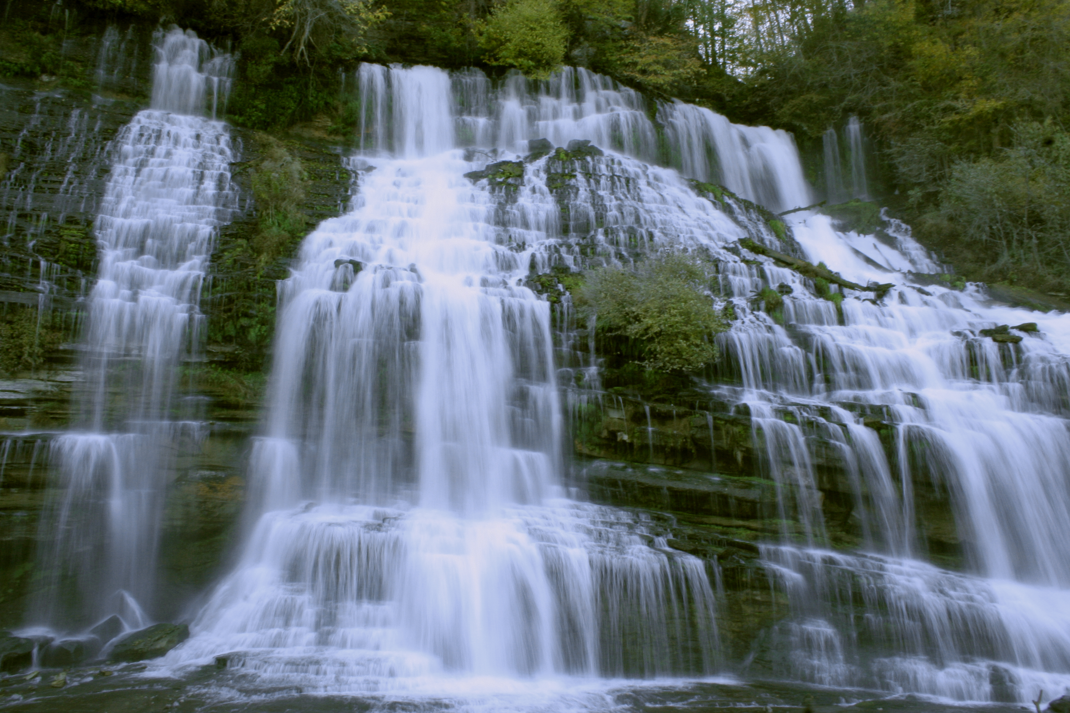
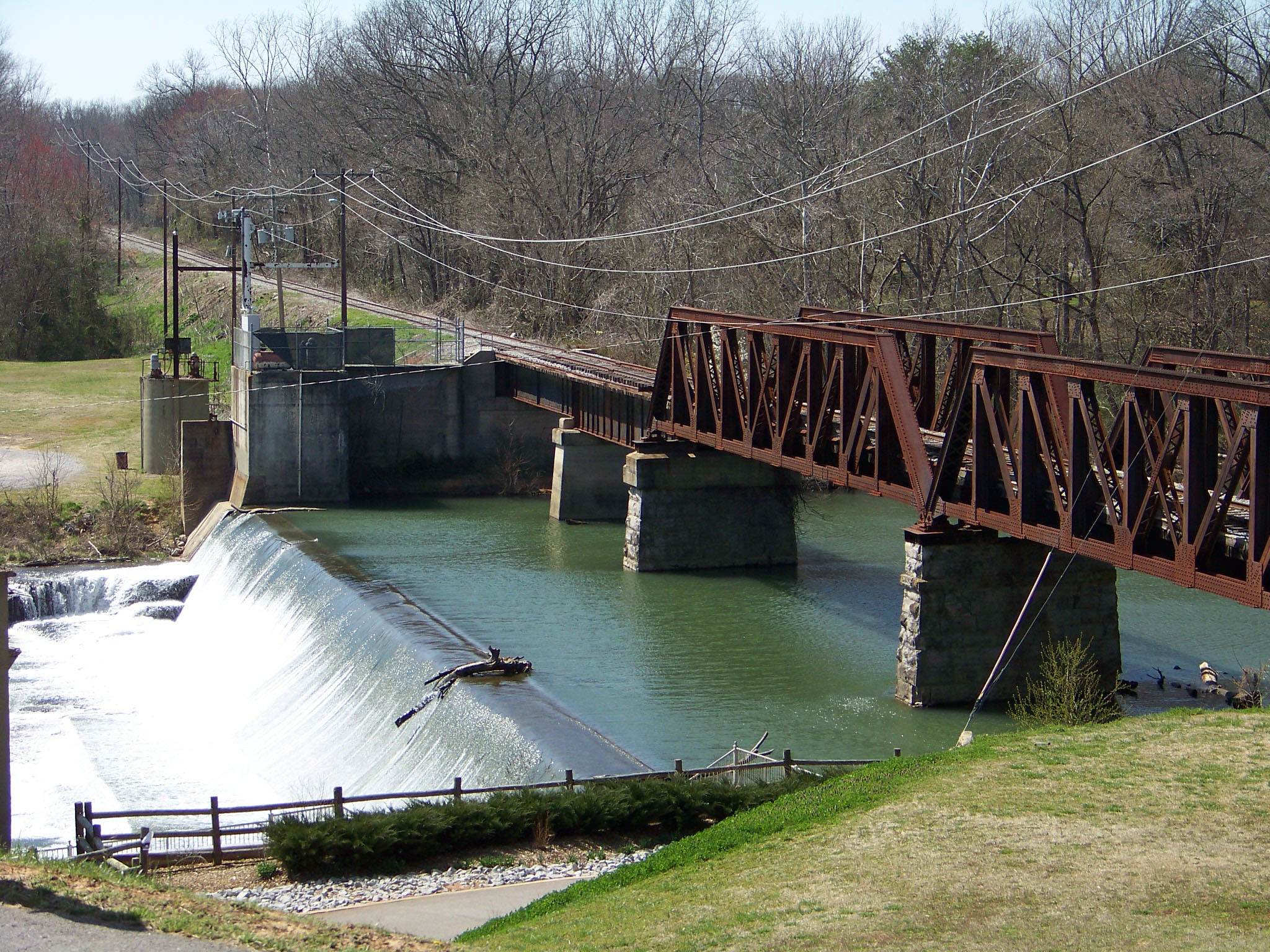
Rock Island State Park is located on the northeastern border with White County. This park is the site of the Tennessee Valley Authority's Great Falls Dam, includes many hiking trails, and offers whitewater rafting.
Cumberland Caverns, located east of McMinnville under Cardwell Mountain, is Tennessee's largest show cave. It is the second longest mapped cave in Tennessee with 27.6 mi of passages, and displays some of the largest cave rooms in eastern North America. Cumberland Caverns is the 15th longest cave in the United States.
Hubbard's Cave, the largest gray bat hibernaculum in Tennessee, with over 100,000 bats, is located in the county. The cave is owned by the Nature Conservancy and it is securely gated to protect the bats, which are an Endangered Species.
Falcon Rest, an 1896 Victorian mansion in McMinnville built by local manufacturer Clay Faulkner, is listed on the National Register of Historic Places (NRHP). It is open to the public as a historic house museum. His father's mansion in the same city, Falconhurst, is also on the NRHP.
Communities
City
- McMinnville (county seat)
Towns
- Centertown
- Morrison
- Viola
Unincorporated communities
- Berea
- Bratchers Crossroads
- Campaign
- Daylight
- Irving College
- Midway
- Rock Island
- Shady Rest
- Shellsford
- Smartt
- Spring Creek
- Stewart Chapel
Politics
Warren County was a Democratic stronghold for most of the 20th century. The last Democrat to win Warren County was Al Gore in 2000. After the 2000 election, Warren County began to trend Republican, with each passing election having an increasing margin for the Republican candidate. Donald Trump won Warren county in 2016 by 42%, compared to Mitt Romney's margin of 25% in 2012.
References
References
- James Dillon, "[http://tennesseeencyclopedia.net/entry.php?rec=1469 Warren County]," ''Tennessee Encyclopedia of History and Culture''. Retrieved: April 23, 2013.
- "Census - Geography Profile: Warren County, Tennessee". [[United States Census Bureau]].
- "Find a County". National Association of Counties.
- Thomas C. Barr, Jr., "Caves of Tennessee", ''Bulletin 64 of the Tennessee Division of Geology,'' 1961, 568 pages.
- "Ordinances of Secession".
- "Archived copy".
- "CW Monument".
- [http://home.freeuk.com/gazkhan/tenn_battle-flags_h-company.html FreeUK]{{dead link. (May 2024)
- (August 22, 2012). "2010 Census Gazetteer Files". United States Census Bureau.
- "U.S. Decennial Census". United States Census Bureau.
- "Historical Census Browser". University of Virginia Library.
- (March 27, 1995). "Population of Counties by Decennial Census: 1900 to 1990". United States Census Bureau.
- (April 2, 2001). "Census 2000 PHC-T-4. Ranking Tables for Counties: 1990 and 2000". United States Census Bureau.
- "State & County QuickFacts". United States Census Bureau.
- "Explore Census Data".
- (2021). "2020 Decennial Census Demographic Profile (DP1)".
- (2023). "2020 Decennial Census Demographic and Housing Characteristics (DHC)".
- (2021). "2020 Decennial Census Redistricting Data (Public Law 94-171)".
- "U.S. Census website". [[United States Census Bureau]].
- "Cumberland Caverns" by Larry E. Matthews, Second Edition, 2005, {{ISBN. 978-0-9663547-2-0
- USA Long Cave List, October 19, 2010, by Bob Gulden.
- [http://www.falconrest.com Falcon Rest official site]. Retrieved: April 23, 2013.
- Leip, David. "Dave Leip's Atlas of U.S. Presidential Elections".
- (December 2, 2024). "State of Tennessee General Election Results, November 5, 2024, Results By County". Secretary of State of Tennessee.
- "Election Results {{!}} Tennessee Secretary of State".
- "Election Results {{!}} Tennessee Secretary of State".
- "Election Results {{!}} Tennessee Secretary of State".
- "Election Results {{!}} Tennessee Secretary of State".
- "Election Results {{!}} Tennessee Secretary of State".
This article was imported from Wikipedia and is available under the Creative Commons Attribution-ShareAlike 4.0 License. Content has been adapted to SurfDoc format. Original contributors can be found on the article history page.
Ask Mako anything about Warren County, Tennessee — get instant answers, deeper analysis, and related topics.
Research with MakoFree with your Surf account
Create a free account to save articles, ask Mako questions, and organize your research.
Sign up freeThis content may have been generated or modified by AI. CloudSurf Software LLC is not responsible for the accuracy, completeness, or reliability of AI-generated content. Always verify important information from primary sources.
Report