From Surf Wiki (app.surf) — the open knowledge base
Walla Crag
Fell in the Lake District, England
Fell in the Lake District, England
| Field | Value |
|---|---|
| name | Walla Crag |
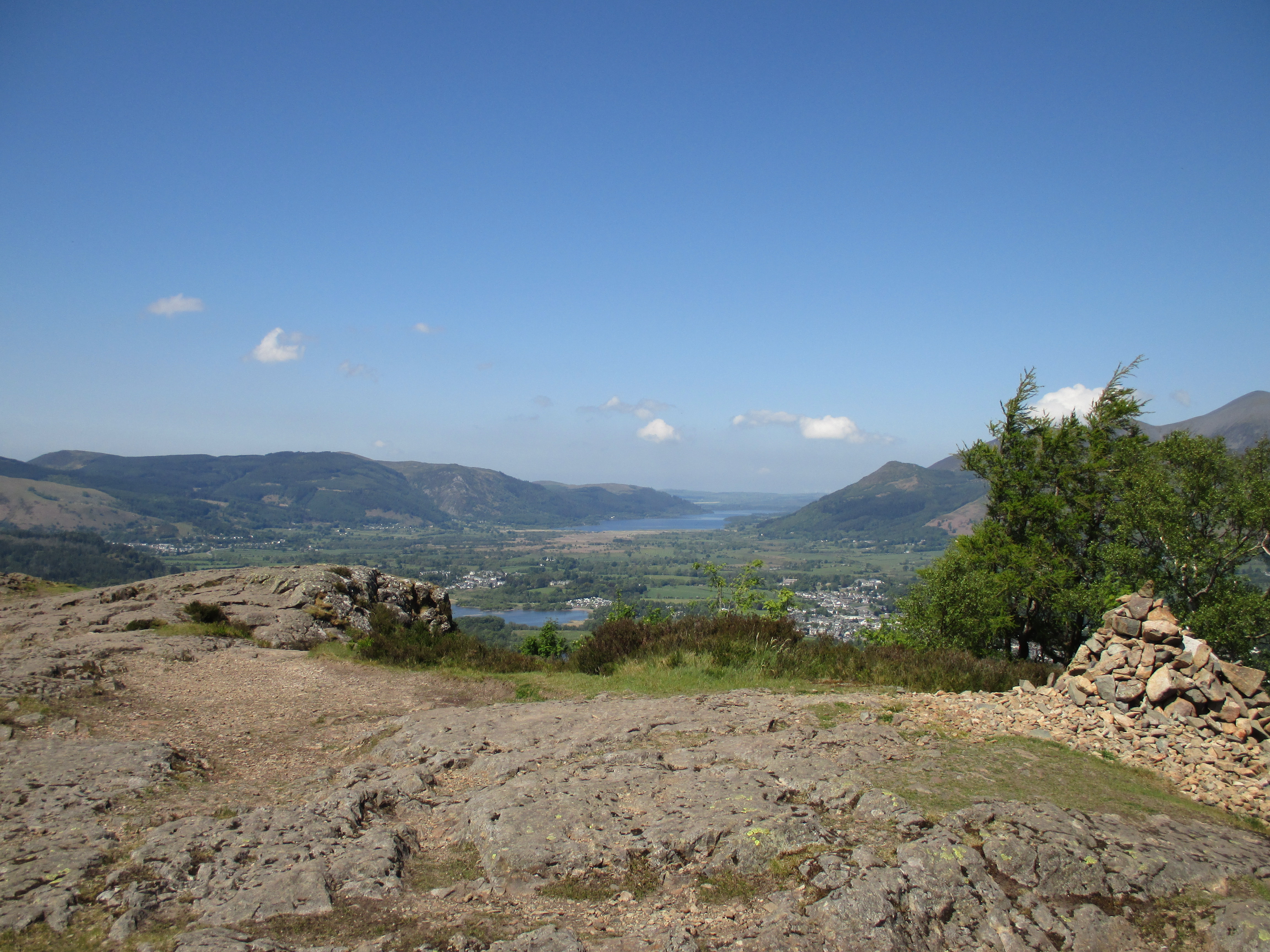
| photo | Walla_Crag_from_Hause_Gate_(2).JPG |
| photo_caption | Walla Crag from Hause Gate on the |
| opposite side of Derwent Water | |
| elevation_m | 379 |
| prominence_m | 24 |
| parent_peak | Bleaberry Fell |
| listing | Wainwright |
| location | Cumbria, England |
| range | Lake District, Central Fells |
| coordinates | |
| grid_ref_UK | NY276212 |
| topo | OS Explorer OL4 |
| map | United Kingdom Lake District |
| map_caption | Location in Lake District, UK |
opposite side of Derwent Water
Walla Crag is a fell in the English Lake District, near Keswick. The fell is a short walk from Keswick and overlooks Derwentwater.
Topography
The crag is the terminal cliff on a short ridge running north west from Bleaberry Fell, dropping about 400 ft from the plateau above. Below this are further steep slopes before the gradient slackens on the shore of Derwentwater. The face is heavily wooded — mainly with conifers — almost to the top. The trees continue down through Great Wood to the lake. Walla Crag has one major breach, Lady's Rake.
The summit lies a little way back from the brink, the smooth heather-clad hinterland then dropping to the broad depression of Low Moss. Beyond here the ground rises again to Bleaberry Fell. The southern boundary of the fell is formed by Cat Gill, which flows west from Loss Moss to the lake. The gill separates Walla Crag from the neighbouring Falcon Crag, popular with rock climbers. Brockle Beck flows north from Low Moss, before turning west to enter Derwentwater at Strandshag Bay.
Geology
The crag itself exposes the plagioclase-phyric andesite lavas of the Birker Fell Formation. The summit area is overlain by drift deposits.
Summit
The top is marked by a large cairn and overlooks the islands of northern Derwentwater and the Vale of Keswick. There is also a clear line of sight down Borrowdale to the high fells.
Ascents
Walla Crag makes a half day or evening walk from Keswick and can be climbed via Brockle Beck, Great Wood (a traverse under the face) or Cat Gill. There is also a clear path from Bleaberry Fell.
Height
Fellwalkers of an older generation found the height of Walla Crag an easily memorable 1,234 ft, much as Scafell Pike was once a simple 3,210 ft. More recent work by the Ordnance Survey has now elevated Walla Crag to 1,243 ft.
References
References
- [[British Geological Survey]] 1:50,000 series maps: Sheet 38: BGS (1998)
- Wainwright, A. (1958). "[[Pictorial Guide to the Lakeland Fells". Westmorland Gazette.
- Mark Richards: ''The Central Fells'': Collins (2003): {{ISBN. 0-00-711365-X
This article was imported from Wikipedia and is available under the Creative Commons Attribution-ShareAlike 4.0 License. Content has been adapted to SurfDoc format. Original contributors can be found on the article history page.
Ask Mako anything about Walla Crag — get instant answers, deeper analysis, and related topics.
Research with MakoFree with your Surf account
Create a free account to save articles, ask Mako questions, and organize your research.
Sign up freeThis content may have been generated or modified by AI. CloudSurf Software LLC is not responsible for the accuracy, completeness, or reliability of AI-generated content. Always verify important information from primary sources.
Report