From Surf Wiki (app.surf) — the open knowledge base
Wadi Gaza
Wadi in southern Israel and Palestine
_-_Flooding_in_the_Negev_(1).jpg)
Wadi in southern Israel and Palestine
| Field | Value |
|---|---|
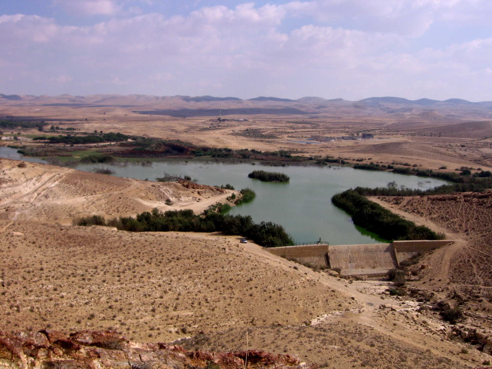
| name | Wadi Gaza / Besor Stream |
| name_other | وادي غزة / נחל הבשור |
| image | GesherTzeelim.jpg |
| image_caption | Besor Stream |
| mapframe | yes |
| mapframe-zoom | 8 |
| source1_location | Negev |
| source1_coordinates | |
| mouth_location | Mediterranean Sea |
| mouth_coordinates | |
| subdivision_type1 | Country |
| subdivision_name1 | Israel, Palestine |
| mapframe-zoom = 8
Wadi Gaza () and Besor Stream (, ) are parts of a river system in the Gaza Strip in Palestine and the Negev region of Israel. Wadi Gaza is a wadi (river valley) that divides the northern and southern ends of the Gaza Strip, whose major tributary is Besor Stream.
History
Nahal Besor has shown evidence of epipaleolithic sites above paleolithic sediments. Finds of pottery and flints were studied by Ann Roshwalb who found evidence of both Egyptian and late Neolithic occupations. Archaeologists Pierre de Miroschedji and Moain Sadeq suggest that in the late 4th millennium BCE, Egypt's expansion into the southern Levant consisted of a core of permanent settlement with areas of seasonal habitation and Egyptian influence where ancient Egyptians and Canaanites interacted. The permanent core was focused around the wadi, encompassing the settlements at Tell es-Sakan (likely an administrative centre) and En Besor.
In the Old Testament, Besor was a ravine or brook in the extreme south-west of Judah, where 200 of David's men stayed behind because they were faint, while the other 400 pursued the Amalekites.
Around the year 390, a group of monks from Scetis around Silvanus settled in several hermit cells along the watercourse. The community would only gather on Saturdays and Sundays for communal prayer and meals, doing various manual works and prayer during the week. In 520, the so-called monastery of Seridus was founded a bit further south where the famous hermits Barsanuphius and John the Prophet lived.
During the Ottoman period, the area was inhabited by the Bedouin tribe of 'Arab al-Jubarat (عرب الجبارات).
Between 1951 and 1954, the Yeruham Dam was built on one of the tributaries of the HaBesor Stream. In 2012, Palestine added Wadi Gaza to the tentative list of World Heritage Sites.
In October 2023, as part of the Gaza war, Israel ordered 1.1 million people then living north of the Wadi Gaza bridge to move south.
File:Wadi Gaza in the PEF Survey of Western Palestine composite (cropped).jpg|1888 File:Wadi Gaza in the 1933 Motor map of Palestine, Survey of Palestine (cropped).jpg|1933 File:09-09-WadiGhazza-1942.jpg|1942
Wadi Gaza Nature Reserve
Main article: Wadi Gaza Nature Reserve
The Wadi Gaza Nature Reserve was declared a nature reserve by the Environmental Quality Authority of Palestinian Authority in June 2000. It is confined to the course of the Wadi and its floodplain and banks within the Palestinian jurisdiction.
The Gaza section of the Coastal Aquifer is the only significant source of water in the Gaza Strip. The Wadi Gaza runs through a wetland, the Gaza Valley, and as of 2012 it is used as a wastewater dump.
In 2022, rehabilitation began to turn Wadi Gaza back into a nature reserve.
Geography

The stream begins at Mount Boker (near Sde Boker), and spills into the Mediterranean Sea near Al-Zahra in the Gaza Strip. Further upstream it was marked as Wadi esh-Shallaleh on the 1878 Survey of Western Palestine map. The area has several important archaeological sites.
The stream is the largest in the northern Negev, and together with its largest tributaries, the Nahal Gerar, and the Beersheba stream, reaches as far east into the desert as Sde Boker, Yeruham, Dimona, and Arad/Tel Arad.
The source of Besor River lies at Mount Boker, near Sde Boker and the educational center Midreshet Ben-Gurion. From there it flows northwest towards the town of Ashalim, where it meets Nahal Be'er Hayil.
From there it flows north towards the ancient town of Haluza (Al-Khalasa). Then it continues northwest until it meets the Beersheba River a little to the east of the town of Tze'elim.
Near the village of Re'im, Nahal Besor meets the Nahal Gerar river, which is its biggest tributary.
One of the tributaries of the Besor River reaches kibbutz Urim. Tributaries from south to north: HaRo'e Stream, Boker Stream, Mesora Stream, Zalzal Stream, Revivim Stream, Atadim Stream, Beersheba Stream, Assaf Stream, Amar Stream, Sahaf Stream, and Wadi Abu Katrun.
Finally, Bezor Stream flows across the Israeli border with the Gaza Strip, and into the Mediterranean sea.
Ecology and environment

Fauna
The Gaza–Israel barrier presents a physical barrier which effects the makeup of wildlife in the portion of the wadi in the Gaza Strip by limiting movement. Between 2002 and 2004 a survey of wildlife around the wadi as it passes through the Gaza Strip found that it was devoid of large mammals, though small mammals such as bats, hedgehogs, and rodents were common. Wildlife hunting for food is more common in this area than in Israel.
Pollution
A study conducted in 2001 and 2002 found that the section of the wadi flowing through the Gaza Strip had higher levels of pollutants in summer than winter, when greater rainfall diluted the concentration. There were high levels of mercury, cadmium, iron and zinc.
Archaeology
Several archaeological sites were excavated by Eann Macdonald in 1929 to 1930 along the Wadi Ghazzeh in lower Nahal Besor that show signs of specialist flint production. Some of these sites were re-excavated in 1969 by Jean Perrot.
Several important Bronze Age archaeological sites are in this area. Among them are Tel Gamma, and Tell el-Far'ah (South). A smaller site of Qubur al-Walaydah is located between them.
Taur Ikhbeineh
Main article: Taur Ikhbeineh
Taur Ikhbeineh is an Early Bronze Age settlement 3 km inland from Gaza's Mediterranean coast. It was occupied in the 4th millennium BC and pottery from the site indicates interactions between Canaanite and Egyptian people. It was located along a probable paleo-estuary of the wadi.
Tell es-Sakan
,_fig_19.4.png)
Main article: Tell es-Sakan
Tell es-Sakan is an Early Bronze Age settlement on the northern bank of the Wadi Gaza, close to Gaza City. It covers an area of 8-9 ha and was inhabited between 3300 and 2300 BC. It began as an Egyptian settlement before it was abandoned around 3000 BC and later inhabited by Canaanites in 2600 BC.
Tell el-Ajjul
Main article: Tell el-Ajjul
Tell el-Ajjul was established in the Bronze Age and was likely a successor settlement to Tell es-Sakan. It is on the northern bank of the wadi.
Tell Jemmeh/Tel Gamma
Main article: Tell Jemmeh

Tell Jemmeh (Arabic) or Tel Gamma (תל גמה; Hebrew) is located on the west side of Nahal Besor, near Re'im and is close to 50000 m2 in size. The site was continuously settled only between the Middle Bronze IIB (c. 1700–1550 BCE) and the Persian period (c. 530–330 BC). During the Iron I (c. 1200–1000 BE) the site was part of the Philistine territory.
The first archaeological excavations mistakenly identified Tel Gamma as biblical Gerar, and it has since been identified by researchers as the Canaanite city of Yurzah (ירזה), that was cited on the lists of Pharaoh Thutmose III (15th century BCE), as well as in Amarna letters.
Tell el-Farah (South)
Main article: Tell el-Far'ah (South)
Tell el-Farah (South), sometimes referred to as Tell Fara, is on the west side of Nahal Besor, near Ein HaBesor. The tell is 37 ha in size and 15 m high and was an important fortified site in the Middle Bronze Age. The earliest major settlement that has been uncovered to date is from the Middle Bronze Age II, lasting from ca. 1650 to 1550 BCE. It was controlled by Egypt in the Late Bronze Age and inhabited by Philistines into the Iron Age. A hematite seal in the shape of the head of a bull was found and identified by Flinders Petrie to originate from Syria, it showed a bull attacking a lion beneath a scorpion.
Flinders Petrie first identified the site as Beth-Pelet () and published the excavation reports under the names Beth-Pelet I - II. It has been linked by William Foxwell Albright to the ancient settlement of Sharuhen, although Tell el-Ajjul near the estuary of Nahal Besor, and Tel Haror to the north, are also being suggested. Nahal Besor has been suggested to be the Brook of Egypt.
Flooding
Besor Stream is subject to annual flooding following heavy rains. Some Palestinians have claimed that Israel is at fault for the flooding, due to the opening of one or more dams opened upstream, and in 2015, AFP posted a video showing flooding, entitled "Gaza village floods after Israel opens dam gates." Several days later, AFP published a story acknowledging that "no such dam exists in Israel that could control the flow of water into Gaza, according to a team of AFP reporters on the ground as well as interviews with Israeli and international experts."
References
References
- Thomas E. Levy. (1 November 1998). "The archaeology of society in the Holy Land". Continuum International Publishing Group.
- (1987). "Shiqmim I: Text". B.A.R..
- (2005). "Archaeological Perspectives on the Transmission and Transformation of Culture in the Eastern Mediterranean". Council for British Research in the Levant.
- de Miroschedji, Pierre. (2015). "Les relations entre l'Égypte et le levant aux IVe et IIIe millénaires à la lumière des fouilles de Tell Es-Sakan". Comptes rendus des séances de l'Académie des Inscriptions et Belles-Lettres.
- {{bibleverse. 1. Samuel. 30:9-10, {{bibleverse-nb. 1. Samuel. 30:21.
- (February 2006). "The Monastic School of Gaza". Brill.
- (2004). "Christian Gaza in Late Antiquity". Brill.
- Marom, Roy. (2025-01-01). "Vines Among the dunes: sand/dune agriculture in Rimāl Isdūd/Ashdod-Yam during the Late Ottoman and British Mandate periods". Contemporary Levant.
- "Wadi Gaza Coastal Wetlands".
- (15 October 2023). "Gaza evacuation: Why getting people out in less than 24 hours is 'impossible'".
- MedWetCoast project. "MANAGEMENT PLAN- WADI GAZA".
- [https://books.google.com/books?id=7rgHmpppZ-wC&pg=PA109 ''Integrated Water Resources Management and Security in the Middle East''], p. 109. Clive Lipchin; Springer, 2007
- "Gaza's Valley of Slow Death | إعلاميون من أجل صحافة استقصائية عربية (أريج)". Arij.net.
- "From sewage dump to nature reserve, UN hopes to save Gaza Valley". Middle East Monitor.
- (2022-02-07). "From sewage dump to nature reserve, UN hopes to save Gaza Valley". Reuters.
- (2007). "Wild mammals in the Gaza Strip, with particular reference to Wadi Gaza". The Islamic University Journal (Series of Natural Studies and Engineering).
- (2005). "Seasonal Variations of Chemical Composition of Water and Bottom Sediments in the Wetland of Wadi Gaza, Gaza Strip". Wetlands Ecology and Management.
- (2002). "Encyclopedia of Prehistory: Volume 8: South and Southwest Asia". Springer.
- (1990). "Levant". British School of Archaeology in Jerusalem [and] British Institute at Amman for Archaeology and History..
- "Excavations at Qubur al-Walaydah, 2007–2009". academia.edu.
- (1992). "The Nile Delta in Transition: 4th–3rd Millennium B.C.". Israel Exploration Society.
- (2005). "Human settlement and coastal change in Gaza since the Bronze Age". Méditerranée: Revue géographique des pays méditerranéens.
- (2008). "Sakan, Tell es-". [[Israel Exploration Society]]/[[Biblical Archaeology Society]] (BAS).
- (2001). "Les fouilles de Tell es-Sakan (Gaza): nouvelles données sur les contacts égypto-cananéens aux IVe-IIIe millénaires". Paléorient.
- (2005). "Archaeological Perspectives on the Transmission and Transformation of Culture in the Eastern Mediterranean". Council for British Research in the Levant.
- Winter, Holly A.. (2018). "Tell el-'Ajjul palaces I and II: Context and function". Palestine Exploration Quarterly.
- (1930). "Beth-Pelet 1: Tell Fara". British School of Archaeology in Egypt.
- (1998). "Gods, goddesses, and images of God in ancient Israel". Continuum International Publishing Group.
- (31 December 2000). "Eerdmans Dictionary of the Bible". Amsterdam University Press.
- Nadav Na'aman, [https://www.academia.edu/12932443 The Brook of Egypt and Assyrian Policy on the Egyptian Border.] Tel Aviv 6 (1979), pp. 68-90
- Ward, Hazel. (2015-02-27). "Gaza floods: dispelling the myth about Israeli 'dams'". Yahoo! News.
- Vilnai, Ze'ev. (1976). "Besor (Stream)". [[Am Oved]].
- (2014). "Tell Jemmeh, Philistia and the Neo-Assyrian Empire during the Late Iron Age". Levant.
- Mario Liverani. (1995). "Neo-Assyrian geography, p. 111". Università di Roma, Dipartimento di scienze storiche, archeologiche e antropologiche dell'Antichità.
- Berman, Lazar. (2015-02-25). "False 'Israel drowns Gaza' claims sweep internet". [[Times of Israel]].
This article was imported from Wikipedia and is available under the Creative Commons Attribution-ShareAlike 4.0 License. Content has been adapted to SurfDoc format. Original contributors can be found on the article history page.
Ask Mako anything about Wadi Gaza — get instant answers, deeper analysis, and related topics.
Research with MakoFree with your Surf account
Create a free account to save articles, ask Mako questions, and organize your research.
Sign up freeThis content may have been generated or modified by AI. CloudSurf Software LLC is not responsible for the accuracy, completeness, or reliability of AI-generated content. Always verify important information from primary sources.
Report