From Surf Wiki (app.surf) — the open knowledge base
VERTCON
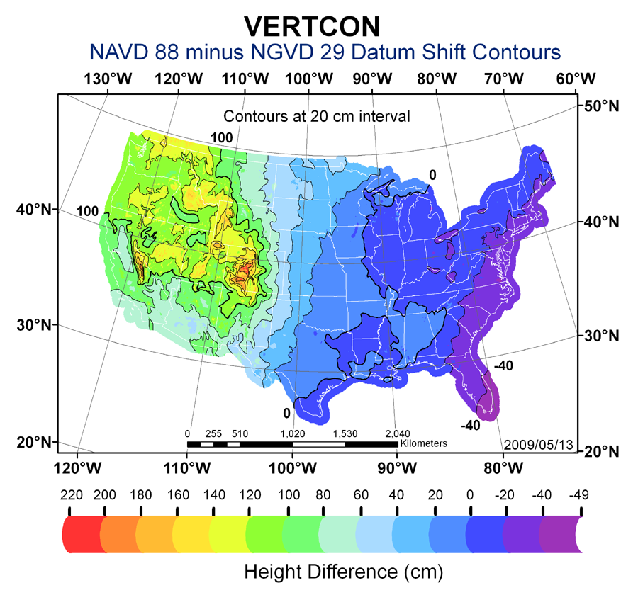
VERTCON is a computer program that computes the modeled difference in orthometric height between the North American Vertical Datum of 1988 (NAVD 88) and the National Geodetic Vertical Datum of 1929 (NGVD 29) for a location in the contiguous United States. The parameters required are the latitude and longitude of the location.
The program was created by the National Geodetic Survey (NGS) in 1994 and is available as an online tool, or PC executable package. The package contains the Perl source code. The NGS is the government agency charged with responsibility for the National Spatial Reference System.
References
References
- "National Geodetic Survey (NGS) Height Conversion Methodology". National Geodetic Survey.
- "VERTCON". National Geodetic Survey.
- "PC Software Download - VERTCON". National Geodetic Survey.
- "NGS Toolkit, Part 9: The National Geodetic Survey VERTCON Tool". Professional Surveyor Magazine.
This article was imported from Wikipedia and is available under the Creative Commons Attribution-ShareAlike 4.0 License. Content has been adapted to SurfDoc format. Original contributors can be found on the article history page.
Ask Mako anything about VERTCON — get instant answers, deeper analysis, and related topics.
Research with MakoFree with your Surf account
Create a free account to save articles, ask Mako questions, and organize your research.
Sign up freeThis content may have been generated or modified by AI. CloudSurf Software LLC is not responsible for the accuracy, completeness, or reliability of AI-generated content. Always verify important information from primary sources.
Report