From Surf Wiki (app.surf) — the open knowledge base
U.S. Route 95 in Idaho
Section of U.S. Highway in Idaho, United States

Section of U.S. Highway in Idaho, United States
| Field | Value | |||||
|---|---|---|---|---|---|---|
| state | ID | |||||
| type | US | |||||
| route | 95 | |||||
| alternate_name | North and South Highway | |||||
| map | ||||||
| map_custom | yes | |||||
| map_notes | US-95 highlighted in red | |||||
| length_mi | 538.562 | |||||
| length_ref | ||||||
| established | November 11, 1926 | |||||
| direction_a | South | |||||
| terminus_a | at the Oregon state line | |||||
| junction | {{plainlist | |||||
| *{{jct | state | ID | SH | 55}} west of Marsing | ||
| *{{Jct | state | ID | US | 20 | US | 26}} in Parma |
| *{{Jct | state | ID | US | 20 | US | 26}} near Nyssa, Ore. |
| *{{jct | state | ID | I | 84 | US | 30}} in Fruitland |
| *{{jct | state | ID | SH | 55}} in New Meadows | ||
| *{{jct | state | ID | US | 12}} east of Lewiston | ||
| *{{jct | state | ID | US | 195}} north of Lewiston | ||
| *{{jct | state | ID | I | 90}} in Coeur d'Alene | ||
| *{{jct | state | ID | US | 2}} in Sandpoint | ||
| *{{jct | state | ID | US | 2}} north of Bonners Ferry | ||
| direction_b | North | |||||
| terminus_b | at the Canadian border in Eastport | |||||
| counties | Owyhee, Canyon, Payette, Washington, Adams, Idaho, Lewis, Nez Perce, Latah, Benewah, Kootenai, Bonner, Boundary | |||||
| previous_type | US | |||||
| previous_route | 93 | |||||
| next_type | ID | |||||
| next_route | 97 | |||||
| tourist | Part of the | |||||
| International Selkirk Loop |
- west of Marsing
- in Parma
- near Nyssa, Ore.
- in Fruitland
- in New Meadows
- east of Lewiston
- north of Lewiston
- in Coeur d'Alene
- in Sandpoint
- north of Bonners Ferry International Selkirk Loop In the U.S. state of Idaho, U.S. Route 95 (US 95) is a north–south highway near the western border of the state, stretching from Oregon to British Columbia for over 538 mi; it was earlier known in the state as the North and South Highway.
As indicated by its original name, it is the primary north–south highway in Idaho; US 95 connects the Boise metropolitan area in southwestern Idaho with the small cities of Fruitland, Payette, Weiser and New Meadows within the Mountain Time Zone portion of the state. North of the Salmon River where it enters the Pacific Time Zone, US 95 provides an important link to the cities of Grangeville (via SH 13), Lewiston (via US 12) and directly serves Moscow, Coeur d'Alene, Sandpoint and Bonners Ferry before reaching the Canadian border at its northern terminus and continuing into the province of British Columbia as Highway 95. It is also the only road to connect the Idaho Panhandle with the rest of the state.
Route description
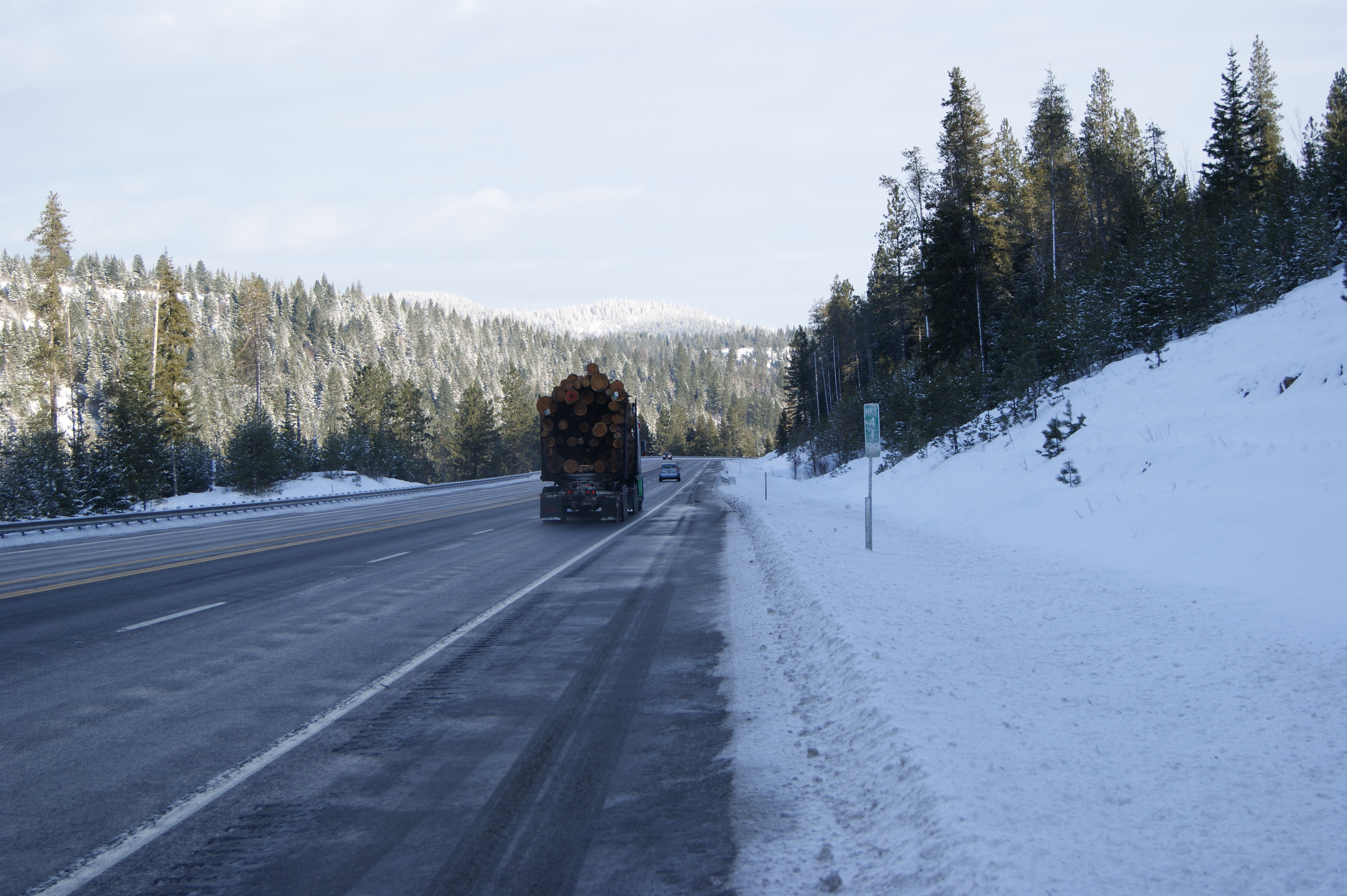
US 95 continues into Idaho from southeastern Oregon as an undivided two-lane highway for the majority of its length. As it is the state's primary north–south highway, Idaho is in the process of widening US 95 to an Interstate-style divided four-lane highway from the Oregon state line in the southwest to Eastport at the northern border with Canada at Kingsgate, British Columbia.
In Oregon, US 95 continues south, crosses into Nevada in McDermitt and meets Interstate 80 in Winnemucca.
Oregon border to New Meadows
US 95 departs Malheur County, Oregon and enters Idaho in the high desert of Owyhee County, about 50 mi southwest of Boise. It progresses north-northeast to just west of Marsing where it meets with the southern terminus of State Highway 55. US 95 then turns briefly west, then north to Homedale and crosses the Snake River before a junction with concurrent US 20 and US 26 as it passes through Parma. US 95 runs north concurrent with US 20/26 for 8 mi.
As it proceeds north near Idaho's western border, US 95 crosses Interstate 84 (exit 3) and US 30 before proceeding north through Payette and Weiser. It continues on to Midvale, Cambridge and Council then climbs into the Payette National Forest, passing the Tamarack sawmill site and turns east to New Meadows. Here, US 95 joins with Highway 55, the two-lane undivided route that connects to Boise through McCall, Cascade and Horseshoe Bend. The elevation at the junction in New Meadows is 3865 ft above sea level.
Meadows Valley to Lewiston
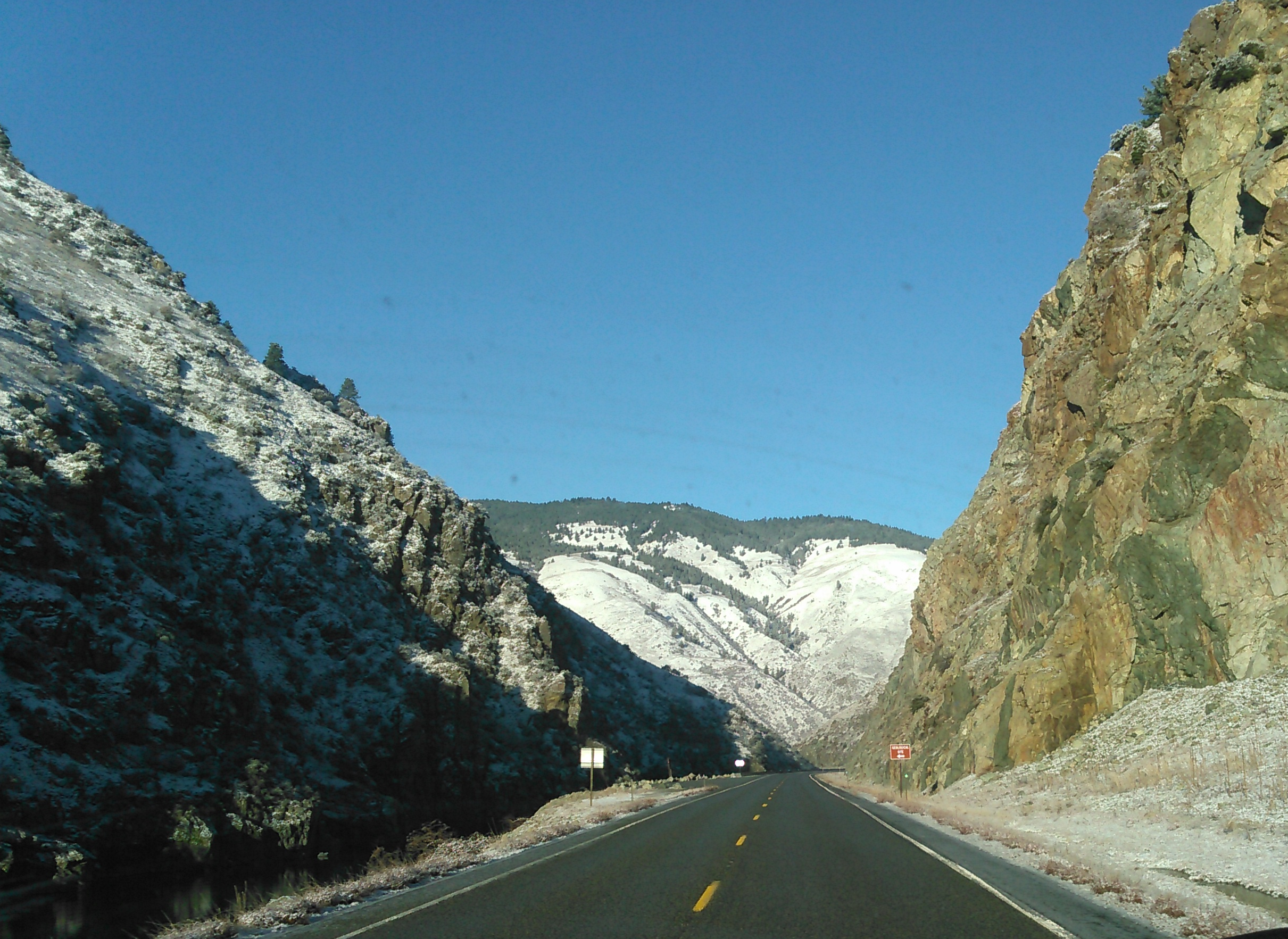
US 95 continues north through Meadows Valley north of the junction, then descends 2000 ft with the Little Salmon River to Riggins, tree-sparse but surrounded by mile-high mountains (vertical drop). Immediately after Riggins, the highway crosses the main Salmon River, crossing from the Mountain Time Zone to the Pacific Time Zone; the current tied-arch Goff Bridge was completed in 1999, replacing the truss edition of 1936; the original bridge was built in 1911 and moved to Stites in 1936.
Northbound US 95 gradually descends with the widening river, crossing it two more times (re-entering the Mountain Time Zone and leaving it within a half-mile) until White Bird where it climbs 2700 feet in 7 mi to the cut at the top of White Bird Hill, peaking at an elevation of 4245 ft with an average gradient of over 7%. The steeper, straighter and faster multi-lane grade was opened in 1975 after ten challenging years of construction. The two-lane road of 1921 to the east was first paved in 1938; it left the Salmon River at White Bird Creek following it up through the town of White Bird and then gradually climbed the grade in twice the distance with multiple switchback curves. The arcs, if combined, would form 37 full 360° circles, an average of 950° per mile (590° per km). Following the completion of the new steel bridge over White Bird Creek, the new routing opened in June 1975, ending a decade of construction.
North of the summit, US 95 descends in a steep but relatively short descent to the Camas Prairie and Grangeville at 3390 ft. The highway then travels northwest towards Cottonwood, whose bypass was finished in 1976, then enters the Nez Perce Indian Reservation. New route construction in the early 1990s bypassed the main streets of Ferdinand and Craigmont. The new routing is now above, rather than in, the curvy Lawyers Creek Canyon between the cities, crossing the canyon on an elevated 900 ft bridge constructed in 1991. Lawyers Canyon is named after Chief Lawyer (c.1801–76) of the Nez Perce, nicknamed for his skill in dealing with the encroaching whites; he is buried in Kamiah. US 95 winds its way westward across the high prairie near the many timber railroad trestles of the Camas Prairie Railroad, to just east of Winchester. Here, at just under 4000 ft, the highway turns northward and descends over 3,000 vertical feet (900 m), mostly in the Lapwai Canyon, passing Culdesac, Lapwai and Spalding at 807 ft.
Until 1960, US 95 was routed through Winchester and descended Culdesac Hill, considered the worst of the three major grades (White Bird, Lewiston), all of which were extremely twisty. The new route through Lapwai Canyon was built in three years and reduced the distance by over 4 mi and saved 25 minutes of driving time. After Spalding, it then proceeds towards the bridge over the Clearwater River to join with US 12 and depart the reservation. The current bridge for US 12 upstream at Arrow replaced the old Spalding bridge in 1973; ice jams on the river a decade earlier shifted it.
After crossing the Clearwater on the new Spalding bridge (1962), US 95 joins with US 12 for 7 mi along its north bank, heading westward, adding lanes and gradually descending toward Lewiston. About midway along the co-sign, the reservation is departed; the highways split several miles later at Lewiston's northeast edge. US 12 briefly turns south to re-cross the river into the city center and then west to cross the Snake River into Clarkston, Washington.
Lewiston grade to Canada
#Lewiston grade

US 95 turns northeast, then westward to climb a steep grade, gaining over 1900 ft in 5 mi, ascending to the southern edge of the rolling Palouse region, referred to by many locals as the "Lewiston Hill". The multi-lane grade (averaging over 7%) was opened on October 28, 1977, after 27 months of construction and two decades of planning. It replaced the Lewiston Spiral Highway, a narrow and switchback-laden 1917 route to the west with 64 spiral curves and about twice the length; it is visible from a scenic overlook. Similar to the White Bird Hill grade, the descending southbound lanes on the new route have three "runaway truck ramps" to halt any vehicles that experience brake failure.
Just north of the Lewiston grade is a junction with US 195, which proceeds north in Washington to Pullman and Spokane. US 95 continues north in Idaho on the Palouse as a four-lane divided highway (roadcam) , completed in October 2007 to Thorn Creek Road, midway between Genesee and Moscow. In October 2025, the remaining section of divided highway to Moscow, home of the University of Idaho, was completed. Scheduled to be completed first, the divided highway construction between Thorn Creek and Moscow was put on hold, due to new right-of-way and environmental impact concerns.
In Moscow, US 95 is diverted a block to either side of Main Street onto multi-lane one-way arterials: northbound on Washington Street, southbound on Jackson Street. The original couplets of 1981 used existing streets and were later modified to eliminate sharp right angle turns which were difficult for large trucks to safely manage. The north end couplets were completed in the early 1990s, the south end in 2000. The construction on the northeast couplet forced the demolition of a noted Moscow watering hole's original west end in January 1991,{{cite news|url=https://news.google.com/newspapers?nid=2026&dat=19901207&id=e5MrAAAAIBAJ&sjid=stAFAAAAIBAJ&pg=2366,638830
North of Moscow, US 95 resumes as an undivided two-lane highway. As it leaves Latah County, it gradually departs the Palouse and enters the lake country region of the north Panhandle. As it enters Benewah County, US 95 enters the Coeur d'Alene Indian Reservation. US 95 intersects State Highway 5 in Plummer. US 95 becomes a four-lane divided highway as it leaves Worley and has an interchange with State Highway 58. This recently completed section bypasses the tribal casino and its Circling Raven golf course. US 95 continues north as a divided highway until just south of the Spokane River, where US 95 enters downtown Coeur d'Alene.
US 95 becomes an arterial street and crosses over Interstate 90 Business (Northwest Boulevard) at an interchange. US 95 crosses Interstate 90 at exit 12 and becomes a divided highway north to Hayden, then as an undivided highway past State Highway 54 and Farragut State Park. After crossing Lake Pend Oreille on the 1.1 mi Sandpoint Long Bridge, US 95 enters Sandpoint and has a junction with US 2. The two routes run concurrent for 35 mi, until a few miles after Bonners Ferry, where US 2 heads east into Montana and southeast to Libby, while US 95 continues north for 29 mi to the Canadian border in Eastport. At the border, US 95 meets BC 95, which continues northeastward in British Columbia to Cranbrook.
In 2019, ITD had started a construction project at US 95's intersection with State Highway 53 to reconfigure the intersection, replaced the current signalized intersection with single-point urban interchange. The project straightened out SH-53 over the nearby train tracks, removed an intersection with Garwood Road with a new bridge and extended the frontage road on the east side to Garwood Road.
History
US 95 was established on November 11, 1926 as one of the original routes in the American Association of State Highway and Transportation Officials (AASHTO) system of national highways. It originally terminated at U.S. Route 30 north of Parma near the Oregon state line and was wholly located within Idaho except for a small segment in Washington state northwest of Lewiston. Prior to the designation, the north–south highway was part of State Highway 24 (the number has since re-purposed for another highway).
An auxiliary route, numbered US 95E, was established in 1927 between Potlatch and Coeur d'Alene and later replaced by US 95 Alternate. A proposal to extend US 95 south was considered by AASHTO in 1937, but deferred until January 1, 1940, while routes in Oregon were improved. US 95 then was extended through Oregon and Nevada to California, terminating in Blythe.
Since the 1990s, sections of the highway between Coeur d'Alene and Sandpoint have been widened to four lanes and gained limited-access grade separation.
Future
.svg)
A proposal to expand the freeway sections of US 95 into a full-fledged Interstate Highway which would be numbered as Interstate 11 is considered by both federal and state government officials since 1987.
Major intersections
References
References
- (May 3, 1936). "North & South Highway bringing to reality old dreams of united Idaho". Lewiston Morning Tribune.
- Idaho Transportation Department. "Milepost Log, US 95".
- (March 5, 1920). "Highway plans". Lewiston Morning Tribune.
- (December 19, 1937). "Average of 400 autos daily uses North & South Highway". Lewiston Morning Tribune.
- (January 26, 1947). "Idaho: scenic road knits north and south". Spokesman-Review.
- (October 6, 1955). "North and South Highway helped bind state together". Lewiston Morning Tribune.
- "Idaho Historical Markers - Owyhee Country".
- (May 19, 1997). "Time Zone Bridge over Salmon River heading west". The Spokesman-Review.
- Johnson, David. (June 21, 1997). "Time (zone) marches on". Lewiston Morning Tribune.
- Roche, Kevin. (June 17, 1975). "'Goat trail' symbol breaks as Whitebird route opens". Lewiston Morning Tribune.
- (November 27, 1918). "New Idaho road will rival Lewiston hill". Spokane Daily Chronicle.
- "Idaho Historical Markers - White Bird".
- Woods, Roy C.. (June 15, 1975). "New Whitebird bridge". Lewiston Morning Tribune.
- (July 29, 1976). "Whitebird bridge abutment repairs planned". Lewiston Morning Tribune.
- Harrell, Sylvia. (October 27, 1977). "The new hill route: $12 million and two decades in the making". Lewiston Morning Tribune.
- (July 13, 1976). "Cottonwood bypass open to U.S. traffic". Lewiston Morning Tribune.
- "The Nez Perce Reservation with a Map Insert of Idaho". Nez Perce Tribe.
- (June 1, 1988). "Highway work underway in Lawyer's Canyon". Idahonian.
- Hedberg, Kathy. (November 10, 1988). "Citizenry unhappy with reborn U.S. 95 proposal". Lewiston Morning Tribune.
- (November 10, 1988). "Opposition heard on U.S. 95 work". Idahonian.
- (April 20, 1989). "1st part of Lawyer's Canyon construction nearly done". Lewiston Morning Tribune.
- Pettit, Diane. (July 16, 1989). "Lawyers Canyon road construction enters second phase this month". Lewiston Morning Tribune.
- (October 8, 1991). "Lawyers Canyon Bridge set to open today". Lewiston Morning Tribune.
- [http://itd.idaho.gov/accountability/US_95_Lawyers_Canyon.htm Idaho Transportation Dept.] - Bridge deck rehabilitation - 2010-08-06 - accessed 2011-09-25
- Ruark, Janice. (February 23, 1977). "Lawyer lead Nez Perce in peace before war". Spokane Daily Chronicle.
- Carter, Jack. (July 4, 1960). "Winding Winchester grade won't bother much longer". Lewiston Morning Tribune.
- (January 2, 1961). "Culdesac cutoff finished in 1960". Lewiston Morning Tribune.
- Hughes, John B.. (June 29, 1958). "New Culdesac cutoff to be scenic wonder". Lewiston Morning Tribune.
- (February 21, 1973). "Bridge opens". Spokane Daily Chronicle.
- (February 21, 1973). "New bridge will open today". Lewiston Morning Tribune.
- Harrell, Sylvia. (February 22, 1973). "First cars move across highway bridge at Arrow". Lewiston Morning Tribune.
- Swank, Gladys Rae. (July 10, 1967). "Highway building pushed in Idaho". Spokane Daily Chronicle.
- (February 5, 1963). "Idaho bridge shifts". Spokane Daily Chronicle.
- (December 6, 1962). "Highway bridge stands ready to carry traffic to nowhere". Lewiston Morning Tribune.
- (October 17, 1977). "Highway replaces 'goat trail'". Spokane Daily Chronicle.
- (October 27, 1977). "Lewiston Spiral Highway". Lewiston Morning Tribune.
- (October 17, 1977). "Truck escape". Spokane Daily Chronicle.
- (October 18, 2007). "U.S. 95 widening will be celebrated". The Spokesman-Review.
- "New U.S. Highway 95 route south of Moscow open to drivers this weekend".
- Matson, Malia. (May 15, 2004). "More work on U.S. Highway 95 planned for spring 2005". Moscow-Pullman Daily News.
- Doyle, Megan. (January 19, 2006). "Path of least resistance". Moscow-Pullman Daily News.
- (Spring 1982). "Which way do I go?". Gem of the Mountains, University of Idaho yearbook.
- (August 25, 1981). "One way or another". Argonaut.
- Long, Ben. (June 4, 1991). "Crews start rerouting Moscow street". Idahonian.
- Goetsch, Lara. (July 10, 1991). "1st traffic flow through Moscow couplet". Idahonian.
- (March 27, 1992). "Clarkston firm wins Moscow project". Moscow-Pullman Daily News.
- (July 27, 2000). "Moscow work will divert traffic". Lewiston Morning Tribune.
- Long, Ben. (January 9, 1991). "A real bar bash: Corner Club demolished". Idahonian.
- Bartlett, Maureen. (January 15, 1991). "Local "watering hole" torn down". Argonaut.
- Johnson, David. (September 2, 1979). "To the Club for a tub!". Lewiston Morning Tribune.
- (June 22, 1956). "Dedication set today for Sandpoint bridge but opening doubtful". Spokane Daily Chronicle.
- (October 23, 1980). "Sandpoint span due next year". Spokane Daily Chronicle.
- Jensen, Janet. (August 5, 1981). "Bridge almost finished". The Spokesman-Review.
- (November 11, 1926). "United States System of Highways Adopted for Uniform Marking by the American Association of State Highway Officials". [[United States Geological Survey]].
- "Rand McNally Official 1926 Auto Trails Map: Idaho-Montana-Wyoming". [[Rand McNally]].
- (June 6, 1925). "Pulvers' Auto Highway Map, State of Idaho Including Western Montana". Edward W. Pulver.
- {{AASHTO minutes. (1927A)
- Weingroff, Richard. (October 17, 2008). "U.S. 95 and Idaho's North and South Highway". [[Federal Highway Administration]].
- Russell, Betsy Z.. (April 9, 2017). "Two major Highway 95 projects in North Idaho could be funded under transportation bill". Spokesman-Review.
- Trillhasse, Marty. (December 14, 1987). "Idaho on road to north-south freeway". [[Moscow-Pullman Daily News]].
This article was imported from Wikipedia and is available under the Creative Commons Attribution-ShareAlike 4.0 License. Content has been adapted to SurfDoc format. Original contributors can be found on the article history page.
Ask Mako anything about U.S. Route 95 in Idaho — get instant answers, deeper analysis, and related topics.
Research with MakoFree with your Surf account
Create a free account to save articles, ask Mako questions, and organize your research.
Sign up freeThis content may have been generated or modified by AI. CloudSurf Software LLC is not responsible for the accuracy, completeness, or reliability of AI-generated content. Always verify important information from primary sources.
Report