From Surf Wiki (app.surf) — the open knowledge base
U.S. Route 19W
Suffixed section of U.S. Highway in Tennessee and North Carolina
Suffixed section of U.S. Highway in Tennessee and North Carolina
| Field | Value |
|---|---|
| country | USA |
| type | US |
| route | 19W |
| map | |
| map_custom | yes |
| map_notes | US 19W highlighted in red |
| length_mi | 62.9 |
| length_ref | |
| established | 1930 |
| direction_a | South |
| direction_b | North |
| terminus_a | in Cane River, NC |
| junction | near Erwin, TN |
| terminus_b | near Bluff City, TN |
| states | North Carolina, Tennessee |
| counties | NC: Yancey |
| TN: Unicoi, Carter, Washington, Sullivan | |
| spur_of | 19 |
| spur_type | US |
| system1 | |
| system2 | |
| browse |
TN: Unicoi, Carter, Washington, Sullivan U.S. Route 19W (US 19W) traverses approximately 63 mi from Cane River, North Carolina, to Bluff City, Tennessee.
Route description
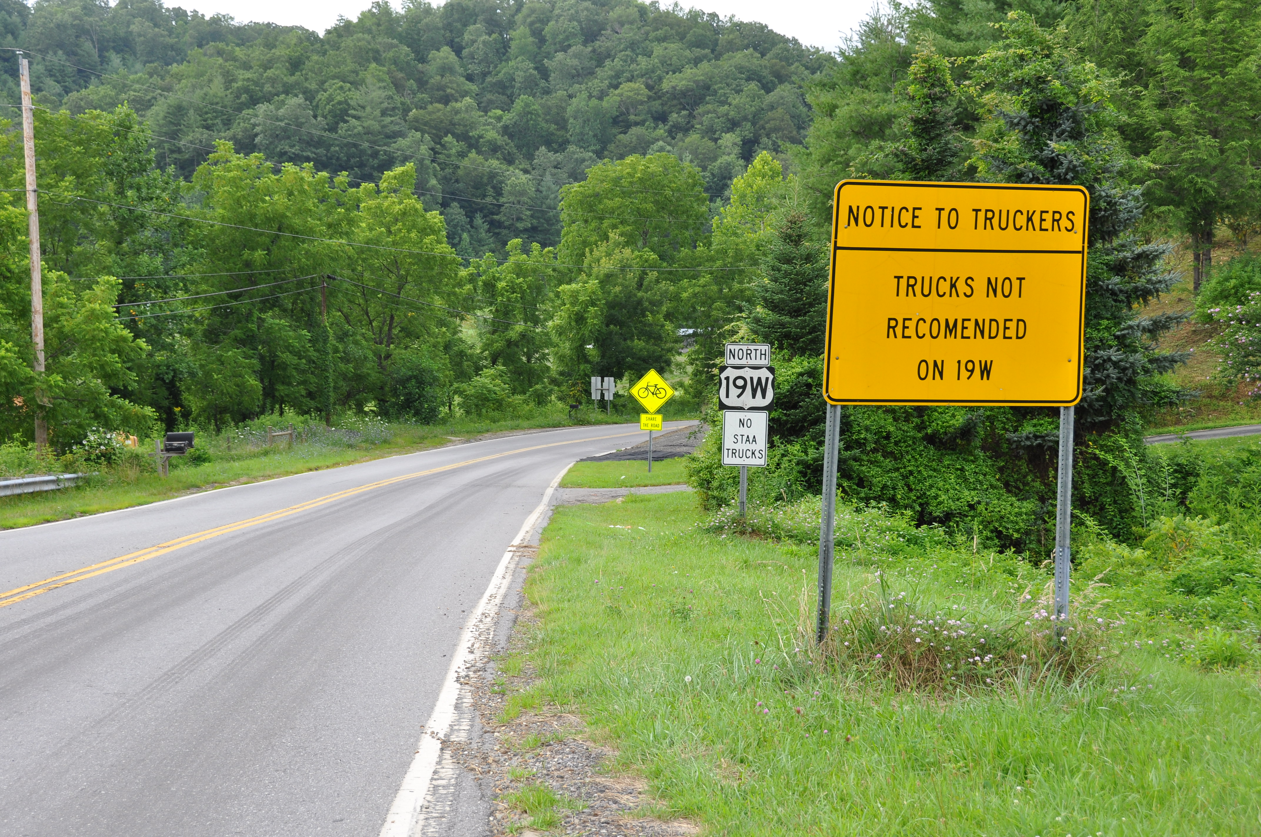
US 19W begins in North Carolina in western Yancey County in the community of Cane River, at the intersection of US 19/US 19E. Several signs at the beginning of the route strongly recommend truckers against using this route. The road then proceeds north through Pisgah National Forest, connecting the communities of Elk Shoal, Ramseytown, and Sioux, to the Tennessee state line (near Spivey Gap), a 22 mi drive of frequent curves and elevation changes.
Once past the state line in Tennessee, the road enters the Cherokee National Forest and is much the same for another 6.3 mi to State Route 352 (SR 352)/Flag Pond Road. From Flag Pond Road, it is just 1 mi to Interstate 26 (I-26), where US 19W merges with the Interstate to Johnson City. US 19W overlaps with I-26/US 23 from exit 43 (Hill Road) to exit 20 (Roan Street). There it leaves I-26 and continues north on the Bristol Highway, overlapped with US 11E, for 9.4 mi, after which it reconnects with US 19E to reform US 19 near Bluff City.
History

Established in 1930, US 19 was split at Cane River into US 19E and US 19W. US 19E follows the original routing via Spruce Pine and Elizabethton to Bluff City. US 19W was rerouted with US 23 and North Carolina Highway 692 (NC 692) into Tennessee, then through the cities of Erwin and Johnson City, before rejoining US 19E in Bluff City. In late 1934, NC 692 was dropped along the route; then, in 1952, US 23 abandoned US 19W in North Carolina by rerouting west through Faust and Wolf Laurel, meeting back at Ernestville. In 1984, US 19 was realigned on a straighter path in Yancey County; US 19W was thus extended 0.4 mi.
In late September 2024, several large sections of US 19W was washed out by the effects of Hurricane Helene in North Carolina. In November, the North Carolina Department of Transportation (NCDOT) stated that it expects to spend $1 billion to rebuild the two-lane highway, which could take six to 10 years. A new, permanent US 19W would be to modern standards, which likely mean wider shoulders and possibly wider travel lanes; concrete walls will also be used instead of earthen embankments in some places. Until then, temporary gravel roads are being used to connect isolated communities.
North Carolina Highway 692
North Carolina Highway 692 (NC 692) was established in 1923 as new primary routing to Tennessee; NC 692 was the original highway number from Cane River to Spivey Gap. In 1929, NC 692 was truncated at Sioux, replaced by an extension of NC 19 from Bakersville. In 1930, US 19W and US 23 were overlapped on the remaining section of NC 692. In late 1934, NC 692 was decommissioned.
Junction list
References
References
- "US 19W".
- {{AASHTO minutes. (1930S)
- (May 2019). "NCRoads.com: US 19".
- (May 2019). "NCRoads.com: US 19-W".
- Stradling, Richard. (November 14, 2024). "NCDOT: Helene repairs will cost $5 billion. This road will account for a fifth of that". [[The Charlotte Observer]].
- Stradling, Richard. (March 26, 2025). "In one rural NC county, rebuilding two highways after Helene will cost more than $1 billion". The Charlotte Observer.
- "North Carolina Highway 692".
- (May 2019). "NCRoads.com: N.C. 692".
This article was imported from Wikipedia and is available under the Creative Commons Attribution-ShareAlike 4.0 License. Content has been adapted to SurfDoc format. Original contributors can be found on the article history page.
Ask Mako anything about U.S. Route 19W — get instant answers, deeper analysis, and related topics.
Research with MakoFree with your Surf account
Create a free account to save articles, ask Mako questions, and organize your research.
Sign up freeThis content may have been generated or modified by AI. CloudSurf Software LLC is not responsible for the accuracy, completeness, or reliability of AI-generated content. Always verify important information from primary sources.
Report