From Surf Wiki (app.surf) — the open knowledge base
Tomales, California
| Field | Value |
|---|---|
| official_name | Tomales |
| settlement_type | Unincorporated Community |
| Census Designated Place | |
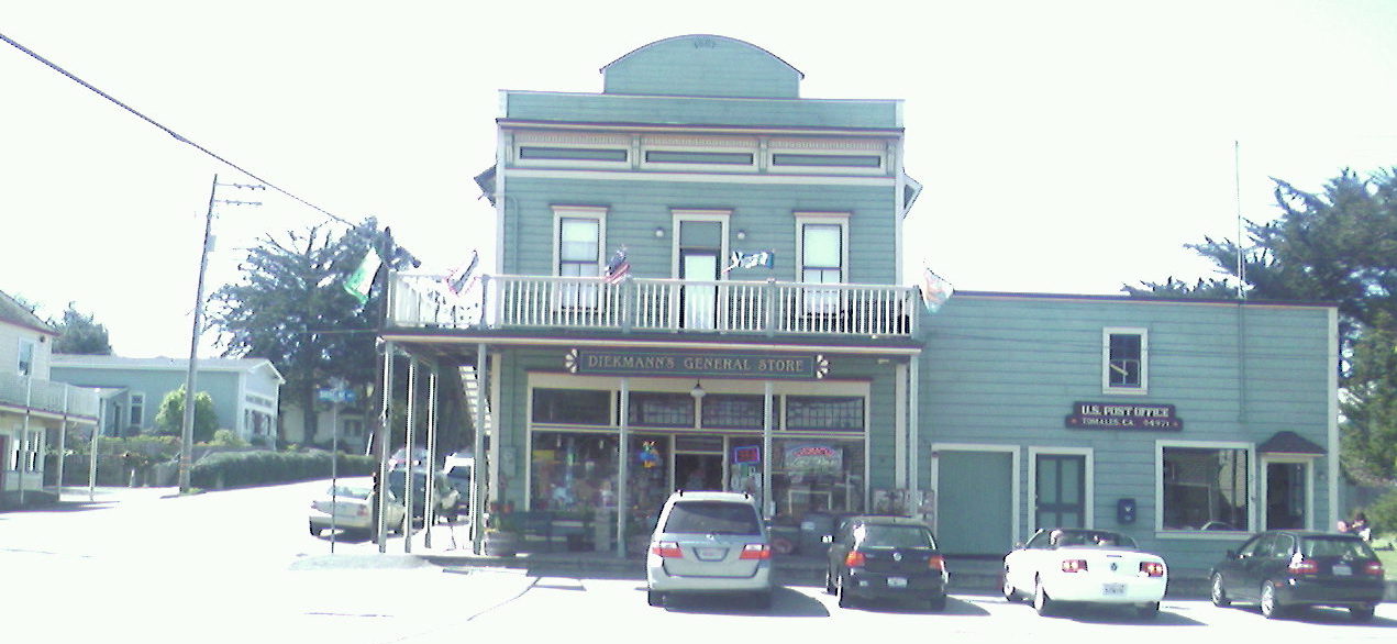
| image_skyline | Tomales.jpg |
| image_caption | Tomales, viewed from the northeast |
| image_map | Marin_County_California_Incorporated_and_Unincorporated_areas_Tomales_Highlighted.svg |
| mapsize | 250x200px |
| map_caption | Location in Marin County and the state of California |
| pushpin_map | USA |
| pushpin_map_caption | Location in the United States |
| coordinates | |
| coordinates_footnotes | |
| subdivision_type | Country |
| subdivision_name | |
| subdivision_type1 | State |
| subdivision_name1 | California |
| subdivision_type2 | County |
| subdivision_name2 | Marin |
| leader_title | County Board |
| leader_name | District 4 |
| Dennis Rodoni | |
| leader_title1 | State Senator |
| leader_name1 | |
| leader_title2 | Assemblymember |
| leader_name2 | |
| leader_title3 | U. S. Rep. |
| leader_name3 | |
| unit_pref | US |
| area_footnotes | |
| area_total_km2 | 0.859 |
| area_total_sq_mi | 0.332 |
| area_land_km2 | 0.859 |
| area_land_sq_mi | 0.332 |
| area_water_km2 | 0 |
| area_water_sq_mi | 0 |
| area_water_percent | 0 |
| elevation_footnotes | |
| elevation_m | 27 |
| elevation_ft | 89 |
| population_footnotes | |
| population_total | 187 |
| population_as_of | 2020 |
| population_density_sq_mi | auto |
| timezone | PST |
| utc_offset | -8 |
| timezone_DST | PDT |
| utc_offset_DST | -7 |
| postal_code_type | ZIP code |
| postal_code | 94971 |
| area_code | 707 |
| blank_name | FIPS code |
| blank_info | |
| blank1_name | GNIS feature ID |
| blank1_info |
Census Designated Place Dennis Rodoni
Tomales is a census-designated place (CDP) on State Route 1 in Marin County, California, United States. The population was 187 at the 2020 census.
Geography
Tomales is located above Keys Creek, about 3 mi northeast of Tomales Bay. The nearest city is Petaluma, 16 mi to the east by road, and the nearest large city is San Francisco, about 75 minutes (58 mi) to the south.
The CDP has a total area of 0.33 sqmi, all of it land.
History
When Europeans first reached Tomales Bay, it was home to Coast Miwok people. Numerous authenticated Miwok villages are known from this area, including one (named Utumia) sited near the present-day town of Tomales.
The "Tomalles" post office opened in 1854, and changed its spelling to "Tomales" before 1879.
Starting in the 1870s, Tomales was a stop on the North Pacific Coast Railroad connecting Cazadero to the Sausalito ferry.
Built near the San Andreas Fault, Tomales was affected by the 1906 San Francisco earthquake. One of the town's two cemeteries predates the earthquake, and the damage to the pre-1906 plots shows just how widespread the quake's effects were.
Demographics
|align-fn=center 1860–1870 1880-1890 1900 1910 1920 1930 1940 1950 1960 1970 1980 1990 2000 2010
Tomales first appeared as a census designated place in the 2000 U.S. census.
2020
The 2020 United States census reported that Tomales had a population of 187. The population density was 563.3 PD/sqmi. The racial makeup of Tomales was 157 (84.0%) White, 0 (0.0%) African American, 4 (2.1%) Native American, 5 (2.7%) Asian, 0 (0.0%) Pacific Islander, 8 (4.3%) from other races, and 13 (7.0%) from two or more races. Hispanic or Latino of any race were 14 persons (7.5%).
The census reported that 182 people (97.3% of the population) lived in households, 5 (2.7%) lived in non-institutionalized group quarters, and no one was institutionalized.
There were 86 households, out of which 17 (19.8%) had children under the age of 18 living in them, 44 (51.2%) were married-couple households, 4 (4.7%) were cohabiting couple households, 17 (19.8%) had a female householder with no partner present, and 21 (24.4%) had a male householder with no partner present. 22 households (25.6%) were one person, and 18 (20.9%) were one person aged 65 or older. The average household size was 2.12.
The age distribution was 16 people (8.6%) under the age of 18, 8 people (4.3%) aged 18 to 24, 38 people (20.3%) aged 25 to 44, 63 people (33.7%) aged 45 to 64, and 62 people (33.2%) who were 65years of age or older. The median age was 57.2years. There were 90 males and 97 females.
There were 108 housing units at an average density of 325.3 /mi2, of which 86 (79.6%) were occupied. Of these, 53 (61.6%) were owner-occupied, and 33 (38.4%) were occupied by renters.
2010
At the 2010 census Tomales had a population of 204. The population density was 614.9 PD/sqmi. The racial makeup of the CDP was 94.6% White, 1.5% Native American, 2.0% Asian, and 2.0% from two or more races. 4.4% of the population was Hispanic or Latino of any race.
The census reported that 100% of the population lived in households.
There were 99 households, 13 (13.1%) had children under the age of 18 living in them, 47 (47.5%) were opposite-sex married couples living together, 9 (9.1%) had a female householder with no husband present, 2 (2.0%) had a male householder with no wife present. There were 10 (10.1%) unmarried opposite-sex partnerships, and 1 (1.0%) same-sex married couple or partnership. 32 households (32.3%) were one person and 6 (6.1%) had someone living alone who was 65 or older. The average household size was 2.06. There were 58 families (58.6% of households); the average family size was 2.55.
The age distribution was 22 people (10.8%) under the age of 18, 12 people (5.9%) aged 18 to 24, 43 people (21.1%) aged 25 to 44, 93 people (45.6%) aged 45 to 64, and 34 people (16.7%) who were 65 or older. The median age was 50.5 years. For every 100 females, there were 85.5 males. For every 100 females age 18 and over, there were 80.2 males.
There were 122 housing units at an average density of 367.7 /sqmi, of which 59.6% were owner-occupied and 40.4% were occupied by renters. The homeowner vacancy rate was 1.6%; the rental vacancy rate was 7.0%. 61.8% of the population lived in owner-occupied housing units and 38.2% lived in rental housing units.
2000
At the 2000 census, the median household income was $51,953 and the median family income was $52,708. Males had a median income of $41,607 versus $46,389 for females. The per capita income for the CDP was $26,609. None of the families and 14.3% of the population were living below the poverty line, including no under eighteens and 14.3% of those over 64.
Education
It is in the Shoreline Unified School District. Shoreline USD operates Tomales Elementary School and Tomales High School. The high school is the largest employer in Tomales and has a student body of approximately 190 from northwest Marin County and southwest Sonoma County.
In popular culture
Much of the 2001 movie Bandits was filmed in and around Tomales, as were the opening shots of Mumford (1999), and parts of Scream (1996), and Village of the Damned (1995).
References
References
- {{Cite gnis. 236439. Tomales
- "County of Marin District 4 webpage". [[County of Marin]].
- "Final Maps {{!}} California Citizens Redistricting Commission".
- {{Cite GovTrack. CA. 2
- "2021 U.S. Gazetteer Files: California". United States Census Bureau.
- "P1. Race – Tomales CDP, California: 2020 DEC Redistricting Data (PL 94-171)". U.S. Census Bureau.
- "Google Maps".
- "Miwok Indian Tribe". Access Genealogy.
- {{California's Geographic Names. 714
- "Decennial Census by Decade".
- "1870 Census of Population - Population of Civil Divisions less than Counties - California - Almeda County to Sutter County".
- "1870 Census of Population - Population of Civil Divisions less than Counties - California - Tehama County to Yuba County".
- "1890 Census of Population - Population of California by Minor Civil Divisions".
- "1900 Census of Population - Population of California by Counties and Minor Civil Divisions".
- "1910 Census of Population - Supplement for California".
- "1920 Census of Population - Number of Inhabitants - California".
- "1930 Census of Population - Number and Distribution of Inhabitants - California".
- "1940 Census of Population - Number of Inhabitants - California".
- "1950 Census of Population - Number of Inhabitants - California".
- "1960 Census of Population - General population Characteristics - California".
- "1970 Census of Population - Number of Inhabitants - California".
- "1980 Census of Population - Number of Inhabitants - California".
- "1990 Census of Population - Population and Housing Unit Counts - California".
- "2000 Census of Population - Population and Housing Unit Counts - California".
- "2010 Census of Population - Population and Housing Unit Counts - California".
- "Tomales CDP, California; DP1: Profile of General Population and Housing Characteristics - 2020 Census of Population and Housing".
- "Tomales CDP, California; P16: Household Type - 2020 Census of Population and Housing".
- "2010 Census Interactive Population Search: CA - Tomales CDP". U.S. Census Bureau.
- "U.S. Census website". [[United States Census Bureau]].
- "2020 CENSUS - SCHOOL DISTRICT REFERENCE MAP: Marin County, CA". [[U.S. Census Bureau]].
- "Filming locations for Bandits (2001)". The Internet Movie Database.
- [http://www.filminamerica.com/PacificNorthwest/NCA/MarinCounty/Tomales/ filminamerica.com]
- "Filming locations for Scream (1996/I)". The Internet Movie Database.
- [http://www.theofficialjohncarpenter.com/pages/themovies/vd/vdpronotes.html John Carpenter website] {{Webarchive. link. (2008-03-09)
This article was imported from Wikipedia and is available under the Creative Commons Attribution-ShareAlike 4.0 License. Content has been adapted to SurfDoc format. Original contributors can be found on the article history page.
Ask Mako anything about Tomales, California — get instant answers, deeper analysis, and related topics.
Research with MakoFree with your Surf account
Create a free account to save articles, ask Mako questions, and organize your research.
Sign up freeThis content may have been generated or modified by AI. CloudSurf Software LLC is not responsible for the accuracy, completeness, or reliability of AI-generated content. Always verify important information from primary sources.
Report