From Surf Wiki (app.surf) — the open knowledge base
Titsey
Village and parish in Surrey, England

Village and parish in Surrey, England
| Field | Value |
|---|---|
| country | England |
| official_name | Titsey |
| population_ref | (Civil Parish 2011) |
| area_total_km2 | 10.99 |
| civil_parish | Titsey |
| coordinates | |
| population | 272 |
| static_image_name | Titsey Place Oxted Surrey.jpg |
| static_image_caption | Titsey Place is the surviving manor of Titsey but a stately home that is open for visitors and is charitably run |
| shire_district | Tandridge |
| shire_county | Surrey |
| region | South East England |
| constituency_westminster | East Surrey |
| post_town1 | WESTERHAM |
| post_town2 | OXTED |
| postcode_district1 | TN16 |
| postcode_district2 | RH8 |
| postcode_area1 | TN |
| postcode_area2 | RH |
| dial_code | 01959 |
| os_grid_reference | TQ4157 |
| london_distance_mi | 16 |
| london_direction | NNE |
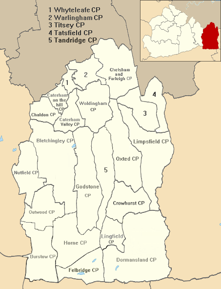
Titsey is a rural village and a civil parish on the North Downs almost wholly within the M25 London Orbital Motorway in the Tandridge District of Surrey, England.
In local government it forms the south-western part of the ward Tatsfield and Titsey and in national statistics approximates to output area E00157289. It has no railway stations however one is centred 1.5 mi south-west, Oxted which also has the administrative centre of the district. Approximately half of it land is owned by a charity running the Titsey Place estate, with the remainder being a mixture of common and privately owned woodland and smallholdings.
History
The village lay within the Tandridge hundred, of greatest use in the Anglo-Saxon Kingdom of England and it continues to form a parish in the church of England until its church became appropriated by that of Tatsfield.
The eastern parish boundary follows the London to Lewes Way Roman road which descends the escarpment of the North Downs here, crossing two important ancient east–west routes, the North Downs ridgeway and the Pilgrims Way on the lower slopes.
Titsey appears in Domesday Book of 1086 as a village: Ticesei held by Haimo the Sheriff (of Kent) when its assets were: 2 hides; 1 church, 9 ploughs, pasture worth every seventh hog of the villeins. It rendered £11 per year to its feudal system overlords.
The parish church of St James the Greater dates from 1861 and is on the site of an earlier church built in 1776. That in turn replaced a much older church, dating from the 14th century. Some of the memorials to the Gresham family date from the 16th and 17th centuries. There is a 19th century side chapel with memorials to the Leveson-Gower family.
Until the early 20th century, the local economy was entirely agricultural.
In 1929, the BBC established its radio signals receiving station in the parish of Titsey, though the facility was named after the nearby village of Tatsfield. The station's masts and shortwave aerials were a prominent local landmark. The station closed in 1974 when its work was merged with that of BBC Monitoring's receiving station at Crowsley Park in South Oxfordshire. Some derelict remains of the BBC station can still be seen.
Demography and housing
| Output area | Detached | Semi-detached | Terraced | Flats and apartments | Caravans/temporary/mobile homes/houseboats | Shared between households |
|---|---|---|---|---|---|---|
| E00157289 | 67 | 37 | 2 | 2 | 0 | 0 |
The average level of accommodation in the region composed of detached houses was 28%, the average that was apartments was 22.6%.
| Output area | Population | Households | % Owned outright | % Owned with a loan | hectares |
|---|---|---|---|---|---|
| E00157289 | 272 | 108 | 36.1 | 23.1 | 1,099 |
The proportion of households who owned their home outright compares to the regional average of 35.1%. The proportion who owned their home with a loan compares to the regional average of 32.5%. The remaining % is made up of rented dwellings (plus a negligible % of households living rent-free).
In 2011 the ward of the United Kingdom, Tatsfield and Titsey, almost twice its size, had 1,816 inhabitants
Local government
The (civil) parish council clerk is David Innes.
Geography
Titsey covers a long tract which reaches up the southern escarpment of the North Downs, specifically to the highest point of the range, Botley Hill, which is in the parish. The north has altitude of around 230 m where the North Downs Way passes through the parish. Springs in Titsey, rising at the foot of the chalk scarp of the North Downs, are the source of the River Eden.
It is a dispersed settlement bordering Farleigh to the north and the London Borough of Bromley to the north-east. Biggin Hill is to the north-east, across the village centre of Tatsfield. The boundary with Kent is centred 1.5 mi east. Titsey has two post towns depending on exact location.
References
References
- [http://neighbourhood.statistics.gov.uk Key Statistics; Quick Statistics: Population Density] [[2011 United Kingdom census]] ''[[Office for National Statistics]]'' Retrieved 21 November 2013
- Margary, Ivan. (1948). "Roman Ways in the Weald". J. M. Dent.
- [http://www.achurchnearyou.com/tatsfield-st-mary/ Tatsfield St Mary] Church of England. Retrieved 31 December 2013
- Margary (1948: 130)
- [http://www.gwp.enta.net/surrnames.htm Surrey Domesday Book] {{webarchive. link. (15 July 2007)
- "Parishes: Titsey Pages 330-334 A History of the County of Surrey: Volume 4.". Victoria County History, 1912.
- "Church of St James the Greater".
- [http://www.bbceng.info/Operations/Receivers/Tatsfield/tatsfield.htm "The BBC Engineering Measurement and Receiving Station at Tatsfield"] ''Recollections of BBC engineering from 1922 to 1997''
- [http://bbceng.info/Operations/Receivers/Tatsfield/BBC_Tatsfield_March%201961.pdf "The BBC Engineering Measurement and Receiving Station at Tatsfield"] BBC Engineering Information Department pamphlet, 1961
- [http://www.whatdotheyknow.com/request/information_relating_to_the_tats Information relating to the Tatsfield Monitoring Station] BBC response to Freedom of Information request, January 2010
- [http://www.derelictplaces.co.uk/main/showthread.php?t=6231 Derelict Places] ''Tatsfield Monitoring Station''
- [http://www.surreycc.gov.uk/__data/assets/pdf_file/0010/166267/Tandridge-parishes.pdf Tandridge Census Statistics]
- [http://www.tandridge.gov.uk/YourCouncil/CouncillorsMeetings/ParishCouncil/titsey.htm Tandridge Borough Council]
- (1850). "The geography of Great Britain". Woodall.
- (1957). "London's Countryside: Geographical Field Work for Students and Teachers of Geography". Methuen.
This article was imported from Wikipedia and is available under the Creative Commons Attribution-ShareAlike 4.0 License. Content has been adapted to SurfDoc format. Original contributors can be found on the article history page.
Ask Mako anything about Titsey — get instant answers, deeper analysis, and related topics.
Research with MakoFree with your Surf account
Create a free account to save articles, ask Mako questions, and organize your research.
Sign up freeThis content may have been generated or modified by AI. CloudSurf Software LLC is not responsible for the accuracy, completeness, or reliability of AI-generated content. Always verify important information from primary sources.
Report