From Surf Wiki (app.surf) — the open knowledge base
Three Forks, Montana
City in Montana, United States

City in Montana, United States
| Field | Value |
|---|---|
| official_name | Three Forks |
| settlement_type | City |
| image_skyline | Three Forks, Montana.jpg |
| imagesize | 250px |
| image_caption | Three Forks and the Tobacco Root Mountains |
| image_map | Gallatin_County_Montana_Incorporated_and_Unincorporated_areas_Three_Forks_Highlighted.svg |
| mapsize | 250px |
| map_caption | Location of Three Forks, Montana |
| subdivision_type | Country |
| subdivision_name | United States |
| subdivision_type1 | State |
| subdivision_name1 | Montana |
| subdivision_type2 | County |
| subdivision_name2 | Gallatin |
| government_type | Montana Incorporated City, Elected Mayor and City Council |
| leader_title | Mayor |
| unit_pref | Imperial |
| area_footnotes | |
| area_total_km2 | 3.88 |
| area_land_km2 | 3.73 |
| area_water_km2 | 0.15 |
| area_total_sq_mi | 1.50 |
| area_land_sq_mi | 1.44 |
| area_water_sq_mi | 0.06 |
| population_as_of | 2020 |
| population_total | 1989 |
| population_density_km2 | 533.74 |
| population_density_sq_mi | 1382.21 |
| timezone | Mountain (MST) |
| utc_offset | -7 |
| timezone_DST | MDT |
| utc_offset_DST | -6 |
| elevation_footnotes | |
| elevation_ft | 4072 |
| coordinates | |
| postal_code_type | ZIP code |
| postal_code | 59752 |
| area_code_type | Area code |
| area_code | 406 |
| blank_name | FIPS code |
| blank_info | 30-73975 |
| blank1_name | GNIS feature ID |
| blank1_info | 2412067 |
| website | http://www.threeforksmontana.us |
Three Forks is a city in Gallatin County, Montana, United States and is located within the watershed valley system of both the Missouri and Mississippi rivers drainage basins — and is historically considered the birthplace or start of the Missouri River. The population was 1,989 at the 2020 census. The city of Three Forks is named so because it lies geographically near the point, in nearby Missouri Headwaters State Park, where the Jefferson, Madison, and Gallatin rivers converge to form the Missouri River — the longest single river in North America, as well as the major portion of the Missouri–Mississippi River System from the headwaters near Three Forks to its discharge into the Gulf of Mexico. Three Forks is part of the Bozeman, MT Micropolitan Statistical Area of approximately 100,000 people and located thirty miles west of Bozeman.
History
The three rivers, west to east, were named by Meriwether Lewis in late July 1805 for President Thomas Jefferson, Secretary of State James Madison, and Treasury Secretary Albert Gallatin which was in the times the genesis of a mild controversy and eventually spawned a modern-day geographical controversy{{ mdash
The Lewis and Clark expedition visited the site on July 28, 1805. Meriwether Lewis in his journal entry wrote:
:"Both Capt. C. and myself in opinion with to the impropriety of calling either of these [three] streams the Missouri and accordingly agreed to name them after the President of the United States and the Secretaries of the Treasury and state..."
One consequence of their decision to designate, map and name the Jeffersonthe largest as a separate tributary river, is that today the Mississippi River can arguably be called longer than the Missouri River because extensive re-channelization of the streambed for hydroelectric power projects has shortened the river while the Mississippi Delta has grown, lengthening the rival river.
Honored in Three Forks, the Indian woman Sacagawea is best known as the interpreter and guide for the Lewis and Clark Expedition. In 1800, she was captured by the Mennetaree tribe near the present site of Three Forks. She later returned to this area with Lewis and Clark and the Corps of Discovery. A statue of Sacagawea now sits in a park off Main Street.
The present-day city of Three Forks was founded September 17, 1908 by John Q. Adams, agent for the Milwaukee Land Company, a subsidiary of the Chicago, Milwaukee and St. Paul Railway. The Milwaukee Land Co., platted the town and held a lot sale that day. Some buildings were moved to the present city from "Old Town Three Forks", a mile to the northeast. The city became a division point on the Milwaukee Road's Rocky Mountain Division and was an important hub for the railroad during the existence of the Milwaukee in Montana (1908-1980).
Two banks for the town were chartered in 1909 and 1910; John Q. Adams financed construction of the latter one, the Three Valleys State Bank, whose building survives, is listed on the National Register of Historic Places, and serves as a local history museum. The town's early growth prospects foundered from the effects of economic depression, crop failures, and an earthquake that hit the town on June 27, 1925, damaging all of its brick buildings. The town's population never reached the 10,000 level that some once hoped for, and dropped to about 1,000. Some prosperity returned during and after World War II, and population has grown modestly since.
Geography
According to the United States Census Bureau, the city has a total area of 1.50 sqmi, of which 1.44 sqmi is land and 0.06 sqmi is water.
Climate
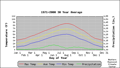
Photo Gallery
Image:Bridger Mountains From Three Forks.jpg|The Bridger Mountains from Three Forks Image:Bridger Mountains From Three Forks 2.jpg|The Bridger Mountains from Three Forks Image:Bridger Mountains From Three Forks 3.jpg|The Bridger Mountains from Three Forks Image:Three Forks.JPG| Three Forks
Demographics
|align-fn=center
2010 census
As of the census of 2010, there were 1,869 people, 785 households, and 524 families residing in the city. The population density was 1297.9 PD/sqmi. There were 850 housing units at an average density of 590.3 /sqmi. The racial makeup of the city was 98.1% White, 0.2% African American, 0.4% Native American, 0.5% Asian, and 0.9% from two or more races. Hispanic or Latino of any race were 2.1% of the population.
There were 785 households, of which 31.1% had children under the age of 18 living with them, 51.2% were married couples living together, 9.0% had a female householder with no husband present, 6.5% had a male householder with no wife present, and 33.2% were non-families. 28.4% of all households were made up of individuals, and 11.3% had someone living alone who was 65 years of age or older. The average household size was 2.37 and the average family size was 2.90.
The median age in the city was 40.8 years. 24.8% of residents were under the age of 18; 6.4% were between the ages of 18 and 24; 24.5% were from 25 to 44; 28.4% were from 45 to 64; and 15.8% were 65 years of age or older. The gender makeup of the city was 49.9% male and 50.1% female.
2000 census
As of the census of 2000, there were 1,728 people, 686 households, and 469 families residing in the city. The population density was 1,360.7 PD/sqmi. There were 726 housing units at an average density of 571.7 /sqmi. The racial makeup of the city was 97.57% White, 1.10% Native American, 0.17% Asian, 0.23% Pacific Islander, 0.35% from other races, and 0.58% from two or more races. Hispanic or Latino of any race were 1.33% of the population.
There were 686 households, out of which 35.4% had children under the age of 18 living with them, 59.3% were married couples living together, 5.8% had a female householder with no husband present, and 31.5% were non-families. 26.7% of all households were made up of individuals, and 12.1% had someone living alone who was 65 years of age or older. The average household size was 2.51 and the average family size was 3.08.
In the city, the population was spread out, with 28.4% under the age of 18, 6.0% from 18 to 24, 28.9% from 25 to 44, 21.8% from 45 to 64, and 15.0% who were 65 years of age or older. The median age was 38 years. For every 100 females there were 102.8 males. For every 100 females age 18 and over, there were 102.6 males.
The median income for a household in the city was $34,212, and the median income for a family was $39,938. Males had a median income of $30,086 versus $19,196 for females. The per capita income for the city was $15,362. About 5.5% of families and 7.7% of the population were below the poverty line, including 6.6% of those under age 18 and 6.7% of those age 65 or over.
Government
The City of Three Forks is a Mayor–council government form of government in which the City Council is chaired by an elected Mayor. These two entities form the legislative and executive branches of the government. There are six elected City Council members.
Randy Johnston became mayor in 2022. He was unopposed in the 2025 election.
Infrastructure
Three Forks Airport is a public use airport located 1 mile southeast of town.
A large beaver dam measuring 2,139 feet (650 m) long, 14 feet (4.3 m) high and 23 feet (7.0 m) thick at the base is located within the Three Forks area, which was the longest known beaver dam until 2007.
Education
The municipality is in the Three Forks Elementary School District and the Three Forks High School District. The Three Forks elementary and high school districts are both a part of Three Forks Public Schools.
Three Forks Schools educates students from kindergarten through 12th grade. Three Forks High School's team name is the Wolves.
The Three Forks Community Library is a public library.
Media
The Three Forks Voice is a weekly newspaper serving the area.
References
References
- "ArcGIS REST Services Directory". United States Census Bureau.
- {{GNIS. 2412067
- "U.S. Census website". [[United States Census Bureau]].
- [https://lewisandclarkjournals.unl.edu/item/lc.jrn.1805-07-28#lc.jrn.1805-07-28.01 Journals of the Lewis & Clark Expedition] 28 July 1805. Retrieved 7 January 2020.
- "THREE FORKS {{!}} Headwaters Museum".
- "Adams Block Historical Marker".
- [http://www.tfhistory.org/pdfs/Founding%20TF%20Resource.pdf Three Forks Area Historical Society (pdf)]
- "Three Forks". Montana Historical Society.
- Marcia Fairhurst. (January 2005). ["National Register of Historic Places Inventory/Nomination: Three Valleys State Bank / American National Bank; First Security Bank; Headwaters Historical Society; Headwaters Heritage Museum"]({{NRHP url). [[National Park Service]].
- "US Gazetteer files 2010". [[United States Census Bureau]].
- "Census of Population and Housing". Census.gov.
- "U.S. Census website". [[United States Census Bureau]].
- "U.S. Census website". [[United States Census Bureau]].
- "Three Forks City Government". City of Three Forks.
- (January 5, 2022). "New Mayor: Johnston takes the reins". Three Forks Voice.
- "Gallatin County, Montana, elections, 2025". Ballotpedia.
- "The Longest Beaver Dam in the World". EcoInformatics International.
- "2020 CENSUS - SCHOOL DISTRICT REFERENCE MAP: Gallatin County, MT". [[U.S. Census Bureau]].
- (2024-03-13). "Directory of Montana Schools". [[Montana Office of Public Instruction]].
- "Three Forks Schools". Three Forks Schools.
- "Member Schools". Montana High School Association.
- "Three Forks Community Library". Three Forks Community Library.
- "Home page". Three Forks Voice.
This article was imported from Wikipedia and is available under the Creative Commons Attribution-ShareAlike 4.0 License. Content has been adapted to SurfDoc format. Original contributors can be found on the article history page.
Ask Mako anything about Three Forks, Montana — get instant answers, deeper analysis, and related topics.
Research with MakoFree with your Surf account
Create a free account to save articles, ask Mako questions, and organize your research.
Sign up freeThis content may have been generated or modified by AI. CloudSurf Software LLC is not responsible for the accuracy, completeness, or reliability of AI-generated content. Always verify important information from primary sources.
Report