From Surf Wiki (app.surf) — the open knowledge base
The Dalles, Oregon
City in the United States
City in the United States
| Field | Value |
|---|---|
| name | The Dalles |
| official_name | City of the Dalles |
| settlement_type | City |
| image_skyline | The Dalles OR with Columbia River.jpg |
| imagesize | 300px |
| image_caption | The Dalles and the Columbia River in November 2008 |
| image_flag | Flag of The Dalles, Oregon.jpg |
| image_seal | TDSeal.png |
| motto | "Cognito timor Vincit" (Latin), "Knowledge Conquers Fear" (English) |
| image_map | Wasco_County_Oregon_Incorporated_and_Unincorporated_areas_City_of_The_Dalles_Highlighted.svg |
| mapsize | 250px |
| map_caption | Location in Oregon |
| coordinates | |
| subdivision_type | County |
| subdivision_name | Wasco County |
| established_title | Incorporated |
| established_date | 1857 |
| leader_title | Mayor |
| leader_name | Richard Mays |
| unit_pref | Imperial |
| area_footnotes | |
| area_total_km2 | 17.98 |
| area_total_sq_mi | 6.94 |
| area_land_km2 | 17.25 |
| area_land_sq_mi | 6.66 |
| area_water_km2 | 0.72 |
| area_water_sq_mi | 0.28 |
| elevation_footnotes | |
| elevation_ft | 243 |
| population_total | 16010 |
| population_as_of | 2020 |
| population_footnotes | |
| population_density_km2 | 927.99 |
| population_density_sq_mi | 2403.54 |
| population_metro | 26,403 |
| postal_code_type | ZIP code |
| postal_code | 97058 |
| area_codes | 458 and 541 |
| website | City of The Dalles |
| timezone | PST |
| utc_offset | −8 |
| timezone_DST | PDT |
| utc_offset_DST | −7 |
| blank_name | FIPS code |
| blank_info | 41-72950 |
| blank1_name | GNIS feature ID |
| blank1_info | 2412059 |
The Dalles ( ) formally the City of the Dalles and also called Dalles City, is an inland port, the county seat of and the largest city in Wasco County, Oregon, United States. The population was 16,010 at the 2020 census, and it is the largest city in Oregon along the Columbia River outside the Portland Metropolitan Area. The Dalles is 75 miles (121 km) east of Portland, within the Columbia River Gorge National Scenic Area.
History
The area around The Dalles is known to have been a trading center for Native Americans as long as 10,000 years ago and is thus one of the oldest inhabited places in North America.
The site of what is now the city of The Dalles was a major Native American trading center. The general area is one of the continent's most significant archaeological regions. Lewis and Clark camped near Mill Creek on October 25–27, 1805, and recorded the Indian name for the creek as Quenett.
Etymology
The name of the city comes from the French word dalle, meaning either "sluice", akin to English "dale" and German T[h]al, "valley", or "flagstone", referring to the columnar basalt rocks carved by the river (in voyageur French used to refer to rapids), which was used by the French-Canadian employees of the North West Company to refer to the rapids of the Columbia River between the present-day city and Celilo Falls. Also in the same area was the Petites Dalles or Little Dalles, or Short Narrows. In French, "les dalles" means "the slabs". When a river flows over hard flat rocks, it becomes shallow, and rapids are created.
Fur trade
The first use of the name Dalles, according to Oregon Geographic Names, appears in fur trader Gabriel Franchère's Narrative, on April 12, 1814, referring to the long series of major rapids in the river.
In 1821 the North West Company was absorbed by the giant London-based Hudson's Bay Company (HBC). Fort Vancouver, built in 1824, replaced Fort Astoria as the regional fur trade headquarters. The HBC's trading network made extensive use of the Columbia River. The rapids of the Columbia River at The Dalles was the largest and longest of the four "great portages", where fur trading boats had to unload and transship their cargoes. Sometimes, during high water, boats traveling downriver would "shoot the rapids" instead of portaging, although the practice was dangerous and many people died as a result over the years.
Wascopam Mission
Main article: Wascopam Mission
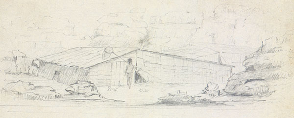
In 1838 a branch of Jason Lee's Methodist Mission was established at Celilo Falls, named the Wascopam Mission, after the native Wasco Indians. In 1850 the U.S. Army founded a small post at the site of the old mission, being eventually named Fort Dalles. Fort Dalles became the nucleus of the town of The Dalles, which began to develop along the waterfront. In 1855, at the end of the Cayuse War, the Indians living near The Dalles were forcibly relocated by the U.S. Army to the Warm Springs Indian Reservation.
American settlement
In the early 1840s American settlers began to arrive in significant numbers, traveling overland via the Oregon Trail. The trail ended at The Dalles. It was not possible to take wagons farther west due to steep cliffs that fell straight into the Columbia River. Until the construction of the Barlow Road in 1846, the only way to reach Fort Vancouver and the Willamette Valley was by rafting down the river from The Dalles.
A post office was established within the boundaries of the current city in 1851, and The Dalles was incorporated as a city in 1857. It has been the major commercial center between Portland and Pendleton since. The city was originally named just "Dalles". In 1853 it was changed to "Wascopum," then, in 1860, to "The Dalles".
In 1864, the U.S. Congress appropriated money to build a U.S. mint in The Dalles that was to use gold from Canyon City for coinage. The supply of gold from Canyon City began to dwindle, however, and other problems, such as cost overruns, workers leaving to work the gold fields, and flooding from the Columbia River, also contributed to the project running two years behind schedule and led eventually to its demise. In 1870, the State of Oregon received the property from the U.S. Government and the building was put to other uses. The mint is now home to Freebridge Brewing.

20th and 21st centuries
Construction of The Dalles Dam in 1957 submerged the Long Narrows and Celilo Falls.
In 1963, Ken Kesey's novel One Flew Over the Cuckoo's Nest was published featuring the narrator, Chief, who is from The Dalles.
In 1970, the Bonneville Power Administration opened the Celilo Converter Station near the northern terminus of the Pacific DC Intertie which sends 3,100 megawatts of electricity to Los Angeles.
In 1982, a curly-coated kitten was born on a farm in The Dalles owned by Linda and Dick Koehl. The Koehls used this kitten and her offspring to develop a new breed of cat called the LaPerm, which went on to become a popular, established, championship pedigree cat breed around the world.{{cite web | access-date =May 29, 2011
In 1984, The Dalles was the site of the first and single largest bioterrorism attack in United States history.
In 1986, Penalty Phase, a film starring Peter Strauss and Melissa Gilbert, was filmed in and around The Dalles.
In 2018, Terry A. Davis, creator of the TempleOS operating system, walked from Portland, Oregon to The Dalles in three days via the Columbia River Gorge. There, he was struck by a train and died at the age of 48.
Geography

Highways I-84, US 30, and US 197 meet in the city.
According to the United States Census Bureau, the city has a total area of 20.61 sqmi, of which 20.35 sqmi is land and 0.26 sqmi is water.
Climate
The Dalles is usually classified as a semiarid (Köppen BSk) climate region. However, it has some characteristics of the midlatitude oceanic climate that dominates west of the Cascade Mountains, combined with seasonal precipitation patterns very similar to those found in Mediterranean climates. The city's location in the eastern Columbia Gorge results in the presence of numerous microclimates within a few miles of town. To the immediate west, the winters are significantly wetter, and summers are significantly cooler. In contrast, upland locations to the south are significantly cooler in all seasons. The generally warm and dry summers near town make it the ideal climate for the numerous Bing cherry orchards in the area.
The summer season runs from mid-June through early September and is quite warm by Pacific Northwest standards; however, summer weather often oscillates between intense heat waves and much cooler and windier periods. Except for the occasional sporadic thunderstorm, there is almost no summer rainfall.
From late September through early November, the area experiences an abrupt autumn during which normal temperatures drop very rapidly and cloudy, wet weather quickly picks up. Prior to the sudden onset of the rainy season in mid- to late fall, there are often days with a very wide disparity between daytime and nighttime temperatures, sometimes exceeding 36 F-change. There is far less wind in the fall than in spring and early summer, though passing frontal systems can still bring quick bouts of strong wind.
Winter is the wet season in The Dalles. Despite the rain shadow effect created by the Cascades, there is still enough precipitation most years to support relatively high soil moisture levels for most of the winter. This is a very similar pattern to what happens in classic Mediterranean climates – except that the temperatures are significantly colder. The area receives measurable snowfall virtually every year, but the snow totals fluctuate dramatically from one year to the next; some seasons see only one or two brief light snow events while others get major snowstorms and cumulative totals of 20 in or more. The most snowfall in a season has been 85.5 in between July 1949 and June 1950. Average winter temperatures are only about 3 to colder than in cities such as Portland and Seattle, and temperatures below 0 F are very rare, but not unheard of – historically occurring on three mornings out of every five winters, but only once since February 1996.
As in the summer, winter temperatures can vary tremendously from one day to the next. During arctic air events the daytime high temperatures will generally be well below 32 F, while a strong subtropical push can raise temperatures into the 50s and low 60s F, even in January. It is quite common for relatively cold air to become trapped at low elevations due to an inversion above; depending on the temperature of the surface airmass, depth of the inversion layer, and temperatures above the inversion layer, this can result in snow, sleet, freezing rain or a very cold liquid rain.
Springtime conditions generally run from late February through early June, during which time the overall trend gradually becomes warmer and drier and the landscape briefly turns lush and green. This is the windiest season of all, with a powerful west wind on most afternoons. During stormy periods in spring, conditions are usually cloudy and cool, while most sunny and calm days become intensely warm, especially from April onward. Springtime temperatures often vary more from one week to the next than they do from one month to the next.
The growing season is roughly 200 days long in a typical year, generally running from early April through most of October. However, the spring frost dates can range from mid-March to early May, and the fall frost dates can range from late September to mid-November.
A weather station is located at nearby Columbia Gorge Regional Airport, also known as The Dalles Municipal Airport.
| Jan record high F = 68 | Feb record high F = 70 | Mar record high F = 80 | Apr record high F = 95 | May record high F = 107 | Jun record high F = 118 | Jul record high F = 112 | Aug record high F = 110 | Sep record high F = 105 | Oct record high F = 90 | Nov record high F = 74 | Dec record high F = 70 | year record high F = 118 | Jan avg record high F = 57.8 | Feb avg record high F = 60.8 | Mar avg record high F = 71.2 | Apr avg record high F = 81.6 | May avg record high F = 91.8 | Jun avg record high F = 98.1 | Jul avg record high F = 104.0 | Aug avg record high F = 103.3 | Sep avg record high F = 95.9 | Oct avg record high F = 80.0 | Nov avg record high F = 66.2 | Dec avg record high F = 56.5 | year avg record high F = 105.5 | Jan avg record low F = 17.1 | Feb avg record low F = 18.9 | Mar avg record low F = 24.7 | Apr avg record low F = 30.1 | May avg record low F = 36.3 | Jun avg record low F = 44.9 | Jul avg record low F = 50.7 | Aug avg record low F = 49.7 | Sep avg record low F = 40.4 | Oct avg record low F = 28.2 | Nov avg record low F = 21.6 | Dec avg record low F = 18.8 | year avg record low F = 11.0 |Jan record low F = −8 |Feb record low F = −4 |Mar record low F = 6 |Apr record low F = 23 |May record low F = 28 |Jun record low F = 37 |Jul record low F = 40 |Aug record low F = 42 |Sep record low F = 29 |Oct record low F = 15 |Nov record low F = −1 |Dec record low F = −5 |year record low F= |access-date = April 18, 2024}}{{cite web |access-date = April 18, 2024}}{{cite web |access-date = April 18, 2024}}
Economy
In 2006, Google began building a major data center, known locally as Project 02, along the Columbia River in The Dalles, using the area's reliable hydroelectric power and underutilized fiber optic capacity. The new complex includes two buildings, each approximately the size of a football field, and two cooling plants, each four stories high. The project promised hundreds of jobs in the area, mainly in construction, with an additional 200 permanent positions expected later in 2006 although as of 2013 Google employed only 150 combined company employees and contractors in The Dalles.
Top employers
In 2021, Wasco County published a list of top employers in the region. Mid-Columbia Medical Center was the number one employer listed with over 500 employees; a local school district, Oregon Cherry Growers and Fred Meyer all reported more than 250 employers. Google employed between 100 and 250 people, according to the list.
In 2012, the top 15 employers in The Dalles according to the Mid-Columbia Economic Development District report on "Largest Employers in Wasco County" were:
| # | Employer | # of employees |
|---|---|---|
| 1 | Adventist Health Columbia Gorge | 915 |
| 2 | North Wasco County School District | 360 |
| 3 | Oregon Cherry Growers | 275 |
| 4 | State of Oregon | 243 |
| 5 | Fred Meyer | 230 |
| 6 | Oregon Veteran's Home | 208 |
| 7 | Columbia Gorge Community College | 200 |
| 8 | Wasco County | 181 |
| 9 | 150 | |
| 10 | Safeway | 142 |
| 11 | U.S. Army Corps of Engineers | 125 |
| 12 | City of The Dalles | 100 |
| 13 | Home Depot | 100 |
| 14 | Cousin's Country Inn | 100 |
| 15 | Orchard View Farms | 90 |
Education
Main article: Columbia Gorge Community College
The Dalles is home to Oregon School District 21. Originally 2 school districts; District 9 in the Chenoweth area and District 12 which included much of The Dalles.
District 21 includes 3 elementary schools: Colonel Wright Elementary, Chenoweth Elementary and Dry Hollow Elementary. District 21 is also home to Innovations Academy, The Dalles Middle School and The Dalles High School.
St Mary's Academy is a k-8 school affiliated with the Catholic Church in The Dalles.
Columbia Lutheran School is a Christian elementary school of the Evangelical Lutheran Synod in The Dalles.
The Dalles is also home to the main campus of Columbia Gorge Community College which began in 1977 as Wasco Area Education Service District. It is a leading institution in renewable energy technology education and training.
Demographics
U.S. Decennial Census
| align-fn = center
2020 census
As of the 2020 census, The Dalles had a population of 16,010 people, and the median age was 39.2 years. 22.1% of residents were under the age of 18 and 20.5% of residents were 65 years of age or older. For every 100 females there were 96.1 males, and for every 100 females age 18 and over there were 93.0 males age 18 and over.
According to the 2020 Decennial Census Demographic and Housing Characteristics profile, 99.8% of residents lived in urban areas, while 0.2% lived in rural areas.
There were 6,272 households in The Dalles, of which 30.2% had children under the age of 18 living in them. Of all households, 43.5% were married-couple households, 18.3% were households with a male householder and no spouse or partner present, and 30.0% were households with a female householder and no spouse or partner present. About 29.8% of all households were made up of individuals and 14.4% had someone living alone who was 65 years of age or older.
There were 6,643 housing units, of which 5.6% were vacant. Among occupied housing units, 59.5% were owner-occupied and 40.5% were renter-occupied. The homeowner vacancy rate was 1.5% and the rental vacancy rate was 5.5%.
| Race | Number | Percent |
|---|---|---|
| White | 11,827 | 73.9% |
| Black or African American | 90 | 0.6% |
| American Indian and Alaska Native | 246 | 1.5% |
| Asian | 196 | 1.2% |
| Native Hawaiian and Other Pacific Islander | 177 | 1.1% |
| Some other race | 1,457 | 9.1% |
| Two or more races | 2,017 | 12.6% |
| Hispanic or Latino (of any race) | 3,561 | 22.2% |
2010 census
As of the census of 2010, there were 13,620 people, 5,472 households, and 3,441 families residing in the city. The population density was 2144.9 PD/sqmi. There were 5,903 housing units at an average density of 929.6 /sqmi. The racial makeup of the city was 87.9% White, 0.5% African American, 1.5% Native American, 1.0% Asian, 0.8% Pacific Islander, 5.7% from other races, and 2.7% from two or more races. Hispanic or Latino people of any race were 17.0% of the population.
There were 5,472 households, of which 30.3% had children under the age of 18 living with them, 46.1% were married couples living together, 12.4% had a female householder with no husband present, 4.4% had a male householder with no wife present, and 37.1% were non-families. 31.0% of all households were made up of individuals, and 14.1% had someone living alone who was 65 years of age or older. The average household size was 2.40 and the average family size was 2.99.
The median age in the city was 39.7 years. 23.8% of residents were under the age of 18; 8.3% were between the ages of 18 and 24; 24.1% were from 25 to 44; 25.8% were from 45 to 64; and 17.9% were 65 years of age or older. The gender makeup of the city was 48.4% male and 51.6% female.
2000 census
As of the census of 2000, there were 12,156 people, 4,896 households, and 3,226 families residing in the city. The population density was 892.3/km2. There were 5,227 housing units at an average density of 383.7/km2. The racial makeup of the city was 87.8% White, 0.4% African American, 1.2% Native American, 1.0% Asian, 0.8% Pacific Islander, 6.2% from other races, and 2.6% from two or more races. Hispanic or Latino people of any race were 10.5% of the population.
There were 4,896 households, out of which 30.0% had children under the age of 18 living with them, 51.1% were married couples living together, 10.6% had a female householder with no husband present, and 34.1% were non-families. 29.2% of all households were made up of individuals, and 13.5% had someone living alone who was 65 years of age or older. The average household size was 2.40, and the average family size was 2.94.
In the city, the population was spread out, with 24.8% under the age of 18, 7.9% from 18 to 24, 25.7% from 25 to 44, 23.5% from 45 to 64, and 18.1% who were 65 years of age or older. The median age was 39 years. For every 100 females, there were 94.7 males. For every 100 females age 18 and over, there were 91.5 males.
The median income for a household in the city was $35,430, and the median income for a family was $43,041. Males had a median income of $36,387 versus $22,583 for females. The per capita income for the city was $17,511. About 9.0% of families and 12.4% of the population were below the poverty line, including 16.6% of those under age 18 and 8.6% of those age 65 or over.
Arts and culture

Annual cultural events
The Northwest Cherry Festival is held in The Dalles in April.
Museums and other points of interest
- Columbia Gorge Discovery Center & Museum, the official interpretive center for the Columbia River Gorge National Scenic Area
- Fort Dalles Museum, Oregon's oldest history museum located in the Surgeon's Quarters built in 1856 at Fort Dalles
- Pulpit Rock, used by Methodist missionaries to preach to Native Americans
- North Wasco County Aquatic Center, the most recent in many iterations of the local swimming pool. Previously known as the Natatorium, "Nat" or "Nat Club".
- The river front trail, runs along the Columbia River from the Discovery Center to the local boat marina.
- Sorosis Park, a 45 acre park. Contains a memorial rose garden with the Vogt Fountain as the centerpiece.
Media
Radio
- KACI 1300/103.9 FM
- KODL 1440AM/99.1 FM
- KMSW 92.7/102.9 FM
- KACI-FM 93.5 FM
- KCGB-FM 105.5/96.9 FM
- KJYV 101.5 FM
Television
- K34KE-D translator for KGW Portland, NBC affiliate
- K23OV-D translator for KOIN Portland, CBS affiliate
Newspaper
- Columbia Gorge News
- Columbia Community Connection Digital, Bilingual and Local News for the Mid-Columbia Region
Rajneeshee Movement
Main article: 1984 Rajneeshee bioterror attack
In 1984, The Dalles was the scene of a bioterrorist incident launched by members of the Rajneesh Movement in an attempt to gain control of the local government of Wasco County, which failed on Election Day. Salmonella placed in ten restaurants resulted in 751 cases of Salmonellosis. It was the first known bioterrorism attack of the 20th century in the United States. The circumstances of the attack are documented in an American Medical Association article (JAMA Vol 278, No 5, page 389, 6 Aug 1997).
Notable people
· Only people who already have a Wikipedia article may appear here. This establishes notability. · The biographical article must mention how they are associated with The Dalles, whether born, raised, or residing. · The fact of their association should have a reliable source cited in this article, unless it is well-known. · Alphabetical by last name, please. · All others will be deleted without further explanation.
- Homer D. Angell, Republican U.S. congressman for OR-3, 1939–1955
- Lefty Bertrand, Major League Baseball player
- John Callahan, cartoonist, grew up in The Dalles
- H. L. Davis, Oregon's only Pulitzer Prize winner in literature with Honey in the Horn (1936)
- Ken Dayley, Major League Baseball player
- Alan Embree, Major League Baseball player
- Shemia Fagan, Democratic State Senator for Portland and Former Oregon Secretary of State, 2021–2023.
- Jacob Glanville, Ph.D., computational immunoengineer and businessperson
- Jennifer Lyon, Survivor: Palau contestant
- Todd Nelson, touring professional tennis player
- Wilma Roberts, local photographer who lived and worked at the Elite Studio, later called "Mel O's" in The Dalles
- Greg Walden, Republican congressman from OR-2, 1999–2021.
- Philip Whalen, a poet associated with the Beat Generation, grew up in The Dalles
- Terry A. Davis, computer programmer best known for creating the operating system TempleOS
Sister cities
The Dalles has one sister city:
- Japan Miyoshi City, Japan (formerly Ikeda)
References
References
- "ArcGIS REST Services Directory". United States Census Bureau.
- {{GNIS. 2412059
- "Historic The Dalles". Wasco County Historical Society.
- Gibson, James R.. (1997). "The Lifeline of the Oregon Country: The Fraser-Columbia Brigade System, 1811–47". University of British Columbia (UBC) Press.
- {{OGN. 6th
- "Fort Astoria, 1813". [[Oregon Historical Society]].
- Gibson, James R.. (1998). "The Lifeline of the Oregon Country: The Fraser-Columbia Brigade System, 1811–47". UBC Press.
- "Fort Dalles History". Fort Dalles Museum and the Anderson Homestead.
- [http://www.wasco-history.r9esd.k12.or.us/comm/td/mint.html Wasco History] {{Webarchive. link. (February 5, 2012 . Wasco-history.r9esd.k12.or.us. Retrieved on June 4, 2012.)
- [http://www.historicthedalles.org/the_dalles_commercial_district.htm#mint The Dalles U.S. Branch Mint/Erin Glenn Winery (1870)]
- "Mint that Never Was Makes Interesting Tale".
- [http://www.cliffsnotes.com/WileyCDA/LitNote/One-Flew-Over-the-Cuckoo-s-Nest-Summary-and-Analysis-They-re-Out-There.id-136,pageNum-13.html One Flew Over the Cuckoo's Nest: Summary and Analysis: There's a Monopoly Game]. CliffsNotes. Retrieved on June 4, 2012.
- [http://tarlton.law.utexas.edu/lpop/etext/ucla/hickman48.htm Tarlton Law Library – Law in Popular Culture Collection – Law and Lawyers in Popular Culture] {{Webarchive. link. (January 6, 2009 . Tarlton.law.utexas.edu. Retrieved on June 4, 2012.)
- Terry Davis. (2018-06-07). "Terry Davis: Portland Exodus".
- "US Gazetteer files 2010". [[United States Census Bureau]].
- Rogoway, Mike. "Google plans much bigger data center if it expands in The Dalles". The Oregonian.
- Markoff, John. (June 14, 2006). "Hiding in Plain Sight, Google Seeks More Power". The New York Times.
- [https://www.google.com/datacenter/thedalles/ The Dalles · Google Data Centers]. Google.com. Retrieved on June 4, 2012.
- "North Wasco County School District / District Home Page".
- "ST. MARY'S ACADEMY – The Dalles, Oregon {{!}} Established in 1864".
- "About Us".
- "Columbia Gorge Community College Leads Nation in Wind Training".
- Moffatt, Riley. ''Population History of Western U.S. Cities & Towns, 1850–1990''. [[Lanham, Maryland. Lanham]]: Scarecrow, 1996, 216.
- United States Census Bureau. "Census of Population and Housing".
- "Census Population API". United States Census Bureau.
- (2021). "2020 Decennial Census Demographic Profile (DP1)".
- (2023). "2020 Decennial Census Demographic and Housing Characteristics (DHC)".
- (2021). "2020 Decennial Census Redistricting Data (Public Law 94-171)".
- "U.S. Census website". [[United States Census Bureau]].
- "U.S. Census website". [[United States Census Bureau]].
- [http://www.thedalleschamber.com/cherryfestival.htm 30th Annual Northwest Cherry Festival] {{webarchive. link. (January 9, 2010)
- Authorized by the Columbia River Gorge National Scenic Area Act (PL99-663)
- [http://www.historicthedalles.org/fort_dalles/index.htm Fort Dalles Museum]. Historicthedalles.org. Retrieved on June 4, 2012.
- Horner, John B.. (1919). "Oregon: Her History, Her Great Men, Her Literature". The J.K. Gill Co..
- "Gorge Discovery Center Photo Archive".
- "Bioterrorism in History – 1984: Rajneesh Cult Attacks Local Salad Bar". WBUR.org.
- [http://www.ochcom.org/davis/ Oregon Cultural Heritage Commission]. Ochcom.org (June 30, 2004). Retrieved on June 4, 2012.
- (2020-05-22). "Fagan wins Democratic primary for secretary of state".
- [http://www.ci.tukwila.wa.us/mayor/ikawa.html Tukwila Sister City Affiliation] {{Webarchive. link. (March 7, 2009 . Ci.tukwila.wa.us (November 19, 1979). Retrieved on June 4, 2012.)
This article was imported from Wikipedia and is available under the Creative Commons Attribution-ShareAlike 4.0 License. Content has been adapted to SurfDoc format. Original contributors can be found on the article history page.
Ask Mako anything about The Dalles, Oregon — get instant answers, deeper analysis, and related topics.
Research with MakoFree with your Surf account
Create a free account to save articles, ask Mako questions, and organize your research.
Sign up freeThis content may have been generated or modified by AI. CloudSurf Software LLC is not responsible for the accuracy, completeness, or reliability of AI-generated content. Always verify important information from primary sources.
Report