From Surf Wiki (app.surf) — the open knowledge base
Thann, Haut-Rhin
Subprefecture and commune in Grand Est, France
Subprefecture and commune in Grand Est, France
| Field | Value |
|---|---|
| name | Thann |
| native name | Dànn |
| commune status | Subprefecture and commune |
| image | CollegialeDeThannOeilDeLaSorciere.jpg |
| caption | The church in Thann |
| image coat of arms | Blason Thann 68.svg |
| arrondissement | Thann-Guebwiller |
| canton | Cernay |
| INSEE | 68334 |
| postal code | 68800 |
| mayor | Gilbert Stoeckel |
| term | 2020–2026 |
| intercommunality | CC de Thann-Cernay |
| coordinates | |
| elevation m | 343 |
| elevation min m | 328 |
| elevation max m | 922 |
| area km2 | 12.51 |
| population | |
| population date | |
| population footnotes |
|image coat of arms = Blason Thann 68.svg
Thann (; Alsatian: Dànn, , ) is a commune in the northeastern French department of Haut-Rhin, in Grand Est. It is the sous-préfecture of the arrondissement of Thann-Guebwiller and part of the canton of Cernay. Its inhabitants are known as Thannois.
Geography
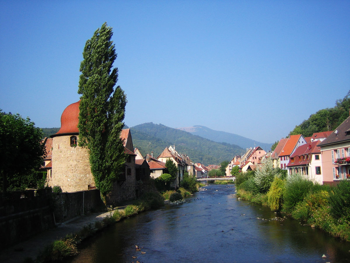
Thann is situated at the foot of the Vosges mountains, where the valley of the river Thur enters the Upper Rhine Plain. The Thur runs through the middle of the town.


Toponymy
The town's name comes from the German word Tanne, meaning fir tree. A fir tree does indeed appear on the coat of arms of Thann (canting arms).
- Villa Danne, 10th century;
- Castrum Tanne, 1251;
- Oppidum Thanna, 1304;
- Dan, 16th century;
- Pinetum, by Jérôme Gebwiller (1473-1545), probably because the coat of arms of Thann features a fir tree;
- Tann, Nazi period (1940-1945).
History
In 1635, during the Thirty Years' War, Thann was taken by imperialist forces. A mercenary among those troops described it as a "beautiful city, which lies on a mountain and is strongly fortified."
Transport
Thann is 43 km from Colmar and 21 km from Mulhouse. The town is also well situated for the French autoroute network such as the A35 and A36.
The RN66 (Route Nationale 66) passes through Thann, providing an east–west route between Mulhouse and Épinal.
- Thann and the Thur valley are served by regular TER trains on a branch line running from Mulhouse to Kruth.
- A new tram-train service of the Mulhouse tramway links Thann to the city centre of Mulhouse.
Demographic evolution
|1968 |8318 |1975 |8519 |1982 |7788 |1990 |7751 |1999 |8033 |2007 |7973 |2012 |7931 |2017 |7780
Architectural heritage
Despite sustaining heavy damage in World War I and World War II, Thann contains several old buildings and monuments of significance.
La Collégiale Saint-Thiébaut
Main article: Saint-Thiébaut Church, Thann
Situated in the centre of the old town, the church known as the Collégiale is good example of the style of Gothic architecture that flourished in the Rhine valley in the late Middle Ages. The Cathedrals of Strasbourg and Freiburg in Germany are also built in a similar style.
The building owes its name "La collégiale" to the college of monks who moved to Thann from the nearby town of Saint-Amarin in 1442. Construction of the collégiale took more than 200 years, from the end of the 13th Century through the 15th Century, and was completed in 1516 with the 78m tall spire.
For an extensive study of the Thann collegiate church, circumstances of its erection, issues of patronage, and unique sculptural programs, see Assaf Pinkus, Workshops and Patrons of St. Theobald in Thann (Waxmann Verlag: Muenster, Berlin, New York, 2006).
La Tour des Sorcières (The Witches' Tower)
This was a tower in the old town walls, and built in 1411. The bulbous roof dates from 1628. Today the interior houses a museum dedicated to winemaking.
Le Château de l'Engelbourg (Engelbourg Castle)
The ruins of the Engelbourg Castle sit on a hill to the north of the old town. The castle was constructed in the 13th century by the Counts of Ferrette to control the entrance to the valley and ensure the paying of tolls by those wishing to cross the Vosges by way of the Thur valley and the col de Bussang. The castle was destroyed on the orders of Louis XIV. During demolition, one of towers overturned and cracked into sections, one of which forms a large stone ring known locally today as The Witch's Eye (L'œil de la sorcière).
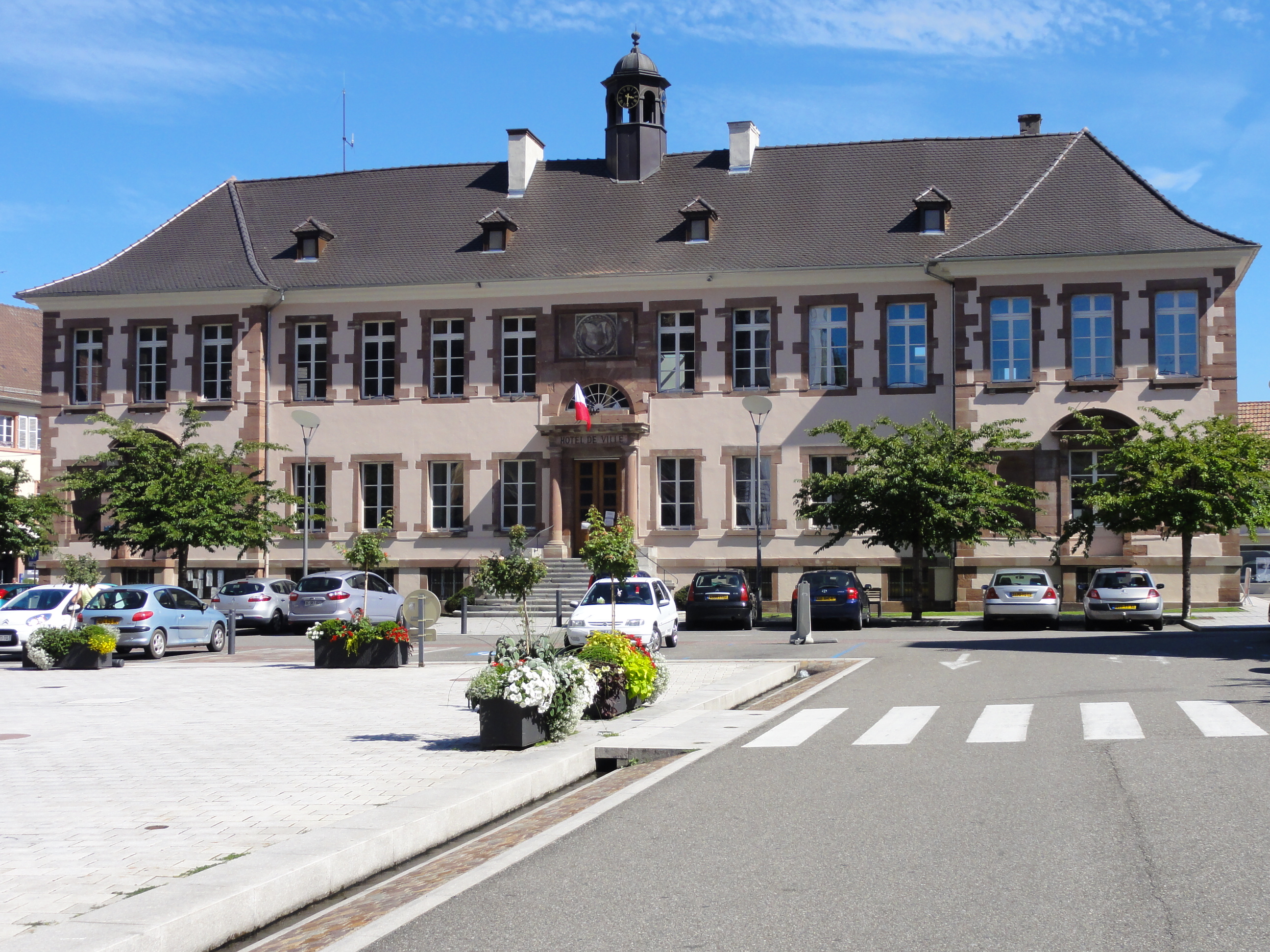
L'Hôtel de Ville
The Hotel de Ville was originally conceived as a hospital, but was opened as a town hall in 1793.
Education
The town is served by four écoles maternelles; three écoles élémentaires; two collèges (Collège Charles Walch and Collège Rémy Faesch); and two lycées (Lycée Professionel Charles Pointet and Lycée Scheurer-Kestner).
Tourism
- Thann is the southern terminus of the route des Vins d'Alsace. The northern side of the town is overlooked by the Rangen vineyard, one of the few vineyards in Alsace to be classed grand cru.
- Thann is well situated for access to the .
People
- Ernst Robert Curtius, literary critic
- Emmanuel Fernandes, politician
- Jean-Baptiste-Joseph Gobel
Twin towns
- Italy - Gubbio, Italy
- France - Tonneins, France
References
References
- (2 December 2020). "Répertoire national des élus: les maires".
- [https://www.insee.fr/fr/metadonnees/geographie/commune/68334-thann Commune de Thann (68334)], INSEE
- (1837). "Histoire des Saints d'Alsace".
- Helfferich, Tryntje, The Thirty Years War: A Documentary History (Cambridge, 2009), pp. 290.
- (2010-12-13). "Railway Gazette: Mulhouse tram-train enters service".
- [https://www.insee.fr/fr/statistiques/4515315?geo=COM-68334#ancre-POP_T1 Population en historique depuis 1968], INSEE
- "Hôtel de ville de Thann".
This article was imported from Wikipedia and is available under the Creative Commons Attribution-ShareAlike 4.0 License. Content has been adapted to SurfDoc format. Original contributors can be found on the article history page.
Ask Mako anything about Thann, Haut-Rhin — get instant answers, deeper analysis, and related topics.
Research with MakoFree with your Surf account
Create a free account to save articles, ask Mako questions, and organize your research.
Sign up freeThis content may have been generated or modified by AI. CloudSurf Software LLC is not responsible for the accuracy, completeness, or reliability of AI-generated content. Always verify important information from primary sources.
Report