From Surf Wiki (app.surf) — the open knowledge base
Teton County, Wyoming
County in Wyoming, United States

County in Wyoming, United States
| Field | Value |
|---|---|
| county | Teton County |
| state | Wyoming |
| ex image | Jackson wy.jpg |
| ex image size | 220px |
| ex image cap | George Washington Memorial Park (Jackson, Wyoming) |
| flag | Flag_of_Teton_County,_Wyoming.svg |
| founded | February 15, 1921 (authorized) |
| 1922 (organized) | |
| seat wl | Jackson |
| largest city | Jackson |
| city type | town |
| area_total_sq_mi | 4216 |
| area_land_sq_mi | 3995 |
| area_water_sq_mi | 221 |
| area percentage | 5.2% |
| population_as_of | 2020 |
| population_total | 23331 |
| pop_est_as_of | 2024 |
| population_est | 23272 |
| density_sq_mi | auto |
| time zone | Mountain |
| named for | Teton Range |
| district | At-large |
1922 (organized) | web tetoncountywy.gov
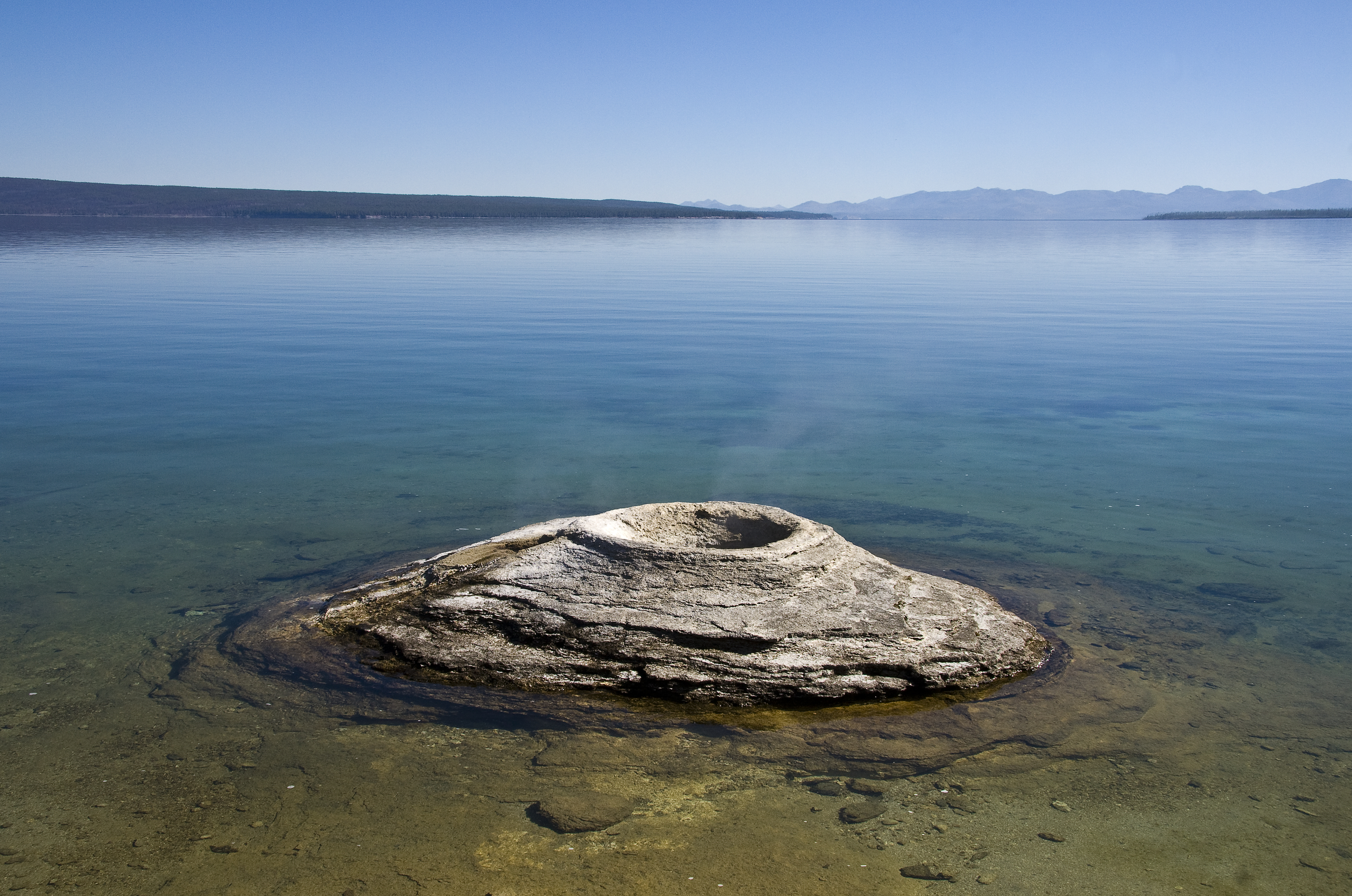
Teton County is a county in the U.S. state of Wyoming. As of the 2020 United States census, the population was 23,331. Its county seat is Jackson. Its west boundary line is also the Wyoming state boundary shared with Idaho and the southern tip of Montana. Teton County is part of the Jackson, WY-ID Micropolitan Statistical Area. Teton County contains the Jackson Hole ski area, all of Grand Teton National Park, and 40.4% of Yellowstone National Park's total area, including over 96.6% of its water area (largely in Yellowstone Lake).
History
Teton County was created February 15, 1921, from a portion of Lincoln County. Its governing organization was completed in 1922. The county was named for the Teton Range. The county was created because the inhabitants lived too far away from Kemmerer, the county seat of Lincoln County. The creation of the county required a special act of the Wyoming Legislature, because the area was too poor and had too few people to qualify for county status under the normal requirements.
Geography
According to the US Census Bureau, the county has a total area of 4216 sqmi, of which 3995 sqmi is land and 221 sqmi (5.2%) is water.
Adjacent counties
- Park County – northeast
- Fremont County – east
- Sublette County – southeast
- Lincoln County – south
- Bonneville County, Idaho – southwest
- Teton County, Idaho – southwest
- Fremont County, Idaho – west
- Gallatin County, Montana – northwest
National protected areas
- Bridger-Teton National Forest (part)
- Caribou-Targhee National Forest (part)
- Grand Teton National Park
- John D. Rockefeller Memorial Parkway
- National Elk Refuge
- Shoshone National Forest (part)
- Yellowstone National Park (part)
Demographics
|align-fn=center 1870–2000 2010–2016
2020 census
As of the 2020 census, the county had a population of 23,331. Of the residents, 19.6% were under the age of 18 and 16.0% were 65 years of age or older; the median age was 40.0 years. For every 100 females there were 104.8 males, and for every 100 females age 18 and over there were 104.4 males.
The racial makeup of the county was 82.3% White, 0.2% Black or African American, 0.8% American Indian and Alaska Native, 1.4% Asian, 6.1% from some other race, and 9.2% from two or more races. Hispanic or Latino residents of any race comprised 14.1% of the population.
There were 9,609 households in the county, of which 27.3% had children under the age of 18 living with them and 21.2% had a female householder with no spouse or partner present. About 27.2% of all households were made up of individuals and 9.0% had someone living alone who was 65 years of age or older.
There were 13,233 housing units, of which 27.4% were vacant. Among occupied housing units, 58.7% were owner-occupied and 41.3% were renter-occupied. The homeowner vacancy rate was 1.3% and the rental vacancy rate was 5.6%.
2010 census
As of the 2010 United States census, there were 21,294 people, 8,973 households, and 4,938 families in the county. The population density was 5.3 /mi2. There were 12,813 housing units at an average density of 3.2 /mi2. The racial makeup of the county was 88.4% white, 1.1% Asian, 0.5% American Indian, 0.2% black or African American, 0.1% Pacific islander, 8.1% from other races, and 1.6% from two or more races. Those of Hispanic or Latino origin made up 15.0% of the population.
Of the 8,973 households, 25.5% had children under the age of 18 living with them, 45.7% were married couples living together, 5.6% had a female householder with no husband present, 45.0% were non-families, and 29.2% of all households were made up of individuals. The average household size was 2.34 and the average family size was 2.89. The median age was 36.9 years.
The median income for a household in the county was $70,271 and the median income for a family was $90,596. Males had a median income of $40,594 versus $36,715 for females. The per capita income for the county was $42,224. About 5.1% of families and 8.2% of the population were below the poverty line, including 15.5% of those under age 18 and 0.8% of those age 65 or over.
2000 census
As of the 2000 United States census there were 18,251 people, 7,688 households, and 4,174 families in the county. The population density was 5 /mi2. There were 10,267 housing units at an average density of 3 /mi2. The racial makeup of the county was 93.59% White, 0.15% Black or African American, 0.53% Native American, 0.54% Asian, 0.03% Pacific Islander, 3.93% from other races, and 1.22% from two or more races. 6.49% of the population were Hispanic or Latino of any race. 19.2% were of German, 14.2% English, 11.7% Irish and 6.7% American ancestry.
There were 7,688 households, out of which 25.60% had children under the age of 18 living with them, 45.30% were married couples living together, 5.70% had a female householder with no husband present, and 45.70% were non-families. 27.30% of all households were made up of individuals, and 3.70% had someone living alone who was 65 years of age or older. The average household size was 2.36 and the average family size was 2.89.
The county population contained 19.90% under the age of 18, 9.80% from 18 to 24, 38.30% from 25 to 44, 25.00% from 45 to 64, and 6.90% who were 65 years of age or older. The median age was 35 years. For every 100 females, there were 114.30 males. For every 100 females age 18 and over, there were 115.50 males.
The median income for a household in the county was $54,614, and the median income for a family was $63,916. Males had a median income of $34,570 versus $29,132 for females. The per capita income for the county was $38,260. About 2.80% of families and 6.00% of the population were below the poverty line, including 5.70% of those under age 18 and 4.40% of those age 65 or over.
Economy
$200,000
$300,000
$400,000
$500,000
$600,000
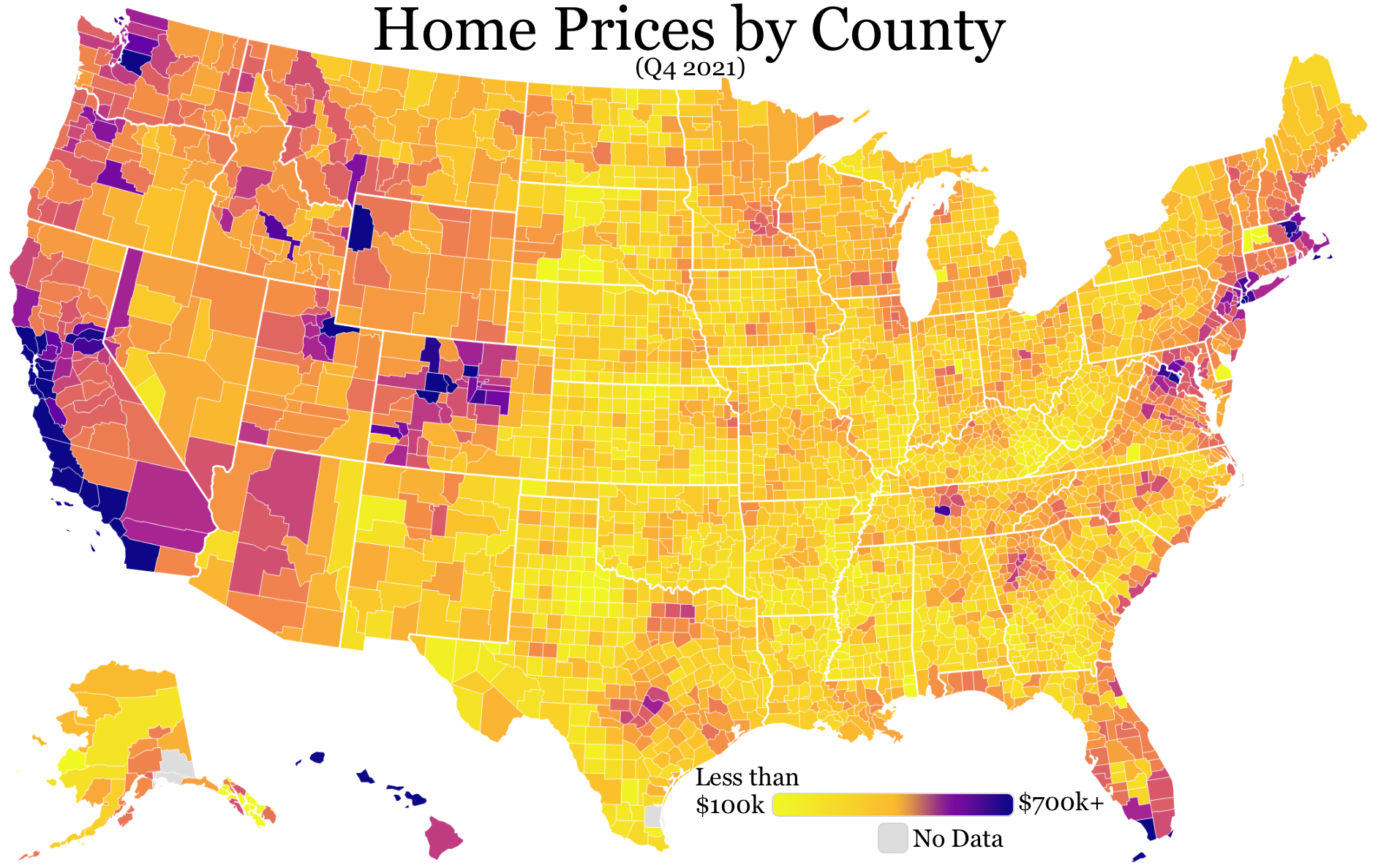
$700,000+ ]] Teton County is one of the highest-income counties in the United States. A 2019 Bloomberg L.P. report (citing Bureau of Economic Analysis figures) found that Teton had the highest average incomes per capita of any county in the United States, at $252,000. This was partly attributed to the high incomes of Jackson Hole residents, where property owners include Bill Gates.
As of the fourth quarter of 2021, the median home price in Teton County was $1,060,093, an increase of 17.8% from the prior year.
Communities
Town
- Jackson (county seat)
Census-designated places
- Alta
- Hoback
- Kelly
- Moose Wilson Road
- Rafter J Ranch
- South Park
- Teton Village
- Wilson
Unincorporated communities
- Moran
- Moose
Politics
Liz Skalka of the Huffpost described Teton as a "liberal county" in August 2022. Previously a staunchly Republican county, which produced Governor and U.S. Senator Clifford Hansen, a mass immigration of wealthy liberals from the West Coast has made Teton County the most Democratic county in Wyoming, which is one of the most Republican states in the nation. The only Republican presidential candidate since 1992 to win Teton County was George W. Bush in 2000 who had county resident Dick Cheney on the ticket. In the 2008 election, Barack Obama carried Teton County by a 23.6 percentage point margin over John McCain, with McCain winning statewide by a 32.2 percentage point margin over Obama, his widest margin in any state. Albany County, which includes the University of Wyoming at Laramie, was the only other county in the state to have backed Obama. In 2004, Teton was the only Wyoming county won by John F. Kerry over George W. Bush. In the 2016 election, Hillary Clinton beat Donald Trump by 57.9%–31.1%.
In 2020, Joe Biden beat Donald Trump by 37.5%, the largest margin for a Democrat ever in the county. In 2024 it was the only county to vote for Democrat Kamala Harris, despite Trump winning 71.6% of the vote in Wyoming, the highest vote share ever won in the state.
The county has, however, voted at times for Republican candidates for the governorship and United States Senate. Most recently, the county voted for Republican Mark Gordon for governor in 2022, although by the slimmest margin of any county in Wyoming.
Education
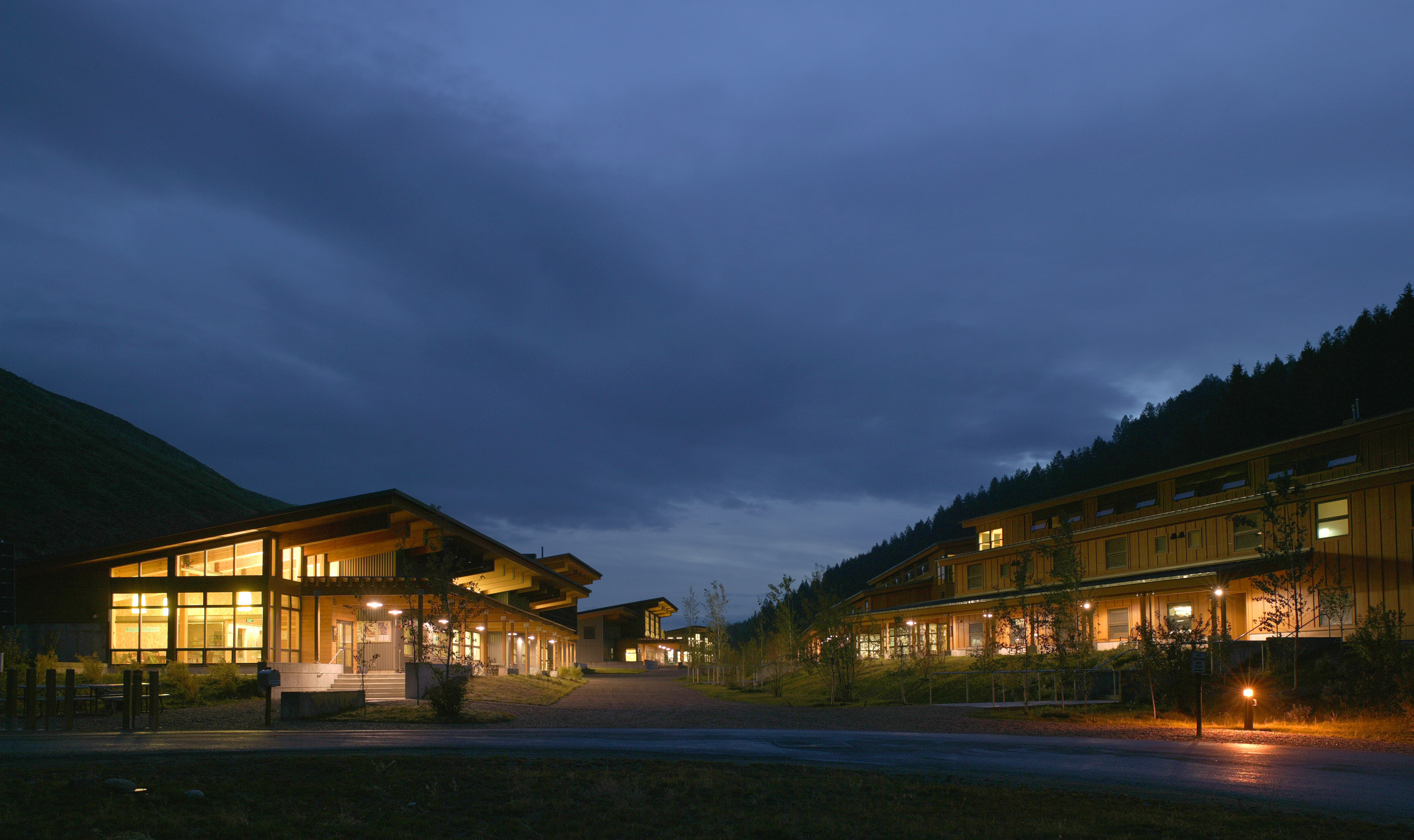
Teton County School District Number 1 is the school district for the entire county.
In prior eras, a portion of the county was not in any school district.
References
References
- "HISTORICAL DECENNIAL CENSUS POPULATION FOR WYOMING COUNTIES, CITIES, AND TOWNS". Wyoming Economic Analysis Division.
- "Find a County". National Association of Counties.
- "U.S. Census website". US Census Bureau.
- (2004). "Wyoming: Individual County Chronologies". The [[Newberry Library]].
- Urbanek, Mae. (1988). "Wyoming Place Names". Mountain Press Pub. Co..
- (August 22, 2012). "2010 Census Gazetteer Files". US Census Bureau.
- "US Decennial Census". US Census Bureau.
- "Historical Decennial Census Population for Wyoming Counties, Cities, and Towns". Wyoming Department of Administration & Information, Division of Economic Analysis.
- (2021). "2020 Decennial Census Demographic Profile (DP1)".
- (2021). "2020 Decennial Census Redistricting Data (Public Law 94-171)".
- "Profile of General Population and Housing Characteristics: 2010 Demographic Profile Data". US Census Bureau.
- "Population, Housing Units, Area, and Density: 2010 - County". US Census Bureau.
- "Selected Social Characteristics in the US – 2006-2010 American Community Survey 5-Year Estimates". US Census Bureau.
- "Selected Economic Characteristics – 2006-2010 American Community Survey 5-Year Estimates". US Census Bureau.
- "U.S. Census website". US Census Bureau.
- (November 29, 2019). "The Richest U.S. Counties Are Getting Even Richer".
- "County Median Home Price".
- Skalka, Liz. (August 16, 2022). "Wyoming Democrats Back Liz Cheney In Her Home County".
- Leip, Dave. "Atlas of US Presidential Elections". uselectionatlas.org.
- "2016 election results: Wyoming".
- Walkey, Will. (November 6, 2020). "As Wyoming Goes Further Right, Teton County Continues Pushing Left".
- Leip, Dave. US Election Atlas [https://uselectionatlas.org/RESULTS/statesub.php?year=2016&fips=56039&f=1&off=0&elect=0 2016 Presidential General Election Results – Wyoming: Teton County] (and earlier years)
- "2020 CENSUS - SCHOOL DISTRICT REFERENCE MAP: Teton County, WY". [[U.S. Census Bureau]].
- (March 8, 2006). "School Districts (Map), State of Wyoming". [[Wyoming Department of Revenue]], Property Tax Division.
This article was imported from Wikipedia and is available under the Creative Commons Attribution-ShareAlike 4.0 License. Content has been adapted to SurfDoc format. Original contributors can be found on the article history page.
Ask Mako anything about Teton County, Wyoming — get instant answers, deeper analysis, and related topics.
Research with MakoFree with your Surf account
Create a free account to save articles, ask Mako questions, and organize your research.
Sign up freeThis content may have been generated or modified by AI. CloudSurf Software LLC is not responsible for the accuracy, completeness, or reliability of AI-generated content. Always verify important information from primary sources.
Report