From Surf Wiki (app.surf) — the open knowledge base
Teluk Kumbar
| Field | Value | |
|---|---|---|
| official_name | Teluk Kumbar | |
| settlement_type | Suburb of George Town | |
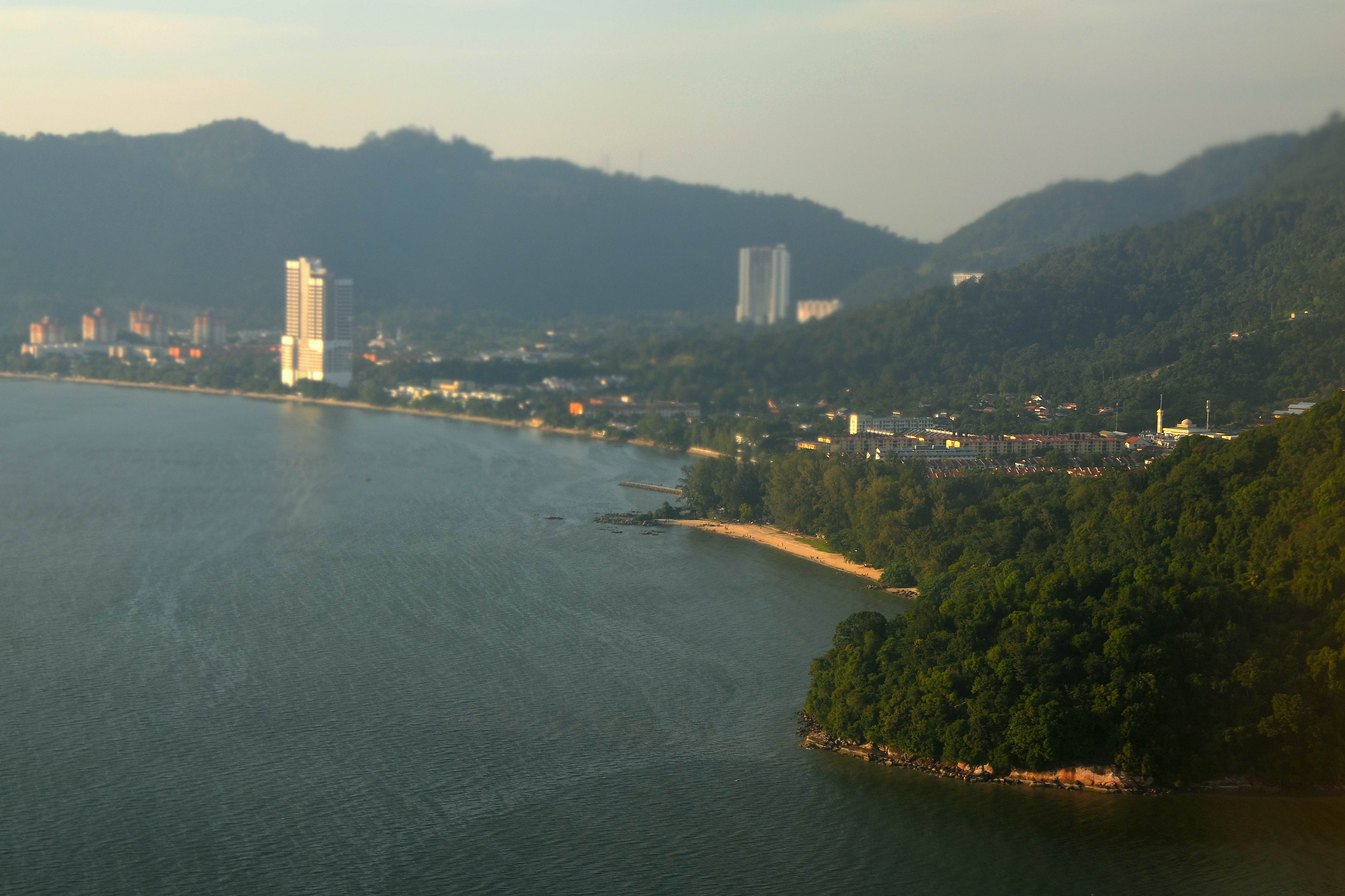
| image_skyline | Teluk Kumbar, Penang.jpg | |
| imagesize | 250px | |
| image_map | ||
| pushpin_map | Malaysia Penang George Town city centre | |
| pushpin_label_position | bottom | |
| pushpin_map_caption | Location within George Town in Penang | |
| coordinates | ||
| subdivision_type | Country | |
| subdivision_name | Malaysia | |
| subdivision_type1 | State | |
| subdivision_type2 | City | |
| subdivision_name1 | Penang | |
| subdivision_name2 | [[File:Seal of George Town.svg | 20px]] George Town |
| subdivision_type3 | District | |
| subdivision_name3 | Southwest | |
| population_total | 21481 | |
| population_as_of | 2020 | |
| population_footnotes | ||
| postal_code_type | Postal code | |
| postal_code | 11920 | |
| timezone | MST | |
| utc_offset | +8 | |
| timezone_DST | Not observed | |
| demographics_type1 | Demographics | |
| demographics1_footnotes | ||
| demographics1_title1 | Ethnic groups | |
| demographics1_info1 | ||
| area_total_km2 | 6.8 | |
| population_density_km2 | auto |
- 68.2% Bumiputera
- 67.7% Malay
- 0.5% indigenous groups from Sabah and Sarawak
- 21.8% Chinese
- 5.0% Indian
- 0.5% Other ethnicities
- 4.5% Non-citizens Teluk Kumbar is a suburb of George Town in the Malaysian state of Penang. It is located about 17.8 km south of the city centre, at the southern coast of Penang Island between Bayan Lepas to the east and Gertak Sanggul to the west.
Etymology
Teluk Kumbar in Malay literally means 'kumbar bay', a reference to the salak trees (Salacca zalacca; Malay: kumbar) that grew within the area.
History
Until the late 20th century, the town's residents depended on rice farming and fishing as the main economic activities. In the 1990s, the development of Teluk Kumbar was spearheaded by the Penang Regional Development Authority (PERDA), an agency of the Malaysian federal government which was tasked with the development of rural areas within Penang.
Geography
Click link at the top right corner to zoom in. |auto-caption=10
| map-data=Q7448218 |map-data-light=Q7448218
|label-posD=bottom
| mark-coord1= | mark-title1=Teluk Bayu | shape-color1=black | shape-outline1=white,0 | mark-size1=9
| mark-coord2= | mark-title2=Sungai Batu | shape-color2=black | shape-outline2=white,0 | mark-size2=9
| mark-coord3= | mark-title3=Kampung Seronok | shape-color3=black | shape-outline3=white,0 | mark-size3=9
| mark-coord4= | mark-title4=One Foresta | shape-color4=black | shape-outline4=white,0 | mark-size4=9
Demographics
, Teluk Kumbar was home to a population of 21,481. Malays constituted nearly 68% of the suburb's population, while Chinese made up another two-fifths, followed by Indians at 5%.
Transportation
Jalan Teluk Kumbar is the main thoroughfare within the town. It forms part of the pan-island Federal Route 6, linking Teluk Kumbar with Bayan Lepas to the east and Gertak Sanggul to the west. To alleviate worsening traffic congestion in the area, the Malaysian Public Works Department has widened a stretch of the road leading to the town in 2017.
Rapid Penang bus routes 308, 401 and 401E include stops within Teluk Kumbar. These routes connect the town with various destinations, including the city centre, the Penang International Airport, Universiti Sains Malaysia, Queensbay Mall, Sungai Nibong, Bayan Lepas and Balik Pulau.
Education
Teluk Kumbar is served by two primary schools and two high schools.
Primary schools
- SK Bayan Lepas II
- SK Sungai Batu High schools
- SMK Bayan Lepas
- SMK Sungai Batu
References
References
- (February 2024). "MyCensus 2020: Mukim/Town/Pekan". [[Department of Statistics Malaysia]].
- (1 May 2015). "George Town meliputi 'pulau', jelas Datuk Bandar". Buletin Mutiara.
- Raudhah. "Teluk Kumbar".
- Quattrocchi, Umberto. (2017). "CRC World Dictionary of Palms: Common Names, Scientific Names, Eponyms, Synonyms, and Etymology". CRC Press.
- Haji Salleh, Muhammad. (2015). "Early History of Penang". [[University of Science, Malaysia.
- "Widening of Bayan Lepas-Teluk Kumbar stretch ready in December - Metro News {{!}} The Star Online".
- [http://www.rapidpg.com.my/journey-planner/route-maps/details/308.gif Route map] rapidpg.com.my
- [http://www.rapidpg.com.my/journey-planner/route-maps/details/401.gif Route map] rapidpg.com.my
- [http://www.rapidpg.com.my/journey-planner/route-maps/details/401e.gif Route map] rapidpg.com.my
- "SK BAYAN LEPAS 2 - PULAU PINANG - Carian Sekolah Malaysia".
- "SK SUNGAI BATU - PULAU PINANG - Carian Sekolah Malaysia".
- "SEKOLAH MENENGAH KEBANGSAAN BAYAN LEPAS - PULAU PINANG - Carian Sekolah Malaysia".
- "SK Sungai Batu, Bayan Lepas - Malaysia Education Directory".
This article was imported from Wikipedia and is available under the Creative Commons Attribution-ShareAlike 4.0 License. Content has been adapted to SurfDoc format. Original contributors can be found on the article history page.
Ask Mako anything about Teluk Kumbar — get instant answers, deeper analysis, and related topics.
Research with MakoFree with your Surf account
Create a free account to save articles, ask Mako questions, and organize your research.
Sign up freeThis content may have been generated or modified by AI. CloudSurf Software LLC is not responsible for the accuracy, completeness, or reliability of AI-generated content. Always verify important information from primary sources.
Report