From Surf Wiki (app.surf) — the open knowledge base
Tasikmalaya Regency
Regency in West Java, Indonesia

Regency in West Java, Indonesia
| Field | Value |
|---|---|
| official_name | Tasikmalaya Regency |
| native_name | Kabupaten Tasikmalaya |
| native_name_lang | id |
| translit_lang1 | Other |
| translit_lang1_type1 | Sundanese |
| translit_lang1_info1 | |
| nicknames | Pearl of the East Preanger |
| Beieren van Java (Bavaria of Java) | |
| motto | Sukapura Ngadaun Ngora |
| (Sukapura will a developed economy in Future) | |
| settlement_type | Regency |
| image_shield | Seal of Tasikmalaya Regency.svg |
| image_map | Map of West Java highlighting Tasikmalaya Regency.svg |
| map_caption | Location within West Java |
| pushpin_map | Indonesia_Java#Indonesia |
| pushpin_label | Tasikmalaya Regency |
| pushpin_label_position | right |
| pushpin_map_caption | Location in Java and Indonesia |
| coordinates | |
| subdivision_type | Country |
| subdivision_name | Indonesia |
| subdivision_type1 | Province |
| subdivision_name1 | West Java |
| seat_type | Regency seat |
| seat | Singaparna |
| leader_title | Regent |
| leader_name | Ade Sugianto |
| leader_title1 | Vice Regent |
| leader_name1 | |
| area_total_km2 | 2708.82 |
| population_as_of | mid-2024 estimate |
| population_note | |
| population_total | 1920921 |
| population_density_km2 | auto |
| timezone | IWST |
| utc_offset | +7 |
| elevation_m | 430 |
| postal_code_type | |
| area_code_type | Area code |
| area_code | (+62) 265 |
| website |
Beieren van Java (Bavaria of Java) (Sukapura will a developed economy in Future) Tasikmalaya Regency (pronounced ; , Sundanese: ) is a regency (, sub-provincial region) in the Indonesian province of West Java. With an area of 2,708.82 km2, it is the biggest and most important in the southeast region of East Preanger (). Tasikmalaya Regency had a population of 1,687,776 at the 2010 census and 1,865,203 at the 2020 census; the mid-2024 official estimate was 1,920,921 (comprising 972,023 males and 948,898 females).
The regency was previously administered from Tasikmalaya City; however, Tasikmalaya City and Tasikmalaya Regency now are administratively independent of each other, and the area and population listed above exclude the city. The administrative centre of the regency is now at Singaparna, west of the city.
Agricultural fields and forestry are the regency's dominant land uses. Most residents are farmers. Tasikmalaya is a major religious centre for West Java. The regency is known as the city of Muslim students (kota santri), with more than 800 traditional Islamic boarding schools (pesantren). Tasikmalaya is known for handicrafts () and salak (zalacca). The regency's most famous food is hot steamed rice mixed with oncom (nasi tutug oncom).
History
Toponymy
The origin of the name Tasikmalaya is uncertain. The word has no apparent meaning in local languages. Three possibilities have been proposed, all of which are combinations of Sundanese words: (1) the name may be a conflation of tasik and (ma)layah, literally "an ocean of hills"; (2) the source words may be tasik, jeung, and laya, meaning "large tracts of sand" (, ); (3) the name's original words may be Tasik (lake, sea), and Malaya (a chain of mountains or highlands), also meaning "an ocean of hills". The "ocean" or large area is presumed to begin at Sukapura, formerly called Tawang or Tawang-Galunggung. Tawang means paddy fields or literary "a wide range of an open space". The eruption of Mount Galunggung created mountains, hills, and mounds of scattered sand in the formerly open region of Sukapura.
Ancient origins

In the 7th to 8th centuries, a realm with an unknown form of governance was centered near Mount Galunggung. The realm had the authority to designate the sovereigns of the Galuh Kingdom. Its rulers were Batara Semplakwaja, Batara Kuncung Putih, Batara Kawindu, Batara Wastuhayu, and finally Batari Hyang, who changed the form of governance into a monarchy (kingdom).
According to the Geger Hanjuang inscription, the Kingdom of Galunggung was established on 13th Bhadrapada 1033 Shaka (21 August 1111), and Queen Batari Hyang was its first ruler. Her famous teachings, known as Sang Hyang Siksakanda ng Kareksian, were still used as an official doctrine in the era of Prabu Siliwangi (1482–1521), the monarch of Pakuan Pajajaran. The Kingdom of Galunggung lasted for six more rulers, each in hereditary succession.
Modern

At the start of the 16th century, a government in Sukakerta faced an opportunity to secede from its sovereign ruler, the Pajajaran Kingdom, which was ruled by Prabu Surawisesa (successor to Sri Baduga Maharaja Prabu Siliwangi). His kingdom faced a threat of expansion from the Banten Sultanate and Demak with the spread of Islam. As this expansion weakened the kingdom, its territories tried to break away.
In the early 17th century, three major forces (Mataram, Banten, and the VOC) were in conflict on the island of Java. After ten years of upheaval in the region of Priangan, the head of Sukakerta, Wirawangsa, was assigned as the Regent of Sukapura and honoured with a nobility name of Wiradadaha I by Sultan Agung of Mataram. Upon the promotion of its leader, the regency changed its name to Sukapura and the capital of the regency was moved from Dayeuh Tengah to Leuwiloa, Sukaraja.

Years later, under the governance of Raden Tumenggung Surialaga (1813–14), the capital of the regency was brought to Tasikmalaya. In 1832, under the governance of Wiradadaha VIII, the capital was moved to Manonjaya, but after some consideration, particularly economically, it was switched back to Tasikmalaya. In 1913, the name of the regency, Sukapura, was changed to Tasikmalaya by the government regent R.A.A. Wiratanuningrat (1908–1937).
Based on the Geger Hanjuang inscription, the date of August 21 has been assigned as the date of Tasikmalaya regency's anniversary. The inscription, as it tells, was made to mark the establishment of the Kingdom of Galunggung and the inauguration of its first sovereign, Queen Batari Hyang, on 21 August 1111.
Government Regent history (1641 to 1937)
- 1641–1674: Raden Ngabehi Wirawangsa (Raden Tumenggung Wiradadaha I)
- 1674: Raden Jayamanggala (Raden Tumenggung Wiradadaha II)
- 1674–1723: Raden Anggadipa I (Raden Tumenggung Wiradadaha III)
- 1723–1745: Raden Subamanggala (Raden Tumenggung Wiradadaha IV)
- 1745–1747: Raden Secapati (Raden Tumenggung Wiradadaha V)
- 1747–1765: Raden Jaya Anggadireja (Raden Tumenggung Wiradadaha VI)
- 1765–1807: Raden Djayamanggala II (Raden Tumenggung Wiradadaha VII)
- 1807–1837: Raden Anggadipa II (Raden Tumenggung Wiradadaha VIII)
- 1837–1844: Raden Tumenggung Danudiningrat
- 1844–1855: Raden Tumenggung Wiratanubaya
- 1855–1875: Raden Tumenggung Wiraadegdana
- 1875–1901: Raden Tumenggung Wirahadiningrat
- 1901–1908: Raden Tumenggung Prawirahadingrat
- 1908–1937: Raden Tumenggung Wiratanuningrat
Administrative districts
Tasikmalaya Regency is divided into 39 administrative districts (, ), listed below with their areas and their populations at the 2010 Census and the 2020 Census, together with the official estimates as at mid-2024. The table also includes the locations of the district administrative centres, the number of administrative villages in each district (all 351 classed as rural desa), and their postcodes. The town of Singaparna (on the west side of Tasikmalaya City) is the administrative centre of the regency.
| [[Image:Tasikmalaya Regency Subdistricts map revised.png | 250px | Tasikmalaya Regency Subdistricts map]] |
|---|
| No. | ||
|---|---|---|
| on | ||
| map | Kode | |
| Wilayah | Name of | |
| District | ||
| (kecamatan) | Area | |
| in | ||
| km2 | Pop'n | |
| 2010 | ||
| census | Pop'n | |
| 2020 | ||
| census | Pop'n | |
| mid-2024 | ||
| estimate | Admin | |
| centre | No. | |
| of | ||
| Villages | Post | |
| code | ||
| 36 | ||
| 37 | ||
| 38 | ||
| 39 | ||
| 35 | ||
| 34 | ||
| 28 | ||
| 32 | ||
| 33 | ||
| 31 | ||
| 26 | ||
| 27 | ||
| 20 | ||
| 21 | ||
| 22 | ||
| 23 | ||
| 30 | ||
| 29 | ||
| 19 | ||
| 25 | ||
| 18 | ||
| 24 | ||
| 15 | ||
| 14 | ||
| 17 | ||
| 16 | ||
| 9 | ||
| 11 | ||
| 12 | ||
| 10 | ||
| 13 | ||
| 8 | ||
| 6 | ||
| 7 | ||
| 5 | ||
| 3 | ||
| 1 | ||
| 2 | ||
| 4 | ||
Notes: (a) Cikalong District includes two small offshore islands - Pulau Batukolotok and Pulau Nusamanuk.
Geography

The land of the regency is predominantly hilly, especially in the south. Some areas are mountainous, such as in the northwestern Galunggung highlands. Only 13% of the region is low-lying areas with an elevation between 0 and 200 metres. The average elevation is 200 to 500 metres. The highest point is the stratovolcanic Mount Galunggung, at 2,168 metres.
Like much of Java, Tasikmalaya Regency is traversed by volcanic chains, and the soil is naturally fertile. Water resources are abundant, as the region experiences heavy rainfall. The regency is also situated on a low-cavity mountainside, which increases the rainfall catchment area and water absorption area.
The area is known for producing silk goods printed with batik, paper umbrellas, and handbags woven by hand from bamboo and pandanus leaves. The production of handicrafts for domestic and international consumption is an important local industry; in 1998 and 1999, the export of handicrafts earned 2.6 billion rupiah for the region.
The regency was a major centre of early support and organization for Darul Islam, an Islamist group formed in 1948 to resist Dutch attempts to retake Java after World War II. After the Dutch were defeated, Darul Islam worked to establish a state in Indonesia governed by Islamic law.
Climate
Like the rest of Preanger's regencies, the climate of Tasikmalaya Regency is normally a tropical rainforest climate. It receives an average annual precipitation of 2.072 m. Although it experiences heavy rainfall the regency gets a considerable amount of heat. The average daily temperature of the regency is mildly varied, ranging from 20-34 C in lowland areas and 18-22 C in the upland areas.
Location
Following the excision of Tasikmalaya City, the residual Tasikmalaya Regency comprises an area of 2,708.82 km2. It is bounded on the east by Garut Regency, marked by the Galunggung highlands, from southwest along to the northwest. Far to the north, the regency borders on Majalengka Regency and continues to the east with Ciamis Regency and Tasikmalaya City, the latter which it surrounds on three sides. Finally, to the south, Tasikmalaya Regency is bounded by the Indian Ocean. Tasikmalaya Regency's greatest distance from north to south is about 75 km, and about 56.25 km from east to west.
Places of interest
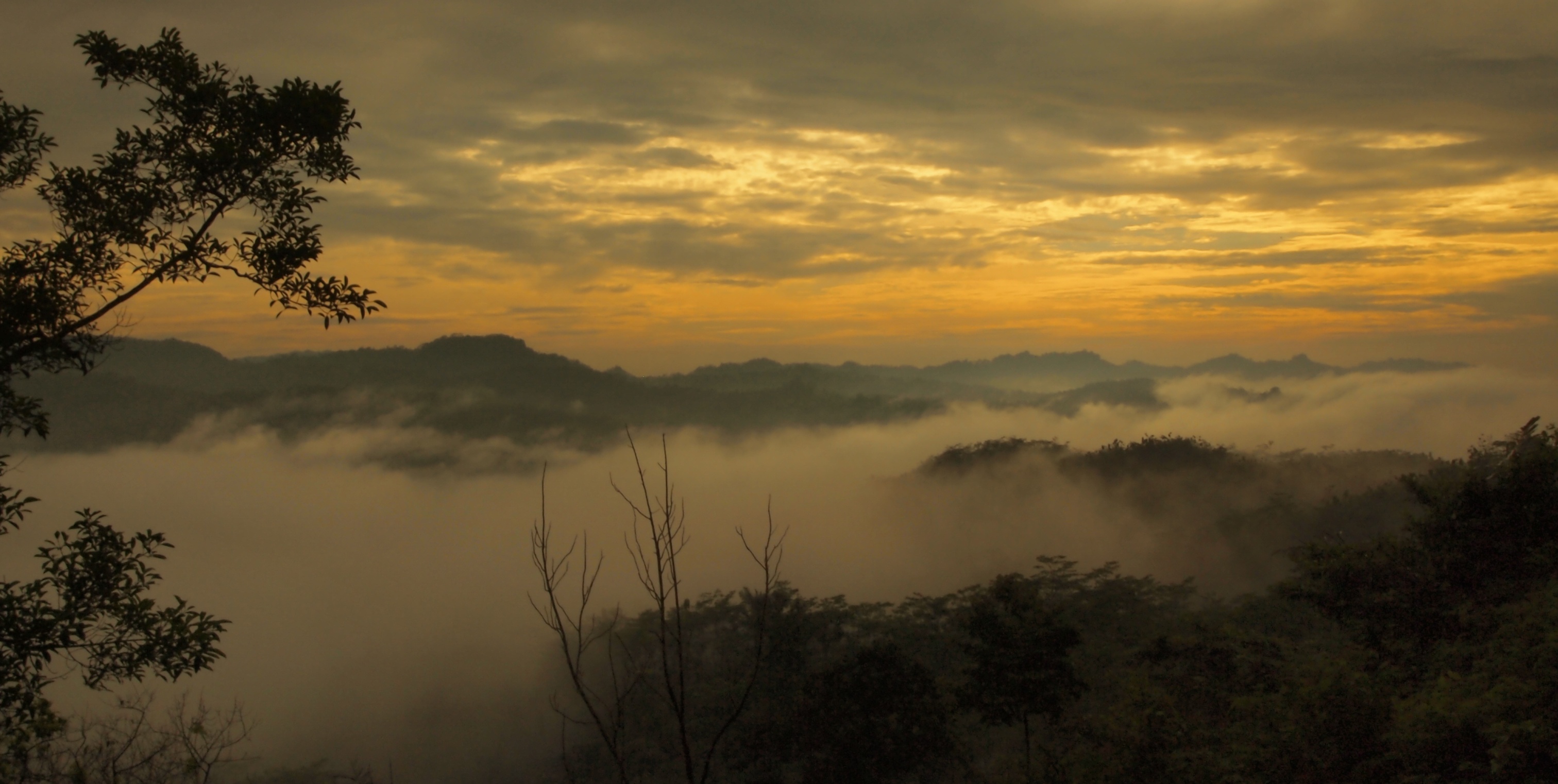
Tasikmalaya Regency is one of Indonesia's foremost tourist destinations. It has a number of accessible tourist attractions, even though many are located deep in the rural area of the regency. In the southern area, where the regency borders the Indian Ocean, tourist destinations are primarily along the coastline of the regency, which features caves and beaches. To the interior—where the land is mostly hilly and characterised by tropical rainforests—waterfalls, natural hot springs, and archaeological sites are the most visited attractions.
Among Tasikmalaya Regency's tourist destinations is Kampung Naga (Dragon Village), an idyllic traditional village where inhabitants have a strong ancient Sundanese tradition. Mount Galunggung's volcanic crater is scenic, featuring a lake surrounded by rainforests. A number of natural hot springs are issued nearby the mountain, adding to the regency's tourist destinations.
List of tourist destinations in Tasikmalaya Regency
There are more than 70 spots of tourist destinations in Tasikmalaya Regency, some of them are listed below.
- Ponpes Suryalaya
- Cakrabuana site
- Geger sunten site
- Cipacing hotspring
- Pamoyanan hotspring
- Rajapolah handicrafts' centre
- Citiis waterfall
- KH. Z. Mustofa grave
- Pamijahan sacred grave
- Manonjaya mosque
- Tanjungmalaya
- Cirahong bridge
- Gimbal and Cilangkap sites
- Kabuyutan Ngarantengah site
- Rd. A. Dewi Sartika grave
- Sukapura museum
- Batik of Sukaraja
- Baginjing grave
- Cigunung hotspring
- Bumi Rongsok site
- Cimanintin waterfall
- Rangga Wulung cave
- Cibalong hotspring
- Cupu Agung cave
- Hulu Kuya cave
- Malawang cave
- Arca and Wayang caves
- Nyai cave and Ciodeng cave
- Jasper Geopark
- Karangtawulan beach
- Cimanuk beach
- Sindangjaya beach
- Padabumi beach
- Kalaparea beach
- Sheikh Zaenudin sacred grave
- Garuda Ngupuk
- Parat cave and Lalay cave
- Cimaranggi cave
- Cipatujah beach
- Cipatujah hotspring
- Bubujung beach
- Joglo sacred grave
- Sarongge cave
- Ambu Hawuk cave
- Dengdeng waterfall
- Pamayang fisherman village
- Sidangkerta turtle conservation
- Sindangkerta/Taman Lengser beach
- Pamayangsari beach
Jasper Geopark
Pasirgintung village (in Cibuniasih subdistrict, Pancatengah district) is known for its numerous red jasper rocks; however, now only about 120 rocks remain. The administration will conserve it as Jasper Geopark.
Notes
References
Notes
- Christomy, Tommy (1959), "Signs of the Wali: Narratives at the sacred sites in Pamijahan, West Java", 201, (Canberra, AU), 2008, . Retrieved 6 January 2011.
- Permadi, Agus (September 1975), "Prasasti Geger Hanjuang; Ngahanjuang-siangkeun Hari Jadi Tasikmalaya", Mangle, 495, (Bandung, ID), 2009, cited in Miftahul Falah (August 21, 2009), "Etimologi Tasikmalaya", (in Indonesia). Retrieved 6 January 2011.
References
- Badan Pusat Statistik, Jakarta, 28 February 2025, ''Kabupaten Tasikmalaya Dalam Angka 2025'' (Katalog-BPS 1102001.3206)
- Biro Pusat Statistik, Jakarta, 2011.
- Badan Pusat Statistik, Jakarta, 2021.
- (2008). "Population and Labour force – West Java". West Java Government.
- [https://www.timesindonesia.co.id/read/news/145390/mencari-kota-santri Mencari Kota Santri]. ''Times Indonesia''. Retrieved April 2, 2021.
- Christomy 1959, p. 22.
- (September 2023). "Agriculture – West Java". West Java Government.
- Permadi 1975, p. 3.
- (September 2023). "Toponimi Jawa Barat". West Java Government.
- "Sejarah Singkat Kabupaten Tasikmalaya". Tasikmalaya Regency Government.
- (2008). "Government – West Java". West Java Government.
- (2004). "Kabupaten Tasikmalaya". West Java Central Agency for Statistic.
- Badan Pusat Statistik, Jakarta, 26 September 2025, ''Kecamatan Cipatujah Dalam Angka 2025'' (Katalog-BPS 1102001.3206010)
- Badan Pusat Statistik, Jakarta, 26 September 2025, ''Kecamatan Karangnunggal Dalam Angka 2025'' (Katalog-BPS 1102001.3206020)
- Badan Pusat Statistik, Jakarta, 26 September 2025, ''Kecamatan Cikalong Dalam Angka 2025'' (Katalog-BPS 1102001.3206030)
- Badan Pusat Statistik, Jakarta, 26 September 2025, ''Kecamatan Pancatengah Dalam Angka 2025'' (Katalog-BPS 1102001.3206040)
- Badan Pusat Statistik, Jakarta, 26 September 2025, ''Kecamatan Cukatomas Dalam Angka 2025'' (Katalog-BPS 1102001.3206050)
- Badan Pusat Statistik, Jakarta, 26 September 2025, ''Kecamatan Cibalong Dalam Angka 2025'' (Katalog-BPS 1102001.3206060)
- Badan Pusat Statistik, Jakarta, 26 September 2025, ''Kecamatan Parungponteng Dalam Angka 2025'' (Katalog-BPS 1102001.3206061)
- Badan Pusat Statistik, Jakarta, 26 September 2025, ''Kecamatan Bantarkalong Dalam Angka 2025'' (Katalog-BPS 1102001.3206070)
- Badan Pusat Statistik, Jakarta, 26 September 2025, ''Kecamatan Bojongasih Dalam Angka 2025'' (Katalog-BPS 1102001.3206071)
- Badan Pusat Statistik, Jakarta, 26 September 2025, ''Kecamatan Culamega Dalam Angka 2025'' (Katalog-BPS 1102001.3206072)
- Badan Pusat Statistik, Jakarta, 26 September 2025, ''Kecamatan Bojonggambir Dalam Angka 2025'' (Katalog-BPS 1102001.3206080)
- Badan Pusat Statistik, Jakarta, 26 September 2025, ''Kecamatan Sodonghilir Dalam Angka 2025'' (Katalog-BPS 1102001.3206090)
- Badan Pusat Statistik, Jakarta, 26 September 2025, ''Kecamatan Taraju Dalam Angka 2025'' (Katalog-BPS 1102001.3206100)
- Badan Pusat Statistik, Jakarta, 26 September 2025, ''Kecamatan Puspahiang Dalam Angka 2025'' (Katalog-BPS 1102001.3206111)
- Badan Pusat Statistik, Jakarta, 26 September 2025, ''Kecamatan Tanjungjaya Dalam Angka 2025'' (Katalog-BPS 1102001.3206120)
- Badan Pusat Statistik, Jakarta, 26 September 2025, ''Kecamatan Sukaraja Dalam Angka 2025'' (Katalog-BPS 1102001.3206130)
- Badan Pusat Statistik, Jakarta, 26 September 2025, ''Kecamatan Salopa Dalam Angka 2025'' (Katalog-BPS 1102001.3206140)
- Badan Pusat Statistik, Jakarta, 26 September 2025, ''Kecamatan Jatiwaras Dalam Angka 2025'' (Katalog-BPS 1102001.3206141)
- Badan Pusat Statistik, Jakarta, 26 September 2025, ''Kecamatan Cineam Dalam Angka 2025'' (Katalog-BPS 1102001.3206150)
- Badan Pusat Statistik, Jakarta, 26 September 2025, ''Kecamatan Karangjaya Dalam Angka 2025'' (Katalog-BPS 1102001.3206151)
- Badan Pusat Statistik, Jakarta, 26 September 2025, ''Kecamatan Manonjaya Dalam Angka 2025'' (Katalog-BPS 1102001.3206160)
- Badan Pusat Statistik, Jakarta, 26 September 2025, ''Kecamatan Gunungtanjung Dalam Angka 2025'' (Katalog-BPS 1102001.3206161)
- Badan Pusat Statistik, Jakarta, 26 September 2025, ''Kecamatan Salawu Dalam Angka 2025'' (Katalog-BPS 1102001.3206110)
- Badan Pusat Statistik, Jakarta, 26 September 2025, ''Kecamatan Singaparna Dalam Angka 2025'' (Katalog-BPS 1102001.3206190)
- Badan Pusat Statistik, Jakarta, 26 September 2025, ''Kecamatan Sukarame Dalam Angka 2025'' (Katalog-BPS 1102001.3206191)
- Badan Pusat Statistik, Jakarta, 26 September 2025, ''Kecamatan Mangunreja Dalam Angka 2025'' (Katalog-BPS 1102001.3206192)
- Badan Pusat Statistik, Jakarta, 26 September 2025, ''Kecamatan Cigalontang Dalam Angka 2025'' (Katalog-BPS 1102001.3206200)
- Badan Pusat Statistik, Jakarta, 26 September 2025, ''Kecamatan Leuwisari Dalam Angka 2025'' (Katalog-BPS 1102001.3206210)
- Badan Pusat Statistik, Jakarta, 26 September 2025, ''Kecamatan Padakembang Dalam Angka 2025'' (Katalog-BPS 1102001.3206212)
- Badan Pusat Statistik, Jakarta, 26 September 2025, ''Kecamatan Sariwangi Dalam Angka 2025'' (Katalog-BPS 1102001.3206211)
- Badan Pusat Statistik, Jakarta, 26 September 2025, ''Kecamatan Sukaratu Dalam Angka 2025'' (Katalog-BPS 1102001.3206221)
- Badan Pusat Statistik, Jakarta, 26 September 2025, ''Kecamatan Cisayong Dalam Angka 2025'' (Katalog-BPS 1102001.3206230)
- Badan Pusat Statistik, Jakarta, 26 September 2025, ''Kecamatan Sukahening Dalam Angka 2025'' (Katalog-BPS 1102001.3206231)
- Badan Pusat Statistik, Jakarta, 26 September 2025, ''Kecamatan Rajapolah Dalam Angka 2025'' (Katalog-BPS 1102001.3206240)
- Badan Pusat Statistik, Jakarta, 26 September 2025, ''Kecamatan Jamanis Dalam Angka 2025'' (Katalog-BPS 1102001.3206250)
- Badan Pusat Statistik, Jakarta, 26 September 2025, ''Kecamatan Ciawi Dalam Angka 2025'' (Katalog-BPS 1102001.3206260)
- Badan Pusat Statistik, Jakarta, 26 September 2025, ''Kecamatan Kadipaten Dalam Angka 2025'' (Katalog-BPS 1102001.3206261)
- Badan Pusat Statistik, Jakarta, 26 September 2025, ''Kecamatan Pagerageung Dalam Angka 2025'' (Katalog-BPS 1102001.3206270)
- Badan Pusat Statistik, Jakarta, 26 September 2025, ''Kecamatan Sukjaresik Dalam Angka 2025'' (Katalog-BPS 1102001.3206271)
- "Selayang Pandang Kabupaten Tasikmalaya". West Java Government.
- (2008). "Geographical Condition – West Java". West Java Government.
- Horikoshi, Hiroko (1975). The Dar ul-Islam movement in West Java (1948–62): an experience in the historical process. ''Indonesia'' 20:58-86.
- (2007). "Updated world map of the Koppen-Geiger climate classification". Hydrology and Earth System Sciences.
- "Peta Jawa Barat". West Java Government.
- Badan Pusat Statistik, Jakarta, 2020.
- "Peta Jawa Barat". West Java Government.
- (June 24, 2018). "Best Places to Visit in Tasikmalaya Regency".
- Redaktur1. "Peta Obyek Wisata Tasik". Tasikmalaya Regency Government.
- [http://www.pikiran-rakyat.com/node/150558 Jasper Geopark]
This article was imported from Wikipedia and is available under the Creative Commons Attribution-ShareAlike 4.0 License. Content has been adapted to SurfDoc format. Original contributors can be found on the article history page.
Ask Mako anything about Tasikmalaya Regency — get instant answers, deeper analysis, and related topics.
Research with MakoFree with your Surf account
Create a free account to save articles, ask Mako questions, and organize your research.
Sign up freeThis content may have been generated or modified by AI. CloudSurf Software LLC is not responsible for the accuracy, completeness, or reliability of AI-generated content. Always verify important information from primary sources.
Report