From Surf Wiki (app.surf) — the open knowledge base
Tanyard Creek Park
Tanyard Creek Park is a 14.5 acre park in the Buckhead area of Atlanta. It is located along Tanyard Creek between Collier Road on the north and BeltLine rail corridor to the south. The neighborhood of Collier Hills borders it on the west and Collier Hills North on the east.
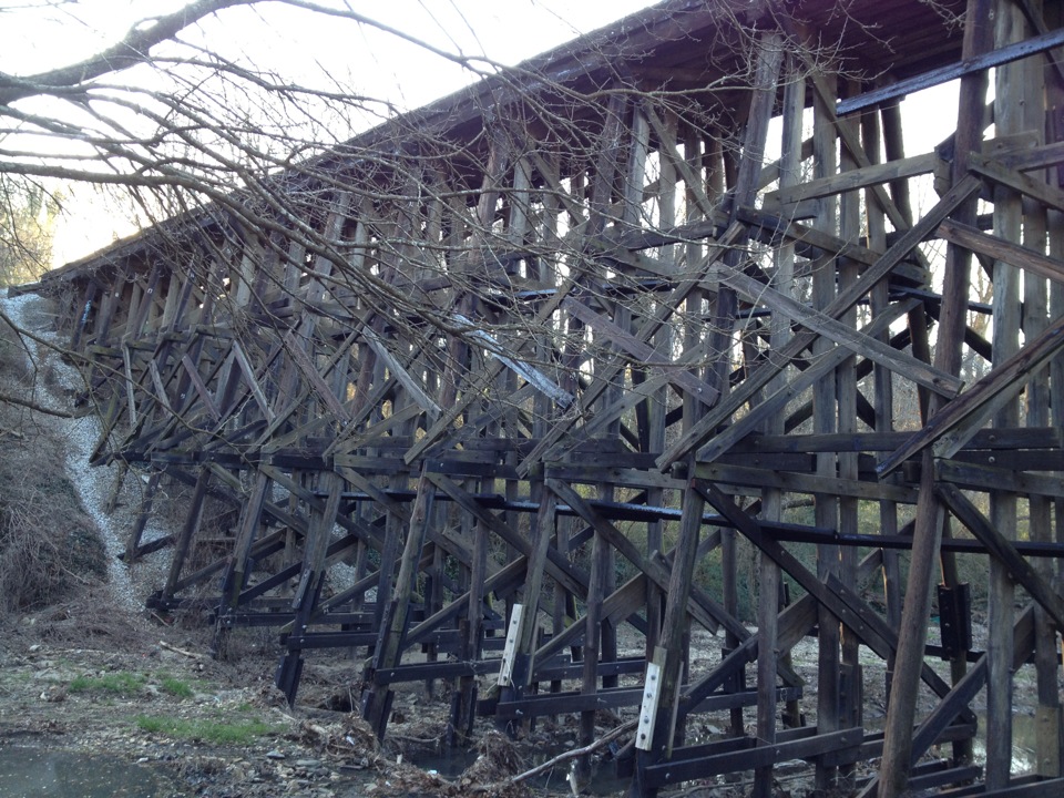
A 1 mi-long BeltLine trail runs through the park - not along the BeltLine rail corridor itself but perpendicular to it. The trail begins at the west end of Colonial Homes neighborhood, proceeds west along the south end of Bobby Jones Golf Course, Louise G. Howard Park, under Collier Road and through Tanyard Creek Park, under a trestle bridge (active CSX rail line), connecting to both Ardmore Park in the Ardmore neighborhood and into the Tanyard Creek Urban Forest. The trail, and urban forest, terminates at Semel Circle, a new infill development area at the back of Brookwood neighborhood. The trail opened in April 2010.
The Civil War Battle of Peachtree Creek took place in and around the park.
References
References
- [http://www.atlantaga.gov/government/parks/burparks_parklocations.aspx "Park Locations", ''City of Atlanta online''] {{Webarchive. link. (2010-06-04)
- "Beltline trail opening ceremony, park clean-up on Saturday | Fresh Loaf".
This article was imported from Wikipedia and is available under the Creative Commons Attribution-ShareAlike 4.0 License. Content has been adapted to SurfDoc format. Original contributors can be found on the article history page.
Ask Mako anything about Tanyard Creek Park — get instant answers, deeper analysis, and related topics.
Research with MakoFree with your Surf account
Create a free account to save articles, ask Mako questions, and organize your research.
Sign up freeThis content may have been generated or modified by AI. CloudSurf Software LLC is not responsible for the accuracy, completeness, or reliability of AI-generated content. Always verify important information from primary sources.
Report