From Surf Wiki (app.surf) — the open knowledge base
Taitung County

| Field | Value | |
|---|---|---|
| name | Taitung County | |
| official_name | ||
| native_name | 臺東縣 | |
| other_name | Taitō, Tâi-tang | |
| settlement_type | County | |
| image_skyline | Taitung County Montage.png | |
| image_caption | Top: View of Orchid Island, from Ji-teiwan, Second left: Zhiben Spa area, Second right: A view of downtown Taitung, Third left: View of White Sand Bay in Taimali Township, Third right: A memorial for Yami people's boat in Orchid Island, Bottom: A coast of Xiaoyeliu | |
| image_flag | Flag of Taitung County.svg | |
| image_seal | Emblem of Taitung County (2014).svg | |
| seal_type | Logo | |
| image_map | ||
| image_map1 | Taiwan ROC political division map Taitung County.svg | |
| coordinates | ||
| subdivision_type | Country | |
| subdivision_name | ||
| subdivision_type2 | Region | |
| subdivision_name2 | Eastern Taiwan | |
| seat_type | Seat | |
| seat | Taitung City | |
| iso_code | TW-TTT | |
| seat1_type | Largest city | |
| seat1 | Taitung City | |
| parts | 1 cities, 15 (2 urban, 13 rural) townships | |
| leader_title | County Magistrate | |
| leader_name | April Yao (KMT) | |
| area_total_km2 | 3,515.2526 | |
| area_rank | 3 of 22 | |
| population_total | 211681 | |
| population_as_of | September 2023 | |
| population_rank | 22 of 22 | |
| population_density_km2 | auto | |
| timezone | National Standard Time | |
| utc_offset | +8 | |
| website | ||
| module | {{Infobox place symbols | embedded=yes |
| flower | Moth orchid (Phalaenopsis) | |
| tree | Camphor tree (Cinnamomum camphora) |
Taitung{{efn native lang|tw|name=word1
Name
While its name means "Eastern Taiwan", it is also known as "Houshan" () by many of the locals, meaning behind the mountains or the back mountains.
History
Qing dynasty
In 1887, the new Fujian-Taiwan Province included Taitung Prefecture as one of four prefectures.
Empire of Japan
Main article: Taitō Prefecture
During the Japanese rule of Taiwan, Taitung County was administered as Taitō Prefecture.
Republic of China
After the handover of Taiwan from Japan to the Republic of China on 25 October 1945, Taitung was established as a county of Taiwan Province on 25 December the same year.
Geography

Taitung runs along the southeastern coast of Taiwan. Taitung County, controlling 3515 km2 is the 3rd largest county in Taiwan after Hualien County and Nantou County. Mainland Taitung County's coastline is 166 km long. The Huatung Valley runs along the northern half of the county. Taitung currently has a population of 234,123.
Due in part to its remote location and isolation by mountains from Taiwan's main population centers, Taitung was the last part of the island to be colonized by Han Chinese immigrants (late 19th century). Throughout the 20th century Taitung remained an economic backwater. Sparsely populated even today, this isolation may have been a blessing in disguise, as Taitung mostly escaped the urbanization and pollution that have come to plague much of the island's lowland areas.
In addition to the area on Taiwan proper, the county includes two major islands, Green Island or Isla Verde and Orchid Island. Green Island was home to an infamous penal colony used for political prisoners during the "White Terror" period of Chinese Nationalist (KMT) rule (from 1947 until the end of martial law in 1987). Orchid Island, home of the Tao people (Taiwanese aborigines closely related to the people of the northern Philippines), has become a major tourist attraction despite the government-operated Taiwan Power Company's controversial use of part of the island as a nuclear waste dump.
Government


Administrative divisions
Taitung County is divided into 1 city, 2 urban townships, 8 rural townships and 5 mountain indigenous townships. Taitung County has the second highest number of mountain indigenous townships in Taiwan after Pingtung County. The seat of the county is located at Taitung City, where it houses the Taitung County Government and Taitung County Council. The current Magistrate of Taitung County is April Yao of the Kuomintang. After streamlining of Taiwan Province in 1998, the county has since directly governed by the Executive Yuan.
| Type | Name | Chinese | Taiwanese | Hakka | Formosan | Japanese and other |
|---|---|---|---|---|---|---|
| City | Taitung City | Tâi-tang | Thòi-tûng | PusungAmis, Paiwan, Puyuma | ||
| **Urban | ||||||
| townships** | Chenggong | Sêng-kong | Sṳ̀n-kûng | MadawdawAmis | ||
| Guanshan | Koan-san | Kûan-sân | KinalaunganBunun | |||
| **Rural | ||||||
| townships** | Beinan | Pi-lâm | Pî-nàm | PuyumaAmis, Puyuma, PinangRukai | ||
| Changbin | Tn̂g-pin | Tshòng-pîn | KakacawanAmis | Nagahama (長浜) | ||
| Chishang (Chishang) | Tî-siōng | Tshṳ̀-song | Ikegami (池上) | |||
| Dawu | Tāi-bú | Thai-vú | PalangoePaiwan | |||
| Donghe | Tong-hô | Tûng-hò | FafukodAmis | |||
| Ludao | Le̍k-tó | Liu̍k-tó | SanasayAmis, JitanaseyYami | Green Island | ||
| Luye | Lo̍k-iá | Lu̍k-yâ | Shikano (鹿野) | |||
| Taimali | Thài-mâ-lí | Thai-mà-lî | TjavualjiAmis, Paiwan | |||
| **Mountain | ||||||
| indigenous | ||||||
| townships** | Daren | Ta̍t-jîn | Tha̍t-yìn | TadrenPaiwan | ||
| Haiduan | Hái-toaⁿ | Hói-tôn | HaitutuanBunun | |||
| Jinfeng (Jinfong) | Kim-hong | Kîm-fûng | KinzangPaiwan | |||
| Lanyu | Lân-sū | Làn-yí | Ponso no TaoYami | Orchid Island | ||
| Yanping | Iân-pêng | Yèn-phìn | InpiingBunun |
Colors indicates the common languages status of Hakka and Formosan languages within each division.
Politics
Taitung County elected one Democratic Progressive Party legislator to the Legislative Yuan during the 2016 legislative election.
Demographics
|1985 |276389 |1990 |256803 |1995 |254375 |2000 |245312 |2005 |235957 |2010 |230673 |2015 |222452 Taitung County is home to seven aboriginal ethnicities, including Amis, Bunun, Kavalan, Paiwan, Puyuma, Rukai and Yami. Taitung County has the largest aboriginal to overall population of a county or city in Taiwan, at 35.5%.
Education
Education in Taitung County is administered under the Education Department of the Taitung County Government.
- National Taitung University
- National Taitung Junior College
Culture
Taitung County possesses a very diverse collection of aboriginal cultures. Because Taitung is probably one of the least affected counties by the settlement of the Han Chinese, most of the aboriginal cultures are still very much a part of everyday society.
Energy
Taitung County houses the Lanyu Power Plant, a 6.5 MW fuel-fired power plant located in Orchid Island.
Tourist attractions

Buildings
Duoliang Station, Kunci Temple, Green Island Lighthouse, Moving Castle and Taitung Chinese Association.
Historical sites
Beinan Cultural Park, Dulan Site and Green Island White Terror Memorial Park.
Museums and galleries
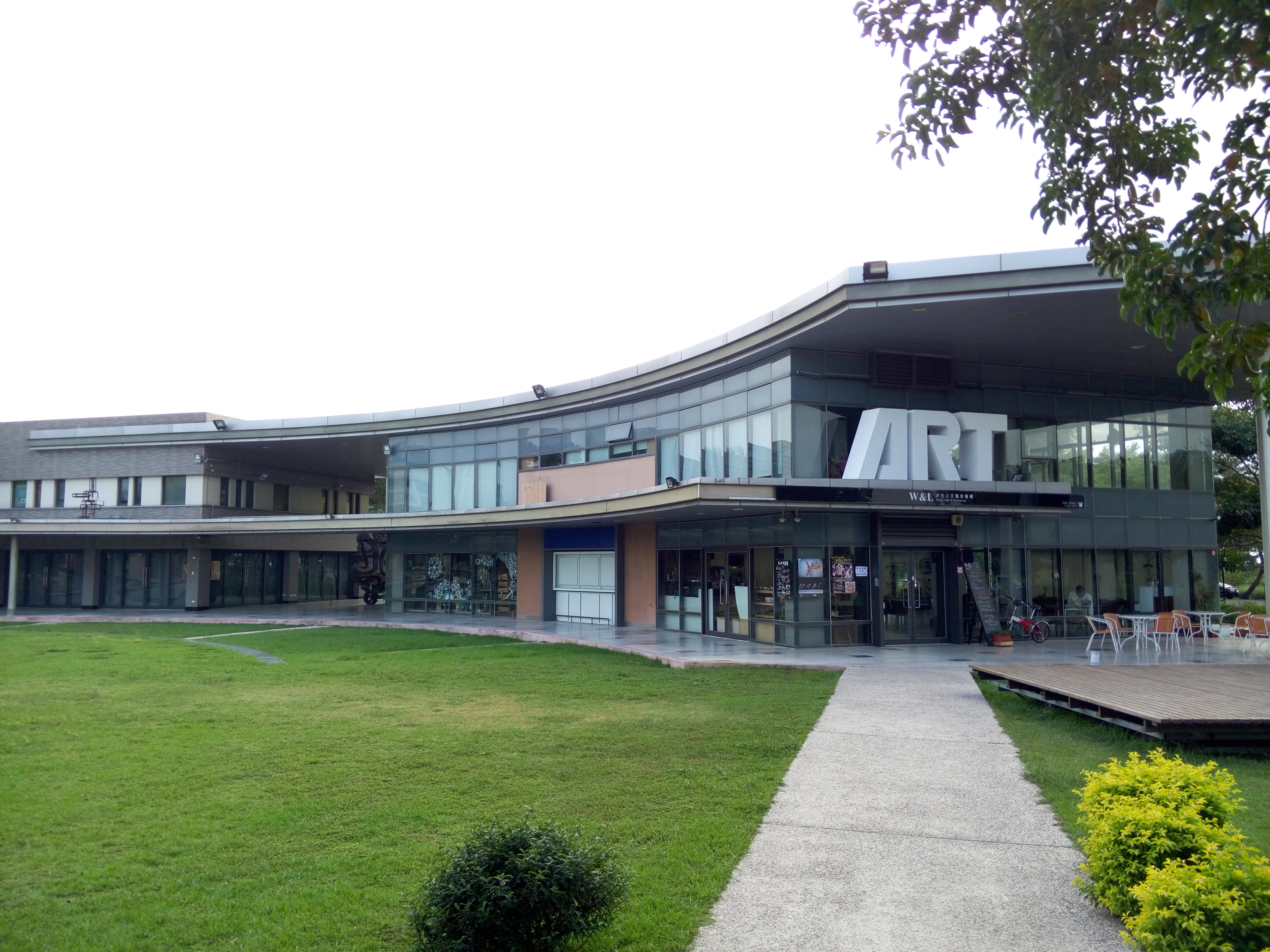
Lanyu Flying Fish Cultural Museum, National Museum of Prehistory, Rice Village Museum, Taitung Aboriginal Gallery, Taitung Art Museum, Taitung County Museum of Natural History, Taitung Performing Art Center, Taitung Story Museum, Wu Tao Chishang Lunch Box Cultural History Museum.
Nature
Baxian Caves, Chulu Ranch, Dapo Pond, , , Green Island, Zhiben National Forest Recreation Area, Mount Dulan, Orchid Island, Sanxiantai, Sika Deer Ecological Park, Taitung Forest Park, Xiangyang National Forest Recreation Area and Zhaori Hot Spring.
Theme parks
Bunun Tribal Leisure Farm
Transportation
Air
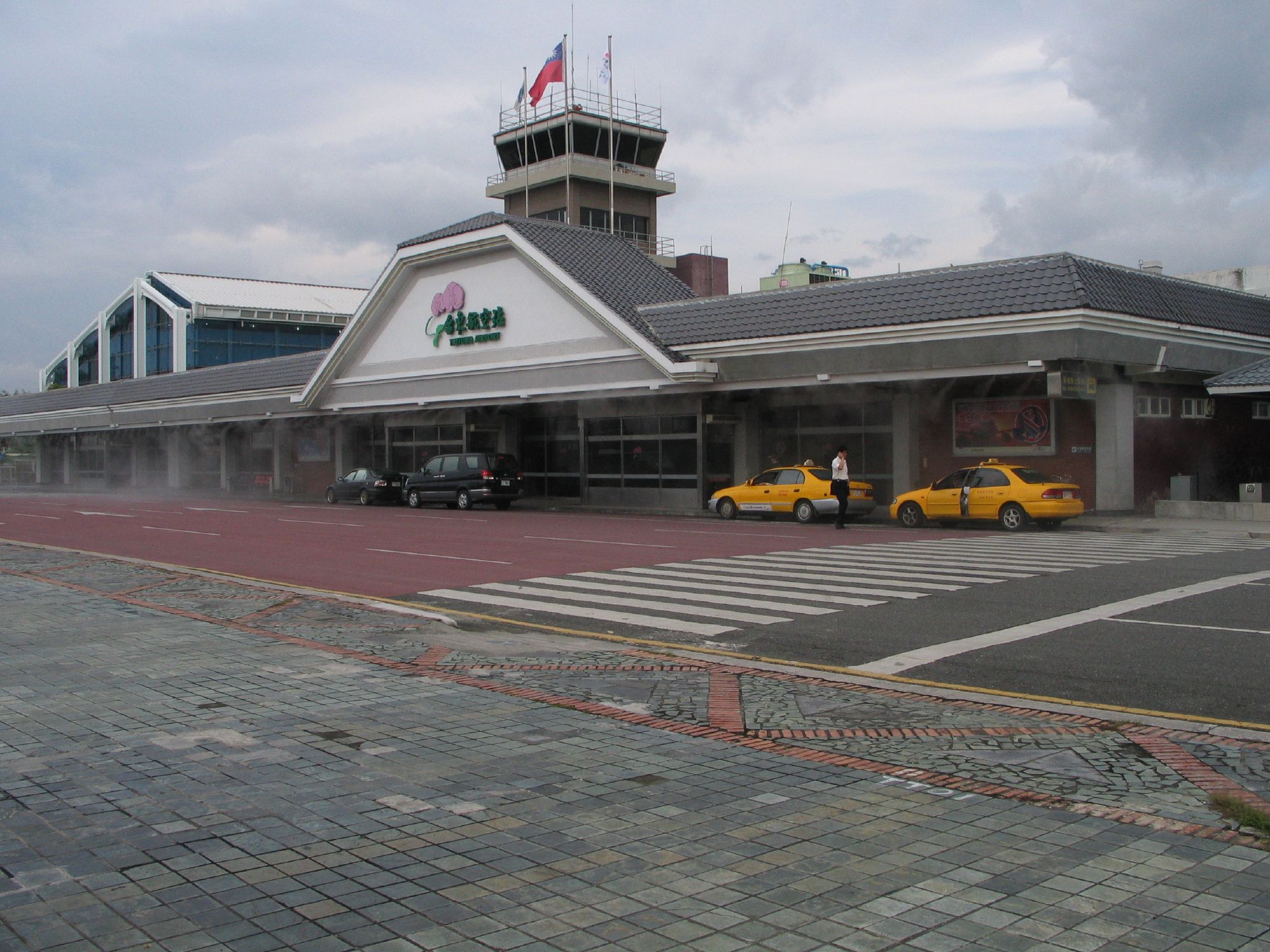
Taitung County houses the international Taitung Airport in the mainland Taitung County of Taitung City and another two airports at the outlying islands, which are Green Island Airport in Green Island and Lanyu Airport in Orchid Island.
Rail
Taitung County is crossed by two Taiwan Railway lines of South-Link Line and Hualien–Taitung Line. The stations consist of Chishang, Dawu, Guanshan, Guzhuang, Haiduan, Jinlun, Kangle, Longxi, Luye, Ruihe, Ruiyuan, Shanli, Taimali, Taitung and Zhiben Station.
Water
Chenggong Fish Harbor, Fugang Fishery Harbor and Green Island Nanliao Harbor.
Notable natives
- Yu Chang, Major League Baseball player
- Yang Chuan-kwang, 1960 Summer Olympics decathlon medalist
- Tank, singer
- A-Mei, singer
- Cudjuy Patjidres, tattoo artist
Relative location
Notes
References
References
- (1903). "The Island of Formosa, Past and Present : history, people, resources, and commercial prospects : tea, camphor, sugar, gold, coal, sulphur, economical plants, and other productions". Macmillan & co..
- "Taitung County Government English-About Taitung".
- "About Taitung".
- "Township (City) Offices".
- link. (August 2020). Ministry of the Interior]]
- "2016 The 14th Presidential and Vice Presidential Election and The 9th Legislator Election".
- "Taitung County Government English".
- "Amis remains Taiwan's biggest aboriginal tribe at 37.1% of total".
- link
- "The Ethnics".
- "Yu Chang #2". MLB Advanced Media, LP..
This article was imported from Wikipedia and is available under the Creative Commons Attribution-ShareAlike 4.0 License. Content has been adapted to SurfDoc format. Original contributors can be found on the article history page.
Ask Mako anything about Taitung County — get instant answers, deeper analysis, and related topics.
Research with MakoFree with your Surf account
Create a free account to save articles, ask Mako questions, and organize your research.
Sign up freeThis content may have been generated or modified by AI. CloudSurf Software LLC is not responsible for the accuracy, completeness, or reliability of AI-generated content. Always verify important information from primary sources.
Report