From Surf Wiki (app.surf) — the open knowledge base
Syr Darya
River in Central Asia

River in Central Asia
| Field | Value |
|---|---|
| name | Syr Darya |
| native_name | |
| name_other | Jaxartes |
| image | Syr Darya.jpg |
| image_size | 250px |
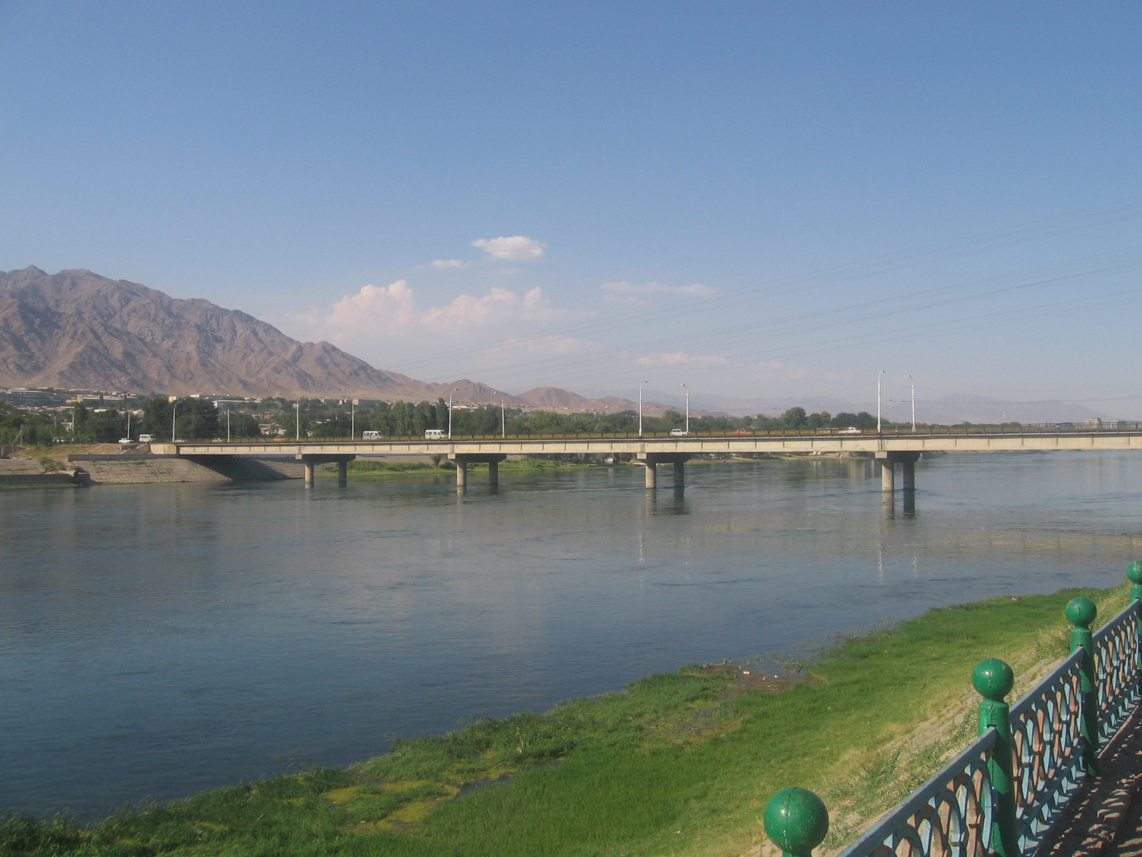
| image_caption | Syr Darya at Kyzylorda, Kazakhstan |
| map | Aral_Sea_watershed.png |
| map_caption | Map of area around the Aral Sea. Aral Sea boundaries are c. 2008. The Syr Darya drainage basin is in yellow, and the Amu Darya basin in orange. |
| mapframe | yes |
| mapframe-zoom | 4 |
| subdivision_type1 | Country |
| subdivision_name1 | Kyrgyzstan, Uzbekistan, Tajikistan, Kazakhstan |
| subdivision_type5 | Cities |
| subdivision_name5 | Khujand, TJ, Tashkent, UZ, Turkestan, KZ, Kyzylorda, KZ, Baikonur, KZ |
| length | 2256.25 km |
| discharge1_min | 170 m3/s |
| discharge1_avg | 1180 m3/s |
| discharge1_max | 3,900 m3/s |
| source1 | Confluence of Naryn and Kara Darya |
| source1_location | Fergana Valley, Uzbekistan |
| source1_coordinates | |
| source1_elevation | 400 m |
| mouth | North Aral Sea |
| mouth_location | Kazaly, Kazakhstan |
| mouth_coordinates | |
| mouth_elevation | 42 m |
| basin_size | 402760 km2 |
| tributaries_left | Kara |
| tributaries_right | Naryn, Chirciq, Arys, Sarysu |
| custom_label | Protection status |
| custom_data | {{Designation list |
| embed | yes |
| designation1 | Ramsar |
| designation1_offname | Lesser Aral Sea and Delta of the Syrdarya River |
| designation1_date | 2 February 2012 |
| designation1_number | 2083}} |
| mapframe-zoom = 4
The Syr Darya, historically known as the Jaxartes ( ; ), is a river in Central Asia. The name, which is Persian, literally means Syr Sea or Syr River. It originates in the Tian Shan mountains in Kyrgyzstan and eastern Uzbekistan, and flows for 2256.25 km west and north-west through Uzbekistan, Sughd province of Tajikistan, and southern Kazakhstan to the northern remnants of the Aral Sea. It is the northern and eastern of the two main rivers in the endorheic basin of the Aral Sea, the other being the Amu Darya.
During the Soviet era, extensive irrigation projects were constructed around both rivers, diverting their water into farmland and causing, during the post-Soviet era, the virtual disappearance of the Aral Sea, once the world's fourth-largest lake. The point at which the river flows from Tajikistan into Uzbekistan is, at 300 m above sea level, the lowest elevation in Tajikistan.
Name
The second part of the name (darya, ) means "lake" or "sea" in Persian and "river" in the Central Asian Persian. The current name dates only from the 18th century.
The earliest recorded name was Jaxartes or Iaxartes (Ἰαξάρτης) in Ancient Greek, consist of two morpheme Iaxa and artes, found in several sources, including those relating to Alexander the Great. This variant of the Greek name hearkens back to the Old Persian name Yakhsha Arta ("True Pearl"), perhaps a reference to the color of its glacially-fed water. However there is also usage of the name Tanais river in certain sources, such as those of Arrian, a possible usage of the actual Tanais River's name to represent a furthest east river by distance. More evidence for the Persian etymology comes from the river's Turkic name up to the time of the Arab conquest, the Yinçü, or "Pearl river", from Middle Chinese 眞珠 *t͡ɕiɪn-t͡ɕɨo. Tang Chinese also recorded this name as Yaosha River 藥殺水 (MC: *jɨɐk-ʃˠɛt) and later Ye River 葉河 (MC: *jiɛp).
The current local name of the river, Syr (Sïr), does not appear before the 16th century. In the 17th century, Abu al-Ghazi Bahadur Khan, historian and ruler of Khiva, called the Aral Sea the "Sea of Sïr," or Sïr Tengizi.
The important evidence is the etymology of the name of the Syr-Darya River mentioned by the ancient authors – Yaksart, established by V. A. Livshits (2003: 10). It means 'flowing' or 'streaming'. The word belongs to the Sogdian dialect that had emerged from the Saka language group.
History
When the Macedonian army of Alexander the Great reached the Jaxartes in 329 BC, after travelling through Bactria and Sogdia without encountering any opposition, they met with the first instances of native resistance to their presence. In October 329 BC the Macedonians fought the Battle of Jaxartes against the Saka, killing some 1,200 combatants including the leader of the nomads. Alexander was forced to retire south to deal with a revolt in Sogdia. Alexander was wounded in the fighting that ensued and the native tribes took to attacking the Macedonian garrisons stationed in their towns. As the revolt against Alexander intensified it spread through Sogdia, plunging it into two years of warfare, the intensity of which surpassed any other conflict of the Anabasis Alexandri.
On the shores of the Syr Darya, Alexander placed a garrison in the City of Cyrus (Cyropolis in Greek), which he then renamed after himself Alexandria Eschate—"Alexandria the furthest"—in 329 BC. For most of its history since at least the Muslim conquest of Central Asia in the 7th to 8th centuries AD, the name of this city (in present-day Tajikistan) has been Khujand.
In the mid-19th century, during the Russian conquest of Turkestan, the Russian Empire introduced steam navigation to the Syr Darya, initially from Fort Raim but with an important river port at Kazalinsk (Kazaly) from 1847 to 1882, when service ceased.
During the Soviet era, a resource-sharing system was instituted in which Kyrgyzstan and Tajikistan shared water originating from the Amu Darya and Syr Darya rivers with Kazakhstan, Turkmenistan, and Uzbekistan in summer. In return, Kyrgyzstan and Tajikistan received Kazakh, Turkmen, and Uzbek coal, gas, and electricity in winter. After the 1991 fall of the Soviet Union, this system disintegrated and the Central Asian nations have failed to reinstate it. Inadequate infrastructure, poor water-management, and outdated irrigation methods all exacerbate the issue. International Crisis Group. "Water Pressures in Central Asia", CrisisGroup.org. 11 September 2014. Retrieved 6 October 2014.
In 2012, the Syrdarya–Turkestan State Regional Natural Park was opened in Kazakhstan, in hopes of protecting the river plain ecosystems, archaeological sites, and historical-cultural monuments, as well as plants and animal species, some of which are rare or endangered.
Geography
The river rises in two headstreams in the Tian Shan Mountains in Kyrgyzstan and eastern Uzbekistan—the Naryn River and the Kara Darya which come together in the Uzbek part of the Fergana Valley—and flows for some 2212 km west and north-west through Uzbekistan and southern Kazakhstan to the remains of the Aral Sea. The Syr Darya drains an area of over 800000 km2, but no more than 160000 km2 actually contribute significant flow to the river:{{cite conference|last1=Agaltseva|first1=N.A.|last2=Borovikova
Along its course, the Syr Darya irrigates the most productive agricultural regions in Central Asia. After crossing the Kazakhstan–Uzbekistan border, Syr Darya meets the Shardara Dam, which is connected to the Aydar Lake. Syr Darya then flows north, before turning west and emptying into the North Aral Sea.
Various local governments throughout history have built and maintained an extensive system of canals. These canals are of central importance in this arid region. Many fell into disuse in the 17th and early 18th century, but the Khanate of Kokand rebuilt many in the 19th century, primarily along the Upper and Middle Syr Darya.
Ecological damage
Massive expansion of irrigation canals in Middle and Lower Syr Darya during the Soviet period to water cotton and rice fields caused ecological damage to the area. The amount of water taken from the river was such that in some periods of the year, no water at all reached the Aral Sea. The Amu Darya in Uzbekistan and Turkmenistan faced a similar situation.
Main article: Northern river reversal
The uranium concentration of the stream water is increased in Tajikistan with values of 43 μg/L and 12 μg/L; the WHO guideline value for drinking water of 30 μg/L is partly exceeded. The main input of uranium occurs upstream in Uzbekistan and Kyrgyzstan.
Notes
References
References
- Daene C. McKinney. "Cooperative Management of Transboundary Water Resources in Central Asia". Ce.utexas.edu.
- "Lesser Aral Sea and Delta of the Syrdarya River".
- "Tajikistan".
- (1 March 2010). "Territorial and border issues".
- "General information about Tajikistan".
- "Sïr Daryā." Encyclopaedia of Islam, Second Edition. Edited by: P. Bearman, Th. Bianquis, C.E. Bosworth, E. van Donzel, W.P. Heinrichs. Brill Online, 2014.
- James, Dylan. (2020). "Arrian?s Indica 27.1 (FGrH 133 F 1 III)". Mnemosyne.
- В. В. Бартольд. К истории орошения Туркестана. (On the history of Irrigation in Turkestan) in Работы по исторической географии (Works on Historical Geography). Moscow: Vostochnaia Literatura, 2002. Pages 210-231
- Tekin, Talat. (1997). "Notes on Some Chinese Loanwords in Old Turkic". Türk Dilleri Araştırmaları.
- Koryakova, Ludmila. (2008-06-01). "Review at Cambridge Core- Elena E. Kuzmina (edited by J.P. Mallory): The Origins of the Indo-Iranians. xviii+762 pages, 132 figures. 2007. Leiden: Brill; 978-90-04-16054-5 hardback.". Antiquity Publications.
- (1989). "Alexander the Great and Bactria: The Formation of a Greek Frontier in Central Asia". Brill.
- (1877). "l'Asie Centrale Et Le Réveil De La Question D'Orient". Revue des Deux Mondes (1829-1971).
- "Сырдарья-Туркестанский государственный региональный природный парк". [[Tomsk State University]].
- (2018). "Monitoring of uranium concentrations in water samples collected near potentially hazardous objects in North-West Tajikistan". Journal of Environmental Radioactivity.
This article was imported from Wikipedia and is available under the Creative Commons Attribution-ShareAlike 4.0 License. Content has been adapted to SurfDoc format. Original contributors can be found on the article history page.
Ask Mako anything about Syr Darya — get instant answers, deeper analysis, and related topics.
Research with MakoFree with your Surf account
Create a free account to save articles, ask Mako questions, and organize your research.
Sign up freeThis content may have been generated or modified by AI. CloudSurf Software LLC is not responsible for the accuracy, completeness, or reliability of AI-generated content. Always verify important information from primary sources.
Report