From Surf Wiki (app.surf) — the open knowledge base
Sursand
Town in Bihar

Town in Bihar
| Field | Value |
|---|---|
| name | Sursand |
| settlement_type | Town |
| image_skyline | Sursand temple 3.jpg |
| image_size | 320px |
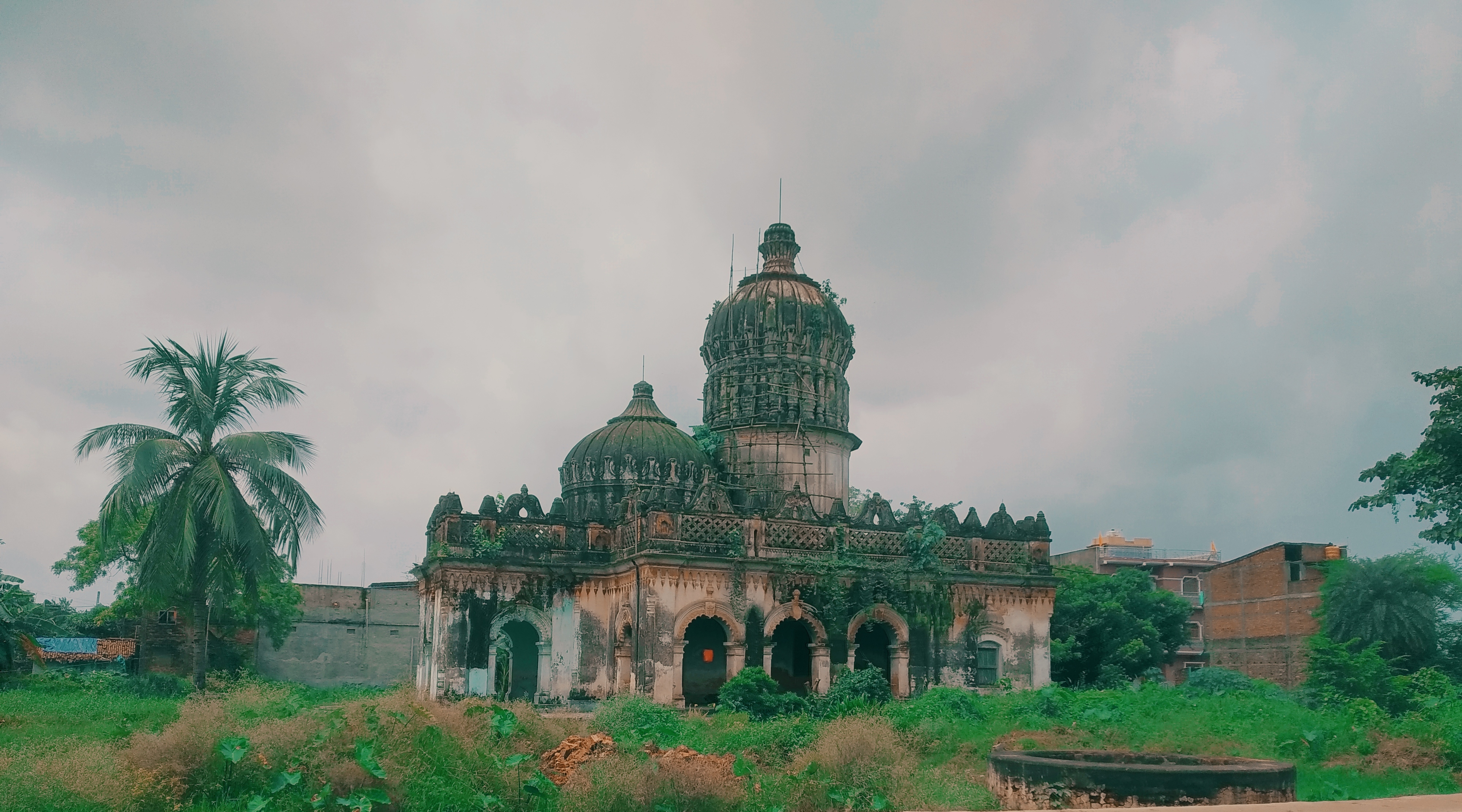
| image_caption | An ancient temple locally known as Choraut Mandir in Sursand |
| pushpin_map | India Bihar |
| pushpin_label_position | right |
| pushpin_map_caption | Location in Bihar, India |
| coordinates | |
| subdivision_type | Country |
| subdivision_name | India |
| subdivision_type1 | State |
| subdivision_name1 | Bihar |
| subdivision_type2 | Region |
| subdivision_name2 | Mithila |
| subdivision_type3 | District |
| subdivision_name3 | Sitamarhi |
| established_title | |
| government_type | Nagar Panchayat |
| unit_pref | Metric |
| elevation_m | 55 |
| elevation_footnotes | |
| population_total | 29688 |
| population_as_of | 2011 |
| population_density_km2 | auto |
| demographics_type1 | Languages |
| demographics1_title1 | Official |
| demographics1_info1 | Maithili, Hindi |
| timezone1 | IST |
| utc_offset1 | +5:30 |
| postal_code_type | |
| postal_code | 843331 |
| registration_plate | BR-30 |
| blank1_name_sec1 | Coastline |
| blank1_info_sec1 | 0 km |
Sursand or Sursand Raj is an Indian town in the Mithila region of Bihar near the Indo-Nepal border. It is about 25 kilometres away from Sitamarhi, the district headquarters, and approximately 5 kilometers away from Bhitthamore.
History
The village has the ruins of a fortress known as Sursandgarh, which was constructed during the Mughal period by King Sursen.
According to an account published in the Bengal District Gazetteers,
The name of the place is said to be derived from Sur Sen, a chieftain who once lived there. After his death, it lapsed once more into jungle, until it was reclaimed by two brothers—Mahesh Jha and Amar Jha, the founders of the present Sursand family. These brothers, the story runs, left their home at Ghograha, in the district of Darbhanga, and came to settle at Jadupati, a village belonging to them, 8 miles from Sursand. One day Mahesh Jha went with his astrologer to hunt in the woods at Sursand, and came across the ruins of Sur Sen's fort. The astrologer having told him that the man who made a home there would be a Raja, Mahesh Jha acted on his advice and cleared the jungle. The several branches of the Sursand family sprang from his son, Chaudhri Kelwal Krishna. Amar Jha's branch did not prosper, and his descendants are impoverished. Chaudhri Hirdai Narayan, a descendant of the elder branch, added largely to the family estates.
Gallery

Archaeological geography
In the outskirts of the modern town, the area locally known as Garh Devi Sthan has a three-metre high circular mound covering about two acres of ground.
Notable people
Shyam Nandan Prasad Mishra served as the Union Deputy Minister for Planning from 1954 to 1962.
Schools and College
Jawahar Lal Neharu Memorial College, Nawahi, Sitamarhi
References
References
- "Maps, Weather, and Airports for Sursand, India".
- "Sursand News, Sursand की ताज़ा ख़बर, Sursand हिंदी न्यूज़ page1".
- Mandal, R. B.. (1989). "Systems of rural settlements in developing countries". Concept Publishing.
- (1907). "Bengal District Gazetteers". The Bengal Secretariat Book Depôt.
- (2001). "Archaeological Geography of the Ganga Plain: The Lower and the Middle Ganga". Orient Blackswan.
This article was imported from Wikipedia and is available under the Creative Commons Attribution-ShareAlike 4.0 License. Content has been adapted to SurfDoc format. Original contributors can be found on the article history page.
Ask Mako anything about Sursand — get instant answers, deeper analysis, and related topics.
Research with MakoFree with your Surf account
Create a free account to save articles, ask Mako questions, and organize your research.
Sign up freeThis content may have been generated or modified by AI. CloudSurf Software LLC is not responsible for the accuracy, completeness, or reliability of AI-generated content. Always verify important information from primary sources.
Report