From Surf Wiki (app.surf) — the open knowledge base
Surigao del Sur
| Field | Value |
|---|---|
| name | Surigao del Sur |
| nickname | Shangri-La by the Pacific |
| settlement_type | |
| image_skyline | {{Photomontage |
| photo2b | Wellenreiten.jpg |
| photo3a | Hinatuan enchanted river.jpg |
| photo3b | Britania Is.jpg |
| photo4a | SAN NICOLAS DE TOLENTINO CATHEDRAL.jpg |
| size | 260 |
| spacing | 2 |
| color | transparent |
| border | 0 |
| image_caption | (from top: left to right) Tinuy-an Falls in Bislig, White beach in Cagwait, surfer in beach of Lanuza, Hinatuan River, Britania Islands, and San Nicolas de Tolentino Cathedral |
| image_flag | Surigao_del_Sur_Flag.png |
| flag_size | 120x80px |
| image_seal | Provincial seal of Surigao del Sur, Philippines.png |
| seal_size | 100x80px |
| image_map | |
| map_caption | Location in the Philippines |
| coordinates | |
| subdivision_type | Country |
| subdivision_name | |
| subdivision_type1 | Region |
| subdivision_name1 | |
| established_title | Founded |
| established_date | June 19, 1960 |
| seat_type | Capital |
| seat | |
| government_type | |
| leader_title | Governor |
| leader_name | Johnny T. Pimentel (NUP) |
| leader_title1 | Vice Governor |
| leader_name1 | Manuel O. Alameda (PFP) |
| leader_title3 | Legislature |
| leader_name3 | Surigao del Sur Provincial Board |
| area_footnotes | |
| area_total_km2 | |
| area_rank | 21st out of 82 |
| elevation_max_m | 611 |
| elevation_max_point | Mount Diuata |
| population_footnotes | |
| population_total | |
| population_as_of | |
| population_rank | 47th out of 82 |
| population_density_km2 | auto |
| population_density_rank | 66th out of 82 |
| population_demonym | South Surigaonon |
| demographics_type1 | Divisions |
| demographics1_title1 | Independent cities |
| demographics1_info1 | 0 |
| demographics1_title2 | Component cities |
| demographics1_info2 | {{Collapsible list |
| titlestyle | font-weight:normal;text-align:left;background-color:WhiteSmoke; |
| title | 2 |
| demographics1_title3 | Municipalities |
| demographics1_info3 | {{Collapsible list |
| titlestyle | font-weight:normal;text-align:left;background-color:WhiteSmoke; |
| title | 17 |
| demographics1_title4 | Barangays |
| demographics1_info4 | 309 |
| demographics1_title5 | Districts |
| demographics1_info5 | Legislative districts of Surigao del Sur |
| timezone | PHT |
| utc_offset | +8 |
| postal_code_type | ZIP code |
| postal_code | |
| area_code_type | |
| area_code | |
| iso_code | |
| blank_name_sec1 | Spoken languages |
| blank_info_sec1 | |
| blank_name_sec2 | Income classification |
| blank_info_sec2 | 1st class |
| website | |
| seat1 | Bislig |
| seat1_type | Largest city |
| mapframe | yes |
| mapframe-zoom | 8 |
Tinuy-an falls 5 mikepeligro.jpg Cagwait White Beach, Cagwait, Surigao del Sur.jpg | Bislig | Tandag | Barobo | Bayabas | Cagwait | Cantilan | Carmen | Carrascal | Cortes | Hinatuan | Lanuza | Lianga | Lingig | Madrid | Marihatag | San Agustin | San Miguel | Tagbina | Tago | mapframe-zoom = 8
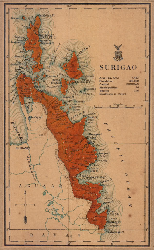
Surigao del Sur (Surigaonon: Probinsya nan Surigao del Sur; ; ), officially the Province of Surigao del Sur, is a province in the Philippines located in the Caraga region in Mindanao. Its capital is Tandag City while Bislig is the most populous city in the province. Surigao del Sur is situated at the eastern coast of Mindanao and faces the Philippine Sea to the east.
Etymology
There are two hypotheses on the original meaning of "Surigao" among linguists, depending on the original root word. If the root word was taken to be sulig ("sprout" or "spring up"), then Surigao may have derived from ("spring water"), likely referring to the Surigao River (known as "Suligaw" in Mandaya) that empties at the northern tip of the island of Mindanao. Early historical accounts record the name of the river as , Surigao, or Zurigan.
Another possibility is that it is derived from Visayan or suyogao, meaning "water current". From suyog (also sulog or ), "current"; cf. Sinulog, Sulu, and Tausug (Suluk).
History
Early history
In precolonial times, the region of Surigao was inhabited by the Visayan Surigaonon people in the coastal areas, as well as Lumad groups in the interiors like the Mandaya, Mansaka, Mamanwa and Manobo.
Spanish colonial era
During the Spanish Occupation in 1860, six military districts were created in Mindanao, with Surigao and Agusan forming the "East District". In 1870, the district was renamed to "Distrito de Surigao".
American colonial era
In 1901, Distrito de Surigao became chartered province. Agusan became an independent province in 1907 during the American era, when it was separated from Surigao.
Philippine independence
Foundation
Surigao del Sur was created as the 56th Philippine province on June 19, 1960, through Republic Act 2786, separated from its mother province, Surigao, on September 18, 1960.
At the time of its inception, it was classified as 4th Class province with an annual income of over 300,000.00. Seven years later, because of rapid increase of revenue collection particularly from the logging ventures, it has been reclassified as Ist Class B and in 1980 as Ist Class A with an estimated annual income of around 13,000,000. It has been reclassified as 2nd Class with a revenue adding up to 315,888,300.63.
Recaredo B. Castillo was the appointed first governor and subsequently elected governor while Vicente L. Pimentel was the first elected congressman.
The province was formed with 13 municipalities. Six more were added, raising the number to 19 with Tandag as the capital. Two of its municipalities have been elevated to cities; the first was Bislig City.
Contemporary
The capital town Tandag became a component city by virtue of Republic Act No. 9392 which sought to convert the town into a city. The law was ratified on June 23, 2007. However, the cityhood status was lost twice in the years 2008 and 2010 after the LCP questioned the validity of the cityhood law. The cityhood status was reaffirmed after the court finalized its ruling on February 15, 2011 which declared the cityhood law constitutional.
House Bill No. 2336 of the 19th Congress seeks to separate the southern part of the province to be formed as the new Province of Surigao Oriental. Once the bill is signed into law it will be approved and ratified in a referendum.
Geography

Surigao del Sur is located along the northeastern coast of Mindanao facing the Philippine Sea between 125°40' to 126°20' east longitudes and 7°55' and 9°20' north latitudes. It is bounded on the northwest by the province of Surigao del Norte, on the southeast by Davao Oriental, on the west and southwest by Agusan del Norte and Agusan del Sur.
Situated west is the Diwata Mountain Range, isolating the province from the rest of Mindanao. To the east lies the Philippine Sea. The Mindanao Deep, one of the deepest trenches in the world, is situated a few kilometers east of the coastline.
Land area

The land area of the province is 4,932.70 km2 representing 27.75 percent of the total land area of Caraga Administrative Region and about 5.14 percent and 1.74 percent of the total land area of Mindanao and Philippines, respectively. The province is elongated in shape, extending from the northeastern portion at Carrascal to the southernmost municipality of Lingig. It is approximately 300 km in length and 50 km at its widest point which runs from Cagwait to San Miguel.
Municipal-wise, San Miguel has the biggest land area accounting for of the total provincial land area while Bayabas has the smallest constituting only about .
Of the 5,230.50 km2 land, only 1,703.72 km2 or 32.22 percent are classified as alienable and disposable (A and D) while 3,583.523 km2 or 67.78 percent are forest land. Tagbina has the biggest share of alienable and disposable land with 234.21 km2 or about 56.51 percent of its land area followed by Hinatuan with 202.52 km2 or 63.56 percent of its land area.

Of the 3,583.523 km2 of forest land, 636.076 km2 are protection forest, 2,582.43 km2 production forest, 12.68 km2 are non-forest agriculture and 352.337 km2 are for non-forest mining. As of today, the province still has vast areas of remaining old growth and mossy forest.
Climate
The province falls under Type II climate of the Philippines, characterized by rainfall distributed throughout the year, although there is a distinct rainy season which begins from the month of November and ends in March. However, the climatic behavior of the province for the past few years has shown variations wherein the onset of the rainy seasons no longer occurs on the usual time. Months with low rainfall are from July to October with September as the driest month. Wet months are from November to June with January as the wettest month.
Surigao del Sur is one of the top 20 most vulnerable provinces to climate change in the Philippines.
Administrative divisions
Surigao del Sur comprises 17 municipalities and two cities, further subdivided into 309 barangays. There are two congressional districts encompassing all cities and towns.

|
|
|
| City or municipality | District | Population | Area | Density | Barangay | Coordinates | (2020) | (2015) | km2 | sq mi | /km2 | /sq mi | Barobo | Bayabas | Bislig | Cagwait | Cantilan | Carmen | Carrascal | Cortes | Hinatuan | Lanuza | Lianga | Lingig | Madrid | Marihatag | San Agustin | San Miguel | Tagbina | Tago | Tandag | Total | 642,255 | 592,250 | 4,932.70 | 4,932.70 km2 | {{sigfig | 642,255/4,932.70 | 2}} PD/km2 | 309 | (see GeoGroup box) |
|---|---|---|---|---|---|---|---|---|---|---|---|---|---|---|---|---|---|---|---|---|---|---|---|---|---|---|---|---|---|---|---|---|---|---|---|---|---|---|---|---|---|
| 2nd | 49,730 | 242.50 km2 | {{sigfig | 53,146/242.50 | 2}} PD/km2 | 21 | |||||||||||||||||||||||||||||||||||
| 1st | 8,164 | 117.84 km2 | {{sigfig | 8,979/117.84 | 2}} PD/km2 | 7 | |||||||||||||||||||||||||||||||||||
| ∗ | 2nd | 94,535 | 331.80 km2 | {{sigfig | 99,290/331.80 | 2}} PD/km2 | 24 | ||||||||||||||||||||||||||||||||||
| 1st | 20,384 | 214.10 km2 | {{sigfig | 21,747/214.10 | 2}} PD/km2 | 11 | |||||||||||||||||||||||||||||||||||
| 1st | 31,492 | 240.10 km2 | {{sigfig | 34,060/240.10 | 2}} PD/km2 | 17 | |||||||||||||||||||||||||||||||||||
| 1st | 10,347 | 160.01 km2 | {{sigfig | 11,720/160.01 | 2}} PD/km2 | 8 | |||||||||||||||||||||||||||||||||||
| 1st | 22,479 | 265.80 km2 | {{sigfig | 24,586/265.80 | 2}} PD/km2 | 14 | |||||||||||||||||||||||||||||||||||
| 1st | 15,912 | 127.08 km2 | {{sigfig | 17,924/127.08 | 2}} PD/km2 | 12 | |||||||||||||||||||||||||||||||||||
| 2nd | 39,842 | 299.10 km2 | {{sigfig | 43,841/299.10 | 2}} PD/km2 | 24 | |||||||||||||||||||||||||||||||||||
| 1st | 12,001 | 290.60 km2 | {{sigfig | 13,642/290.60 | 2}} PD/km2 | 13 | |||||||||||||||||||||||||||||||||||
| 1st | 29,493 | 161.12 km2 | {{sigfig | 33,869/161.12 | 2}} PD/km2 | 13 | |||||||||||||||||||||||||||||||||||
| 2nd | 31,485 | 305.17 km2 | {{sigfig | 35,142/305.17 | 2}} PD/km2 | 18 | |||||||||||||||||||||||||||||||||||
| 1st | 15,223 | 141.20 km2 | {{sigfig | 16,653/141.20 | 2}} PD/km2 | 14 | |||||||||||||||||||||||||||||||||||
| 1st | 18,518 | 312.50 km2 | {{sigfig | 19,441/312.50 | 2}} PD/km2 | 12 | |||||||||||||||||||||||||||||||||||
| 1st | 22,779 | 277.28 km2 | {{sigfig | 22,855/277.28 | 2}} PD/km2 | 13 | |||||||||||||||||||||||||||||||||||
| 1st | 39,340 | 558.00 km2 | {{sigfig | 41,809/558.00 | 2}} PD/km2 | 18 | |||||||||||||||||||||||||||||||||||
| 2nd | 38,833 | 343.49 km2 | {{sigfig | 41,051/343.49 | 2}} PD/km2 | 25 | |||||||||||||||||||||||||||||||||||
| 1st | 35,329 | 253.28 km2 | {{sigfig | 39,831/253.28 | 2}} PD/km2 | 24 | |||||||||||||||||||||||||||||||||||
| † | 1st | 56,364 | 291.73 km2 | {{sigfig | 62,669/291.73 | 2}} PD/km2 | 21 | ||||||||||||||||||||||||||||||||||
| list_style_type=upper-alpha | Former names are italicized. | Coordinates mark the city/town center, and are sortable by latitude. |
Demographics
The population of Surigao del Sur in the 2020 census was 642,255 people, with a density of {{sigfig|642,255/4,932.70|2}} PD/km2.
The province is home to the Kamayo, Agusan, and the eponymous Surigaonon peoples, with the latter ethnolingustically related to the Visayan ethnic groups (though geographically native in Mindanao). Their dances are showcased in the local festival, "Sirong Festival", held especially during the town fiesta of Cantilan. The Sirong Festival depicts the early Christianization of the early Cantilan inhabitants where the natives tried to defend their land against Visayan invaders. Other residents in the province include the migrants (and their native-born descendants) from Ilocandia, Cagayan Valley, Cordillera Administrative Region, Central Luzon, Calabarzon, Mindoro, Marinduque and Bicolandia in Luzon and Panay, Negros, Central and Western Visayas, as well as Chinese and white Europeans (eg. Spaniards and white Americans) and their native-born descendants.
The indigenous people of the province were largely Christianized during the early times of the Spanish conquest.
Languages
The Surigaonon and Tandaganon languages are spoken in most parts of Surigao del Sur (except in Bislig and the towns of Barobo, Hinatuan, Lingig and Tagbina, where most of the inhabitants speak Cebuano and their native Kamayo, a different language but one distantly related to Surigaonon, is spoken by the rest of the population), with the Cantilangnon dialect, a northern variety of Surigaonon that is very much similar to the dialect of Surigaonon as spoken in Surigao del Norte, being spoken mostly in the five northern municipalities of the province, namely Carrascal, Cantilan, Madrid, Carmen and Lanuza (or the municipal cluster called Carcanmadcarlan); these municipalities were once under a single Municipality of Cantilan before December 10, 1918.
Tagalog and English are also widely spoken throughout the province and used as the primary languages of education, business, and administration.
Economy

Surigao del Sur is one of the suppliers of rice, bananas and other tropical fruits. Copper, chromite and silver are also found here. Marine and aquaculture are abundant in the province, being primary livelihoods of the inhabitants as the province is well known for producing seafood and sea by-products.
Mineral resources
Surigao del Sur is endowed with metallic minerals such as copper, gold, chromite, cobalt, nickel and lead zinc, as well as non-metallic (limestone, coal and feldspar, clay diatomite/bentomite and coarse/fine aggregates). There are small and large scale mining activities in the province. Corporations operating in a large scale are the Marc Ventures Mining Development Corporation at Carrascal and Cantilan, operating in an area of 4799 ha within the Diwata Mountain Range. The TP Construction and Mining Corporation, also in Carrascal, focuses on gold and nickel mining in an area of 35.64 km2 and 48.6916 km2, respectively. The Carac-an Development Corporation, also in Carrascal, has an area of 506.3764 km2. Small scale mining activities are found in the municipalities of Barobo, Carmen and San Miguel.
Tourism
Bislig's main tourist attraction is the [Tinuy-an Falls, known as the little "Niagara Falls of the Philippines". It is a white water curtain that flows in three levels about 55 m high and 95 m wide. Its unique natural formation once appeared in the International Travel Magazine. It is also known as the widest waterfall in the Philippines.
Surfing in Surigao del Sur is widely known and has been one of the local tourist attractions. This extreme sport is often practiced in Cantilan and Lanuza. Skimboarding is also found in several municipalities, attracting tourists.
File:Hinatuan enchanted river.jpg|Deep-blue waters of the renowned "Hinatuan Enchanted River", an underground river in Barangay Talisay, Hinatuan File:Tinuy-an Falls, April 2011.jpg|The Tinuy-an Falls in Burboanan, Bislig File:Wellenreiten.jpg|Surfing in Lanuza
Notable people
- Marcelito Pomoy - singer and Pilipinas Got Talent (season 2) Grand Winner and America's Got Talent: The Champions finalist
- Gabriel Amigo III - international Enduro mountain bike racing champion
- Dennis Orcollo - professional pool player; Billiard Congress of America Hall of Fame inductee
- Elmar Sillador - 1992 Philippine National Police Medal of Valor recipient
- Prospero Arreza Pichay, Jr. (Butch Pichay) - son of Provincial Treasurer Prospero Pichay Sr. He became the Congressman of Surigao del Sur 1st district from 1998 until 2007.
- Lt. Gen. William Hotchkiss III - member of the famed Blue Diamonds, a combat ready pilot.
- Gen. Hernando Delfin Carmelo Arreza Iriberri, PMA Class "Matikas", 1983 - became the Commanding General of the Philippine Army (56th) and the 46th Chief of Staff of the Armed Forces of the Philippines.
References
References
- [http://caraganon.com/2012/09/surigao-del-sur-shangri-la-by-the-pacific/ ''Caraganon.com'']
- "List of Provinces". National Statistical Coordination Board.
- (2000). "Ethnomedical documentation of and community health education for selected Philippine ethnolinguistic groups: the Mandaya people of Davao Oriental, Philippines".
- (1898). "La Islas Filipinas. Mindanao, Volume 1". Subinspección de Infantería.
- (1879). "Jolo, Relato Historico-Militar: Desde Su Descubrimiento Por Los Espanoles en 1578 A Nuestros Dias (1879)". Imprenta y Estereotipia de Polo.
- (2017). "The Monosyllabic root -ao in Mindanao Languages". Agusan del Sur State College of Agriculture and Technology.
- (1995). "Fast Facts about Philippine Provinces". Tahanan Books.
- (June 19, 1960). "Republic Act No. 2786 - An Act to Create the Provinces of Surigao del Norte and Surigao del Sur".
- "Philippine Provincial Profile; Surigao del Sur".
- "About Caraga".
- "Weather forecast for Surigao del Sur, Philippines". [[StormGeo.
- "Marcventure's mining operations in Cantilan, Surigao del Sur, Philippines".
- (April 24, 2014). "DENR shuts down Surigao del Sur mining firm". [[The Manila Times]].
- (September 22, 2015). "Caraga tourist arrivals to reach 2M by end of 2015". [[Manila Bulletin]].
- (February 11, 2005). "Tinuy-an Falls: Our little Niagara". [[Sun.Star]] Davao.
- (November 11, 2012). "LGU wants to make Cantilan a surfing destination". Mindanao News and Information Cooperative Center.
- Evangelista, Romie. (January 30, 1992). "PNP marks 1st anniversary". Kamahalan Publishing Corp..
- "BGen.Hernando Iriberri". Appointed commander of the Army’s 503rd Brigade in Abra province..
This article was imported from Wikipedia and is available under the Creative Commons Attribution-ShareAlike 4.0 License. Content has been adapted to SurfDoc format. Original contributors can be found on the article history page.
Ask Mako anything about Surigao del Sur — get instant answers, deeper analysis, and related topics.
Research with MakoFree with your Surf account
Create a free account to save articles, ask Mako questions, and organize your research.
Sign up freeThis content may have been generated or modified by AI. CloudSurf Software LLC is not responsible for the accuracy, completeness, or reliability of AI-generated content. Always verify important information from primary sources.
Report