From Surf Wiki (app.surf) — the open knowledge base
Surf City, North Carolina
| Field | Value |
|---|---|
| official_name | Surf City, North Carolina |
| settlement_type | Town |
| motto | "Big enough to be competitive, small enough to be happy!" |
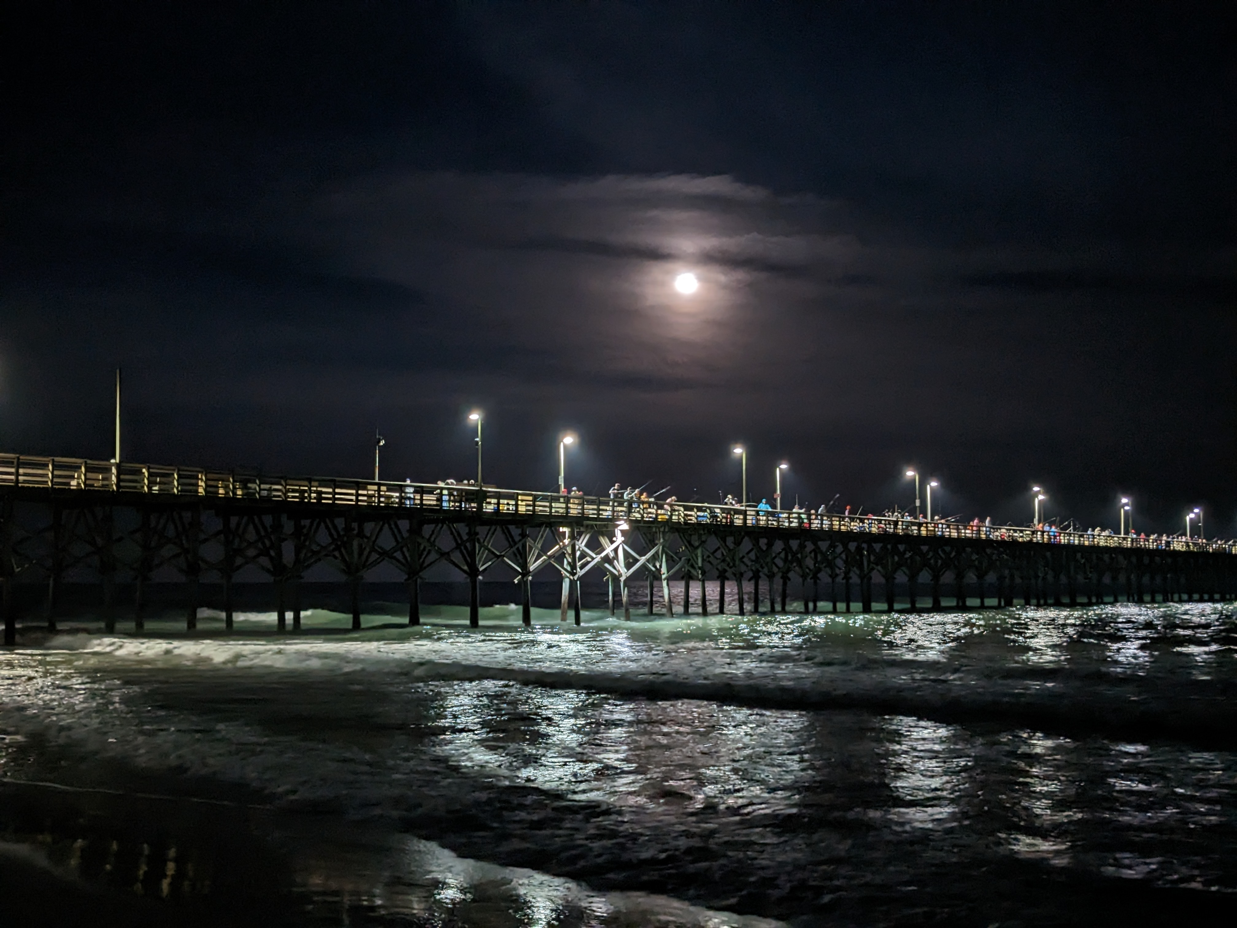
| image_skyline | Public Beach Access 16, Surf City (May 2023) 12.jpg |
| image_caption | Surf City Ocean Pier |
| image_flag | Flag of Surf City, North Carolina.jpg |
| image_seal | Seal of Surf City, North Carolina.png |
| image_map | NCMap-doton-SurfCity.PNG |
| mapsize | 250x200px |
| subdivision_type | Country |
| subdivision_name | United States |
| subdivision_type1 | State |
| subdivision_name1 | North Carolina |
| subdivision_type2 | Counties |
| subdivision_name2 | Pender, Onslow |
| government_type | Municipality |
| leader_title | Mayor |
| leader_name | Teresa B. Batts |
| leader_title1 | Council |
| leader_name1 | {{Collapsible list |
| title | List of Councilmen |
| frame_style | border:none; padding: 0; |
| list_style | text-align:left;display:none; |
| 1 | Teresa B. Batts |
| 2 | Donald R. Helms |
| 3 | William J. "Buddy" Fowler |
| 4 | Jeremy Shugarts |
| 5 | John Koloski |
| established_title | |
| established_title2 | Incorporated (town) |
| established_date2 | 1949 |
| established_title3 | |
| area_total_km2 | 25.60 |
| area_total_sq_mi | 9.88 |
| area_land_km2 | 19.70 |
| area_land_sq_mi | 7.61 |
| area_water_km2 | 5.90 |
| area_water_sq_mi | 2.28 |
| area_water_percent | 20.4 |
| population_as_of | 2020 |
| population_total | 3867 |
| population_density_km2 | 196.33 |
| population_density_sq_mi | 508.48 |
| timezone | EST |
| utc_offset | -5 |
| timezone_DST | EDT |
| utc_offset_DST | -4 |
| coordinates | |
| elevation_footnotes | |
| elevation_ft | 0 |
| postal_code_type | ZIP code |
| postal_code | 28445 & 28443 |
| area_codes | 910, 472 |
| website | |
| blank_name | FIPS code |
| blank_info | 37-66040 |
| blank1_name | GNIS feature ID |
| blank1_info | 2406694 |
| unit_pref | Imperial |
| area_footnotes |
Surf City is a town in Onslow and Pender counties in the U.S. state of North Carolina. The population was 3,867 at the 2020 census. It is located on Topsail Island.
The Pender County portion of Surf City is part of the Wilmington, NC Metropolitan Statistical Area, while the Onslow County portion is part of the Jacksonville, NC Metropolitan Statistical Area.
Geography
According to the United States Census Bureau, Surf City has a total area of 5.3 square miles (13.7 km), of which 4.2 square miles (10.9 km) is land and 1.1 square miles (2.8 km) (20.45%) is water.
Climate
|Jan record high F = |Feb record high F = |Mar record high F = |Apr record high F = |May record high F = |Jun record high F = |Jul record high F = |Aug record high F = |Sep record high F = |Oct record high F = |Nov record high F = |Dec record high F = |year record high F = |Jan record low F = |Feb record low F = |Mar record low F = |Apr record low F = |May record low F = |Jun record low F = |Jul record low F = |Aug record low F = |Sep record low F = |Oct record low F = |Nov record low F = |Dec record low F = |year record low F =
Demographics
2020 census
| Race | Number | Percentage | White (non-Hispanic) | Black or African American (non-Hispanic) | Native American | Asian | Pacific Islander | Other/Mixed | Hispanic or Latino |
|---|---|---|---|---|---|---|---|---|---|
| 3,337 | 86.29% | ||||||||
| 42 | 1.09% | ||||||||
| 8 | 0.21% | ||||||||
| 46 | 1.19% | ||||||||
| 2 | 0.05% | ||||||||
| 221 | 5.72% | ||||||||
| 211 | 5.46% |
As of the 2020 United States census, there were 3,867 people, 1,272 households, and 870 families residing in the town.
2000 census

As of the census of 2000 there were 1,393 people, 689 households, and 403 families residing in the town. The population density was 331.6 PD/sqmi. There were 2,578 housing units at an average density of 613.7 /sqmi. The racial makeup of the town was 97.77% White, 0.43% African American, 0.07% Native American, 0.72% Asian, 0.14% Pacific Islander, 0.22% from other races, and 0.65% from two or more races. Hispanic or Latino of any race were 1.01% of the population.
There were 689 households, out of which 12.6% had children under the age of 18 living with them, 51.5% were married couples living together, 4.9% had a female householder with no husband present, and 41.4% were non-families. 32.4% of all households were made up of individuals, and 7.7% had someone living alone who was 65 years of age or older. The average household size was 2.02 and the average family size was 2.51.
In the town, the population was spread out, with 12.6% under the age of 18, 6.2% from 18 to 24, 25.4% from 25 to 44, 39.6% from 45 to 64, and 16.3% who were 65 years of age or older. The median age was 48 years. For every 100 females, there were 102.2 males. For every 100 females age 18 and over, there were 104.7 males.
The median income for a household in the town was $40,521, and the median income for a family was $48,854. Males had a median income of $36,600 versus $30,000 for females. The per capita income for the town was $25,242. About 9.9% of families and 15.4% of the population were below the poverty line, including 43.3% of those under age 18 and 3.9% of those age 65 or over.
Piers (from south to north)
- Surf City (last 150 feet, to include the Octagon destroyed by Hurricane Florence)
- Barnacle Bill's (destroyed by Hurricane Fran)
- Scotch Bonnet (destroyed by Hurricane Fran)
- Ocean City (destroyed by Hurricane Fran)
Bridges
.jpg)
Until late 2018, road access to Surf City was mainly via the Topsail Island Swing Bridge, a failing steel truss swing-span bridge, built in 1954, which crossed the Intracoastal Waterway. Planning for a replacement bridge began in 2010, with construction beginning in September 2016. It opened in December 2018, a year ahead of schedule. Costing US$54 million, the 3800 ft fixed-span high rise bridge, with a vertical clearance of 65 ft, allows the passage of vessels at any time and eases traffic flow to and from the community. The 50 ft wide bridge provides two lanes for traffic, shoulder bicycle lanes, and a multi-use path. The unusually wide design is intended to permit three lanes for hurricane evacuations. The contractor was scheduled to remove the old bridge by March 31, 2019. In a letter to residents in January, the Town's mayor, Doug Medlin said, "NCDOT and Balfour Beatty understood the sentimental relationship that the Town of Surf City had for our Swing Bridge. We were given the turn bridge control panel and key as well as the cornerstone from when the bridge was first constructed. These items will be displayed in the new Surf City Town Hall as a historical memorial."

References
References
- "U.S. Census website". [[United States Census Bureau]].
- {{GNIS. 2406694
- "ArcGIS REST Services Directory". United States Census Bureau.
- "Census of Population and Housing". Census.gov.
- "Explore Census Data".
- Balfour Beatty, [https://www.balfourbeattyus.com/our-work/project-portfolio/surf-city-bridge-replacement Surf City Bridge Replacement]. Accessed February 15, 2019.
- NCDOT, [https://www.ncdot.gov/projects/topsail-island-bridge/Pages/default.aspx Topsail Island Bridge Replacement Project Page]. Accessed February 15, 2019.
- Bill Walsh, [https://www.starnewsonline.com/news/20181204/surf-city-bridge-opens-ahead-of-schedule Surf City bridge opens ahead of schedule], Star News Online, December 4, 2018. Accessed February 15, 2019.
- [https://www.surfcitync.gov/DocumentCenter/View/1347/Surf-City-Coastal-Connection-Newsletter January Mayor Message] (PDF), ''Surf City Coastal Connection'' (newsletter), February 2019. Accessed February 15, 2019
This article was imported from Wikipedia and is available under the Creative Commons Attribution-ShareAlike 4.0 License. Content has been adapted to SurfDoc format. Original contributors can be found on the article history page.
Ask Mako anything about Surf City, North Carolina — get instant answers, deeper analysis, and related topics.
Research with MakoFree with your Surf account
Create a free account to save articles, ask Mako questions, and organize your research.
Sign up freeThis content may have been generated or modified by AI. CloudSurf Software LLC is not responsible for the accuracy, completeness, or reliability of AI-generated content. Always verify important information from primary sources.
Report