From Surf Wiki (app.surf) — the open knowledge base
Sumter County, South Carolina
County in South Carolina, United States
County in South Carolina, United States
| Field | Value |
|---|---|
| county | Sumter County |
| state | South Carolina |
| seal | Sumter County Seal.png |
| logo | Sumter County Logo.png |
| flag | Sumter County Flag.png |
| founded | January 1, 1800 |
| seat wl | Sumter |
| largest city wl | Sumter |
| city type | community |
| area_total_sq_mi | 682.09 |
| area_land_sq_mi | 665.08 |
| area_water_sq_mi | 17.01 |
| area percentage | 2.49 |
| population_as_of | 2020 |
| population_total | 105556 |
| pop_est_as_of | 2024 |
| population_est | 104776 |
| density_sq_mi | auto |
| coordinates | |
| web | www.sumtercountysc.org |
| time zone | Eastern |
| ex image | Sumter courthouse 1369.JPG |
| ex image cap | Sumter County Courthouse |
| district | 5th |
| district2 | 6th |
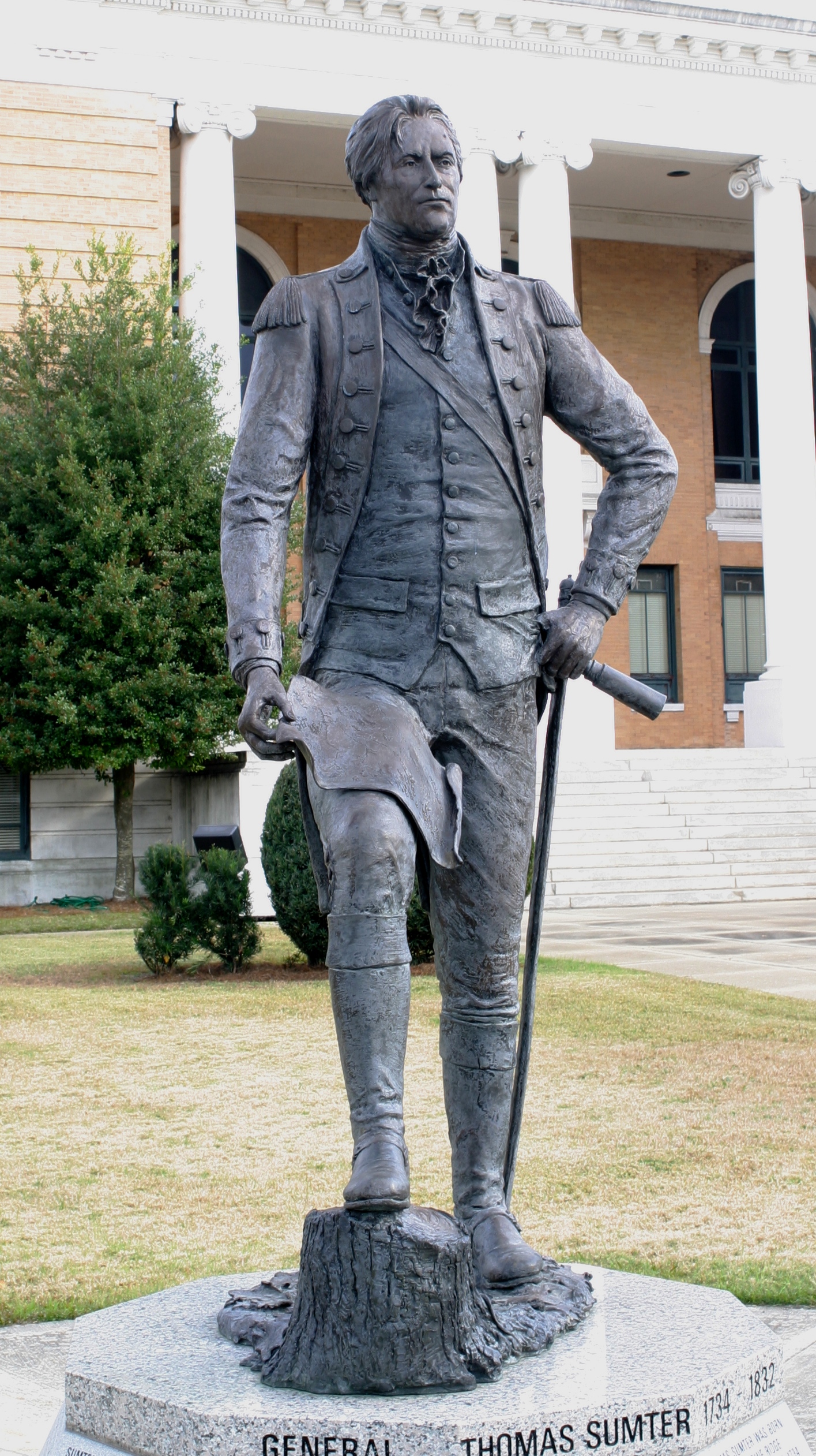
| named for | Thomas Sumter |
| nickname | The Gamecock County |
Sumter County is a county located in the U.S. state of South Carolina. As of the 2020 census, the population was 105,556. Its county seat is Sumter. Sumter County comprises the Sumter, SC Metropolitan Statistical Area, which is also included in the Columbia-Sumter-Orangeburg, SC Combined Statistical Area. The county is also part of "The Midlands" area.
It is the home of Shaw AFB, headquarters to the 9th Air Force, AFCENT, United States Army Central, with a number of other tenant units. It is one of largest bases in the USAF's Air Combat Command.
On September 17, 2024, the National Park Service announced that the City of Sumter and Sumter County were jointly named a World War II Heritage City.
In Sumter County, there is somewhat of a large population of people with Turkish ancestry that descend from Joseph Benenhaley (1753-1823) and other Turks who fled the Ottoman Empire and settled in Sumter County to serve in the American Revolution.https://www.smithsonianmag.com/history/tracing-mysterious-turks-of-south-carolina-back-revolutionary-war-180970383/
History
Sumter County was created from Clarendon, Claremont and Salem Counties as Sumter District in 1798, named after General Thomas Sumter, and became effective in 1800. When the home of Sumter District's clerk of records burnt in 1801, the formative records of the three predecessor counties were also destroyed in the conflagration. As a result, documentary evidence that the three counties were within St. Mark's Parish (formed in 1757 from Prince Frederick's Parish, Craven County) in Camden District (formed 1769) derives from family genealogies and legislative records.
On December 19, 1855, a legislative act was passed partitioning Sumter District by forming Clarendon District, with the same boundaries as defined for Clarendon County in 1785. When effectuated in 1857, a northeastern part of Sumter District (formerly in Salem County) was also separated in the partition (the area east of a line drawn from the northernmost point of old Clarendon County continued north-northeasterly to a point on the boundary line with Darlington District (Sumter County's northeastern cornerpoint abutting Florence County since 1888).
The Sumter District gained a form of self-rule and was renamed Sumter County under the 1868 Constitution.
In 1898, a northwestern part of Sumter County was detached to form part of the first Lee County, but its formation was declared unconstitutional in 1899. In 1902, an even larger northern part of Sumter County (more or less the remaining part of former Salem County) was properly legally detached to form the major sections of the current Lee County, of which some acreage reverted in 1914.
In 1921, southern Sumter County received a section from Clarendon County, of which some acreage reverted in 1922, creating the current boundaries of Sumter County.
Geography
According to the U.S. Census Bureau, the county has a total area of 682.09 sqmi, of which 665.08 sqmi is land and 17.01 sqmi (2.49%) is water. It is drained by the Black River and its tributaries. Its western border is formed by the Wateree River. One of South Carolina's most famous areas are the High Hills of Santee comprising the western part of the county. The county is one of five that borders Lake Marion, also known as South Carolina's "Inland Sea".
State and local protected areas/sites
- Bland Tract Dove Field, Manchester State Forest (MSF) Wildlife Management Area
- Manchester State Forest (part)
- Millford Plantation Historic Site
- Poinsett State Park
- Swan Lake Iris Gardens
- Tuomey Tract Dove Field, Manchester State Forest (MSF) Wildlife Management Area
- Woods Bay State Park (part)
Major water bodies
- Congaree River
- Lake Marion
- Lynches River
- Pocoaligo River
- Rocky Bluff Swamp
- Scape Ore Swamp
- Wateree River
Adjacent counties
- Lee County – north
- Florence County – northeast
- Clarendon County – south
- Calhoun County – southwest
- Richland County – west
- Kershaw County – northwest
Major highways
Major infrastructure
- Shaw Air Force Base
- Sumter Airport
Demographics
|align-fn=center 1790–1960 1900–1990 1990–2000 2010 2020
2020 census
| Race | Num. | Perc. |
|---|---|---|
| White (non-Hispanic) | 46,442 | 44.0% |
| Black or African American (non-Hispanic) | 48,536 | 45.98% |
| Native American | 338 | 0.32% |
| Asian | 1,400 | 1.33% |
| Pacific Islander | 87 | 0.08% |
| Other/Mixed | 4,451 | 4.22% |
| Hispanic or Latino | 4,302 | 4.08% |
As of the 2020 census, there were 105,556 people, 41,904 households, and 29,777 families residing in the county.
The median age was 38.9 years, 22.9% of residents were under the age of 18, and 17.7% were 65 years of age or older; for every 100 females there were 91.9 males, and for every 100 females age 18 and over there were 89.0 males age 18 and over.
The racial makeup of the county was 44.9% White, 46.3% Black or African American, 0.4% American Indian and Alaska Native, 1.4% Asian, 0.1% Native Hawaiian and Pacific Islander, 1.8% from some other race, and 5.1% from two or more races; Hispanic or Latino residents of any race comprised 4.1% of the population.
65.2% of residents lived in urban areas, while 34.8% lived in rural areas.
Of those households, 30.8% had children under the age of 18 living with them, 34.3% had a female householder with no spouse or partner present, 29.4% were single-person households, and 12.8% had someone living alone who was 65 years of age or older.
There were 46,753 housing units, of which 10.4% were vacant; among occupied units, 65.7% were owner-occupied and 34.3% were renter-occupied, with homeowner and rental vacancy rates of 1.4% and 8.0%, respectively.
2010 census
At the 2010 census, there were 107,456 people, 40,398 households, and 28,311 families residing in the county.{{cite web |access-date=March 11, 2016 |archive-url=https://archive.today/20200213030130/http://factfinder.census.gov/bkmk/table/1.0/en/DEC/10_DP/DPDP1/0500000US45085 |archive-date=February 13, 2020 |url-status=dead |access-date=March 11, 2016 |archive-url=https://archive.today/20200213191418/http://factfinder.census.gov/bkmk/table/1.0/en/DEC/10_SF1/GCTPH1.CY07/0500000US45085 |archive-date=February 13, 2020 |url-status=dead |access-date=March 11, 2016 |archive-url=https://archive.today/20200213023704/http://factfinder.census.gov/bkmk/table/1.0/en/ACS/10_5YR/DP02/0500000US45085 |archive-date=February 13, 2020 |url-status=dead
Of the 40,398 households, 36.5% had children under the age of 18 living with them, 44.6% were married couples living together, 20.2% had a female householder with no husband present, 29.9% were non-families, and 25.8% of all households were made up of individuals. The average household size was 2.59 and the average family size was 3.11. The median age was 35.4 years.
The median income for a household in the county was $39,137 and the median income for a family was $45,460. Males had a median income of $36,101 versus $28,421 for females. The per capita income for the county was $18,944. About 15.5% of families and 19.4% of the population were below the poverty line, including 29.1% of those under age 18 and 14.7% of those age 65 or over.{{cite web |access-date=March 11, 2016 |archive-url=https://archive.today/20200213024012/http://factfinder.census.gov/bkmk/table/1.0/en/ACS/10_5YR/DP03/0500000US45085 |archive-date=February 13, 2020 |url-status=dead
Government and politics
A Republican-leaning swing county beginning around 1950, Sumter County has supported Democrats in every election beginning in 2004. Republicans have still gained over 40% of the vote since then, however, and the Democrat margins of victory were narrow (less than 5%) in both 2004 and 2024.
Economy
In 2022, the GDP was $5 billion (about $48,450 per capita), and the real GDP was $4.2 billion (about $40,489 per capita) in chained 2017 dollars.
As of April 2024, some of the largest employers in the county include Becton Dickinson, Central Carolina Technical College, the city of Sumter, Continental AG, the United States Department of Defense, Eaton Corporation, SKF, JCPenney, Pilgrim's Pride, Prisma Health, Speedway, and Walmart.
| Industry | Employment Counts | Employment Percentage (%) | Average Annual Wage ($) |
|---|---|---|---|
| Accommodation and Food Services | 3,537 | 10.0 | 18,980 |
| Administrative and Support and Waste Management and Remediation Services | 1,736 | 4.9 | 42,380 |
| Agriculture, Forestry, Fishing and Hunting | 241 | 0.7 | 49,244 |
| Arts, Entertainment, and Recreation | 342 | 1.0 | 16,692 |
| Construction | 2,529 | 7.2 | 63,388 |
| Educational Services | 2,912 | 8.3 | 48,048 |
| Finance and Insurance | 824 | 2.3 | 73,060 |
| Health Care and Social Assistance | 5,453 | 15.5 | 53,768 |
| Information | 187 | 0.5 | 62,608 |
| Management of Companies and Enterprises | 223 | 0.6 | 93,912 |
| Manufacturing | 6,366 | 18.1 | 62,140 |
| Other Services (except Public Administration) | 978 | 2.8 | 39,312 |
| Professional, Scientific, and Technical Services | 934 | 2.7 | 75,036 |
| Public Administration | 2,510 | 7.1 | 58,448 |
| Real Estate and Rental and Leasing | 221 | 0.6 | 43,680 |
| Retail Trade | 4,497 | 12.8 | 29,796 |
| Transportation and Warehousing | 896 | 2.5 | 60,476 |
| Utilities | 143 | 0.4 | 79,248 |
| Wholesale Trade | 710 | 2.0 | 61,568 |
| Total | 35,239 | 100.0% | 49,611 |
Education
All areas in the county are in the Sumter County Consolidated School District. Additionally, the University of South Carolina Sumter is located in the county.
Communities
Cities
- Sumter (county seat and largest community)
Towns
- Mayesville
- Pinewood
- Rembert
Census-designated places
- Cane Savannah
- Cherryvale
- Dalzell
- East Sumter
- Lakewood
- Mulberry
- Oakland
- Oswego
- Privateer
- Rembert
- Shiloh
- South Sumter
- Stateburg
- Wedgefield
Unincorporated communities
- Horatio
- Millwood
- Wedgefield
Notable people
- Ray Allen, NBA basketball player
- Richard H. Anderson, Confederate lieutenant general
- Mary McLeod Bethune, civil rights activist, feminist, stateswoman, educator, and founder of the National Council of Negro Women; born to parents who had been enslaved
- William Ellison, slave who was freed and settled in Stateburg where he became a large-scale slave owner and lived his life
- David DuBose Gaillard, in charge of the building of the central portion of the Panama Canal
- Sarah Ann Haynsworth Gayle (1804–1835), diarist
- Richard Irvine Manning I, 50th governor of South Carolina
- Richard Irvine Manning III, 92nd governor of South Carolina
- George L. Mabry, Jr., major general, Medal of Honor recipient, and highly decorated soldier of WWII
- Slomon Moody, physician, farmer, and city treasurer of Ocala, Florida
- Franklin J. Moses Jr., Governor of South Carolina from 1872 to 1874; enemies labelled him the "Robber Governor"
- Ja Morant, NBA basketball player for the Memphis Grizzlies
- Bill Pinkney, performer, singer, and member of The Drifters
- Freddie Solomon, NFL wide receiver
- Angelica Singleton Van Buren, Martin Van Buren's daughter-in-law and acting first lady of the United States during his presidency
- Joseph Benenhaley, progenitor of the Ottoman Turkish community in Sumter County, South Carolina and veteran in the American Revolutionary War.
- George Stinney, born in Pinewood, South Carolina, wrongfully executed after being accused of killing two white girls in Alcolu, South Carolina.
References
References
- "Sumter County, South Carolina".
- "Find a County". National Association of Counties.
- (July 21, 2023). "OMB Bulletin No. 23-01: Revised Delineations of Metropolitan Statistical Areas, Micropolitan Statistical Areas, and Combined Statistical Areas, and Guidance on Uses of the Delineations of These Areas".
- "National Park Service Announces New American World War II Heritage Cities - Sept 2024 - Office of Communications (U.S. National Park Service)".
- [https://www.familysearch.org/wiki/en/Sumter_County,_South_Carolina_Genealogy#History Sumter County, South Carolina Genealogy], FamilySearch.org, accessed April 2020.
- (2009). "South Carolina: Individual County Chronologies". The Newberry Library.
- [https://www.familysearch.org/wiki/en/Sumter_District,_South_Carolina Sumter District, South Carolina]. FamilySearch.org, accessed April 2020.
- (August 23, 2022). "2020 County Gazetteer Files – South Carolina". United States Census Bureau.
- {{Cite AmCyc
- "SCDNR Public Lands".
- "County Population Totals and Components of Change: 2020-2024". United States Census Bureau.
- "U.S. Decennial Census". United States Census Bureau.
- "Historical Census Browser". University of Virginia Library.
- (March 27, 1995). "Population of Counties by Decennial Census: 1900 to 1990". United States Census Bureau.
- (April 2, 2001). "Census 2000 PHC-T-4. Ranking Tables for Counties: 1990 and 2000". United States Census Bureau.
- "State & County QuickFacts". United States Census Bureau.
- "QuickFacts: Sumter County, South Carolina". United States Census Bureau.
- "Explore Census Data".
- (2021). "2020 Decennial Census Demographic Profile (DP1)".
- (2021). "2020 Decennial Census Redistricting Data (Public Law 94-171)".
- (2023). "2020 Decennial Census Demographic and Housing Characteristics (DHC)".
- Leip, David. "Dave Leip's Atlas of U.S. Presidential Elections".
- "Our Campaigns - U.S. President".
- U.S. Bureau of Economic Analysis. (2001-01-01). "Gross Domestic Product: All Industries in Sumter County, SC".
- U.S. Bureau of Economic Analysis. (2001-01-01). "Real Gross Domestic Product: All Industries in Sumter County, SC".
- (April 19, 2024). "Sumter County". S.C. Department of Employment & Workforce - Business Intelligence Department.
- (October 28, 2023). "2020 Census – School District Reference Mmap: Sumter County, SC". [[U.S. Census Bureau]].
- "USC Sumter".
- Jones, Martha S.. (2020). "Vanguard : how Black women broke barriers, won the vote, and insisted on equality for all".
- "Freddie Solomon".
This article was imported from Wikipedia and is available under the Creative Commons Attribution-ShareAlike 4.0 License. Content has been adapted to SurfDoc format. Original contributors can be found on the article history page.
Ask Mako anything about Sumter County, South Carolina — get instant answers, deeper analysis, and related topics.
Research with MakoFree with your Surf account
Create a free account to save articles, ask Mako questions, and organize your research.
Sign up freeThis content may have been generated or modified by AI. CloudSurf Software LLC is not responsible for the accuracy, completeness, or reliability of AI-generated content. Always verify important information from primary sources.
Report