From Surf Wiki (app.surf) — the open knowledge base
Summerdale, Alabama
| Field | Value |
|---|---|
| official_name | Summerdale, Alabama |
| settlement_type | Town |
| nickname | The Sunshine of Baldwin County |
| image_seal | Summerdale_seal_photo.jpg |
| seal_size | 100px |
| image_map | File:Baldwin County Alabama Incorporated and Unincorporated areas Summerdale Highlighted 0173872.svg |
| mapsize | 250px |
| map_caption | Location of Summerdale in Baldwin County, Alabama. |
| subdivision_type | Country |
| subdivision_name | United States |
| subdivision_type1 | State |
| subdivision_name1 | Alabama |
| subdivision_type2 | County |
| subdivision_name2 | Baldwin |
| established_title | Incorporated |
| established_date | 1906 |
| leader_title | Mayor |
| unit_pref | Imperial |
| area_footnotes | |
| area_total_sq_mi | 10.17 |
| area_total_km2 | 26.34 |
| area_land_sq_mi | 10.13 |
| area_land_km2 | 26.25 |
| area_water_sq_mi | 0.04 |
| area_water_km2 | 0.09 |
| population_as_of | 2020 |
| population_total | 1468 |
| population_density_km2 | 55.93 |
| population_density_sq_mi | 144.86 |
| timezone | CST |
| utc_offset | -6 |
| timezone_DST | CDT |
| utc_offset_DST | -5 |
| elevation_footnotes | |
| elevation_ft | 102 |
| coordinates | |
| coordinates_footnotes | |
| postal_code_type | ZIP code |
| postal_code | 36580 |
| area_code | 251 |
| blank_name | FIPS code |
| blank_info | 01-73872 |
| blank1_name | GNIS feature ID |
| blank1_info | 2406681 |
| website |
Summerdale is a rural town in south-central Baldwin County, Alabama, United States. It is the site of the Naval Outlying Landing Field Summerdale. At the 2020 census, the population was 1,468. It is part of the Daphne–Fairhope–Foley Metropolitan Statistical Area.
Geography
Alabama State Route 59 passes along the west side of the town, leading north 5 mi to Robertsdale and south 6 mi to Foley.
According to the U.S. Census Bureau, the town has a total area of 25.2 km2, of which 25.1 sqkm is land and 0.1 sqkm, or 0.38%, is water.
Demographics
|align-fn=center 2013 Estimate
2020 census
| Race | Num. | Perc. |
|---|---|---|
| White (non-Hispanic) | 1,242 | 84.6% |
| Black or African American (non-Hispanic) | 55 | 3.75% |
| Native American | 4 | 0.27% |
| Asian | 15 | 1.02% |
| Pacific Islander | 1 | 0.07% |
| Other/Mixed | 86 | 5.86% |
| Hispanic or Latino | 65 | 4.43% |
As of the 2020 United States census, there were 1,468 people, 405 households, and 267 families residing in the town.
2000 census
As of the census of 2000, there were 655 people, 255 households, and 184 families residing in the town. The population density was 125.7 PD/sqmi. There were 282 housing units at an average density of 54.1 /sqmi. The racial makeup of the town was 90.23% White, 4.89% Black or African American, 1.07% Native American, 0.15% Asian, 0.92% from other races, and 2.75% from two or more races. Nearly 2.29% of the population were Hispanic or Latino of any race.
There were 255 households, out of which 34.1% had children under the age of 18 living with them, 56.5% were married couples living together, 10.6% had a female householder with no husband present, and 27.8% were non-families. 23.1% of all households were made up of individuals, and 8.2% had someone living alone who was 65 years of age or older. The average household size was 2.57, and the average family size was 3.04.
In the town, the population was spread out, with 27.6% under the age of 18, 11.5% from 18 to 24, 28.2% from 25 to 44, 21.7% from 45 to 64, and 11.0% who were 65 years of age or older. The median age was 32 years. For every 100 females, there were 104.0 males. For every 100 females age 18 and over, there were 97.5 males.
The median income for a household in the town was $27,917, and the median income for a family was $32,159. Males had a median income of $26,563 versus $19,167 for females. The per capita income for the town was $13,775. About 13.7% of families and 16.4% of the population were below the poverty line, including 28.3% of those under age 18 and 4.9% of those age 65 or over.
Education
Summerdale is a part of the Baldwin County Public Schools system.
Summerdale has one public school, Summerdale School, which serves grades pre-K through 8. Students continue on to Elberta High School in nearby Elberta for grades 9 through 12. Snook Christian Academy is a private school located on the corner of County Roads 28 and 71. It serves grades Pre-K through 12.
Library
The Summerdale Public Library is open Monday - Friday 9-6 and Saturday 9-1. It is conveniently located in the center of town where you can walk to it if you’d like. In addition to books, the library offers wifi, a notary, meeting space, children’s reading programs, and after school programs. http://www.summerdalelibrary.com/index.html
Parks and Recreation
Pioneer Park
Located in the center of what some call “Downtown Summerdale”, Pioneer Park is home to community events, walking trail, and rich history. This park is surrounded by iconic buildings such as the old Tobacco Warehouse, Jurkiewicz Hardware Store, and other old buildings and homes built in the early 1900s. The town clock and a gazebo are located in the park along with a line of large shady oak trees which have survived many hurricanes. The park has brick sidewalks and benches to enjoy. This park is close to the Splash Park and the Tennis Courts and a few blocks away from the school and the library.
Tennis Courts
In 2022, the Town of Summerdale completed new tennis courts located on NW 1st Street.
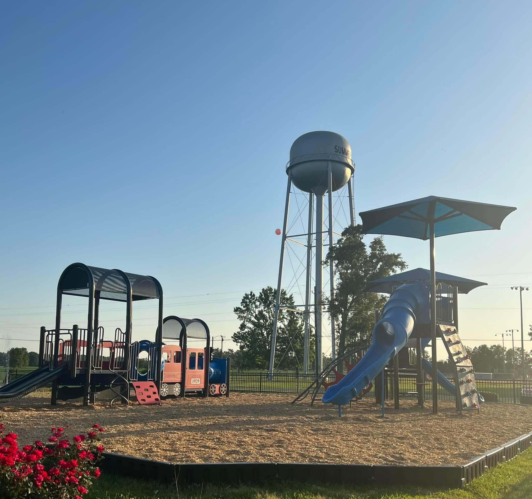
Children’s Splash Park
Located on NW 1st Street (County Rd 71), the children’s splash park is a fun place to take your little ones between April and October. In 2022, the town added a playground to the splash park area. There is also a gazebo available at this park.https://www.summerdaleal.com/splash-park/
Community Center
The Community Center is located in the heart of the community and offers a well shaded playground.
Sidewalks
Summerdale's walking trail starts at Pioneer Park, which is brick. There is a sitting area around the Towns' clock. The sidewalk then goes in front of the Old Tobacco Warehouse that was built in the early 1900's, then crosses Hamm St. where the sidewalk turns to all concrete. In an effort to become more of a walkable community, Summerdale is in the process of expanding sidewalks throughout town. The existing sidewalks and the additional upcoming sidewalks help connect the community to the parks. http://www.bamatrails.com/pages/baldwin-county-trails/pioneer-park-walking-trail.asp
Baseball Parks
Two baseball fields are located near the water tower on County Rd 71.
References
References
- "2020 U.S. Gazetteer Files". United States Census Bureau.
- {{GNIS. 2406681
- "Geographic Identifiers: 2010 Demographic Profile Data (G001): Summerdale town, Alabama". U.S. Census Bureau, American Factfinder.
- "U.S. Decennial Census". Census.gov.
- "Annual Estimates of the Resident Population: April 1, 2010 to July 1, 2013".
- "Explore Census Data".
- "U.S. Census website". [[United States Census Bureau]].
- Geography Division. (December 21, 2020). "2020 Census - School District Reference Map: Baldwin County, AL". [[United States Census Bureau]].
- "Pioneer Park Walking Trail".
- Vaughn, Jessica. "Summerdale awards bid for future tennis courts".
- "Log into Facebook".
- Vaughn, Jessica. "Designs for new Summerdale sidewalks nearing completion".
This article was imported from Wikipedia and is available under the Creative Commons Attribution-ShareAlike 4.0 License. Content has been adapted to SurfDoc format. Original contributors can be found on the article history page.
Ask Mako anything about Summerdale, Alabama — get instant answers, deeper analysis, and related topics.
Research with MakoFree with your Surf account
Create a free account to save articles, ask Mako questions, and organize your research.
Sign up freeThis content may have been generated or modified by AI. CloudSurf Software LLC is not responsible for the accuracy, completeness, or reliability of AI-generated content. Always verify important information from primary sources.
Report