From Surf Wiki (app.surf) — the open knowledge base
Sukabumi
City in West Java, Indonesia

City in West Java, Indonesia
| Field | Value |
|---|---|
| name | Sukabumi |
| official_name | City of Sukabumi |
| Kota Sukabumi | |
| settlement_type | City |
| native_name_lang | id |
| translit_lang1 | Other |
| translit_lang1_type1 | Sundanese |
| translit_lang1_info1 | |
| image_skyline | {{photomontage |
| photo1a | Sukabumi Grand Mosque 2022 01.jpg |
| photo2a | Sukabumi Adipura Roundabout 00.jpg |
| photo2b | Sukabumi Train Station 2020.jpg |
| size | 250 |
| spacing | 1 |
| color | white |
| color_border | white |
| border | 1 |
| position | center |
| imagesize | 250px |
| image_caption | Clockwise from top: |
| Great Mosque of Sukabumi, Sukabumi railway station, Alun-alun Sukabumi | |
| image_flag | City Flag of Sukabumi.svg |
| image_shield | Lambang Kota Sukabumi Vektor.svg |
| motto | |
| Adamant, Firm, Convenient, Harmonious | |
| nickname | Kota Santri |
| "City of Learners" | |
| image_map | Map of West Java highlighting Sukabumi City.svg |
| map_caption | Location within West Java |
| pushpin_map | Indonesia_Java#Indonesia |
| pushpin_label | Sukabumi City |
| pushpin_label_position | right |
| pushpin_map_caption | Location in Java and Indonesia |
| coordinates | |
| subdivision_type | Country |
| subdivision_name | |
| subdivision_type1 | Province |
| subdivision_name1 | West Java |
| established_title | Settled |
| established_date | 1709 |
| established_title1 | Consolidated |
| established_date1 | 1 April 1914 |
| (as Gemeente Soekaboemi) | |
| governing_body | Sukabumi Municipal Government |
| leader_title | Mayor |
| leader_name | |
| leader_title1 | Vice Mayor |
| leader_name1 | |
| total_type | Total |
| unit_pref | Metric |
| area_total_km2 | 48.31 |
| area_water_km2 | 4.815 |
| elevation_m | 584 |
| population_footnotes | |
| population_rank | 37th, Indonesia |
| population_density_km2 | auto |
| population_total | 365735 |
| population_as_of | mid 2024 estimate |
| population_demonym | Sukabumian |
| Warga Sukabumi (id) | |
| Urang Sukabumi (su) | |
| timezone1 | Indonesia Western Time |
| utc_offset1 | +7 |
| postal_code_type | Postcodes |
| postal_code | 431xx |
| area_code_type | Area code |
| area_code | (+62)266 |
| registration_plate_type | Registration plate |
| registration_plate | F |
| blank_name_sec1 | HDI |
| blank_info_sec1 | 0.742 () |
| blank_name_sec2 | Largest district by area |
| blank_info_sec2 | Lembursitu – 10.70 km2 |
| blank1_name_sec2 | Largest district by population |
| blank1_info_sec2 | Cikole (63,730 – mid 2024 estimate) |
| website |
Kota Sukabumi Great Mosque of Sukabumi, Sukabumi railway station, Alun-alun Sukabumi
Adamant, Firm, Convenient, Harmonious "City of Learners" (as Gemeente Soekaboemi) Warga Sukabumi (id) Urang Sukabumi (su)
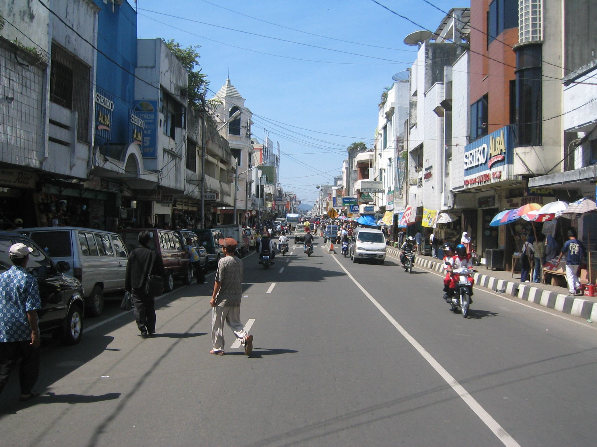
Sukabumi () is a landlocked city surrounded by the regency of the same name (within which it is an enclave) in the southern foothills of Mount Gede, in West Java, Indonesia, about 100 km south of the national capital, Jakarta.
At an altitude of approximately 584 m, the city is a minor hill station resort, with a cooler climate than the surrounding lowlands. The area around Sukabumi is also a popular destination for whitewater rafting. Tea and Rubber production is a major industry in the area. The suburban area surrounding Sukabumi circling the mountain has grown tremendously in population, such that northern Sukabumi Regency, hugging the volcano, and bordering Greater Jakarta, is home to the bulk of the regency's population.
The area of the city is 48.31 km2, and the population at the 2010 Census was 300,359, while the 2020 Census was 346,325; the official estimate as at mid 2024 was 365,735 (comprising 183,757 males and 181,978 females). However, another 1,447,140 million people, as at the mid 2024 official estimates, live in the surrounding metropolitan area within Sukabumi Regency, notably in Cisaat and Gunungguruh Districts to the west of the city and Kebonpedes District to the east, all three being suburbs within the built-up area. The bulk of the metropolitan area population is unusual in that it forms a narrow southwest ring around Mount Gede. The eastern portion of the ringed population belt continues on into Cianjur Regency.
History
Early history
The area around Sukabumi was already inhabited at least in the 11th century. The first written record found in this area was the Sanghyang Tapak inscription in Cibadak, 20 km west of the city. Written in Kawi script, the stone tells about the prohibition of fishing activity in the nearby river by the authorities of the Sunda Kingdom.
At the end of the 16th century, the area was captured by the Banten Sultanate, after the fall of the Sunda Kingdom. The area however became contested in the 1620s between Banten, the Mataram Sultanate in the east and the Batavia-based Dutch East India Company. After a series of military clashes between them, the area was included in a buffer zone territory between Banten and Mataram, although the area is considered de jure as a part of Mataram.
In 1677, after the Dutch forced Mataram to sign a series of unequal treaties as a consequence of Dutch assistance for quelling the Trunajaya rebellion, Sukabumi came under direct control of Tjiandjoer. By that time, there were only few rural Sundanese settlements existed, one of the largest was Tjikole.
Colonial Sukabumi
Sukabumi Coffee Plantations
The area around the present-day Sukabumi (or Soekaboemi in Van Ophuijsen Spelling System) began to develop in the 18th century when the Dutch East India Company started to open coffee plantation areas in the western Priangan region of Java. Due to the high demands of coffee in Europe, in the year of 1709 the Dutch governor-general Abraham van Riebeeck started to open coffee plantations around the area of Tjibalagoeng (present-day Bogor), Tjiandjoer, Djogdjogan, Pondok Kopo, and Goenoeng Goeroeh. Coffee plantations in these five areas had then undergone expansion and intensification during the era of Hendrick Zwaardecroon (1718–1725), where the Tjiandjoer regent at that time Wira Tanoe III acquired territorial expansion of his regency as a compensation for more coffee plantations openings.
The growth of the Goenoeng Goeroeh (Gunungguruh) coffee plantation led to the establishment of small settlements around its area, one of those was the Tjikole (Cikole) hamlet, named after the nearby Tjikole River. In 1776, regent of Tjiandjoer Wira Tanoe Datar VI established the Tjikole Viceregency which were the indirect predecessor of the present-day Sukabumi Regency. The viceregency consisted of six districts of Djampang Koelon, Djampang Tengah, Goenoeng Parang, Tjiheoelang, Tjimahi, and Tjitjoeroeg. The administrative center was located in Tjikole, due to its very strategic locations for communications between Batavia and Tjiandjoer which were the capital of the Priangan Residency at that time.
Tjikole becomes Soekaboemi
After the Dutch East Indies were under the rule of the British in 1811, vast lands in the Tjikole area were bought by Stamford Raffles, the Governor-General of the Dutch East Indies at that time, via an auction held in Batavia. The name Soekaboemi was first used on 1815, when a Priangan-based plantation owner (known then as Preanger Planter) and surgeon, Andries de Wilde visited Tjikole in 1814. From his consultations with local people, De Wilde wrote a letter to Nicolaus Engelhard, a friend and plantation investor, where de Wilde asked Engelhard to propose a name change of the viceregency from Tjikole to Soekaboemi, to which Raffles agreed.
In Dutch colonial times, Soekaboemi was the site of the Politieschool, the colonial police academy. On 8 December 1941, the Empire of Japan invaded the Dutch East Indies as part of World War II and on 6 March 1942, the city came under aerial bombardment by Japanese aircraft. During this attack, both civilian targets (including houses and two schools) and strategic targets (the police academy, the railway line, and the radio station) were hit, resulting in many casualties. During the Japanese occupation, Soekaboemi became the meeting place of Mohammad Hatta and Sutan Sjahrir with representatives of the Japanese Empire to discuss the future of the Dutch East Indies, but both were given 'city prisoner' status. Soekaboemi also became one of the detention sites of American and Australian prisoners of war.
Also during the occupation, the Japanese created a strategic garrison in Ujung Genteng, part of the South Sukabumi Regency. Remains of the harbor and lookout towers at the end of this peninsula are still in place, along with the caves that the Japanese lived and died in towards the end of the war. Ujung Genteng is directly North of Christmas Island and Australia and would have made an excellent point of defense or attack, without official records to substantiate this, it is presumed that they had their sights on Christmas Island and a close link to Australia.
Present day

In early 2005, Sukabumi Regency became the first place in Indonesia that polio was reported in ten years, the beginning of a nationwide outbreak of the disease which had been believed to be eradicated in the country.
Government and politics
Administrative districts
.svg)
The city of Sukabumi is divided into seven districts (kecamatan), listed below with their areas and their populations at the 2010 Census and the 2020 Census, together with the official estimates as of 2024. The table also includes the number of administrative villages (all classed as urban kelurahan) in each district, and its postal codes.
| Kpode | ||||||
|---|---|---|---|---|---|---|
| Wilayah | Name of | |||||
| District | ||||||
| (kecamatan) | Area | |||||
| in | ||||||
| km2 | Pop'n | |||||
| 2010 | ||||||
| Census | Pop'n | |||||
| 2020 | ||||||
| Census | Pop'n | |||||
| mid 2024 | ||||||
| Estimate | No. | |||||
| of | ||||||
| kelurahan | Post | |||||
| codes | ||||||
| 32.72.05 | Baros | 5.58 | 29,536 | 37,734 | 41,320 | 4 |
| 32.72.06 | Lembursitu | 10.70 | 33,719 | 41,432 | 44,690 | 5 |
| 32.72.07 | Cibeureum | 9.13 | 34,719 | 44,961 | 49,500 | 4 |
| 32.72.03 | Citamiang | 4.00 | 47,580 | 53,049 | 55,110 | 5 |
| 32.72.04 | Warudoyong | 7.56 | 52,780 | 58,972 | 61,340 | 5 |
| 32.72.01 | Gunungpuyuh | 5.13 | 43,622 | 48,292 | 50,030 | 4 |
| 32.72.06 | Cikole | 6.21 | 56,775 | 61,885 | 63,730 | 6 |
| *Total for* | *City* | *48.31* | *300,359* | *346,325* | *365,735* | *33* |
| 32.02.34 | Kebonpedes (a) | 10.83 | 27,097 | 33,505 | 35,577 | 5 |
| 32.02.27 | Gunungguruh (a) | 26.31 | 48,099 | 56,764 | 59,196 | 7 |
| 32.02.29 | Cisaat (a) | 21.49 | 113,929 | 129,643 | 133,304 | 13 |
| *Total for* | *Built-up area* | *106.94* | *489,484* | *566,237* | *594,812* | *58* |
Notes: (a) administrative district of Sukabumi Regency, outside the boundaries of the city proper. (b) except the village of Nagrak, with a post code of 43132, and the village of Sukasari, with a post code of 43134.
Climate
Sukabumi has an elevation moderated tropical rainforest climate (Af) with moderate rainfall from July to September and heavy rainfall in the remaining months.
|access-date = 12 November 2020}}
Transportation

After almost one year of hiatus, the railway transport between Sukabumi and Bogor of 57 kilometers was reactivated, with the new train called 'Pangrango' on 9 November 2013. The train has one executive-class car and three economy-class cars.
Bogor-Ciawi–Sukabumi Toll Road is under construction that will connect Bogor Regency, Bogor city, Sukabumi Regency and Sukabumi city. The 15.35-kilometer first section of the toll road between Ciawi and Cigombong was inaugurated by Indonesian President Joko Widodo on 3 December 2018.
Culinary

Sukabumi also has some traditional dishes that are worth trying, for example Roti Priangan, Mochi, Bandros, Soto Mie and Bubur.
Notable people
- Miel Mundt (1880–1949), football player
- Rie Cramer (1887–1977), author and illustrator
- Piet Metman (1916–1990), swimmer
- Lo van Hensbergen (1917–1987), actor and director
- Ellen Beerthuis-Roos (born 1926), sculptor
- Desy Ratnasari (born 1973), actress, singer and politician
- Happy Salma (born 1980), actress, writer, designer, entrepreneur and Balinese royal
- Syahrini (born 1980), actress and singer
References
References
- [http://radarsukabumi.com/2014/09/16/wawali-pertahankan-julukan-kota-santri/ Wawali, Pertahankan Julukan Kota Santri. www.radarsukabumi.com] {{Webarchive. link. (9 October 2016)
- Badan Pusat Statistik, Jakarta, 28 February 2025, ''Kota Sukabumi Dalam Angka 2025'' (Katalog-BPS 1102001.3272)
- Biro Pusat Statistik, Jakarta, 2011.
- Badan Pusat Statistik, Jakarta, 2021.
- [[Marwati Djoened Poesponegoro]], [[Nugroho Notosusanto]]. (1992). "Sejarah nasional Indonesia: Jaman kuna". PT Balai Pustaka.
- G. G. Bandilenko, E.I. Gnevusheva, D.V. Deopik, V.A. Tsyganov. (1992). "History of Indonesia".
- Suryaningrat, Bayu. (1982). "Sajarah Cianjur Sareng Raden Aria Wira Tanu Dalem Cikundul Cianjur". Rukun Warga Cianjur-Jakarta, Jakarta.
- G. G. Bandilenko, E.I. Gnevusheva, D.V. Deopik, V.A. Tsyganov. (1992). "History of Indonesia".
- Jaya, Ruyatna. (2003). "Sejarah Sukabumi". Sukabumi City Government.
- Beekman, E. M.. (1988). "Fugitive Dreams: An Anthology of Dutch Colonial Literature". University of Massachusetts Press.
- Brommer, Bea. (2015). "To My Dear Pieternelletje:Grandfather and Granddaughter in VOC Time, 1710–1720". Brill.
- Danasasmita, Saleh. (1983). "Sejarah Bogor, Volume 1". Pemerintah Daerah Kotamadya DT II Bogor.
- Klaveren, N. A.. (1983). "The Dutch Colonial System in the East Indies". Springer.
- Kumar, Ann. (1997). "Java and Modern Europe: Ambiguous Encounters". Routledge.
- Coolsma, S.. (2010). "De zendingseeuw voor Neederlandsch Oost-Indië". Nabu Press.
- MPI Foundation. (2005). "West Java Miracle Sight: A Mass of Verb and Scene Information".
- Marihandono, Djoko. (2008). "Titik balik historiografi di Indonesia". University of Indonesia.
- Bosma, Ulbe. (2009). "Being "Dutch" in the Indies: A History of Creolisation and Empire, 1500–1920". Ohio University Press.
- Dutch East Indies. Topografische Dienst. (1918). "Jaarverslag".
- Dinas Pariwisata Provinsi Daerah Tingkat I Jawa Barat. (1986). "Wajah Pariwisata Jawa Barat". Dinas Pariwisata Jawa Barat.
- Spiller, Harry. (2015). "American POWs in World War II: Twelve Personal Accounts of Captivity by Germany and Japan". McFarland & Company.
- Jong, Louis de. (2004). "The Collapse of a Colonial Society: The Dutch in Indonesia During the Second World War". Royal Netherlands Institute of Southeast Asian and Caribbean Studies.
- Indonesia confirms the second case of polio, ''ABC Radio Australia'' 5 April 2005.
- Badan Pusat Statistik, Jakarta, 26 September 2024, Kecamatan Baros Dalam Angka 2024 (Katalog-BPS 1102001.3272010)
- Badan Pusat Statistik, Jakarta, 26 September 2024, Kecamatan Lembursitu Dalam Angka 2024 (Katalog-BPS 1102001.3272011)
- Badan Pusat Statistik, Jakarta, 26 September 2024, Kecamatan Cibeureum Dalam Angka 2024 (Katalog-BPS 1102001.3272012)
- Badan Pusat Statistik, Jakarta, 26 September 2024, Kecamatan Citamiang Dalam Angka 2024 (Katalog-BPS 1102001.3272020)
- Badan Pusat Statistik, Jakarta, 26 September 2024, Kecamatan Warudoyong Dalam Angka 2024 (Katalog-BPS 1102001.3272030)
- Badan Pusat Statistik, Jakarta, 26 September 2024, Kecamatan Gunungpuyuh Dalam Angka 2024 (Katalog-BPS 1102001.3272040)
- Badan Pusat Statistik, Jakarta, 26 September 2024, Kecamatan Cikole Dalam Angka 2024 (Katalog-BPS 1102001.3272050)
- Badan Pusat Statistik, Jakarta, 26 September 2024, Kecamatan Kebonpedes Dalam Angka 2024 (Katalog-BPS 1102001.3202171)
- Badan Pusat Statistik, Jakarta, 26 September 2024, Kecamatan Gunungguruh Dalam Angka 2024 (Katalog-BPS 1102001.3202201)
- Badan Pusat Statistik, Jakarta, 26 September 2024, Kecamatan Cisaat Dalam Angka 2024 (Katalog-BPS 1102001.3202200)
- (10 November 2013). "PT KAI revives Bogor-Sukabumi route".
- "This New Toll Road Drastically Cuts the Time It Takes You to Drive to Sukabumi". Jakarta Globe.
This article was imported from Wikipedia and is available under the Creative Commons Attribution-ShareAlike 4.0 License. Content has been adapted to SurfDoc format. Original contributors can be found on the article history page.
Ask Mako anything about Sukabumi — get instant answers, deeper analysis, and related topics.
Research with MakoFree with your Surf account
Create a free account to save articles, ask Mako questions, and organize your research.
Sign up freeThis content may have been generated or modified by AI. CloudSurf Software LLC is not responsible for the accuracy, completeness, or reliability of AI-generated content. Always verify important information from primary sources.
Report