From Surf Wiki (app.surf) — the open knowledge base
Subang, Selangor
| Field | Value |
|---|---|
| official_name | Subang |
| settlement_type | Town and District capital |
| image_skyline | Subang, Mah Seng - panoramio - affnan.jpg |
| pushpin_map | Malaysia West |
| pushpin_label_position | right |
| pushpin_map_caption | Location in Peninsular Malaysia |
| coordinates | |
| subdivision_type | Country |
| subdivision_name | Malaysia Malaysia |
| subdivision_type1 | State |
| subdivision_type2 | District |
| subdivision_name1 | Selangor Selangor |
| subdivision_name2 | Petaling |
| established_title | Establishment |
| area_total_km2 | 200 |
| pop_est_as_of | 2010 |
| population_density_km2 | auto |
| timezone | MST |
| utc_offset | +8 |
| postal_code_type | Postcode |
| postal_code | 40150 |
| 40160 | |
| 47200 | |
| area_code_type | Calling code |
| area_code | +603-78, +603-61 |
40160 47200
Subang is a township in Petaling District, Selangor, Malaysia. It is located about 17 km west of downtown Kuala Lumpur.
It is home to the Sultan Abdul Aziz Shah Airport (Subang Skypark), the former international airport of Kuala Lumpur. The airport now serves domestic flights, as well as cargo and private aviation.
Geography
Subang town falls within the local government area of the Shah Alam City Council (MBSA), corresponding to sections U3, U6 and U7. Clockwise from west to east, it is surrounded by Bukit Jelutong (Shah Alam), Sungai Buloh as well as the townships of Kwasa Damansara, Kota Damansara, Bandar Utama, Ara Damansara and Kelana Jaya (Petaling Jaya).
Subdivisions
Residential areas
As there are many golf courses nearby such as Glenmarie Golf and Country Club, Subang National Golf Club and it is home to the renowned Saujana Golf and Country Club, it is a strategic location for the premier neighbourhoods. These neighbourhoods include a range of houses from luxurious condominiums to villas, semi-detached and bungalows.
- Amaya Saujana
- Serai Saujana
- Lake View Saujana
- Glenhill Saujana
- Maplewoods Saujana
- Bunga Raya Condominium
Economy
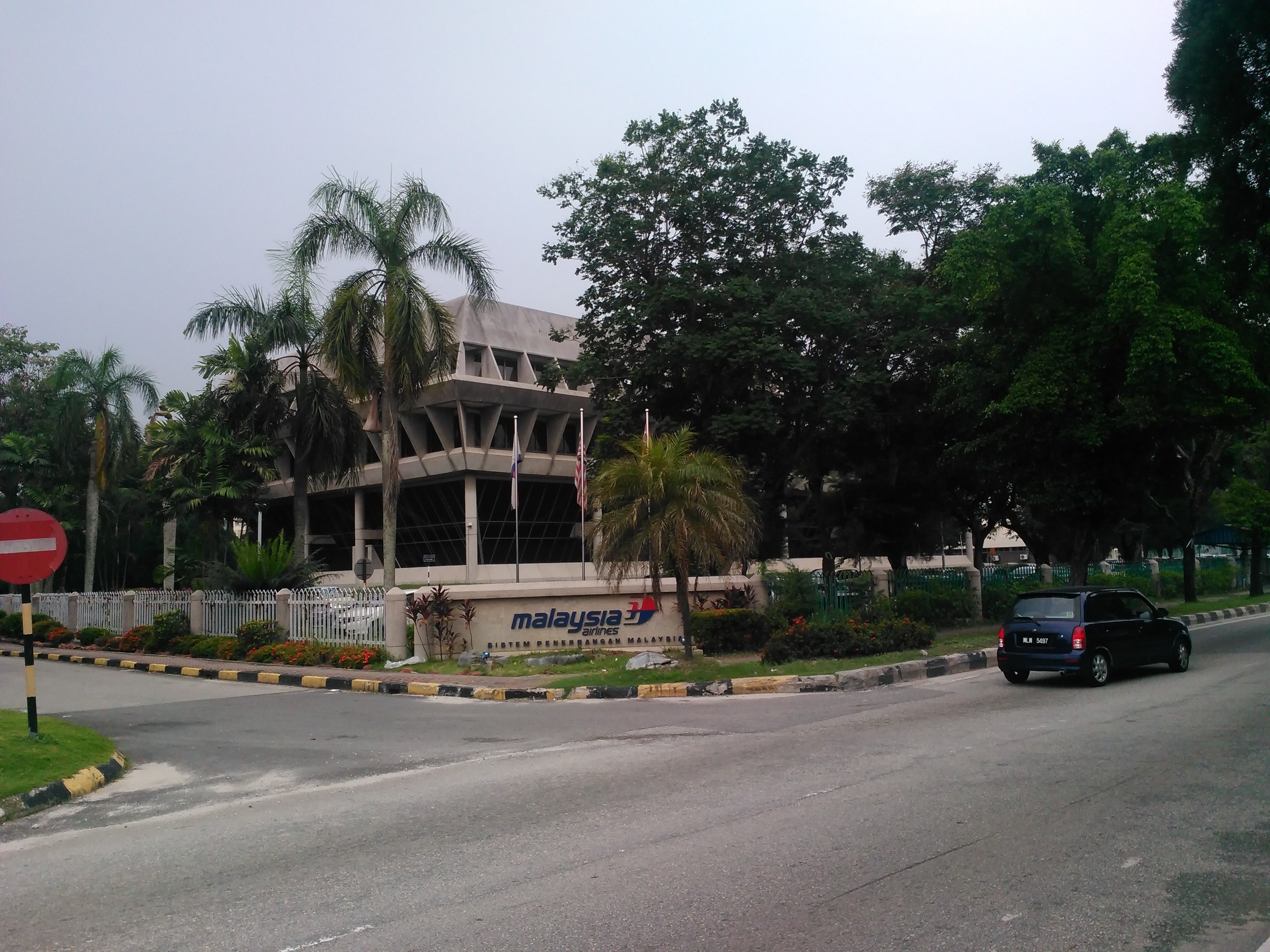
Subang town, being home to the Subang Airport, houses the headquarters of Malaysia Airlines, the Malaysian flag carrier, as well as its low-cost subsidiary Firefly. The complex is across the highway from the airport terminal.
Airbus has a maintenance centre just south of the Malaysia Airlines compound.
West of the airport runway, there is a small industrial area, along the road to the Royal Malaysian Air Force base.
The main commercial area of Subang town is in Taman Subang Perdana, containing several shoplots, located just to the north of the airport runway.
Transportation
Air
Main article: Sultan Abdul Aziz Shah Airport
Subang is home to the Sultan Abdul Aziz Shah Airport, a.k.a. Subang Skypark . It was Malaysia's principal international airport from 1965 to 1998, when it was replaced by the Kuala Lumpur International Airport in Sepang region. The airport still serves domestic flights and limited international flights by Firefly and Malindo Air. Private charter flights provided by Berjaya Air are also available.
The Subang Airport is also a major air cargo hub, operated by Raya Airways.
Rail and bus
Terminal Skypark Komuter station, on the KTM Komuter , designed to connect Subang Airport to KL Sentral, is the main railway station in the area.
Rapid KL has 5 bus routes serving Subang town:
- 772: Subang Suria - Subang Perdana commercial centre - Subang Airport - LRT Ara Damansara ()
- T772: Bukit Subang - Subang Perdana commercial centre - MRT Kwasa Sentral ()
- T804: Subang Airport - MRT Kwasa Sentral ()
- T803: Subang Suria - MRT Kwasa Sentral ()
- T802: Subang Bestari - MRT Kwasa Sentral ()
Road
Subang town is mainly served by the Federal Route 15, which was built as a feeder road for the Subang Airport. The highway links Sungai Buloh in the north to Subang Jaya in the south.
The Guthrie toll road runs through the western border of Subang town.
Indirectly, the PLUS toll road serves Subang town with an interchange with national highway 15 at exit 104 . The exit is next to Ara Damansara LRT station.
Education

The Japanese School of Kuala Lumpur is located on the grounds of the Saujana Golf and Country Club in Subang.
Weather
Subang is considered as the most thunderous place in Malaysia.https://web.archive.org/web/20080320044307/http://www.met.gov.my/english/education/climate/info.html According to Malaysian Meteorological Department:-
- Subang had the highest number of days with lightning in a year with 362 days in 1987.
- Subang has the highest mean annual number of days with thunderstorm with 262 days.
- Subang had the highest number of days with thunderstorms in a year with 269 days in 1969.
Politics
Subang town falls within the Sungai Buloh parliamentary constituency, currently represented by Sivarasa Rasiah (PH-PKR).
On the state level, Subang town is within the borders of the Kota Damansara state constituency. It is currently held by Shatiri Mansor (PH-PKR).
References
- Straight fights in all Subang constituencies, The Star, March 7, 2008.
References
- (19 July 2021). "Airbus in Malaysia".
- "Pekan Subang Shah Alam, Selangor".
- "Taman Subang Perdana 40150 Shah Alam, Selangor".
- "[http://www.jskl.edu.my/HP/page/annai/gaiyo_2.html School Outline] {{Webarchive. link. (2013-01-08 ." [[Japanese School of Kuala Lumpur]]. Retrieved on January 13, 2015. "Saujana Resort Seksyen U2, 40150, Selangor Darul Ehsan, Malaysia")
This article was imported from Wikipedia and is available under the Creative Commons Attribution-ShareAlike 4.0 License. Content has been adapted to SurfDoc format. Original contributors can be found on the article history page.
Ask Mako anything about Subang, Selangor — get instant answers, deeper analysis, and related topics.
Research with MakoFree with your Surf account
Create a free account to save articles, ask Mako questions, and organize your research.
Sign up freeThis content may have been generated or modified by AI. CloudSurf Software LLC is not responsible for the accuracy, completeness, or reliability of AI-generated content. Always verify important information from primary sources.
Report