From Surf Wiki (app.surf) — the open knowledge base
Sturgeon River Provincial Park
Provincial park in Ontario, Canada
Provincial park in Ontario, Canada
| Field | Value |
|---|---|
| name | Sturgeon River Provincial Park |
| iucn_category | II |
| iucn_ref | |
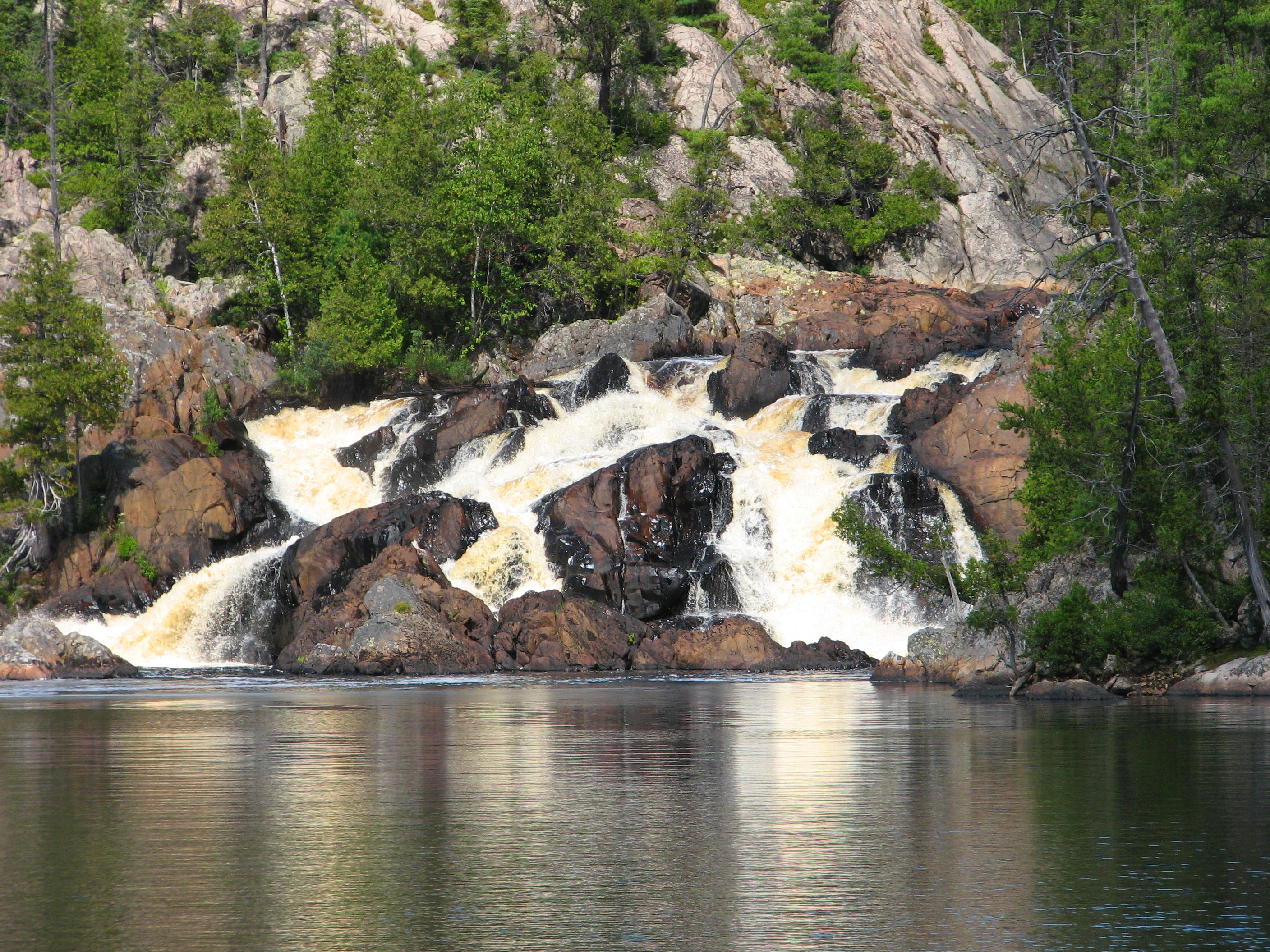
| photo | Upper_Goose_Falls,_Sturgeon_River.jpg |
| photo_caption | Upper Goose Falls |
| location | Sudbury District, Ontario, Canada |
| nearest_city | Greater Sudbury |
| map | Ontario |
| map_caption | Location in Ontario (Canada) |
| relief | yes |
| coordinates | |
| coords_ref | |
| length_km | 70 |
| area_ha | 7985 |
| area_ref | |
| designation | Waterway |
| established | 1989 |
| governing_body | Ontario Parks |
| website | |
| mapframe | yes |
| mapframe-zoom | 8 |
| mapframe-wikidata | yes |
| mapframe-zoom = 8 | mapframe-wikidata = yes
The Sturgeon River Provincial Park is a provincial park in northern Ontario, Canada, that protects about 70 km long section of the Sturgeon River and its banks, from Woods Lake (at the boundary of Lady Evelyn-Smoothwater Park in Timiskaming District) to the Sudbury-Nipissing District boundary. It was established in 1989 and expanded in 2005. It protects outstanding water routes that provide recreational canoe camping opportunities. Other activities include hunting and fishing.
It used to have an area of 33.5 km2 and the park ended south of the Obabika River and Lower Goose Falls. It was extended south in 2005 and now has an area of 79.85 km2. The river itself is 177 km long and continues until it empties at the north shore of and into Lake Nipissing. The town of Sturgeon Falls is located on the river about 3 km north of its mouth.
The park is one of the several provincial parks in the Temagami area. It forms a natural corridor with the adjacent Lady Evelyn-Smoothwater Provincial Park, Solace Provincial Park, Chiniguchi Waterway Provincial Park, and Obabika River Provincial Park. All parks are managed by Ontario Parks.
Features
The river features a continually changing landscape, from the Temagami highlands, with bedrock outcrops and long slender lakes to narrow river channels, rapids and shallows, eventually turning to sandy shores.
This river is only suitable for experienced backcountry canoeists. With some 65 rapids, canoeists should be able to portage and/or have whitewater canoeing skills. Detailed maps for navigation are essential. Despite its remote setting, it is an operating park, requiring permits for camping (not for day use). The only facilities are 35 backcountry campsites.
References
References
- UNEP-WCMC. "Protected Area Profile for Sturgeon River Provincial Park". World Database on Protected Areas.
- {{Cite cgndb. FEUVT. Sturgeon River Provincial Park
- "Sturgeon River". Ontario Parks.
- (1 December 2012). "Policy Report P173e: STURGEON RIVER PROVINCIAL PARK (WATERWAY CLASS)". Ministry of Natural Resources Ontario.
- [http://www.ontarioparks.com/english/sturg.html Ontario Parks official website - Sturgeon River] {{Webarchive. link. (2009-07-05)
- (1988). "Temagami canoe routes". The Canadian Recreational Canoeing Association.
This article was imported from Wikipedia and is available under the Creative Commons Attribution-ShareAlike 4.0 License. Content has been adapted to SurfDoc format. Original contributors can be found on the article history page.
Ask Mako anything about Sturgeon River Provincial Park — get instant answers, deeper analysis, and related topics.
Research with MakoFree with your Surf account
Create a free account to save articles, ask Mako questions, and organize your research.
Sign up freeThis content may have been generated or modified by AI. CloudSurf Software LLC is not responsible for the accuracy, completeness, or reliability of AI-generated content. Always verify important information from primary sources.
Report