From Surf Wiki (app.surf) — the open knowledge base
Stillwater County, Montana
County in Montana, United States
County in Montana, United States
| Field | Value |
|---|---|
| county | Stillwater County |
| state | Montana |
| founded year | 1913 |
| seat wl | Columbus |
| largest city wl | Columbus |
| city type | town |
| area_total_sq_mi | 1805 |
| area_land_sq_mi | 1795 |
| area_water_sq_mi | 9.2 |
| area percentage | 0.5 |
| population_as_of | 2020 |
| population_total | 8963 |
| pop_est_as_of | 2024 |
| population_est | 9450 |
| population_density_sq_mi | auto |
| web | www.stillwater.mt.gov |
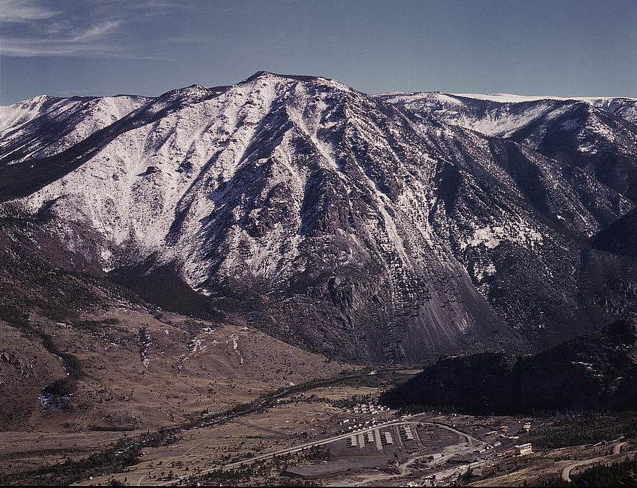
| ex image | I-90 Park City MT.jpg |
| ex image cap | Beartooth Mountains from Park City |
| district | 2nd |
| time zone | Mountain |
| named for | Stillwater River |
- Montana county number 32
Stillwater County is a county in the U.S. state of Montana. As of the 2020 census, the population was 8,963. Its county seat is Columbus.
Geography
According to the United States Census Bureau, the county has a total area of 1805 sqmi, of which 1795 sqmi is land and 9.2 sqmi (0.5%) is water.
Major highways
- [[Image:I-90.svg|20px]] Interstate 90
- [[Image:US 10.svg|20px]] U.S. Highway 10 (Former)
- [[Image:MT-78.svg|20px]] Montana Highway 78
Adjacent counties
- Golden Valley County – north
- Yellowstone County – east
- Carbon County – south
- Park County – southwest
- Sweet Grass County – west
National protected areas
- Custer National Forest (part)
- Grass Lake National Wildlife Refuge
- Hailstone National Wildlife Refuge
Demographics
|align-fn=center 1790–1960, 1900–1990, 1990–2000, 2010–2020
2020 census
As of the 2020 census, there were 8,963 people living in the county. Of the residents, 20.8% were under the age of 18 and 24.4% were 65 years of age or older; the median age was 48.6 years. For every 100 females there were 103.8 males, and for every 100 females age 18 and over there were 103.5 males. 0.0% of residents lived in urban areas and 100.0% lived in rural areas.
The racial makeup of the county was 91.7% White, 0.2% Black or African American, 1.0% American Indian and Alaska Native, 0.3% Asian, 0.9% from some other race, and 5.9% from two or more races. Hispanic or Latino residents of any race comprised 3.0% of the population.
There were 3,777 households in the county, of which 24.8% had children under the age of 18 living with them and 17.2% had a female householder with no spouse or partner present. About 26.3% of all households were made up of individuals and 13.7% had someone living alone who was 65 years of age or older.
There were 4,659 housing units, of which 18.9% were vacant. Among occupied housing units, 81.0% were owner-occupied and 19.0% were renter-occupied. The homeowner vacancy rate was 1.8% and the rental vacancy rate was 7.7%.
2010 census
As of the 2010 census, there were 9,117 people, 3,796 households, and 2,657 families in the county. The population density was 5.1 PD/sqmi. There were 4,803 housing units at an average density of 2.7 /mi2. The racial makeup of the county was 96.8% white, 0.8% American Indian, 0.3% Asian, 0.1% black or African American, 0.4% from other races, and 1.6% from two or more races. Those of Hispanic or Latino origin made up 2.3% of the population. In terms of ancestry, 34.7% were German, 14.1% were Irish, 14.0% were English, 10.8% were Norwegian, and 6.9% were American.
Of the 3,796 households, 28.9% had children under the age of 18 living with them, 60.6% were married couples living together, 6.0% had a female householder with no husband present, 30.0% were non-families, and 25.8% of all households were made up of individuals. The average household size was 2.37 and the average family size was 2.84. The median age was 45.7 years.
The median income for a household in the county was $57,227 and the median income for a family was $65,438. Males had a median income of $51,830 versus $26,909 for females. The per capita income for the county was $27,168. About 6.0% of families and 9.5% of the population were below the poverty line, including 17.9% of those under age 18 and 7.2% of those age 65 or over.
Politics
Stillwater County is a heavily Republican county in presidential elections. It has not voted for a Democratic presidential candidate since Franklin D. Roosevelt in 1936.
Communities
Town
- Columbus (county seat)
Census-designated places
- Absarokee
- Fishtail
- Nye
- Park City
- Rapelje
- Reed Point
Unincorporated communities
- Beehive
- Dean
- Meyers Creek (partial)
- Molt
- Reed Point
Ghost towns
- Limestone
- Springtime
- Wheat Basin
References
References
- "State & County QuickFacts". United States Census Bureau.
- "Find a County". National Association of Counties.
- (August 22, 2012). "2010 Census Gazetteer Files". United States Census Bureau.
- "County Population Totals and Components of Change: 2020-2024". United States Census Bureau.
- "U.S. Decennial Census". United States Census Bureau.
- "Historical Census Browser". University of Virginia Library.
- "Population of Counties by Decennial Census: 1900 to 1990". United States Census Bureau.
- "Census 2000 PHC-T-4. Ranking Tables for Counties: 1990 and 2000". United States Census Bureau.
- (2021). "2020 Decennial Census Redistricting Data (Public Law 94-171)". United States Census Bureau.
- (2023). "2020 Decennial Census Demographic and Housing Characteristics (DHC)". United States Census Bureau.
- (2021). "2020 Decennial Census Demographic Profile (DP1)". United States Census Bureau.
- Leip, David. "Atlas of US Presidential Elections".
- [https://www.google.com/maps/place/Meyers+Creek,+MT+59061/@45.4943823,-109.9406022,15z/data=!3m1!4b1!4m13!1m7!3m6!1s0x5348af8d3f82d59d:0x2d75b7538169a3cd!2sStillwater+County,+MT!3b1!8m2!3d45.7001096!4d-109.3922403!3m4!1s0x534f6f2d14764043:0x556a29187a6ae9a7!8m2!3d45.4944354!4d-109.9317741 ''Meyers Creek MT'' Google Maps (accessed January 7, 2019)]
- [https://www.google.com/maps/place/Reed+Point,+MT+59069/@45.7069271,-109.5503578,15z/data=!3m1!4b1!4m13!1m7!3m6!1s0x5348af8d3f82d59d:0x2d75b7538169a3cd!2sStillwater+County,+MT!3b1!8m2!3d45.7001096!4d-109.3922403!3m4!1s0x534f5511c8ab5b0f:0x74553fbedcd969e8!8m2!3d45.709356!4d-109.5421028 ''Reed Point MT'' Google Maps (accessed January 7, 2019)]
This article was imported from Wikipedia and is available under the Creative Commons Attribution-ShareAlike 4.0 License. Content has been adapted to SurfDoc format. Original contributors can be found on the article history page.
Ask Mako anything about Stillwater County, Montana — get instant answers, deeper analysis, and related topics.
Research with MakoFree with your Surf account
Create a free account to save articles, ask Mako questions, and organize your research.
Sign up freeThis content may have been generated or modified by AI. CloudSurf Software LLC is not responsible for the accuracy, completeness, or reliability of AI-generated content. Always verify important information from primary sources.
Report