From Surf Wiki (app.surf) — the open knowledge base
St. Lawrence River
River in eastern Canada and the United States
River in eastern Canada and the United States
| Field | Value | |
|---|---|---|
| name | St. Lawrence River | |
| name_other | Saint Lawrence River | |
| name_etymology | Saint Lawrence of Rome | |
| <!---------------------- IMAGE & MAP --> | image | Le fleuve Saint-Laurent.jpg |
| image_caption | Montréal-Est, Quebec | |
| map | Grlakes lawrence map.png | |
| map_caption | Great Lakes/St. Lawrence watershed | |
| pushpin_map_caption | ||
| subdivision_type1 | Country | |
| subdivision_name1 | Canada, United States | |
| subdivision_type2 | Provinces | |
| subdivision_name2 | Ontario, Quebec | |
| subdivision_type3 | State | |
| subdivision_name3 | New York, Vermont | |
| <!---------------------- PHYSICAL CHARACTERISTICS --> | length | 500 km excluding the estuary. C. 928 km if included. |
| (St. Lawrence River–Lake Ontario–Niagara–Lake Erie–Detroit–Lake St. Clair–St. Clair–Lake Huron–St. Marys River–Lake Superior–St. Louis–North River: 3,058 km)<ref name | "St. Lawrence River and Seaway" | |
| width_avg | 1-5 km | |
| depth_min | 2 m (Fluvial Section) | |
| depth_max | 60 m (Quebec City) | |
| discharge2_location | Tadoussac | |
| discharge1_location | Pointe-des-Monts | |
| discharge1_min | 10,478 m3/s | |
| discharge1_avg | (Period: 1969–2023)17,600 m3/s | |
| discharge1_max | 33,085 m3/s | |
| discharge2_avg | (Period: 1962–1988)16,800 m3/s | |
| <!---------------------- BASIN FEATURES --> | source1 | Lake Ontario |
| source1_location | Kingston, Ontario / Cape Vincent, New York | |
| source1_coordinates | ||
| source1_elevation | 74.7 m | |
| mouth | Gulf of St. Lawrence / Atlantic Ocean | |
| mouth_location | Quebec, Canada | |
| mouth_coordinates | ||
| mouth_elevation | 0 m | |
| progression | Gulf of St. Lawrence | |
| river_system | St. Lawrence River | |
| basin_size | 1,344,200 km2 | |
| (Pointe-des-Monts: 1,271,547.4 km<sup>2</sup>)<ref name | "St Lawrence-Great Lakes" | |
| discharge3_location | Quebec City | |
| discharge3_min | 8,600 m3/s | |
| discharge3_avg | (Period: 1968–2023)12,500 m3/s | |
| discharge3_max | 22,766 m3/s | |
| discharge4_location | Montreal | |
| discharge4_avg | (Period: 1971–2000)10,063.3 m3/s | |
| discharge5_location | Cornwall | |
| discharge5_avg | (1861–2019)7,060 m3/s |
(St. Lawrence River–Lake Ontario–Niagara–Lake Erie–Detroit–Lake St. Clair–St. Clair–Lake Huron–St. Marys River–Lake Superior–St. Louis–North River: 3,058 km) (Pointe-des-Monts: 1,271,547.4 km2) The St. Lawrence River (, ) is a large international river in the middle latitudes of North America connecting the Great Lakes with the North Atlantic Ocean. Its waters flow in a northeasterly direction from Lake Ontario to the Gulf of St. Lawrence, traversing Ontario and Quebec in Canada and New York in the United States. A portion of the river demarcates the Canada–United States border.
As the primary drainage outflow of the Great Lakes Basin, the St. Lawrence has the second-highest discharge of any river in North America (after the Mississippi River) and the 16th-highest in the world. The estuary of the St. Lawrence is often cited by scientists as the largest in the world. Significant natural landmarks of the river and estuary include the 1,864 river islands of the Thousand Islands, the endangered whales of Saguenay–St. Lawrence Marine Park, and the limestone monoliths of the Mingan Archipelago.
Long a transportation route to Indigenous peoples, the St. Lawrence River has played a key role in the history of Canada and in the development of cities such as Montreal and Quebec City. The river remains an important shipping route as the backbone of the St. Lawrence Seaway, a lock and canal system that enables world marine traffic to access the inland ports of the Great Lakes Waterway.
Etymology
The river has historically been given a variety of different names by local First Nations. Beginning in the 16th century, French explorers visited what is now Canada and gave the river names such as the Grand fleuve de Hochelaga and the Grande rivière du Canada, where fleuve and rivière are two French words (fleuve being a river that flows into the sea).
The river's present name has been used since 1604 when it was recorded on a map by Samuel de Champlain. Champlain opted for the names Grande riviere de sainct Laurens and Fleuve sainct Laurens in his writings, supplanting the earlier names. In contemporary French, the name is rendered as the fleuve Saint-Laurent. The name Saint-Laurent (Saint Lawrence) was originally applied to the eponymous bay by Jacques Cartier upon his arrival into the region on the 10th of August feast day for Saint Lawrence in 1535.
Indigenous people use the following names:
- Innu-aimun, the language of Nitassinan, refer to it as Wepistukujaw Sipo/Wepìstùkwiyaht sīpu.
- the Abenaki call it Moliantegok/Moliantekw ("Montréal River"), Kchitegw/Ktsitekw/Gicitegw ("Great River"), or Oss8genaizibo/Ws8genaisibo/Wsogenaisibo ("River of the Algonquins").
- in Mohawk language it is Roiatatokenti, Raoteniateara, Ken’tarókwen, or Kaniatarowanénhne.
- Tuscarora people call it Kahnawáˀkye or Kaniatarowanenneh ("Big Water Current").
- Algonquin people call it "the Walking Path" or Magtogoek, or Kitcikanii sipi, the "Large Water River".
- the Wendat Nation call it Lada8anna or ''Laooendaooena'''.
- the Atikamekw of Nitaskinan refer to it as Micta sipi ("Huge River").
Geography


Marine weather
In winter, the St. Lawrence River begins producing ice in December between Montreal and Quebec City. The prevailing winds and currents push this ice towards the estuary, and it reaches the east of Les Méchins at the end of December. Ice covers the entire Gulf of St. Lawrence in January and February.
Ice helps navigation by preventing the formation of waves, and therefore spray, and prevents the icing of ships.
Watershed
With the draining of the Champlain Sea, due to a rebounding continent from the Last Glacial Maximum, the St. Lawrence River was formed. The Champlain Sea lasted from about 13,000 years ago to about 10,000 years ago and was continuously shrinking during that time, a process that continues today. The head of the St. Lawrence River, near Lake Ontario, is home to the Thousand Islands.
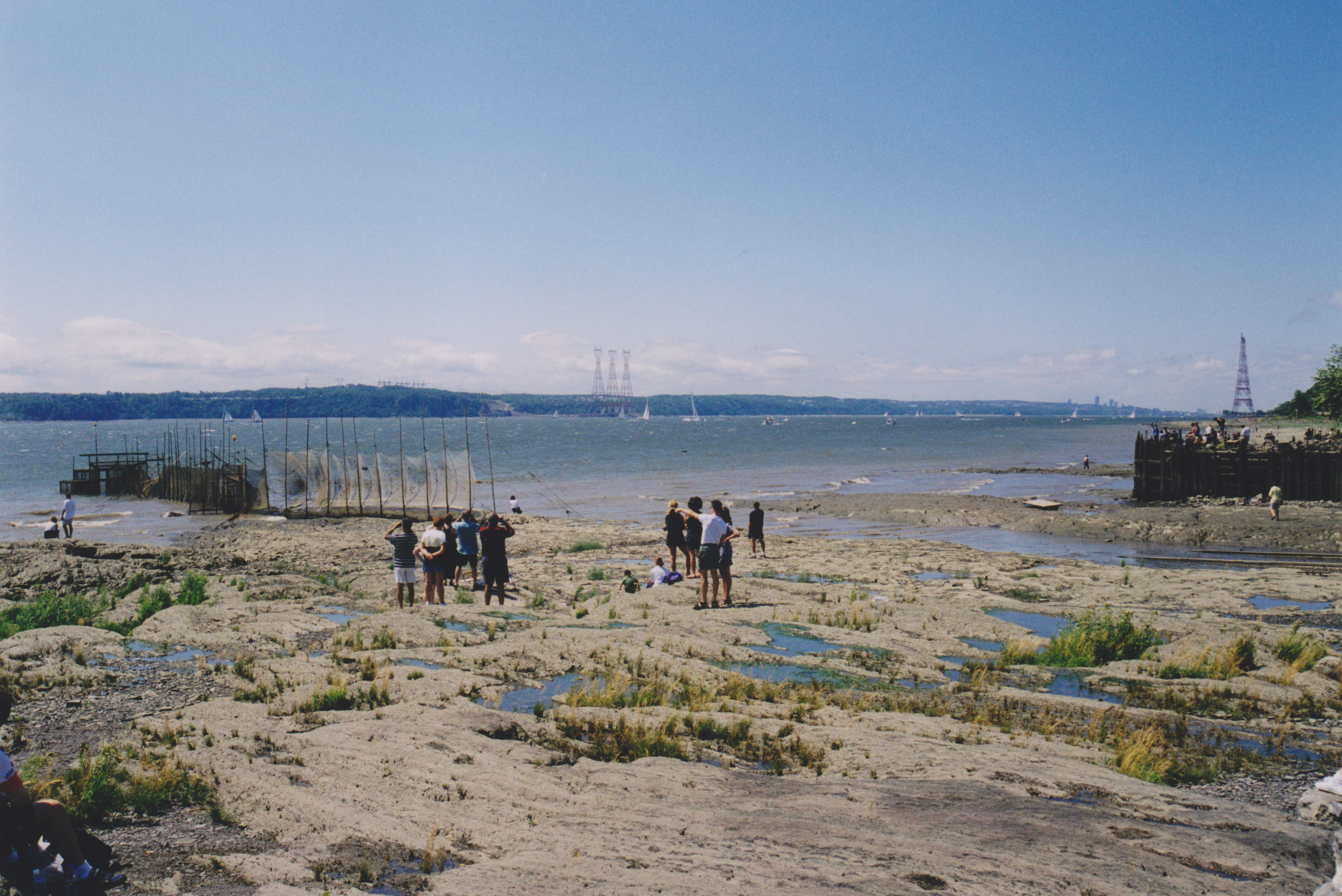
Today, the St. Lawrence River begins at the outflow of Lake Ontario and flows adjacent to Cape Vincent, Gananoque, Clayton, Alexandria Bay, Brockville, Morristown, Ogdensburg, Massena, Cornwall, Montreal, Trois-Rivières, and Quebec City before draining into the Gulf of St. Lawrence, often given as the largest estuary in the world. The estuary begins at the eastern tip of Île d'Orléans, just downstream from Quebec City. The river becomes tidal around Quebec City.
The St. Lawrence River runs 3058 km from the farthest headwater to the mouth and 1197 km from the outflow of Lake Ontario. These numbers include the estuary; without the estuary, the length from Lake Ontario is c. 500 km (c. 300 mi). The farthest headwater is the North River in the Mesabi Range at Hibbing, Minnesota. Its drainage area, which includes the Great Lakes, the world's largest system of freshwater lakes, is 1344200 km2, of which 839200 km2 is in Canada and 505000 km2 is in the United States. The basin covers parts of Ontario and Quebec in Canada, parts of Minnesota, Wisconsin, Illinois, Indiana, Ohio, Pennsylvania, New York, Vermont, and nearly the entirety of the state of Michigan in the United States. The average discharge below the Saguenay River is 16800 m3/s. At Quebec City, it is 12101 m3/s. The average discharge at the river's source, the outflow of Lake Ontario, is 7410 m3/s.
The St. Lawrence River includes Lake Saint Francis at Salaberry-de-Valleyfield, Lake Saint-Louis south of Montreal and Lake Saint Pierre east of Montreal. It encompasses four archipelagoes: the Thousand Islands chain near Alexandria Bay, New York and Kingston, Ontario; the Hochelaga Archipelago, including the Island of Montreal and Île Jésus (Laval); the Lake St. Pierre Archipelago (classified a biosphere world reserve by the UNESCO in 2000) and the smaller Mingan Archipelago. Other islands include Île d'Orléans near Quebec City and Anticosti Island north of the Gaspé. It is the second-longest river in Canada.
Lake Champlain and the Ottawa, Richelieu, Saint-Maurice, Saint-François, Chaudière and Saguenay rivers drain into the St. Lawrence.
The St. Lawrence River is in a seismically active zone where fault reactivation is believed to occur along late Proterozoic to early Paleozoic normal faults related to the opening of the Iapetus Ocean. The faults in the area are rift-related and comprise the Saint Lawrence rift system.
According to the United States Geological Survey, the St. Lawrence Valley is a physiographic province of the larger Appalachian division, containing the Champlain section. However, in Canada, where most of the valley is, it is instead considered part of a distinct St. Lawrence Lowlands physiographic division, and not part of the Appalachian division.
Sources
The source of the North River in the Mesabi Range in Minnesota (Seven Beaver Lake) is considered to be the source of the St. Lawrence River. Because it crosses so many lakes, the water system frequently changes its name. From source to mouth, the names are:
- North River
- Saint Louis River
- Lake Superior
- St. Marys River
- Lake Huron
- St. Clair River
- Lake St. Clair
- Detroit River
- Lake Erie
- Niagara River
- Lake Ontario
The St. Lawrence River also passes through Lake Saint-Louis and Lake Saint-Pierre in Quebec.
Tributaries
The St. Lawrence River and the largest tributaries of the Great Lakes.
The St. Lawrence River tributaries are listed upstream from the mouth. The major tributaries of the inter-lake sections are also shown, as well as the major rivers that flow into the Great Lakes. Great Lakes tributaries are listed in alphabetical order.
The list includes all tributaries with a drainage area of at least 1,000 square kilometres and an average flow of more than 10 cubic metres per second.
| Left | Right tributary | Length (km) | Basin size (km2) | Average discharge (m3/s) |
|---|---|---|---|---|
| St. Lawrence River | ||||
| Godbout | 112 | 1,930.1 | 44.4 | |
| Frankquelin | 67.5 | 582.9 | 12.1 | |
| Manicouagan | 221 | 45,908 | 1,020 | |
| Outardes | 499 | 19,057 | 400 | |
| Mitis | 51 | 1,806.4 | 37 | |
| Betsiamites | 444 | 18,984.1 | 366.7 | |
| Laval | 42 | 641.6 | 13 | |
| Rivière du Sault aux Cochons | 128 | 1,946 | 38.7 | |
| Rimouski | 119.2 | 1,635 | 30.8 | |
| Portneuf | 55 | 2,457.6 | 52.3 | |
| Rivière des Escoumins | 84 | 810.5 | 17.5 | |
| Rivière des Trois-Pistoles | 43 | 966 | 18.4 | |
| Verte | 507.9 | 10.2 | ||
| Saguenay | 170 | 87,635.4 | 1,893.9 | |
| Rivière du Loup | 101.3 | 1,059 | 18.5 | |
| Malbaie | 161 | 1,861.1 | 39.1 | |
| Rivière-Ouelle | 73.4 | 850.6 | 16.8 | |
| Rivière du Gouffre | 76.1 | 1,010.1 | 23.5 | |
| Montmagny (Rivière du Sud) | 86.5 | 1,994.6 | 46.7 | |
| Sainte-Anne | 97 | 1,077 | 31.5 | |
| Montmorency | 103.7 | 1,157.6 | 35.6 | |
| Saint-Charles | 25 | 483.4 | 13.6 | |
| Etchemin | 124 | 1,443.4 | 34.5 | |
| Chaudière | 185 | 6,682 | 146.4 | |
| Jacques-Cartier | 178 | 2,515 | 71.3 | |
| Rivière du Chêne | 80.6 | 855.9 | 21.1 | |
| Sainte-Anne | 123 | 2,753.3 | 73.4 | |
| Batiscan | 196 | 4,690 | 107.1 | |
| Bécancour | 210 | 2,607 | 63.2 | |
| Saint-Maurice | 563 | 41,994.3 | 730 | |
| Nicolet | 137 | 3,380 | 77.8 | |
| Rivière du Loup | 102 | 1,642.9 | 27.8 | |
| Saint François | 218 | 10,230 | 237.8 | |
| Yamaska | 160 | 4,784 | 110.1 | |
| Maskinongé | 40 | 1,205.7 | 21.3 | |
| Richelieu | 124 | 23,717.7 | 455.8 | |
| L'Assomption | 200 | 4,220 | 78.6 | |
| Ottawa | 1,271 | 147,405.8 | 1,948.8 | |
| Châteauguay | 121 | 2,466.7 | 43.8 | |
| Rivière aux Saumons | 70.6 | 1,065.2 | 20.2 | |
| St. Regis River | 138 | 2,219.6 | 44 | |
| Raquette | 235 | 3,250 | 74.4 | |
| Grasse | 117 | 1,657.9 | 32.9 | |
| Oswegatchie | 220 | 4,120 | 88.3 | |
| Gananoque | 909.5 | 12.2 | ||
| Niagara | ||||
| Tonawanda Creek | 140 | 1,700 | 27.2 | |
| Detroit | ||||
| Rouge | 204 | 1,580 | 10.7 | |
| St. Clair River | ||||
| Sydenham | 165 | 2,727.6 | 14.3 | |
| Belle | 118.3 | 556.4 | 4.4 | |
| Black | 130.4 | 1,821.9 | 9.2 | |
| Great Lakes | ||||
| Lake Ontario | ||||
| Black | 201 | 4,964.8 | 159.5 | |
| Credit | 90 | 1,000 | 8.1 | |
| Genesee | 253 | 6,507.7 | 107.5 | |
| Humber | 100 | 1,008.4 | 7.5 | |
| Moira | 98 | 2,736 | 32.6 | |
| Napanee | 60 | 1,099.2 | 12.6 | |
| Niagara | 58 | 682,350.9 | 5,885 | |
| Oak Orchard | 95.2 | 804.3 | 13 | |
| Oswego | 38 | 13,266 | 255 | |
| Salmon | 135 | 1,534 | 18.2 | |
| Salmon | 71 | 820.5 | 21.9 | |
| Sandy Creek | 53 | 501.9 | 11 | |
| Trent | 90 | 13,014.7 | 154.6 | |
| Welland | 140 | 1,136.4 | 8.7 | |
| Lake Erie | ||||
| Black | 68 | 1,217 | 9.8 | |
| Buffalo | 13 | 1,186.4 | 17.4 | |
| Cattaraugus Creek | 109 | 1,510.1 | 24 | |
| Cuyahoga | 136.6 | 2,377.6 | 29 | |
| Detroit | 45 | 595,052 | 5,300 | |
| Grand | 280 | 6,763.8 | 45 | |
| Grand | 165.3 | 1,873.6 | 23.8 | |
| Huron | 210 | 2,145.2 | 20.4 | |
| Huron | 24 | 1,055.6 | 8.8 | |
| Maumee | 220 | 16,460 | 164.1 | |
| Portage | 66.8 | 1,574.6 | 11.3 | |
| Raisin | 224 | 2,780 | 22.8 | |
| Sandusky | 214 | 3,262.1 | 26.1 | |
| Lake St. Clair | ||||
| Clinton | 134 | 1,970.9 | 19.8 | |
| St. Clair River | 65.2 | 583,508.7 | 5,200 | |
| Thames | 273 | 5,825 | 52.9 | |
| Lake Huron | ||||
| Au Gres | 75.2 | 1,262 | 7.2 | |
| Au Sable | 222 | 5,468.5 | 36.4 | |
| Ausable | 64 | 1,142 | 8.1 | |
| Cheboygan | 61 | 3,880.1 | 32.5 | |
| French | 110 | 19,100 | 207 | |
| Garden | 1,061.7 | 14.6 | ||
| Magnetawan | 175 | 3,041.9 | 24.7 | |
| Maitland | 150 | 2,592 | 21.4 | |
| Mississagi | 266 | 9,270 | 118 | |
| Musquash | 29 | 4,591.7 | 43.7 | |
| Nottawasaga | 120 | 3,082.4 | 18.8 | |
| Saginaw–Shiawassee | 216 | 15,525.6 | 136.7 | |
| St. Marys River | 119.9 | 211,833.3 | 2,135 | |
| Sauble | 1,109.7 | 7.6 | ||
| Saugeen | 160 | 4,120 | 81.8 | |
| Seguin | 40 | 1,023 | 9.7 | |
| Serpent | 1,495 | 10.2 | ||
| Severn | 30 | 6,039.2 | 56.9 | |
| Spanish | 338 | 13,368.3 | 150 | |
| Thessalon | 1,125.4 | 8.3 | ||
| Thunder Bay | 121.3 | 3,382.1 | 19.2 | |
| Whitefish | 1,318.9 | 7.2 | ||
| Lake Michigan | ||||
| Burns Waterway | 35.6 | 1,033.2 | 8.9 | |
| Calumet | 66 | 1,183.8 | 10 | |
| Cedar | 108 | 1,158.3 | 6.9 | |
| Elk | 121 | 1,379.5 | 12.5 | |
| Escanaba | 84 | 2,390 | 28.1 | |
| Ford | 174 | 1,414.7 | 10.7 | |
| Fox | 320 | 16,650 | 143.8 | |
| Grand | 406 | 15,206.6 | 143 | |
| Kalamazoo | 210 | 5,230 | 52.8 | |
| Manistee | 310 | 4,600 | 47.5 | |
| Manistique | 114.6 | 3,780 | 52.7 | |
| Manitowac | 57.6 | 1,552.4 | 10.6 | |
| Menomonee | 187 | 10,569 | 99.6 | |
| Milwaukee | 167 | 2,271.5 | 17.1 | |
| Muskegon | 348 | 7,029.8 | 60.8 | |
| Oconto | 91.6 | 2,474.9 | 19.8 | |
| Pere Marquette | 102.8 | 2,074.6 | 18 | |
| Peshtigo | 219 | 2,856.3 | 21.9 | |
| Shebaygan | 130 | 1,226 | 8.8 | |
| St. Joseph River | 340 | 12,130 | 142.2 | |
| White | 38 | 1,458 | 13 | |
| Lake Superior | ||||
| Agawa | 102 | 1,057.8 | 29.1 | |
| Aguasabon | 70 | 964.3 | 16.8 | |
| Bad | 119.6 | 2,659.8 | 44.7 | |
| Batchawana | 95 | 1,396.1 | 36.7 | |
| Black | 66.1 | 724.3 | 15.1 | |
| Black Sturgeon | 72 | 2,815.6 | 43.1 | |
| Brule | 65 | 699.7 | 10 | |
| Chipewa | 40 | 920.9 | 22.4 | |
| Dog | 50.9 | 1,333.5 | 28 | |
| Goulais | 70 | 2,071 | 42.1 | |
| Gravel | 700.1 | 12.1 | ||
| Kaministiquia | 95 | 7,903.1 | 99.4 | |
| Little Pic | 1,459.1 | 21 | ||
| Magpie–Michipicoten | 81 | 7,446.7 | 145.8 | |
| Montreal | 130 | 3,452 | 84 | |
| Montreal | 76.9 | 861.9 | 12.8 | |
| Nemadji | 113.9 | 1,158.4 | 18.6 | |
| Nipigon | 48 | 25,645.4 | 383.6 | |
| Old Woman | 558.8 | 10.9 | ||
| Ontonagon | 40 | 3,720.2 | 75.8 | |
| Pic | 188 | 6,430 | 109.9 | |
| Pigeon | 80 | 1,610.6 | 25.1 | |
| Presque Isle | 67.8 | 1,088.9 | 20.3 | |
| Pukaskwa | 80 | 1,308.3 | 24.6 | |
| Saint Louis | 309 | 9,410 | 146.7 | |
| Sand | 56 | 537.7 | 13 | |
| Steel | 170 | 1,298.8 | 18.3 | |
| Sturgeon | 171 | 1,892.2 | 43.1 | |
| Tahquamenon | 143.4 | 2,258 | 46.3 | |
| Two Hearted | 38 | 575 | 11.7 | |
| White | 140 | 5,228.3 | 95.7 | |
| Wolf | 650.2 | 10 | ||
| Source |
Discharge
| Year | Average discharge | Quebec City | Pointe-des-Monts |
|---|---|---|---|
| 2007 | 10,967 m3/s | 16,600 m3/s | |
| 2008 | 12,550 m3/s | 18,100 m3/s | |
| 2009 | 12,166 m3/s | 17,227 m3/s | |
| 2010 | 11,691 m3/s | 16,187 m3/s | |
| 2011 | 13,221 m3/s | 18,616 m3/s | |
| 2012 | 11,291 m3/s | 16,704 m3/s | |
| 2013 | 12,090 m3/s | 17,098 m3/s | |
| 2014 | 12,563 m3/s | 18,059 m3/s | |
| 2015 | 11,425 m3/s | 17,310 m3/s | |
| 2016 | 12,411 m3/s | 17,563 m3/s | |
| 2017 | 14,309 m3/s | 19,213 m3/s | |
| 2018 | 13,220 m3/s | 16,884 m3/s | |
| 2019 | 15,154 m3/s | 21,004 m3/s | |
| 2020 | 14,113 m3/s | 18,996 m3/s | |
| 2021 | 11,344 m3/s | 16,093 m3/s | |
| 2022 | 13,135 m3/s | 17,902 m3/s | |
| 2023 | 13,560 m3/s | 18,799 m3/s |
Biodiversity
The diversity of the St. Lawrence River includes:
- 19 species of marine mammals
- More than 230 species of birds
- Nearly 35 species of amphibians and reptiles
- 200 species of freshwater and saltwater fish (including 19 sharks and rays)
- 2200 invertebrates in the estuary and its gulf (sponges, jellyfish, corals, crustaceans, etc.)
- Nearly 2000 vascular plants
Marine mammals
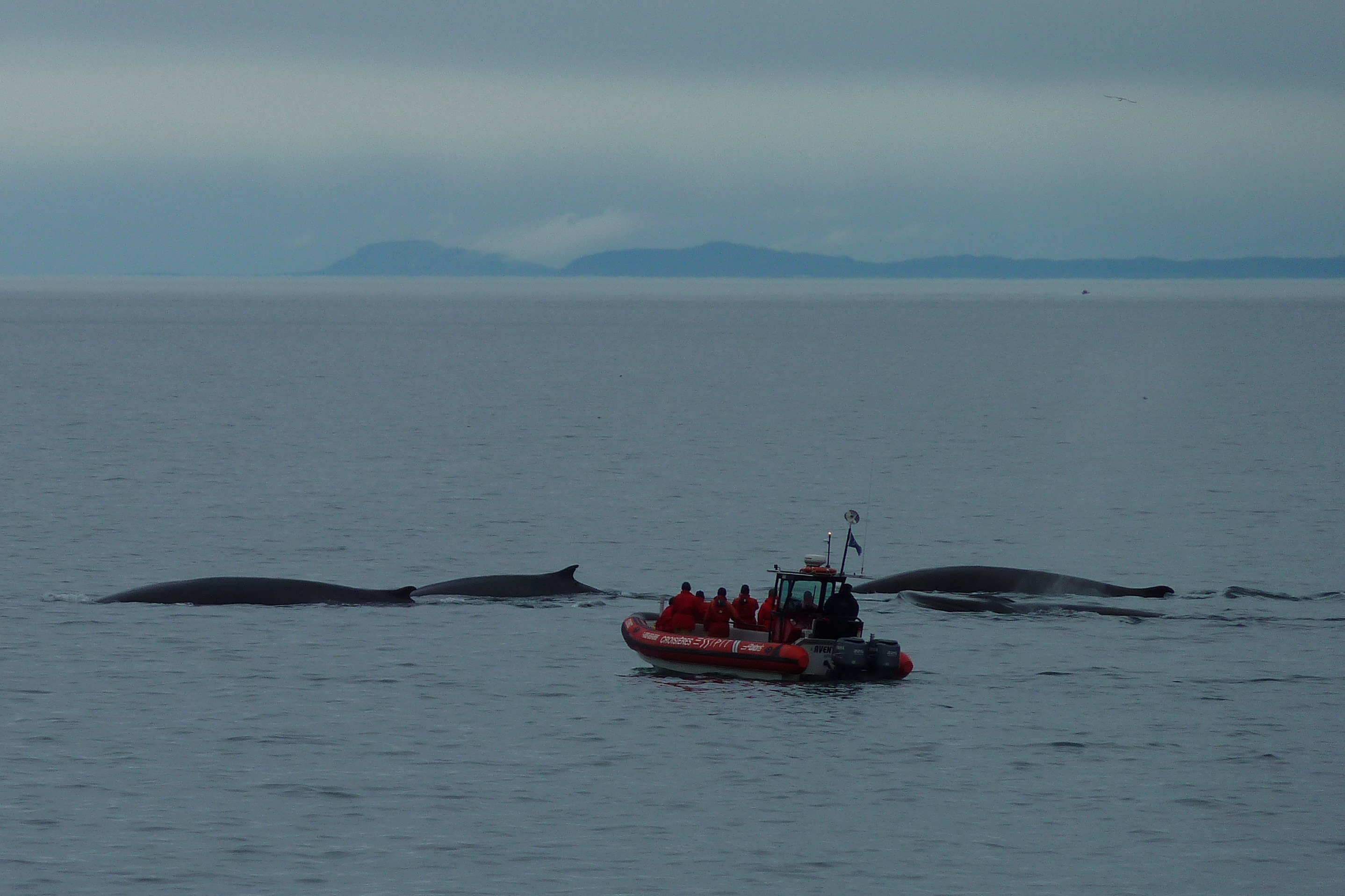
Large marine mammals travel in all the seas of the earth, the research and observations of these giants concern fishermen and shipping industry, exercise a fascination and a keen interest for laymen and, subjects of endless studies for scientists from Quebec, Canada and around the world.
Thirteen species of cetaceans frequent the waters of the estuary and the Gulf of St. Lawrence:
- Northern bottlenose whale
- Delphinapterus leucas (Beluga Whale)
- Sperm whale
- Atlantic white-sided dolphin
- White-beaked dolphin
- Orca
- Long-finned pilot whale
- Phocoena phocoena (Harbour Porpoise)
- North Atlantic right whale
- Common minke whale
- Blue whale
- Humpback whale
- Fin whale
History

First Nations
Flowing through and adjacent to numerous Indigenous homelands, the river was a primary thoroughfare for many peoples. Beginning in Dawnland at the Gulf of St. Lawrence, the river borders Mi'kma'ki in the South (what is today known as the Canadian Maritimes), and Nitassinan in the North, the national territory of the Innu people. On the south shore beyond the Mi'kmaw district of Gespe'gewa'ki, the river passes Wolastokuk (the Maliseet homeland), Pαnawαhpskewahki (the Penobscot homeland), and Ndakinna (the Abenaki homeland). Continuing, the river passes through the former country of the St. Lawrence Iroquois and then three of the six homelands of the Haudenosaunee: the Mohawk or Kanienʼkehá꞉ka, the Oneida or Onyota'a:ka, and the Onondaga or Onöñda’gaga’.
In the early 17th century, the Wendat Nation migrated from their original country of Huronia to what is now known as Nionwentsïo centred around Wendake. Nionwentsïo occupies both the north and south shores of the river, overlapping with Nitassinan and the more western Wabanaki or Dawnland countries. and, upstream, the further reaches of Anishinaabewaki, specifically the homelands of the Algonquin and Mississauga Nations.
European exploration
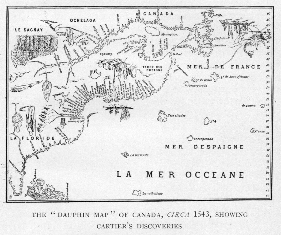
The Norse explored the Gulf of St. Lawrence in the 11th century and were followed by fifteenth- and early sixteenth-century European mariners, such as John Cabot, and the brothers Gaspar and Miguel Corte-Real. The first European explorer known to have sailed up the St. Lawrence River itself was Jacques Cartier. At that time, the land along the river described as "about two leagues, a mountain as tall as a heap of wheat" was inhabited by the St. Lawrence Iroquoians. During Cartier's second voyage in 1535, because Cartier arrived in the estuary on Saint Lawrence's feast day 10 August, he named it the Gulf of Saint Lawrence. | access-date=2011-02-27 }}
The St. Lawrence River is today partly within the U.S. and as such is that country's sixth oldest surviving European place-name.
Early colonists
The earliest regular Europeans in the area were the Basques, who came to the St Lawrence Gulf and River in pursuit of whales from the early 16th century. The Basque whalers and fishermen traded with indigenous Americans and set up settlements, leaving vestiges all over the coast of eastern Canada and deep into the St. Lawrence River. Basque commercial and fishing activity reached its peak before the ''Armada Invencible'''s disaster (1588), when the Basque whaling fleet was confiscated by King Philip II of Spain. Initially, the whaling galleons from Labourd were not affected by the Spanish defeat.
Until the early 17th century, the French used the name Rivière du Canada to designate the St. Lawrence upstream to Montreal and the Ottawa River after Montreal. The St. Lawrence River served as the main route for European exploration of the North American interior, first pioneered by French explorer Samuel de Champlain.
Colonial control
Control of the river was crucial to British strategy to capture New France in the Seven Years' War. Having captured Louisbourg in 1758, the British sailed up to Quebec the following year thanks to charts drawn up by James Cook. British troops were ferried via the St. Lawrence to attack the city from the west, which they successfully did at the Battle of the Plains of Abraham. The river was used again by the British to defeat the French siege of Quebec under the Chevalier de Lévis in 1760.
In 1809, the first steamboat to ply its trade on the St. Lawrence was built and operated by John Molson and associates, a scant two years after Fulton's steam-powered navigation of the Hudson River. The Accommodation with ten passengers made her maiden voyage from Montreal to Quebec City in 66 hours, for 30 of which she was at anchor. She had a keel of 75 feet, and a length overall of 85 feet. The cost of a ticket was eight dollars upstream, and nine dollars down. She had berths that year for twenty passengers. Within a decade, daily service was available in the hotly-contested Montreal-Quebec route.
Because of the virtually impassable Lachine Rapids, the St. Lawrence was once continuously navigable only as far as Montreal. Opened in 1825, the Lachine Canal was the first to allow ships to pass the rapids. An extensive system of canals and locks, known as the St. Lawrence Seaway, was officially opened on 26 June 1959 by Elizabeth II (representing Canada) and President Dwight D. Eisenhower (representing the United States). The Seaway (including the Welland Canal) now permits ocean-going vessels to pass all the way to Lake Superior.
Modern Canada
Alcoa, Reynolds Metals Company, and General Motors (GM) Central Foundry operated along the St. Lawrence River and its tributaries for decades. The Alcoa plant opened in 1903, and Reynolds and GM began operations in the late 1950s. These facilities released toxic substances into the St. Lawrence River and the surrounding area, including PCBs, PAHs, cyanide, fluoride, and dioxins.
During the Second World War, the Battle of the St. Lawrence involved submarine and anti-submarine actions throughout the lower St. Lawrence River and the entire Gulf of St. Lawrence, Strait of Belle Isle and Cabot Strait from May to October 1942, September 1943, and again in October and November 1944. During this time, German U-boats sank several merchant marine ships and three Canadian warships.
In the late 1970s, the river was the subject of a successful ecological campaign (called "Save the River"), originally responding to planned development by the United States Army Corps of Engineers. The campaign was organized, among others, by Abbie Hoffman.
In popular culture

- Gatien Lapointe, Ode au Saint-Laurent, Éditions du Jour, Montréal, 1963, Paradis, A. (1963), report, 3 pages.
- The river was the setting for the Canadian television drama series Seaway.
- It is the namesake of Saint-Laurent Herald.
- In 1980, Jacques Cousteau filmed Cries from the Deep and St. Lawrence: Stairway to the Sea.
- The 1993 Canadian animated short film The Mighty River was about the river.
- The novel and film Black Robe are set primarily on the St. Lawrence River during the 17th century.
- The 1941 children's book Paddle-to-the-Sea, and the film Paddle to the Sea, involve passage through the St. Lawrence River.
- The St. Lawrence River is mentioned in the 1967 single Canadian Railroad Trilogy by Gordon Lightfoot.
References
Bibliography
- {{citation |last =Dawson |first =Samuel Edward |year =2003 |title = The Saint Lawrence: Its Basin and Border-lands
- {{citation |last = Stagg |first =Ronald |year =2010 |title =The Golden Dream: A History of the St. Lawrence Seaway
References
- "St. Lawrence River and Seaway".
- "St. Lawrence River".
- "The St. Lawrence".
- (July 2002). "Physical oceanographic conditions in the Gulf of St. Lawrence during 2023".
- "Rivers". [[Natural Resources Canada]].
- "St Lawrence-Great Lakes".
- "Fleuve Saint-Laurent". Gouvernement du Québec.
- (2018). "Flesh Reborn: The Saint Lawrence Valley Mission Settlements through the Seventeenth Century". McGill-Queens University Press.
- (25 August 2016). "St. Lawrence (Upper river)".
- (25 August 2016). "St. Lawrence, USA & CA".
- Rudes, B. Tuscarora English Dictionary Toronto: University of Toronto Press, 1999
- "Il était une fois un fleuve... et nous.".
- (1886). "Lexique de la langue algonquine". J. Chapleau.
- (2023-01-27). "Estuary and Gulf of St. Lawrence". Fisheries and Oceans Canada.
- (3 April 2013). "The secrets of the Saint-Laurent, marine weather guide". Environnement Canada.
- [http://www.lcbp.org/Atlas/HTML/nat_geology.htm Lake Champlain Basin Atlas: Geology Page] {{webarchive. link. (20 July 2008)
- Miller, William J.. (2015). "Geology: The Science of the Earth's Crust (Illustrations)". P. F. Collier & Son Company.
- "St. Lawrence River Ecosystem".
- "Estuary - National Geographic Society".
- (2005). "Rivers of North America". Academic Press.
- Dawson, Samuel Edward. (October 2007). "The Saint Lawrence: Its Basin and Border-lands". Heritage Books.
- [http://www.pleinairalacarte.com/qc/monteregie/lac-saint-pierre-et-son-archipel.html Lac Saint-Pierre et son archipel] {{Webarchive. link. (2 April 2015 . Pleinairalacarte.com (2008-11-07). Retrieved 2013-07-12.)
- "Physiographic divisions of the conterminous U.S.". U.S. Geological Survey.
- "Physiographic Regions of Canada".
- "Saint Lawrence River and Seaway".
- "Saint Lawrence". MSN Encarta.
- (7 June 2023). "The St. Lawrence, this great river that flows within us (David Suzuki Foundation)". Fondation David Suzuki.
- (1935). "Flore laurentienne". florelaurentienne.com.
- (2024). "Saguenay–St. Lawrence Marine Park". Government Quebec - Government of Canada.
- (2024). "International Marine Mammal Project (IMMP)". Earth Island Institute.
- (7 November 2017). "Right Whales: A Look Back on the Summer of 2017". InfoOceans - New wave.
- (July 2024). "The Species of the St. Lawrence". Group for Research and Education on Marine Mammals (GREMM).
- (27 May 2021). "Béluga - Delphinapterus leucas". Wildlife species; Biodiversity; Species at risk; beluga.
- (1995). "Assessment of knowledge of the beluga population (Delphinapterus leucas) from the St. Lawrence". Fisheries and Oceans Canada.
- (2024). "A black whale in sight! Please call Marine Mammal Emergencies!".
- (22 August 2003). "Blue Whale (Balaenoptera musculus)". Committee on the status of endangered wildlife in Canada (COSEWIC).
- "Gespe'gewa'gi : Our District Territory". Mi’gmawei Mawio’mi.
- ''[[Nitassinan: The Innu Struggle to Reclaim Their Homeland]]'', [[Douglas & McIntyre]], December 1991, 240pp, by [[Marie Wadden]], {{ISBN. 978-1-55365-731-6, [http://www.dmpibooks.com/book/nitassinan (book link)] {{Webarchive. link. (2013-01-21)
- "Territories".
- "Carte du Nionwentsïo". Nation Huronne-Wendat.
- "Murray Treaty of Longueuil (1760)". Historica Canada.
- (9 September 2014). "Les Attikameks s'attaquent à l'indifférence de Québec".
- (8 September 2014). "Les Atikamekw déclarent leur souveraineté".
- Bideaux, Michel. (1986). "Jacques Cartier: Relations". Les Presses de l'Université de Montréal.
- Stewart, George. (1945). "Names on the Land: A Historical Account of Place-Naming in the United States". Random House.
- (2013). "St Lawrence Saga: The Clarke Steamship Story - Before Clarke Steamship".
- {{harvnb. Denison. 1955
- (2024). "The St. Lawrence Seaway, a Vital Waterway". The Great Lakes and St. Lawrence River Seaway System.
- (2008-11-01). "Save the River!".
- (1963). "Ode to the St, Lawrence, poetry". Editions du Jour, Montréal.
- Ohayon, Albert. (2009). "When Cousteau Came to Canada". National Film Board of Canada.
This article was imported from Wikipedia and is available under the Creative Commons Attribution-ShareAlike 4.0 License. Content has been adapted to SurfDoc format. Original contributors can be found on the article history page.
Ask Mako anything about St. Lawrence River — get instant answers, deeper analysis, and related topics.
Research with MakoFree with your Surf account
Create a free account to save articles, ask Mako questions, and organize your research.
Sign up freeThis content may have been generated or modified by AI. CloudSurf Software LLC is not responsible for the accuracy, completeness, or reliability of AI-generated content. Always verify important information from primary sources.
Report