From Surf Wiki (app.surf) — the open knowledge base
St. Albans (city), Vermont
City in Vermont, United States

City in Vermont, United States
| Field | Value |
|---|---|
| official_name | St. Albans, Vermont |
| nickname | Railroad City of Vermont |
| settlement_type | City |
| image_skyline | St Albans VT 11-17-25.jpg |
| image_caption | St. Albans, VT, from the southwest |
| image_blank_emblem | StAlbansVTlogo.png |
| blank_emblem_type | Logo |
| blank_emblem_size | 120px |
| image_map | Franklin County Vermont incorporated and unincorporated areas St. Albans highlighted.svg |
| mapsize | 260px |
| map_caption | Location in Franklin County and the state of Vermont. |
| pushpin_map | USA |
| pushpin_map_caption | Location in the United States |
| subdivision_type | Country |
| subdivision_name | |
| subdivision_type1 | State |
| subdivision_name1 | Vermont |
| subdivision_type2 | County |
| subdivision_name2 | Franklin |
| leader_title | Mayor |
| leader_name | Tim Smith |
| leader_title1 | |
| established_title | Settled |
| established_date | 1783 |
| established_title2 | Organized (town) |
| established_date2 | 1785 |
| established_title3 | Chartered (city) |
| established_date3 | 1896 |
| unit_pref | Imperial |
| area_footnotes | |
| area_total_km2 | 5.25 |
| area_land_km2 | 5.25 |
| area_water_km2 | 0.00 |
| area_total_sq_mi | 2.03 |
| area_land_sq_mi | 2.03 |
| area_water_sq_mi | 0.00 |
| population_as_of | 2020 |
| population_footnotes | |
| population_total | 6877 |
| population_density_km2 | 1309.90 |
| population_density_sq_mi | 3387.68 |
| timezone | EST |
| utc_offset | −5 |
| timezone_DST | EDT |
| utc_offset_DST | −4 |
| coordinates | |
| elevation_footnotes | |
| elevation_m | 61 |
| elevation_ft | 200 |
| postal_code_type | ZIP code |
| postal_code | 05478 |
| area_code | 802 |
| blank_name | FIPS code |
| blank_info | 50-61675 |
| blank1_name | GNIS feature ID |
| blank1_info | 1462196 |
| website | www.stalbansvt.com |
St. Albans is the only city in and the shire town of Franklin County, Vermont, United States. At the 2020 census, the city population was 6,877. St. Albans City is completely surrounded by St. Albans Town, which is a separate municipality. The city is in Northwestern Vermont, about 15 miles south of the Canadian border and 30 miles north of Burlington.
History

One of the New Hampshire grants, St. Albans was chartered by Colonial Governor Benning Wentworth on August 17, 1763, to Stephen Pomeroy and 63 others. Named after St Albans, Hertfordshire, England, it was first settled during the Revolution by Jesse Welden. The war delayed further settlement until 1785, when other pioneers began to arrive from lower New England.
Farmers found the rich, dark loam suitable for cultivation, as well as for the raising of cattle, horses and sheep. Butter and cheese were produced in great quantities. St. Albans also became known as " The Rail City," home to a major depot, operations center and repair shop of the Vermont and Canada Railroad. When the village was incorporated in 1859, it had an iron foundry, a manufacturer of freight cars, and a large number of mechanic shops.
The northernmost engagement of the Civil War, known as the St. Albans Raid, occurred here on October 19, 1864.
In 1869 the Congrégation de Notre Dame, founded in Montreal, Quebec, in the 17th century, established Villa Barlow Convent and St. Mary High School in St. Albans.
In 1902, the City of St. Albans was incorporated, comprising two square miles (518 hectares) within the town of St. Albans. Today it is a tourist destination noted for its Victorian and Craftsman style architecture. Much of this was built during the railroad era, when more than 200 trains passed through daily.
St. Albans is a research focus for genealogists, as European immigrants heading for the United States would sometimes land in Canada at Halifax, Nova Scotia or Montreal, Quebec, then take a train through the border crossing to this city. Some persons traveled to other parts of Vermont, New York or points west. The National Archives (NARA) lists for St. Albans cover the period 1895–1954.
Culture
In late April St. Albans hosts the annual Vermont Maple Festival. The festival includes various food-related contests, as well as the Sap Run, a footrace from Swanton, 8.2 mi to the north. It was home to the Vermont Voltage, a semi-professional men's soccer team, which folded in 2014.
Geography
According to the United States Census Bureau, the city has a total area of 2.0 square miles (5.3 km2), all land. The city is surrounded by the town of St. Albans, with its lush farmland across gently rolling hills. The city is drained by Stevens Brook.
St. Albans is crossed by Interstate 89, U.S. Route 7, as well as Vermont Route 36, 38, 104 and 105. It is about 15 mi from Vermont's border with Quebec.
Climate
St Albans has a warm-summer humid continental climate (Köppen Dfb), bordering on a hot-summer humid continental climate (Köppen Dfa).
|Jan record high F = 64 |Feb record high F = 63 |Mar record high F = 80 |Apr record high F = 88 |May record high F = 92 |Jun record high F = 96 |Jul record high F = 98 |Aug record high F = 99 |Sep record high F = 95 |Oct record high F = 86 |Nov record high F = 74 |Dec record high F = 66 |year record high F =
|Jan avg record high F = 49.8 |Feb avg record high F = 49.6 |Mar avg record high F = 58.2 |Apr avg record high F = 75.5 |May avg record high F = 83.5 |Jun avg record high F = 89.5 |Jul avg record high F = 88.7 |Aug avg record high F = 88.5 |Sep avg record high F = 83.1 |Oct avg record high F = 72.4 |Nov avg record high F = 65.0 |Dec avg record high F = 52.8 |year avg record high F = 89.7
|Jan avg record low F = -13.3 |Feb avg record low F = -8.4 |Mar avg record low F = -1.0 |Apr avg record low F = 22.4 |May avg record low F = 32.4 |Jun avg record low F = 43.6 |Jul avg record low F = 50.3 |Aug avg record low F = 46.0 |Sep avg record low F = 34.6 |Oct avg record low F = 24.9 |Nov avg record low F = 14.2 |Dec avg record low F = -4.5 |year avg record low F = -15.1
|Jan record low F = -32 |Feb record low F = -30 |Mar record low F = -19 |Apr record low F = 6 |May record low F = 25 |Jun record low F = 31 |Jul record low F = 38 |Aug record low F = 36 |Sep record low F = 14 |Oct record low F = 15 |Nov record low F = -6 |Dec record low F = -36 |year record low F =
|access-date = December 13, 2023 |access-date = December 13, 2023
Demographics
|align-fn=center
At the 2020 census, the racial makeup was 91.1% White, 1.2% Black, 1.3% Native American, 0.0% Asian and 1.9% Latino of any race.
At the 2010 census, there were 6,918 people. In the 2000 census there were 7,650 people, 3,235 households and 1,937 families residing in the city. The population density was 3,768.2 per square mile (1,455.0/km2). There were 3,376 housing units at an average density of 1,662.9 per square mile (642.1/km2). The racial makeup of the city was 95.87% White, 0.39% Black or African American, 1.20% Native American, 0.35% Asian, 0.03% Pacific Islander, 0.45% from other races, and 1.70% from two or more races. 0.90% of the population were Hispanic or Latino of any race.
There were 3,235 households, of which 31.6% had children under the age of 18 living with them, 43.6% were married couples living together, 12.1% had a female householder with no husband present, and 40.1% were non-families. 31.4% of all households were made up of individuals, and 12.6% had someone living alone who was 65 years of age or older. The average household size was 2.35 and the average family size was 2.97.
Age distribution was 25.6% under the age of 18, 8.3% from 18 to 24, 31.8% from 25 to 44, 20.3% from 45 to 64, and 14.0% who were 65 years of age or older. The median age was 35 years. For every 100 females, there were 91.6 males. For every 100 females age 18 and over, there were 86.2 males.
Government
St. Albans is governed via a mayor, a city manager and city council. The city council consists of six members, each elected from an individual ward. The mayor is elected by citywide vote.
Economy

Personal income
In the 2010 census, the median household income was $37,221, and the median family income was $44,286. Males had a median income of $31,340 versus $23,262 for females. The city's per capita income was $17,853. About 8.5% of families and 9.6% of the population were below the poverty line, including 9.2% of those under age 18 and 11.9% of those age 65 or over.
Industry
The town's comprehensive annual financial report for the fiscal year that ended June 30, 2020, lists the principal employers in the town as U.S. Department of Homeland Security's U.S. Citizenship and Immigration Services (USCIS) (650 employees), Northwestern Medical Center (612 employees), Maple Run Unified School District (608 employees), Mylan Technologies Inc. (425 employees), Dairy Farmers of America (95 employees), Sticks & Stuff (92 employees), the City of St. Albans (91 employees), A.N. Deringer, Inc. (80 employees), Peoples Trust Company (47 employees), and SB Collins (40 employees).
The USCIS has a service center in St. Albans; the majority of the 1,100 USCIS employees in Vermont are based in St. Albans, and the federal agency is the city's largest employer. The Dairy Farmers of America, a major dairy cooperative, has a manufacturing plant in St. Albans that produces cream, condensed skim milk, and milk powder. The chocolate and cocoa supplier Barry Callebaut has a facility in the city.
Infrastructure
Health care
The Northwestern Medical Center is a hospital serving the city and the Franklin County area.
Buses
Greyhound Lines stops four times daily (twice in each direction) on its Montreal to Boston route. The Saint Albans stop is on Main Street, next to Taylor Park.
Railways
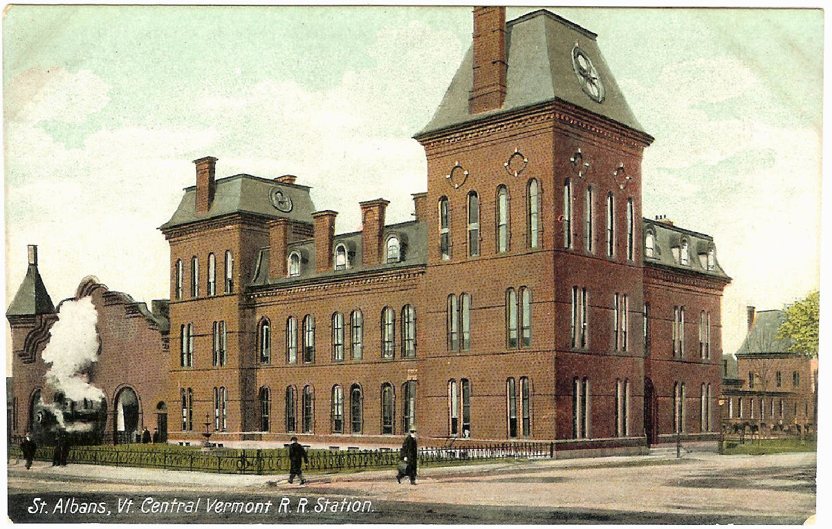
Saint Albans is the northern terminus of the Vermonter, a coach/business class train operated by Amtrak, the national passenger rail system. The train operates daily between Saint Albans and Washington, D.C.
The train formerly continued from Saint Albans to Montreal and was named the Montrealer, but that connection was discontinued in 1995.
Education
It is in the Maple Run Unified School District.
St. Albans is home to St. Albans City School, an elementary school for students in kindergarten through eighth grade, and Bellows Free Academy, St. Albans, a public high school serving students from many towns in the southern half of Franklin Country.
Notable people
Main article: List of people from St. Albans (city), Vermont
References
References
- "2019 U.S. Gazetteer Files". United States Census Bureau.
- "U.S. Census website". [[United States Census Bureau]].
- [https://www.census.gov], [[United States Census Bureau]], 2020. Accessed October 28, 2020.
- (October 25, 2007). "US Board on Geographic Names". [[United States Geological Survey]].
- [http://www.leg.state.vt.us/statutes/fullsection.cfm?Title=24&Chapter=001&Section=00007 Title 24, Part I, Chapter 1, §7], Vermont Statutes. Accessed November 1, 2007.
- "Find a County". National Association of Counties.
- [https://books.google.com/books?id=OcoMAAAAYAAJ&dq=coolidge%20mansfield%20history%20description%20new%20england%201859&pg=PA906 Austin J. Coolidge & John B. Mansfield, ''A History and Description of New England;'' Boston, Massachusetts 1859]
- "St. Albans, Vermont, New England, USA".
- Trade, St Albans Board of. (June 18, 1889). "Advantages, Resources and Attractions of St. Albans, Vt: Its Location, Railroad Facilities, Churches, Schools, Literary and Social Life ; Industries and Institutions; and General Features". Pub. for the Board of trade.
- "STA museum – Everyday life of the Romans".
- Holden, Cindy. "St. Albans Lists".
- "Vermont Maple Festival". Vermont Maple Festival.
- "U.S. Decennial Census". United States Census Bureau.
- U.S. Census Bureau, 2020 Census Report, QuickFacts, St. Albans city, Franklin County, Vermont https://www.census.gov/quickfacts/stalbanscityvermont
- [https://web.archive.org/web/20210421024032/https://www.stalbansvt.com/vertical/sites/%7B6057F00C-4FBC-4942-B5A5-C142459B1038%7D/uploads/St.AlbansVT_CAFR_2020-_Final.pdf ''City of St. Albans, Vermont: Comprehensive Annual Financial Report for the Fiscal Year Ended June 30, 2020''], p. 111.
- Mike Hoey, [https://www.mychamplainvalley.com/news/local-news/uscis-employees-in-st-albans-move-to-essex-junction-for-foreseeable-future/ USCIS employees in St. Albans move to Essex Junction for foreseeable future], WVNY (February 13, 2021).
- Lisa Rathke, [https://www.burlingtonfreepress.com/story/news/2020/07/27/st-albans-vermont-hit-hard-news-immigration-furloughs/5517913002/ Vermont city hit hard by news of immigration furloughs], Associated Press (July 27, 2020).
- [https://www.wcax.com/2020/07/22/dairy-farmers-of-america-kicks-off-30m-expansion-of-st-albans-plant/ Dairy Farmers of America kicks off $30M expansion of St. Albans plant], WCAX (June 22, 2020).
- Douglas Yu, [https://www.confectionerynews.com/Article/2018/09/19/Barry-Callebaut-completes-30m-investment-in-North-American-facilities Barry Callebaut completes $30m investment in North American facilities], ''Confectionary News'' (September 19, 2018).
- Geography Division. (January 15, 2021). "2020 CENSUS - SCHOOL DISTRICT REFERENCE MAP: Franklin County, VT". [[U.S. Census Bureau]].
This article was imported from Wikipedia and is available under the Creative Commons Attribution-ShareAlike 4.0 License. Content has been adapted to SurfDoc format. Original contributors can be found on the article history page.
Ask Mako anything about St. Albans (city), Vermont — get instant answers, deeper analysis, and related topics.
Research with MakoFree with your Surf account
Create a free account to save articles, ask Mako questions, and organize your research.
Sign up freeThis content may have been generated or modified by AI. CloudSurf Software LLC is not responsible for the accuracy, completeness, or reliability of AI-generated content. Always verify important information from primary sources.
Report