From Surf Wiki (app.surf) — the open knowledge base
Spring City, Tennessee
| Field | Value |
|---|---|
| official_name | Town of Spring City |
| name | Spring City, Tennessee |
| settlement_type | Town |
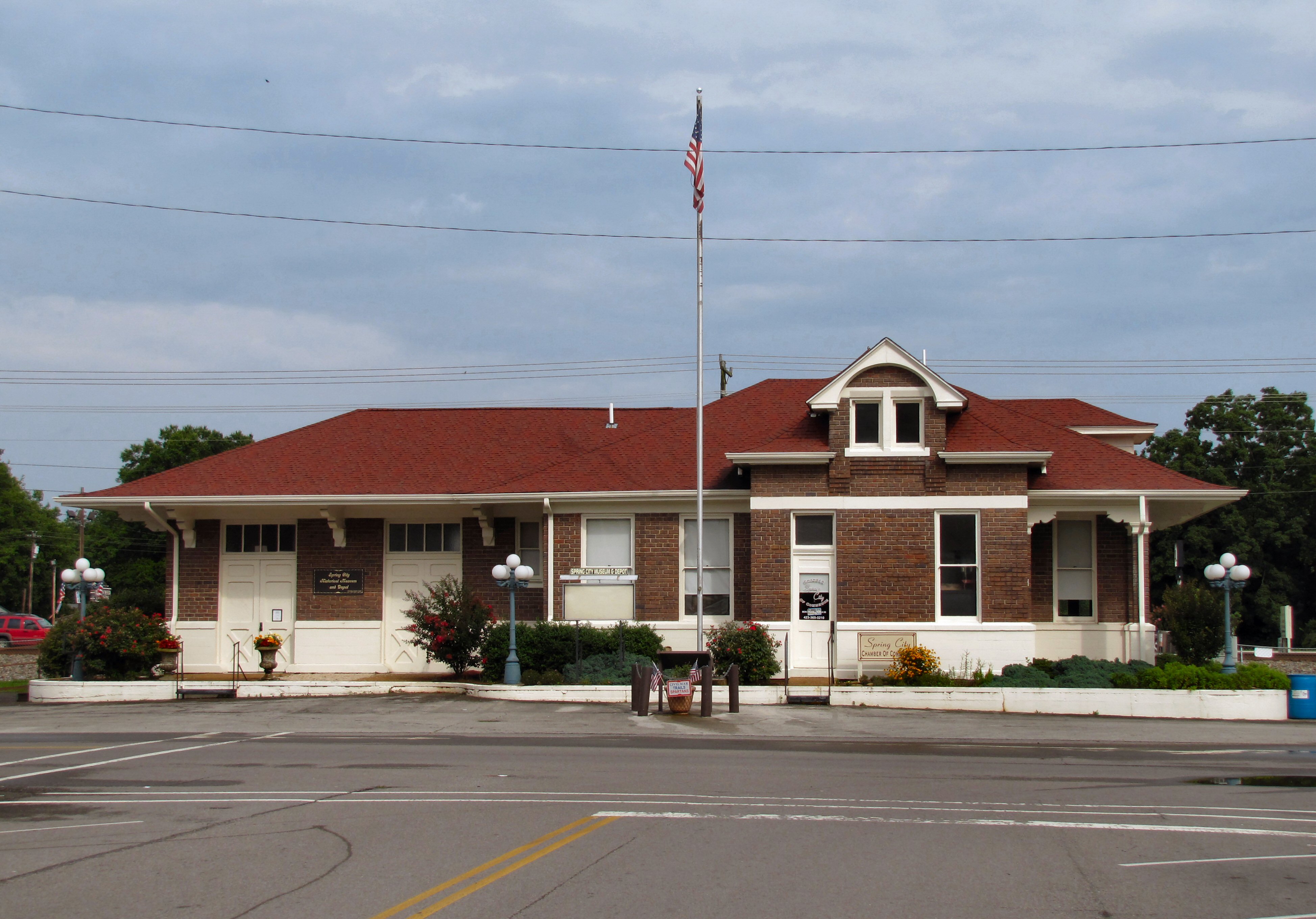
| image_skyline | Spring-City-tn1.jpg |
| imagesize | 250px |
| image_map | File:Rhea County Tennessee Incorporated and Unincorporated areas Spring City Highlighted 4770400.svg |
| mapsize | 250px |
| map_caption | Location of Spring City in Rhea County, Tennessee. |
| subdivision_type | Country |
| subdivision_name | United States |
| subdivision_type1 | State |
| subdivision_name1 | Tennessee |
| subdivision_type2 | County |
| subdivision_name2 | Rhea |
| unit_pref | Imperial |
| area_footnotes | |
| area_total_km2 | 7.25 |
| area_land_km2 | 7.16 |
| area_water_km2 | 0.09 |
| area_total_sq_mi | 2.80 |
| area_land_sq_mi | 2.76 |
| area_water_sq_mi | 0.04 |
| population_as_of | 2020 |
| population_footnotes | |
| population_total | 1949 |
| population_density_km2 | 272.27 |
| population_density_sq_mi | 705.14 |
| timezone | Eastern (EST) |
| utc_offset | -5 |
| timezone_DST | EDT |
| utc_offset_DST | -4 |
| elevation_footnotes | |
| elevation_ft | 768 |
| coordinates | |
| postal_code_type | ZIP codes |
| postal_code | 37337, 37381 |
| area_code | 423 |
| blank_name | FIPS code |
| blank_info | 47-70400 |
| blank1_name | GNIS feature ID |
| blank1_info | 1303755 |
| website |
Spring City is a town in Rhea County, Tennessee, United States. The population was 1,949 at the 2020 census and 1,981 at the 2010 census. The town is located along Watts Bar Lake, and Watts Bar Dam and the Watts Bar Nuclear Generating Station are nearby.
History
Spring City began as a stop along the Cincinnati Southern Railroad in the 1870s. The town was originally named Sulphur Springs, because of the mass amount of sulphur in the water. Sometime later it became "Rheaville," and later became incorporated with nearby Rhea Springs, and took on the name Rhea Springs. Due to an explosion, much of the town flooded or burnt, and the town relocated to its current location and was renamed Spring City, in honor of the original settlement, Sulphur Springs. The original location now lies at the bottom of a nearby section of Watts Bar Lake. Spring City thrived as a railroad shipping hub during the late 19th and early 20th centuries. Its first railroad depot, a simple wooden building constructed in 1879, burned in 1892, and was replaced by a larger one. This second depot was in turn replaced by the current depot, which was completed by the Southern Railway in 1909.
The city received an economic boost in 1942 with the Tennessee Valley Authority's completion of Watts Bar Dam and its associated reservoir southeast of the town. That same year saw the completion of the Watts Bar Fossil Plant, TVA's first coal-fired plant. In 1973, TVA began building Watts Bar Nuclear Plant. Its first reactor, Watts Bar Unit 1, became active in 1996. The construction of the second reactor, Watts Bar Unit 2, was originally suspended in 1985, but resumed in 2007. It entered commercial operation in October 2016.
On August 22, 1955, 11 schoolchildren were killed, and many others injured, when their school bus was struck by a 103-car freight train at a track crossing in Spring City.
On July 28, 2016, a train hauling coal derailed by the train depot and museum due to a faulty wheel on one of the privately owned coal cars. There were no casualties. A lengthy cleanup followed, where both track crossings in town had to be closed while repairs were made and debris cleared.
Geography
Spring City is located at (35.689422, -84.863885).
According to the United States Census Bureau, the town has a total area of 2.5 sqmi, of which, 2.4 sqmi of it is land and 0.04 sqmi of it (1.21%) is water.
Climate
|Jan record high F = 75 |Feb record high F = 81 |Mar record high F = 85 |Apr record high F = 88 |May record high F = 92 |Jun record high F = 103 |Jul record high F = 104 |Aug record high F = 103 |Sep record high F = 96 |Oct record high F = 96 |Nov record high F = 85 |Dec record high F = 76
|Jan avg record high F = 65.7 |Feb avg record high F = 71.1 |Mar avg record high F = 79.5 |Apr avg record high F = 84.5 |May avg record high F = 87.3 |Jun avg record high F = 92.5 |Jul avg record high F = 94.1 |Aug avg record high F = 94.0 |Sep avg record high F = 90.5 |Oct avg record high F = 84.3 |Nov avg record high F = 73.4 |Dec avg record high F = 67.9 |year avg record high F = 95.8
|Jan avg record low F = 9.9 |Feb avg record low F = 14.9 |Mar avg record low F = 20.0 |Apr avg record low F = 29.2 |May avg record low F = 37.1 |Jun avg record low F = 53.0 |Jul avg record low F = 58.2 |Aug avg record low F = 57.3 |Sep avg record low F = 46.5 |Oct avg record low F = 31.0 |Nov avg record low F = 21.3 |Dec avg record low F = 16.8 |year avg record low F = 8.1
|Jan record low F = -5 |Feb record low F = 0 |Mar record low F = 15 |Apr record low F = 20 |May record low F = 24 |Jun record low F = 47 |Jul record low F = 51 |Aug record low F = 47 |Sep record low F = 40 |Oct record low F = 25 |Nov record low F = 12 |Dec record low F = 3
|access-date = March 4, 2023 |access-date = March 4, 2023
Demographics
2020 census
| Race | Number | Percentage | White (non-Hispanic) | Black or African American (non-Hispanic) | Native American | Asian | Other/Mixed | Hispanic or Latino |
|---|---|---|---|---|---|---|---|---|
| 1,745 | 89.53% | |||||||
| 53 | 2.72% | |||||||
| 5 | 0.26% | |||||||
| 13 | 0.67% | |||||||
| 80 | 4.1% | |||||||
| 53 | 2.72% |
As of the 2020 United States census, there were 1,949 people, 935 households, and 537 families residing in the town.
2000 census
As of the census of 2000, there were 2,025 people, 861 households, and 533 families residing in the town. The population density was 829.9 PD/sqmi. There were 974 housing units at an average density of 399.2 /mi2. The racial makeup of the town was 94.52% White, 4.49% African American, 0.40% Native American, 0.05% Asian, and 0.54% from two or more races. Hispanic or Latino of any race were 0.49% of the population.
There were 861 households, out of which 24.7% had children under the age of 18 living with them, 44.9% were married couples living together, 12.7% had a female householder with no husband present, and 38.0% were non-families. 33.8% of all households were made up of individuals, and 17.8% had someone living alone who was 65 years of age or older. The average household size was 2.21 and the average family size was 2.83.
In the town, the population was spread out, with 20.4% under the age of 18, 7.4% from 18 to 24, 23.9% from 25 to 44, 23.5% from 45 to 64, and 24.9% who were 65 years of age or older. The median age was 44 years. For every 100 females, there were 86.0 males. For every 100 females age 18 and over, there were 81.1 males.
The median income for a household in the town was $27,009, and the median income for a family was $31,894. Males had a median income of $27,692 versus $22,050 for females. The per capita income for the town was $14,506. About 15.5% of families and 21.0% of the population were below the poverty line, including 32.7% of those under age 18 and 18.8% of those age 65 or over.

Education
Rhea County Schools is the local school district. The elementary and middle schools are Spring City Elementary School and Spring City Middle School. The district's sole high school is Rhea County High School.
References
References
- "ArcGIS REST Services Directory". United States Census Bureau.
- "U.S. Census website". [[United States Census Bureau]].
- {{GNIS. 1303755
- Pat Guffey, "[http://www.rheaheraldnews.com/lifestyles/article_c5f59738-3527-11e4-b296-001a4bcf887a.html Historical Notes About Spring City]," ''Rhea Herald-News'', September 5, 2014.
- Carroll Van West, ''[https://books.google.com/books?id=Fh11WlwYe9wC&dq Tennessee's Historic Landscapes]'' (University of Tennessee Press, 1995), p. 233.
- (August 22, 1955). "Interstate Commerce {{sic". [[Interstate Commerce Commission]].
- (February 12, 2011). "US Gazetteer files: 2010, 2000, and 1990". [[United States Census Bureau]].
- "Census of Population and Housing: Decennial Censuses". [[United States Census Bureau]].
- "Incorporated Places and Minor Civil Divisions Datasets: Subcounty Resident Population Estimates: April 1, 2010 to July 1, 2012". U.S. Census Bureau.
- "Census Population API". United States Census Bureau.
- "Explore Census Data".
- "2020 CENSUS - SCHOOL DISTRICT REFERENCE MAP: Rhea County, TN". [[U.S. Census Bureau]].
- "Home". Spring City Elementary School.
- "Home". Spring City Middle School.
This article was imported from Wikipedia and is available under the Creative Commons Attribution-ShareAlike 4.0 License. Content has been adapted to SurfDoc format. Original contributors can be found on the article history page.
Ask Mako anything about Spring City, Tennessee — get instant answers, deeper analysis, and related topics.
Research with MakoFree with your Surf account
Create a free account to save articles, ask Mako questions, and organize your research.
Sign up freeThis content may have been generated or modified by AI. CloudSurf Software LLC is not responsible for the accuracy, completeness, or reliability of AI-generated content. Always verify important information from primary sources.
Report