From Surf Wiki (app.surf) — the open knowledge base
Southern Thailand
Region in Thailand

Region in Thailand
| Field | Value | |
|---|---|---|
| <!-- Basic info ----------------> | name | Southern Region |
| other_name | Paktai (ปักษ์ใต้) | |
| settlement_type | Region | |
| image_skyline | {{Photomontage | |
| photo1a | Sunrise_thailand_ko_samui.jpg Sunrise Thailand Ko Samui | |
| photo2a | TaRuTao11.jpg Tarutao National Park | |
| photo2b | Wat phra mahathat woramahawihan nakhon si thammarat.jpg Wat Phra Mahathat Woramahawihan | |
| photo3a | Khao Sok National Park Surat Thani Province, Thailand.jpg Rajjaprabha Dam | |
| photo3b | Phuket, April 2012.jpg Phuket City | |
| size | 270 | |
| position | center | |
| spacing | 2 | |
| color | transparent | |
| border | 0 | |
| foot_montage | From upper-left to lower-right: Sunrise Thailand Ko Samui, Tarutao National Park, Wat Phra Mahathat Woramahawihan, Rajjaprabha Dam and Phuket City. | |
| image_map | Thailand South.png | |
| map_caption | Southern Region in Thailand | |
| parts_type | Provinces | |
| parts_style | coll | |
| parts | 14 Provinces | |
| p1 | Chumphon Province | |
| p2 | Krabi Province | |
| p3 | Nakhon Si Thammarat Province | |
| p4 | Narathiwat Province | |
| p5 | Pattani Province | |
| p6 | Phang Nga Province | |
| p7 | Phatthalung Province | |
| p8 | Phuket Province | |
| p9 | Ranong Province | |
| p10 | Satun Province | |
| p11 | Songkhla Province | |
| p12 | Surat Thani Province | |
| p13 | Trang Province | |
| p14 | Yala Province | |
| subdivision_type1 | Largest city | |
| subdivision_name1 | Hat Yai | |
| unit_pref | metric | |
| area_footnotes | ||
| area_total_km2 | 73,848 | |
| population_as_of | 2018 | |
| population_footnotes | ||
| population_total | 9,454,193 | |
| population_density_km2 | 134 | |
| population_demonym | Southern Thai | |
| blank1_name_sec2 | Language | |
| blank1_info_sec2 | Southern Thai • Pattani Malay • Satun Malay • Mos • Urak Lawoi' • Moklen • Hokkien etc. | |
| <!-- GDP ---------------> | demographics_type2 | GDP |
| demographics2_footnotes | ||
| demographics2_title1 | Total | |
| demographics2_info1 | US$45.6 billion (2019) | |
| demographics2_title2 | Per capita | |
| timezone1 | ICT | |
| utc_offset1 | +07:00 |
| Southern Thailand (formerly Southern Siam and Tambralinga) is the southernmost cultural region of Thailand, separated from Central Thailand by the Kra Isthmus.
Geography
Southern Thailand is on the Malay Peninsula, with an area of around 70714 km2, bounded to the north by Kra Isthmus, the narrowest part of the peninsula. The western part has highly steep coasts, while on the east side river plains dominate. The largest river in the south is the Tapi, in Surat Thani, which, together with the Phum Duang in Surat Thani, drains more than 8000 km2, more than 10 percent of the total area of southern Thailand. Smaller rivers include the Pattani, Saiburi, Krabi, and the Trang. The largest lake in the south is Songkhla Lake (1040 km2 altogether). The largest artificial lake is the Chiao Lan (Ratchaprapha Dam), occupying 165 km2 of Khao Sok National Park in Surat Thani. The total forest area is 17,964 km2 or 24.3 percent of provincial area.
Running through the middle of the peninsula are several mountain chains, with the highest elevation at Khao Luang, 1835 m, in Nakhon Si Thammarat province. Ranging from the Kra Isthmus to Phuket Island is the Phuket chain, which connects to the Tanao Si Mountain Range further north. Almost parallel to the Phuket chain but 100 km to the east is the Nakhon Si Thammarat, or Banthat, chain, which begins with Samui Island, Ko Pha-ngan, and Ko Tao in Surat Thani Province and ends at the Malaysian border at the Ko Ta Ru Tao archipelago. The border with Malaysia is formed by the Sankalakhiri range, sometimes sub-divided into the Pattani, Taluban, and Songkhla chain. At the Malaysian border, the Titiwangsa chain rises.
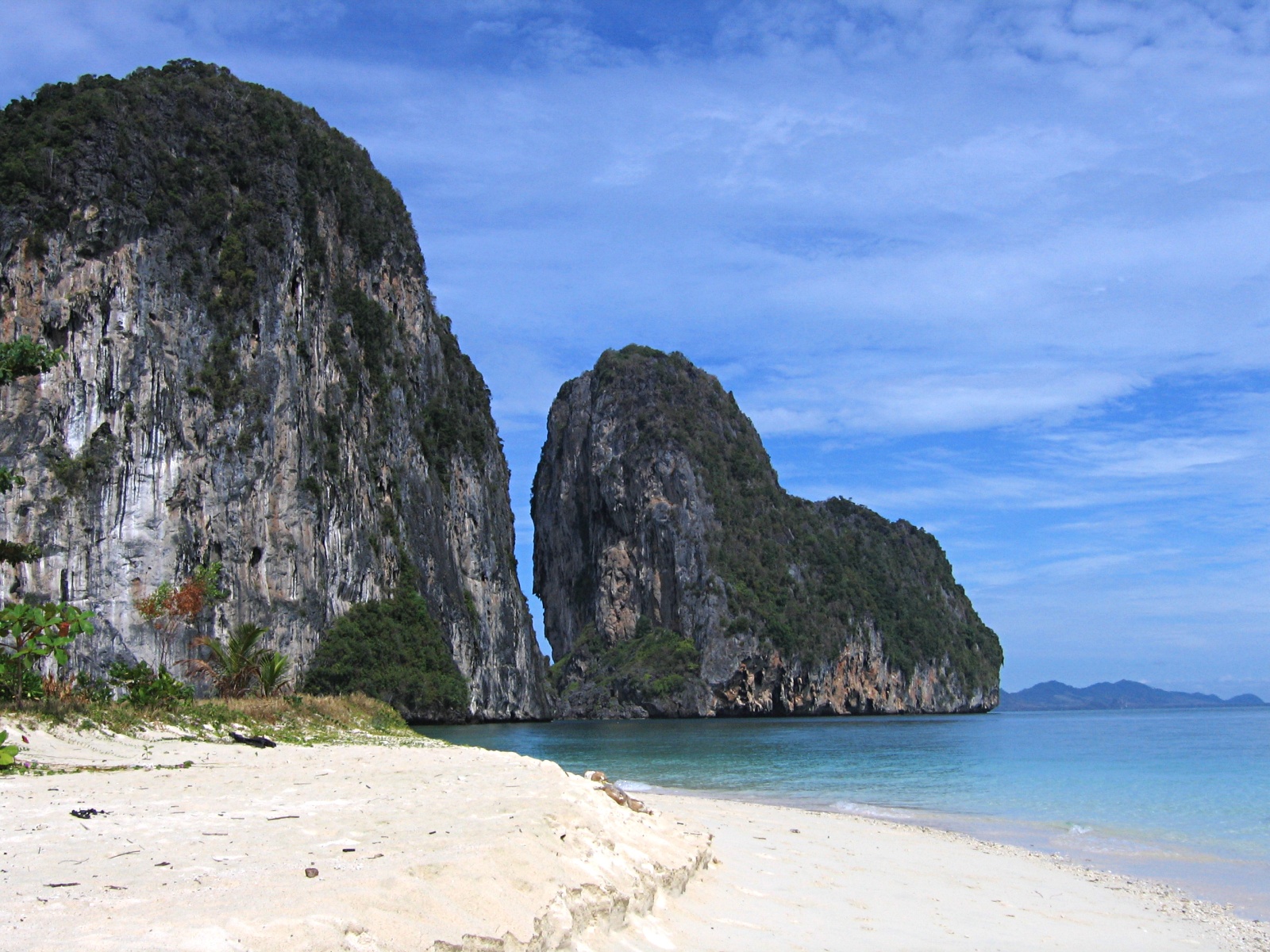
The limestone of the west coast has been eroded into many steep singular hills. The parts submerged by the rising sea after the Last Ice Age now form many islands, like the well-known Phi Phi Islands. Also well known is the so-called James Bond Island in Phang Nga Bay, featured in the movie The Man with the Golden Gun.
The population of the growing region is projected to be 9,156,000 in 2015, up from 8,871,003 in 2010 (census count and adjusted). Although those figures are adjusted for citizens who have left for Bangkok or who moved to the region from elsewhere, as well as registered permanent residents (residency was problematic in the prior 2000 census), the figure is still misleading. There are still a huge number of migrant or informal workers, temporary workers and even stateless people and a large expatriate population, which are not included.
Most of southern Thailand is in Tenasserim–South Thailand semi-evergreen rain forests ecoregion. The Peninsular Malaysian rain forests and Peninsular Malaysian montane rain forests ecoregions extend into southernmost Thailand along the border with Malaysia.
History


The Malay Peninsula has been settled since prehistoric times. Archeological remains were found in several caves, some used for dwellings, others as burial sites. The oldest remains were found in Lang Rongrien Cave, dating 38,000 to 27,000 years before present, and in the contemporary Moh Khiew cave.
In the first millennium, Chinese chronicles mention several coastal cities or city-states. No exact geographical locations were recorded and so the identification of these cities with later settlements is difficult. The most important of those states were Langkasuka, usually considered a precursor of the Patani Kingdom; Tambralinga, probably the precursor of the Nakhon Si Thammarat Kingdom, or P'an-p'an in Phunphin district, Surat Thani, probably located at the Bandon Bay Tapi River. The cities were highly influenced by Indian culture, and have adopted Brahman or Buddhist religion. When Srivijaya in Chaiya extended its sphere of influence, those cities became tributary states of Srivijaya. The city Chaiya in Surat Thani Province contains several ruins from Srivijaya times, and was probably a regional capital of the kingdom. Some Thai historians even claim that it was the capital of the kingdom itself for some time, but this is disputed.
After Srivijaya lost its influence, Nakhon Si Thammarat became the dominant kingdom of the area. During the rule of King Ramkhamhaeng the Great of Sukhothai, Thai influence first reached Nakhon Si Thammarat. According to the Ramkhamhaeng inscription, Nakhon Si Thammarat was a tributary state of Sukhothai. During most of later periods, Nakhon became a tributary of Ayutthaya.
The deep south belonged to the Malay sultanates of Pattani and Kedah, while the northernmost part of the peninsula was under the control of Bangkok.
During the Thesaphiban reforms at the end of the 19th century, both Nakhon Si Thammarat and Pattani were incorporated into the central state. The area was subdivided into 5 monthon, which were installed to control the city states (mueang). Minor mueang were merged into larger ones, thus forming the present 14 provinces. With the Anglo-Siamese Treaty of 1909 the boundary to Malaysia was fixed. Kedah came under British control, while Pattani stayed with Siam.
Languages
Main article: Southern Thai language, Kelantan-Pattani Malay, Thai language}}The largest native language is '''[Southern Thai language, [Southern Thai]]''' ({{langx, th, ภาษาไทยใต้}} {{IPA, th, pʰaːsǎː tʰajtâːj, }}), also known as '''Pak Thai''' or '''Dambro''' ({{langx, th, ภาษาตามโพร}} {{IPA, th, pʰaːsǎː taːmpʰroː, }}), which is a [Southwestern Tai languages, [southwestern Tai]] language [Spoken language, [spoken]] in the 14 [Provinces of Thailand, [''changwat'']] of southern Thailand as well as by small [Malaysian Siamese, [Thai communities]] in the northernmost [[Malaysia]]n states. It is spoken natively by roughly five million people and as a second language by the 1.5 million native speakers of [[Patani Malay]], along with other [[ethnic groups]] such as the local [[Negritos]] communities, and other tribal groups.{{Citation needed
Although Central Thai is the sole official language in Thailand and most people are able to communicate in Central Thai, the language is only the third largest native language in southern Thailand, with roughly four hundred thousand native speakers. In particular, it is native only among some ethnic Chinese groups (Teochew, Hoklo, Hakka and Cantonese Chinese groups), particularly in their major ethnic enclaves like Hat Yai and Bandon districts; their dialect is very similar to the Krungthep dialect (the upper-class dialect of Bangkok) but is seasoned with some Southern Thai loanwords.
Administrative divisions

The Office of the National Economic and Social Development Council (NESDC) identities Southern Thailand as 14 provinces.
The Thai Meteorological Department (TMD) includes for Southern Thailand (east coast) also the two provinces of Prachuap Khiri Khan and Phetchaburi.
| Name | Thai | Area | Pop. | Dens. | Annual | |||
|---|---|---|---|---|---|---|---|---|
| income | Poverty | |||||||
| Ratio | Coastal | |||||||
| region | ||||||||
| 1 | Chumphon | ชุมพร | 6,009.0 | 510,963 | 85 | 351,672 | 5.4% | East |
| 2 | Nakhon Si Thammarat | นครศรีธรรมราช | 9,942.5 | 1,560,433 | 157 | 301,488 | 8.1% | East |
| 3 | Narathiwat | นราธิวาส | 4,475.0 | 802,474 | 179 | 238,680 | 37.3% | East |
| 4 | Pattani | ปัตตานี | 1,940.4 | 718,077 | 370 | 210,156 | 36.0% | East |
| 5 | Phatthalung | พัทลุง | 3,424.5 | 525,044 | 153 | 257,736 | 14.0% | East |
| 6 | Songkhla | สงขลา | 7,393.9 | 1,432,628 | 194 | 331,920 | 8.2% | East |
| 7 | Surat Thani | สุราษฎร์ธานี | 12,891.5 | 1,063,501 | 83 | 437,592 | 1.4% | East |
| 8 | Yala | ยะลา | 4,521.1 | 532,326 | 118 | 187,008 | 21.2% | East |
| 9 | Krabi | กระบี่ | 4,709.0 | 473,738 | 101 | 372,132 | 6.4% | West |
| 10 | Phang Nga | พังงา | 4,170.0 | 268,240 | 64 | 346,104 | 5.1% | West |
| 11 | Phuket | ภูเก็ต | 543.0 | 410,211 | 755 | 378,000 | 0.5% | West |
| 12 | Ranong | ระนอง | 3,298.0 | 191,868 | 58 | 264,420 | 16.6% | West |
| 13 | Satun | สตูล | 2,479.0 | 321,574 | 130 | 278,496 | 5.8% | West |
| 14 | Trang | ตรัง | 4,917.5 | 643,116 | 131 | 279,708 | 15.9% | West |
| Average household annual income in 2015 (Thai baht). | Poverty Ratio in 2016. |
|---|
Demography
Southern Thailand has 9.454 million inhabitants and its population density is 134 /km2.
Ten major cities
| No. | Name | Pop. | Metropolitan | |
|---|---|---|---|---|
| 1 | Hat Yai | 159,627 | 397,379 in Hat Yai District. | |
| 2 | Surat Thani | 130,114 | 177,242 in Mueang Surat Thani District. | |
| 3 | Nakhon Si Thammarat | 104,948 | 271,330 in Mueang Nakhon Si Thammarat District. | |
| 4 | Phuket | 78,923 | 238,866 in Mueang Phuket District. | |
| 5 | Ko Samui | 65,847 | 82,900 in Ko Samui–Ko Pha Ngan. | |
| 6 | Songkhla | 64,602 | 163,083 in Mueang Songkhla District. | |
| 7 | Yala | 61,293 | 167,582 in Mueang Yala District. | |
| 8 | Trang | 59,999 | 156,115 in Mueang Trang District. | |
| 9 | Pattani | 44,900 | 130,178 in Mueang Pattani District. | |
| 10 | Narathiwat | 41,572 | 124,049 in Mueang Narathiwat District. |
Religion
Main article: Religion in Thailand
Thailand is a Buddhist-majority country. About 93.46% in Thailand follow Buddhism. Buddhism is the majority religion in southern Thailand as well but makes up 75.45% of the region's people. The Thai follow Theravada Buddhism. Minority ethnic groups such as Khmer also follow Buddhism, and 10 of the 14 provinces in southern Thailand have Buddhist majorities.
.png)
Islam constitutes 24.33% of Southern Thailand even though it constitutes only 5.36% of the whole country. Islam is mostly followed by the Malay people in Southernmost Thailand: Yala, Pattani, Naratiwat and Satun provinces, near Malaysia. There is also a small Thai Muslim population.
Christianity makes up 0.21% of Southern Thailand's population. Sikhism makes up 0.05% in the region and is practiced by Indian immigrants.
Economy
The bulk of the region's population relies on agriculture for 27 percent of its gross regional product in 2014. It is followed by industry (12 percent), trade (10 percent), transportation (9 percent), tourism (8 percent), and construction and property (7 percent).
For FY 2018, Southern Thailand Region had a combined economic output of 1,402 trillion baht (US$45.2 billion), or 8.6 percent of Thailand's GDP. Surat Thani province had an economic output of 206.869 billion baht (US$6.67 billion), which is equal to a GPP per capita of 182,371 baht (US$5,883), more than double for Yala province, which is fifth and more than three times for Narathiwat province, lowest in the ranking.
| Rank | Province | GPP | |||||||
|---|---|---|---|---|---|---|---|---|---|
| (million baht) | Population | ||||||||
| (x 1000) | GPP per capita (baht) | East coast | 879,715 | 7,096 | 123,973 | ||||
| 1 | Surat Thani | 206,869 | 1,134 | 182,371 | |||||
| 2 | Chumphon | 87,746 | 498 | 176,200 | |||||
| 3 | Songkhla | 248,386 | 1,635 | 151,918 | |||||
| 4 | Nakhon Si Thammarat | 164,375 | 1,507 | 109,050 | |||||
| 5 | Yala | 43,006 | 468 | 91,815 | |||||
| 6 | Pattani | 48,549 | 641 | 75,697 | |||||
| 7 | Phatthalung | 36,006 | 492 | 73,213 | |||||
| 8 | Narathiwat | 44,778 | 721 | 62,066 |
| Rank | Province | GPP | |||||||
|---|---|---|---|---|---|---|---|---|---|
| (million baht) | Population | ||||||||
| (x 1000) | GPP per capita (baht) | West coast | 523,020 | 2,437 | 214,616 | ||||
| 1 | Phuket | 234,028 | 580 | 403,534 | |||||
| 2 | Phang-nga | 78,493 | 250 | 313,919 | |||||
| 3 | Krabi | 86,684 | 418 | 207,415 | |||||
| 4 | Satun | 31,215 | 290 | 107,505 | |||||
| 5 | Ranong | 28,014 | 269 | 103,966 | |||||
| 6 | Trang | 64,586 | 630 | 102,589 |
Transportation
Southern Thailand is connected with Bangkok by railway and highway. Several regional airports are located at the larger towns. The transportation hub of all of southern Thailand is Hat Yai.
Road
Phetkasem Road, the longest road in Thailand, runs from Bangkok along the Kra Isthmus and then along the west coast of the peninsula. From Trang, it crosses over to the east coast to Hat Yai, and ends at the Malaysian border.
Two Asian highways run through southern Thailand: Asian Highway 2 runs mostly parallel to the railroad all the way from Bangkok. It crosses to Malaysia at Sadao, and continues on the west side of the peninsula. Asian Highway 18 begins in Hat Yai and runs south along the east coast, crossing to Malaysia at Sungai Kolok.


Rail
The southern railway connects Bangkok to Hat Yai and continues from there to Sungai Kolok. There are branches from Ban Thung Phoe Junction to Kirirat Nikhom. Two smaller branches of the railway run from Thung Song to Trang and Nakhon Si Thammarat and from Hat Yai Junction to Malaysia and Singapore.
Air
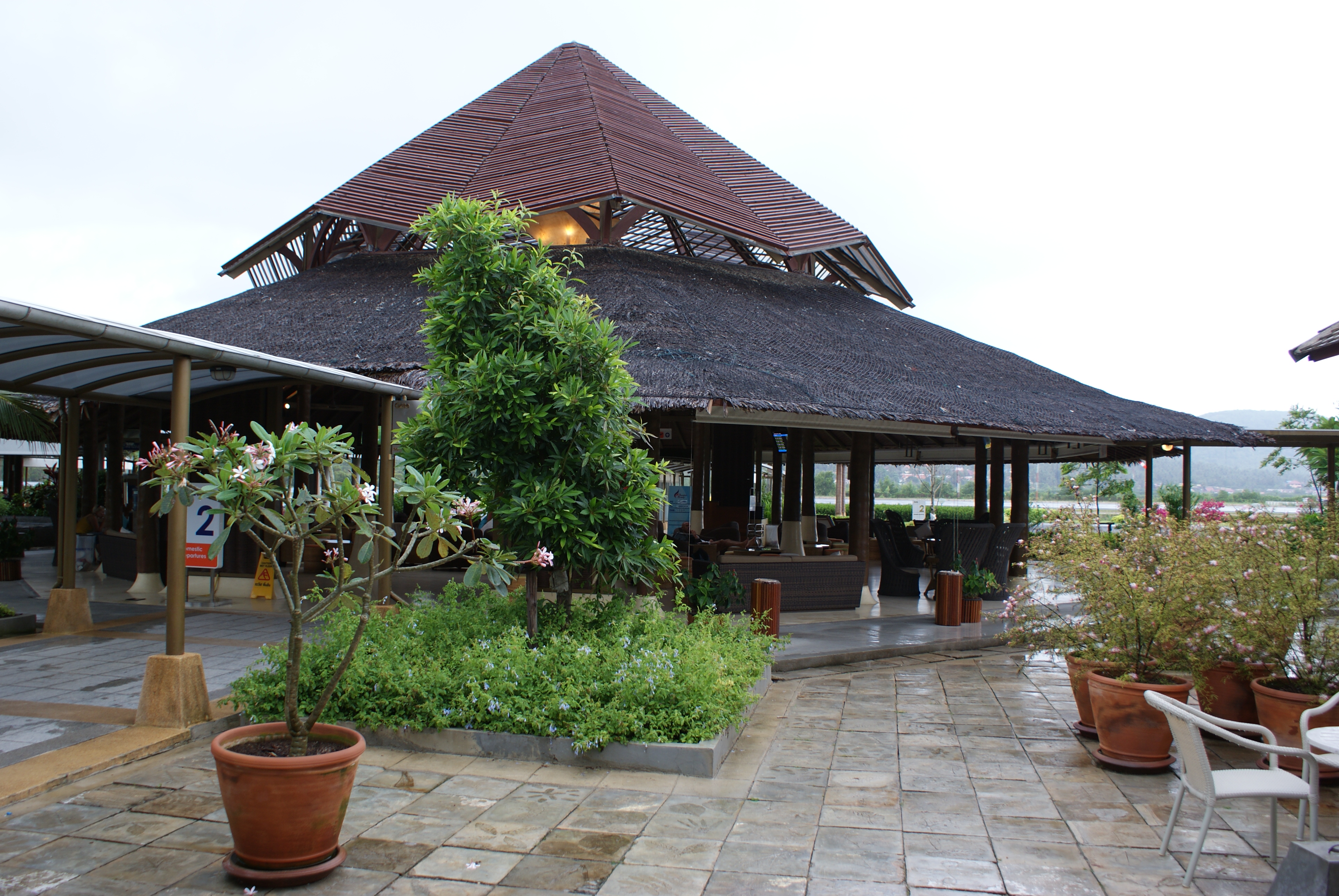
Southern Thailand has five international airports and six domestic airports. Thailand's transport ministry is constructing the 1.9 billion baht Betong Airport. It is scheduled for completion in 2020.
- Chumphon Airport
- Hat Yai International Airport
- Krabi International Airport
- Nakhon Si Thammarat Airport
- Narathiwat Airport
- Pattani Airport
- Phuket International Airport
- Ranong Airport
- Ko Samui International Airport
- Surat Thani International Airport
- Trang Airport
References
References
- (2019). "ตารางที่ 2 พี้นที่ป่าไม้ แยกรายจังหวัด พ.ศ.2562".
- (31 December 2018). "รายงานสถิติจำนวนประชากรและบ้านประจำปี พ.ศ.2561".
- (July 2019). "''Gross Regional and Provincial Product, 2019 Edition''". Office of the National Economic and Social Development Council (NESDC).
- "Thailand: Major Cities, Towns & Communes - Population Statistics, Maps, Charts, Weather and Web Information".
- (2002). "Terrestrial Ecoregions of the Indo-Pacific: a Conservation Assessment". Island Press.
- (July 2018). "Revisions to the Gross Regional and Provincial Product 2016 Edition". The Office of the National Economic and Social Development Board (NESDB).
- (2019). "Weather - Southern-east coast". Thai Meteorological Department.
- {{cite report. (2017). National Economic and Social Development Board (NESDB). link
- {{cite report. (2017). National Economic and Social Development Board (NESDB). link
- "Population by religion, region and area, 2015". NSO.
- "Population by religion, region and area, 2018". NSO.
- (25 August 2017). "Songkhla power plant sit-in an energy wake-up call". Bangkok Post.
- "Phitsanulok Provincial Statistical Report 2562-2019: Economic Statistics - National Accounts". National Statistical Office (NSO).
- (27 August 2018). "Better days around the bend". Bangkok Post.
This article was imported from Wikipedia and is available under the Creative Commons Attribution-ShareAlike 4.0 License. Content has been adapted to SurfDoc format. Original contributors can be found on the article history page.
Ask Mako anything about Southern Thailand — get instant answers, deeper analysis, and related topics.
Research with MakoFree with your Surf account
Create a free account to save articles, ask Mako questions, and organize your research.
Sign up freeThis content may have been generated or modified by AI. CloudSurf Software LLC is not responsible for the accuracy, completeness, or reliability of AI-generated content. Always verify important information from primary sources.
Report