From Surf Wiki (app.surf) — the open knowledge base
South Road
Road in Adelaide, South Australia
Road in Adelaide, South Australia
| Field | Value | |
|---|---|---|
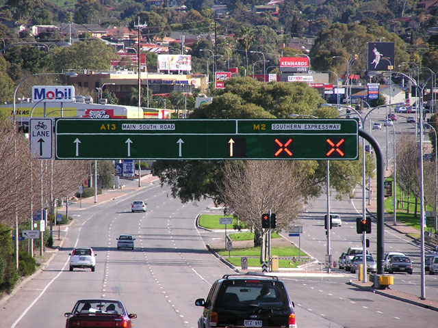
| image | South rd edwardstown south.jpg | |
| caption | South Road near Edwardstown | |
| type | road | |
| road_name | South Road | |
| road_name2 | Main South Road | |
| state | sa | |
| length | 117 | |
| length_ref | ||
| route | {{plainlist | |
| former | {{plainlist | |
| direction_a | North | |
| direction_b | South | |
| mapframe | no | |
| coordinates_a | ||
| coordinates_b | ||
| pushpin_label_position_a | top | |
| pushpin_label_position_b | bottom | |
| end_a | Salisbury Highway | |
| Port River Expressway | ||
| Wingfield, Adelaide | ||
| end_b | Flinders Drive | |
| Cape Jervis, South Australia | ||
| exits | {{plainlist | |
| region | Western Adelaide, Southern Adelaide, Fleurieu and Kangaroo Island | |
| through | , |
- A2 (2017–present) (Wingfield–Darlington)
- A13 (1998–present) (Darlington–Old Noarlunga)
- B23 (1998–present) (Old Noarlunga–Cape Jervis)
- Concurrencies:
- R1 (2017–present) (through Mile End South)
- National Highway A13 (1998–2017) (through Wingfield)
- A13 (1998–2017) (Wingfield–Darlington) Port River Expressway Wingfield, Adelaide Cape Jervis, South Australia
- Grand Junction Road
- Port Road
- Sir Donald Bradman Drive
- Anzac Highway
- Cross Road
- Southern Expressway
- Victor Harbor Road
- Range Road}} South Road (and its southern section as Main South Road outside of Adelaide) is a major north–south conduit connecting Adelaide and the Fleurieu Peninsula, in South Australia. It is one of Adelaide's most important arterial and bypass roads. As South Road, it is designated part of route A2 within suburban Adelaide. As Main South Road, it is designated part of routes A13 and B23.
The northern part of South Road contributes the central component of the North–South Corridor, a series of road projects under construction or planning that will eventually provide a continuous expressway between Old Noarlunga and Gawler.
Route
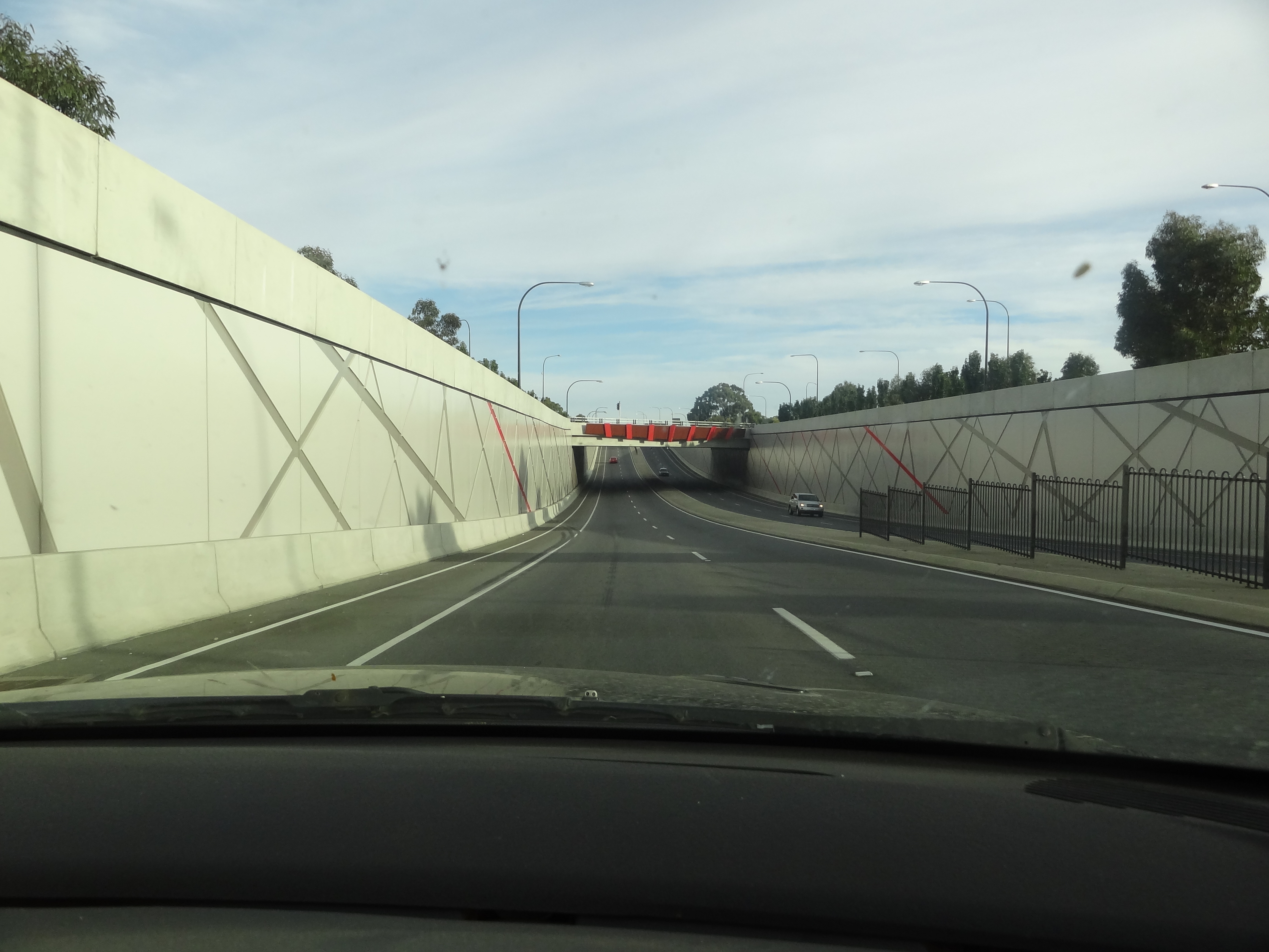
South Road starts at the intersection of the Port River Expressway and the Salisbury Highway in Wingfield. It runs directly south, through much of Adelaide's inner western suburbs, close to the Adelaide city centre. It is complimented by, and in some instances, subsumed into the North-South Motorway. It either runs directly underneath it at ground level with the motorway above it on elevated carriageways, or straddles it on each side with the motorway lowered into a trench.
The motorway currently ends in Hindmarsh just south of the intersections with Port Road and Grange Road. South Road then becomes the main traffic route southwards.
South Road continues south through Mile End and Edwardstown until St Marys, where the Southern Expressway starts in a lowered trench. South Road straddles it on each side, until it reaches the intersection of Ayliffes and Shepherds Hill Roads at Tonsley, where its name changes to Main South Road. It continues through Old Noarlunga (where Victor Harbor Road branches off) and runs parallel to the coastline of Gulf St Vincent. At Normanville, it is known as Willis Drive for 2 km, then continues to Cape Jervis at its southern tip.
The Southern Expressway runs roughly parallel to Main South Road for 18 km between Darlington and Noarlunga and serves to reduce traffic congestion. Main South Road and the Southern Expressway have 3 different intersections along the length of the roads.
History
The first reference to South Road was made in 1842. The South Australian Gazette referred to sheep stations near the corner of South Road and Sturt Road, in what is now Bedford Park.
South Road of today was until the 1970s known by a string of names: Shillabeer Avenue (from what was then its northern terminus at Regency Road to Torrens Road); Government Road (between Torrens and Port Roads); John Street (Port to Grange Roads); Taylors Road (between Grange and Henley Beach Roads); Fisher Terrace (Henley Beach Road to Anzac Highway), and South Road from Anzac Highway southwards.
The town of Old Reynella was bypassed in 1964. Old Noarlunga was bypassed in 1972.
The South Road Extension was built at Dry Creek in the early 1990s, connecting South Road and the Salisbury Highway, between Grand Junction Road and Port Wakefield Road. This was superseded by the Port River Expressway, which opened in 2005.
Congestion and upgrades
South Road suffers from traffic congestion due to its importance as one of Adelaide's main arterial roads and bypasses.
Between 1982 and 1984, an overpass was built at Emerson Crossing, taking South Road over Cross Road and the Seaford railway line. For a long time, this was the only grade separation on South Road, and one of very few in South Australia, removing congestion with Cross Road traffic and the railway line. However, increasing frequency of commuter trains results in vehicle bottlenecks that are anticipated to worsen. Queues on the exit ramps to Cross Road can extend into the through lanes on South Road. The rail crossing can be closed for up to 20 minutes in the peak hour.
In November 2005, the Royal Automobile Association (RAA) released its recommendations to the South Australian government in regards to the road network. South Road was found to be the poorest road in the state, registering a 2/10 on the RAA's scale. The recommendations given included $6 billion of funds to upgrade the roads of South Australia – with $1.5–2 billion to be spent on South Road alone. The RAA's plan for the road included a 6 km tunnel from Port Road all the way to the Anzac Highway underpass. The plan called for over/underpasses at six other major intersections and two rail crossings.
In 2005, along with the decision to make a free flowing South Road, a decision was made to build an underpass for South Road to go under Anzac Highway. Named the Gallipoli Underpass in line with the ANZAC theme, construction started in 2007. The underpass opened in March 2009. To cut down on delays due to construction, an overpass was built at the same time for the Glenelg tram line just half a kilometre to the south, which opened in 2009, significantly removing delays from the area.
In August 2007, Prime Minister John Howard announced that South Road was to be included in the AusLink National Road Network, and pledged $1 billion in funding for the project between 2007 and 2020.
North–South Motorway
Main article: North–South Motorway
The North–South Motorway is an incomplete motorway intended to replace South Road as Adelaide's primary north–south roadway. Running along the same road corridor as South Road and extending further north, the motorway has been progressively constructed in stages. As of November 2020, approximately 22 km of the total 35 km length has been completed.
The first section of the motorway, known as the South Road Superway, was announced in October 2009. It is 3–4 km of elevated motorway running from the Port River Expressway to the intersection with Regency Road. The project started in 2010 and was completed in early 2014.
Following the 2013 Australian federal election, the section of South Road between Torrens Road and the River Torrens was identified and funded for an upgrade. 4 km of lowered motorway was built between the northbound and southbound lanes of South Road. The Torrens to Torrens lowered motorway started construction in 2015 and opened to traffic in 2018. The project included replacing a level crossing of the Outer Harbor railway line, with a new bridge in 2017.
The Darlington Upgrade, an extension of the Southern Expressway through Bedford Park by use of a similar lowered motorway concept, was also identified at this time. Both of these upgrades involved land acquisition to widen the road corridor, surface grade local carriage ways on the edges, and a lowered central roadway carrying the free-flow traffic below the crossing routes. The Darlington Upgrade began construction in 2016 and was opened in 2020.
An upgrade of Regency Road to Pym Street, the gap between the elevated South Road Superway and the (then) almost-completed Torrens to Torrens lowered motorway, was announced in May 2018, to be jointly funded by the state and federal governments. Main construction began in late 2019. The overpass opened at reduced speeds in March 2021.
Preliminary plans for the final section stretching from the River Torrens to Darlington (T2D), which would use a combination of deep-bored tunnels, lowered motorway and surface-level motorway, were announced in late 2020. T2D is under construction.
Major intersections
Salisbury Highway (A9 east) Manton Street (east) Northern terminus of route A2, route M2 continues north along North-South Motorway Deacon Avenue (southwest) – Richmond Oval Southern terminus of route A2, route M2 continues south along Southern Expressway Shepherds Hill Road (south) Northbound entry to and southbound exit from Shepherds Hill Road only Name change: South Road (north), Main South Road (southwest) Northern terminus of route A13 Flagstaff Road (south) Pimpala Road (east) Bains Road (east) Wheatsheaf Road (east) Doctors Road (east) Northern terminus of route B23, route A13 continues south along Victor Harbor Road Tatachilla Road (east)
Tram stop
South Road is also the location of a stop on the Glenelg tram line.
Gallery
Image:South_rd_edwardstown_south.jpg|Looking south from the Cross Road Overpass, Edwardstown. File:TransAdelaide train at Emerson Crossing, Adelaide.jpg|The South Road overpass at Cross Road / Emerson Station.
References
- South Road
References
- "South Road".
- "Location SA Map viewer with regional layers". [[Government of South Australia]].
- "South Road: Past, present and future". Royal Automobile Association of South Australia Inc (RAA).
- Sands and McDougall's Directory, 1962.
- (24 January 2012). "Local Studies. Former Cricketers".
- (24 July 2007). "Old Noarlunga". [[City of Onkaparinga]].
- (May 2015). "North–South Corridor The 10 year Strategy". Department of Planning, Transport and Infrastructure.
- link. (15 January 2009)
- (2008-06-19). "Glenelg Tram Overpass". South Australian Department for Transport, Energy and Infrastructure.
- [http://www.pm.gov.au/media/Release/2007/Media_Release24500.cfm Media Releases] {{webarchive. link. (29 August 2007)
- "Darlington Upgrade Project". [[Department of Planning, Transport and Infrastructure]], [[Government of South Australia]].
- (5 August 2015). "North-South Corridor: Torrens Road to River Torrens". Department of Planning, Transport and Infrastructure, Government of South Australia.
- (31 July 2015). "T2T". T2T Alliance.
- [http://www.t2talliance.com.au/t2t-project-january-2017-outer-harbor-rail-overpass-temporary-south-road-closure/ Outer Harbor Rail Overpass & Temporary South Road Closure] T2T Alliance
- "Regency Road to Pym Street". [[Department of Planning, Transport and Infrastructure]], [[Government of South Australia]].
- Tudge, Alan. (5 July 2019). "Building Regency to Pym to begin this year". [[Government of South Australia]].
- (30 March 2021). "Regency Road overpass open to traffic". R2P Alliance.
- Wingard, Corey. (19 February 2021). "Regency to Pym project on the home stretch – finishing early and under budget". [[Government of South Australia]].
- (10 November 2020). "Budget 2020: The key measures". InDaily.
- (30 October 2025). "River Torrens to Darlington (T2D) Project".
- (27 October 2025). "Department for Infrastructure and Transport".
- "Location SA Map viewer with LGA layers". [[Government of South Australia]].
- "Location SA Map viewer with suburb layers". [[Government of South Australia]].
- (15 March 1945). "Locking of Torrens". [[The Advertiser (Adelaide)]].
- [https://www.adelaidemetro.com.au/timetables/view/GLNELG/0/1/0# Glenelg Tram Timetable (2018)] {{Webarchive. link. (2 April 2019 , [[Adelaide Metro]])
This article was imported from Wikipedia and is available under the Creative Commons Attribution-ShareAlike 4.0 License. Content has been adapted to SurfDoc format. Original contributors can be found on the article history page.
Ask Mako anything about South Road — get instant answers, deeper analysis, and related topics.
Research with MakoFree with your Surf account
Create a free account to save articles, ask Mako questions, and organize your research.
Sign up freeThis content may have been generated or modified by AI. CloudSurf Software LLC is not responsible for the accuracy, completeness, or reliability of AI-generated content. Always verify important information from primary sources.
Report