From Surf Wiki (app.surf) — the open knowledge base
South Khorasan province
Province of Iran
Province of Iran
| Field | Value |
|---|---|
| name | South Khorasan Province |
| native_name | fa |
| settlement_type | Province |
| image_skyline | {{multiple image |
| border | infobox |
| total_width | 300 |
| perrow | 1/1/2/2/2 |
| image1 | Shokatieh.jpg |
| alt1 | Shokatieh |
| image2 | باغ گلشن - طبس - یزد.jpg |
| alt2 | Golshan Garden |
| image3 | قلعه بیرجند-2.jpg |
| alt3 | Birjand Citadel |
| image4 | View of the main door of the mosque.jpg |
| alt4 | Qaen |
| image5 | Iran, South Khorasan Province, Birjand County, Bande Darre.jpg |
| alt5 | Bande Darre |
| image6 | خانه مستوفی بشرویه-3.jpg |
| alt6 | Mostoufi Historical House of Boshrouyeh |
| image_map1 | IranSouthKhorasan-SVG.svg |
| map_caption1 | Location of South Khorasan Province within Iran |
| coordinates | |
| coordinates_footnotes | |
| subdivision_type | Country |
| subdivision_name | Iran |
| subdivision_type1 | Region |
| subdivision_name1 | Region 5 |
| parts_type | Counties |
| parts_style | para |
| p1 | 12 |
| seat_type | Capital |
| seat | Birjand |
| leader_party | Principlist |
| leader_title | Governor-general |
| leader_name | Mohammad-Reza Hashemi |
| unit_pref | Metric |
| area_total_km2 | 151913 |
| population_footnotes | |
| population_total | 768898 |
| population_as_of | 2016 |
| population_density_km2 | auto |
| timezone1 | IRST |
| utc_offset1 | +03:30 |
| iso_code | IR-29 |
| blank_name_sec1 | Main language(s) |
| blank_info_sec1 | Persian |
| blank1_name_sec1 | HDI (2017) |
| blank1_info_sec1 | 0.757 |
| · 27th | |
| website | sko.ir |
· 27th
South Khorasan province () is one of the 31 provinces of Iran, located in the eastern part of the country. Its capital is the city of Birjand. In 2014, the province was placed in Region 5. This province is bordered to the north by Razavi Khorasan Province, to the northwest by Semnan Province, to the west by Isfahan and Yazd Provinces, to the south by Kerman Province, and to the southeast by Sistan and Baluchestan Province. The area of this province is 151,913 square kilometers (58,654 square miles), making it the third largest province in Iran after Kerman and Sistan and Baluchestan. According to the 2016 census, South Khorasan's population is 768,898, making it the fourth least populous province in the country. With only about 5 PD/km2, it is the most sparsely populated province in Iran.
South Khorasan Province is split into two distinct regions: the "mountainous and elevated" areas in the north and northwest, and the "low and flat" central and southern plains. The tallest mountains in the province include "Kamarak" and "Shah Kuh." It experiences a "dry and desert" climate, which can be further divided into "hot and dry" and "mild and dry" categories. The northern and northwestern parts are more fertile, while the southern and southwestern plains endure a dry and harsh climate. The rivers in this region are seasonal, with no permanent rivers present.
History
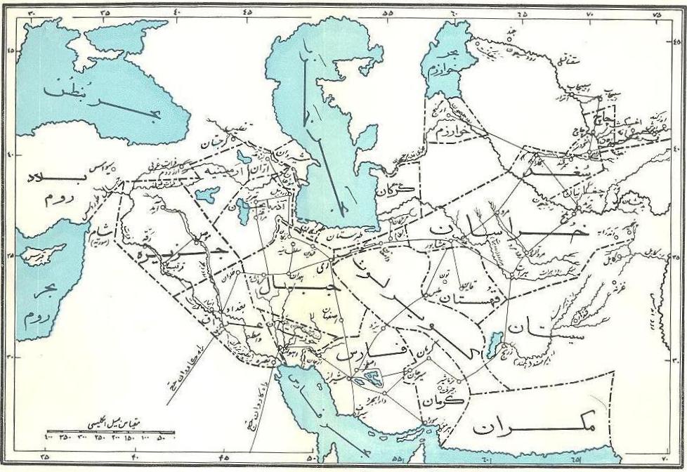
Greater Khorasan has witnessed the rise and fall of many dynasties and governments in its territory throughout history. Various tribes of the Arabs, Turks, Kurds and Turkmen brought changes to the region time and time again. , Mongols Ancient geographers of Iran divided Iran ("Iran-Shahr") into eight segments of which the most flourishing and largest was the territory of Greater Khorasan. Esfarayen, among other cities of the province, was one of the focal points for the residence of the Aryan tribes after entering Iran.
The Parthian empire was based near Merv in Khorasan for many years. At Parthians times, Esfarayen was one of the important villages of Nishapur.
During the Sassanid dynasty, the province was governed by a Spahbod (Lieutenant General) called "Padgoosban" and four margraves, each commander of one of the four parts of the province.
Khorasan was divided into four parts during the Muslim conquest of Persia, each section being named after the four largest cities, Nishapur, Merv, Herat, and Balkh.
In the year 651, the army of Islamic Arabs invaded Khorasan. The territory remained in the hands of the Abbasid clan until 820, followed by the rule of the Iranian Taherid clan in the year 896 and the Samanid dynasty in 900.
Mahmud of Ghazni conquered Khorasan in 994 and in the year 1037 Toghrül, the first of the Seljuq empire rulers conquered Nishapur.
Mahmud of Ghazni retaliated against the invaders several times, and finally the Ghaznavids defeated Sultan Sanjar. But there was more to come, as in 1157 Khorasan was conquered by the Khwarazmids and because of simultaneous attacks by the Mongols, Khorasan was annexed to the territories of the Mongol Ilkhanate.
In the 14th century, a flag of independence was hoisted by the Sarbedaran movement in Sabzevar, and in 1468, Khorasan came into the hands of Tamerlane and the city of Herat was declared as the capital.
In 1507, Khorasan was occupied by Uzbek tribes. After the death of Nader Shah in 1747, parts of it were occupied by the Afghans for a short period.
In these periods, Birjand was a small part of Quhistan which almost encompasses the borders of today South Khorasan. The main cities of Quhistan were Toon (now Ferdows) and Qaen. Birjand grew in recent centuries, especially during the Qajar dynasty and found its important role in this region.
This region was a place of refuge for some movements like the Ismaili, and was the target of Arab refugees who escaped from the tyranny of the Abbasid caliphate. Zoroastrian vestiges also exist in the area.
In 1824, Herat became independent for several years when the Afghan Empire was split between the Durranis and Barakzais. The Persians sieged the city in 1837, but the British assisted the Afghans in repelling them. In 1856, the Persians launched another invasion, and briefly managed to recapture the city; it led directly to the Anglo-Persian War. In 1857 hostilities between the Persians and the British ended after the Treaty of Paris was signed, and the Persian troops withdrew from Herat. Afghanistan reconquered Herat in 1863 under Dost Muhammad Khan, two weeks before his death.
This new province is but the old Quhistan which was included into greater Khorasan in the Iranian administrative planning. However, historically Qohistan forms a separate entity, with a distinct culture, history, environment and ecology.
South Khorasan is one of the three provinces that were created after the division of Khorasan in 2004. While at the beginning, the newly created "South Khorasan" included only Birjand County and some new counties detached from that county (i.e. Nehbandan, Darmian and Sarbisheh), in subsequent years, all northern and western cities and territories of the old Quhistan (such as Qaen, Ferdows and Tabas) have been annexed into South Khorasan, which as of 2016 consists of 11 counties.
Khorasan was the largest province of Iran until it was divided into three provinces on September 29, 2004. The provinces approved by the parliament of Iran (on May 18, 2004) and the Council of Guardians (on May 29, 2004) were Razavi Khorasan, North Khorasan, and South Khorasan.
Demographics
Population
At the time of the 2006 National Census, the province's population was 600,568 in 159,255 households. The following census in 2011 counted 662,534 people in 183,114 households. The 2016 census measured the population of the province as 768,898 in 223,984 households. It is the least densely populated province.
Administrative divisions

The population history and structural changes of South Khorasan province's administrative divisions over three consecutive censuses are shown in the following table.
| Counties | 2006 | 2011 | 2016 | ||||||||||||
|---|---|---|---|---|---|---|---|---|---|---|---|---|---|---|---|
| Birjand | 221,756 | 259,506 | 261,324 | ||||||||||||
| Boshruyeh | — | 24,683 | 26,064 | ||||||||||||
| Darmian | 51,793 | 55,080 | 53,714 | ||||||||||||
| Eshqabad | — | — | — | ||||||||||||
| Ferdows | 61,346 | 41,626 | 45,523 | ||||||||||||
| Khusf{{efn | Separated from Birjand County after the 2011 census{{cite report | title=Approval letter regarding country divisions in South Khorasan province (Birjand County) | language=fa | website=rrk.ir | url=https://rrk.ir/Files/Laws/تصويب%E2%80%8Cنامه%20درخصوص%20تقسيمات%20كشوري%20در%20استان%20خراسان%20جنوبي%20شهرستان%20بيرجند.pdf | archive-url=https://web.archive.org/web/20231109193642/https://rrk.ir/Files/Laws/تصويب%E2%80%8Cنامه%20درخصوص%20تقسيمات%20كشوري%20در%20استان%20خراسان%20جنوبي%20شهرستان%20بيرجند.pdf | last=Rahimi | first=Mohammad Reza | date=6 May 2012 | orig-date=Approved 8 May 1390 | archive-date=9 November 2023 | access-date=9 November 2023 | id=Proposal 1/4/42/81539; Notification 26948/T45233H}}}} | — | — |
| Nehbandan | 56,089 | 57,258 | 51,449 | ||||||||||||
| Qaen | 137,357 | 152,401 | 116,181 | ||||||||||||
| Sarayan | 34,636 | 32,493 | 33,312 | ||||||||||||
| Sarbisheh | 37,591 | 39,487 | 40,959 | ||||||||||||
| Tabas | — | — | 72,617 | ||||||||||||
| Zirkuh | — | — | 40,155 | ||||||||||||
| Total | 600,568 | 662,534 | 768,898 |
Cities
According to the 2016 census, 448,147 people (over 58% of the population of South Khorasan province) live in the following cities:
| City | Population |
|---|---|
| Arianshahr | 3,729 |
| Asadiyeh | 5,460 |
| Ayask | 5,143, |
| Birjand | 203,636 |
| Boshruyeh | 16,426 |
| Deyhuk | 2,959 |
| Eresk | 2,955 |
| Esfeden | 3,598 |
| Eshqabad | 3,965 |
| Eslamiyeh | 7,108 |
| Ferdows | 28,695 |
| Gazik | 2,294 |
| Hajjiabad | 6,168 |
| Khusf | 5,716 |
| Mohammadshahr | 3,590 |
| Mud | 3,477 |
| Nehbandan | 18,304 |
| Nimbeluk | 4,762 |
| Qaen | 42,323 |
| Qohestan | 2,322 |
| Sarayan | 13,795 |
| Sarbisheh | 8,715 |
| Seh Qaleh | 4,436 |
| Shusef | 3,181 |
| Tabas | 39,676 |
| Tabas-e Masina | 4,596 |
| Zohan | 1,118 |
Most populous cities
The following sorted table lists the most populous cities in South Khorasan Province.
| Rank | City | County | Population | 1 | 2 | 3 | 4 | 5 | 6 | 7 | 8 | 9 | 10 |
|---|---|---|---|---|---|---|---|---|---|---|---|---|---|
| Birjand | Birjand | 203,636 | |||||||||||
| Qaen | Qaen | 42,323 | |||||||||||
| Tabas | Tabas | 39,676 | |||||||||||
| Ferdows | Ferdows | 28,695 | |||||||||||
| Nehbandan | Nehbandan | 18,304 | |||||||||||
| Boshruyeh | Boshruyeh | 16,426 | |||||||||||
| Sarayan | Sarayan | 13,795 | |||||||||||
| Sarbisheh | Sarbisheh | 8,715 | |||||||||||
| Eslamiyeh | Ferdows | 7,108 | |||||||||||
| Hajjiabad | Zirkuh | 6,168 |
South Khorasan today
The major ethnic group in this region are the Persians. South Khorasan is known for its famous rugs as well as its saffron, barberry which is produced in almost all parts of the province.
Historic and natural attractions


South Khorasan has many historic and natural attractions, but besides these, South Khorasan encompasses various religious buildings and places of pilgrimage as well.
The Cultural Heritage of Iran lists 1179 sites of historical and cultural significance in all three provinces of Khorasan.
Some of the popular attractions of South Khorasan are:
- Birjand castle
- Deragon Cave
- Furg Citadel
- Ferdows Religious School
- Ferdows Hole-in-the-Rock
- Ferdows Hot Spring
- Ghal'eh Paeen-Shahr
- Jameh Mosque of Ferdows
- Kurit Dam
- Kushk Complex
- Nehbandan Citadel
- Polond Desert
- Qanats of Baladeh Ferdows
Higher education
- Academy of Amuzesh-e Aly
- Academy of Amuzesh-e Modiriat Dolaty
- Academy of Tarbiat-e Moalem
- Birjand University of Medical Sciences
- Birjand University of Technology
- Islamic Azad University of Birjand
- Islamic Azad University of Ferdows
- Payame Noor University
- University of Applied Science and Technology (south khorasan branch)
- University of Birjand
Gallery
File:قلعه تاریخی بیرجند.JPG|Birjand File:Bagh akbarie birjand.jpg|Birjand File:مدرسه شوکتیه.jpg|Birjand File:Kolah Farangi Arg.jpg|Birjand File:خانه مستوفی از نمای بالا.JPG|Boshruyeh File:مدرسه علیا فردوس 02.jpg|Ferdows File:کاروانسرای خوشاب-2.jpg|Ferdows File:Museum of anthropology in ferdows.jpg|Ferdows File:Imamzadeh tomb in ferdows.jpg|Ferdows File:Ferdows Hole in the Rock 3.jpg|Ferdows File:Tabas120.jpg|Tabas File:طاق شاه عباسی 11.jpg|Tabas File:Ebn-e Hesam Khoosfi's Tomb by Mostafa Alizadeh.jpg|Khusf File:Akbarieh garden.jpg|Akbarieh Garden
Notes
References
References
- ((OpenStreetMap contributors)). (7 November 2024). "South Khorasan Province".
- "Sub-national HDI - Area Database - Global Data Lab".
- Habibi, Hassan. (c. 2015). "Approval of the organization and chain of citizenship of the elements and units of the divisions of Khorasan province, centered in Mashhad". Ministry of the Interior, Defense Political Commission of the Government Council.
- (22 June 2014). "همشهری آنلاین-استانهای کشور به ۵ منطقه تقسیم شدند (Provinces were divided into 5 regions)". Hamshahri Online.
- "Kurds in Khorasan". CSKK.
- (1991). "The Cambridge History of Iran (Vol. 7): From Nadir Shah to the Islamic Republic". Cambridge University Press.
- Ewans. (2002). "Afghanistan: A short History of its People and Politics". Perennial.
- "Census of the Islamic Republic of Iran, 1385 (2006): South Khorasan Province". The Statistical Center of Iran.
- "Census of the Islamic Republic of Iran, 1390 (2011): South Khorasan Province". The Statistical Center of Iran.
- "Census of the Islamic Republic of Iran, 1395 (2016): South Khorasan Province". The Statistical Center of Iran.
- (12 November 2008). "Boshruyeh District was upgraded to a county". Ministry of the Interior, Cabinet of Ministers.
- Mokhbar, Mohammad. (19 August 2024). "Approval letter regarding national divisions in Tabas, Boshruyeh, and Bardaskan Counties of South Khorasan province". Ministry of the Interior, Council of Ministers.
- Rahimi, Mohammad Reza. (19 December 2013). "Approval letter regarding the abstraction of Tabas County from Yazd province and its annexation to South Khorasan province". Ministry of the Interior, Council of Ministers.
- Rahimi, Mohammad Reza. (c. 2021). "Reforms and creation of national divisions in Qaen and Zirkuh Counties in South Khorasan province". Ministry of the Interior, Board of Ministers.
- "Ethnologue report for Southern Pashto: Iran (1993)". [[Ethnologue]]: Languages of the World.
- "Home".
- "Home".
This article was imported from Wikipedia and is available under the Creative Commons Attribution-ShareAlike 4.0 License. Content has been adapted to SurfDoc format. Original contributors can be found on the article history page.
Ask Mako anything about South Khorasan province — get instant answers, deeper analysis, and related topics.
Research with MakoFree with your Surf account
Create a free account to save articles, ask Mako questions, and organize your research.
Sign up freeThis content may have been generated or modified by AI. CloudSurf Software LLC is not responsible for the accuracy, completeness, or reliability of AI-generated content. Always verify important information from primary sources.
Report