From Surf Wiki (app.surf) — the open knowledge base
Somme (river)
River in France

River in France
| Field | Value |
|---|---|
| name | Somme |
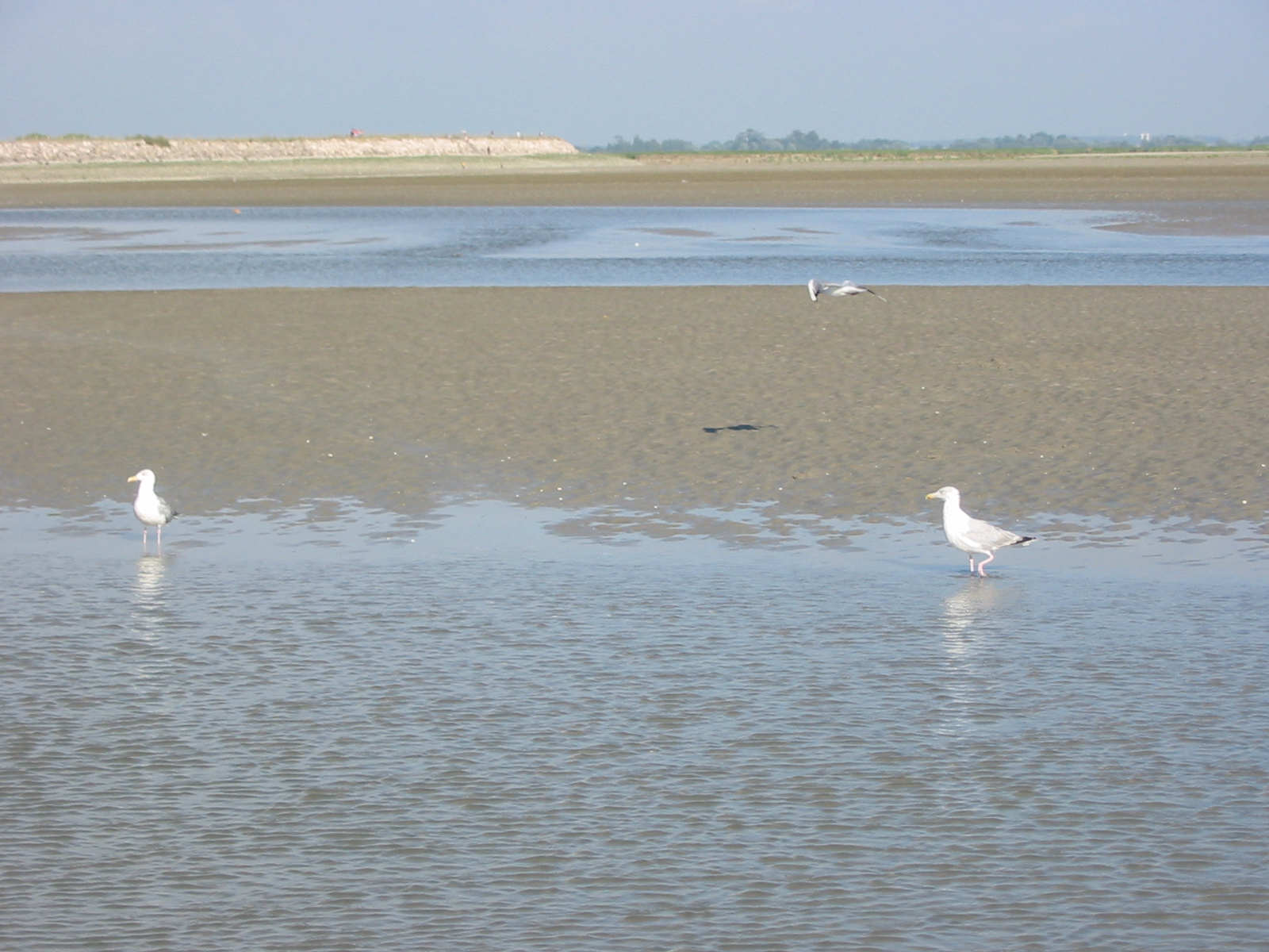
| image | Somme.JPG |
| image_caption | The Somme |
| map | Bassin de la Somme.svg |
| map_caption | Somme basin with course in Northern France |
| subdivision_type1 | Country |
| subdivision_name1 | France |
| subdivision_type3 | Region |
| subdivision_name3 | Picardy |
| length | 245 km |
| discharge1_location | Abbeville |
| discharge1_avg | 35 m3/s |
| source1_location | Fonsommes |
| source1_coordinates | |
| source1_elevation | 85 m |
| mouth_location | Saint-Valery-sur-Somme |
| English Channel | |
| mouth_coordinates | |
| basin_size | 6550 km2 |
English Channel
The Somme ( , ; ) is a river in Picardy, northern France.
The river is 245 km in length, from its source in the high ground of the former at Fonsomme near Saint-Quentin, to the Bay of the Somme, in the English Channel. It lies in the geological syncline which also forms the Solent. This gives it a fairly constant and gentle gradient where several fluvial terraces have been identified.
Name
The Somme river was known in ancient times as Samara. It presumably means 'the summery river', that is to say the 'quiet river', stemming from an adjective *sam-aro- ('summery') itself derived from the Celtic root *samo- ('summer').
The city of Amiens was also known as Samarobriva (Gaulish: 'bridge on the Samara'). It is attested by the early 1st century BC as the chief town of the Ambiani, an ancient Gallic tribe of the region. The modern department of Somme was named after this river.
History
thumb|left|[[Edward III Crossing the Somme]], [[King Edward III]] (at the [[Battle of Blanchetaque]]): painting by [[Benjamin West]], 1788 The Somme has featured prominently in several military campaigns. In 1066, the invasion fleet of William the Conqueror assembled in the Bay of the Somme, at Saint-Valery-sur-Somme. The river also featured in the 1346 withdrawal of Edward III of England's army, which forded the river at the Battle of Blanchetaque during the campaign, which culminated in the Battle of Crécy. Crossing the river also featured prominently in the campaign which led to the Battle of Agincourt in 1415.
In 1636, a Spanish army led by Thomas Francis, Prince of Carignano, crossed the Somme defeating a French army during the Thirty Years War threatening Paris.
Most famously, the Battle of the Somme, during World War I, lasted from July to November 1916 and resulted in more than a million casualties. Private A. S. Bullock in his wartime memoir recalled his first sight of it in early April 1918: "... we reached a small place called Hengest sur Somme. The train stopped and we descended. There in front of us was a muddy, sluggish and somewhat narrow stream, which has given its name to one of the most awful battles in history – the Somme." The great battles that finally stopped the German advance in the Spring Offensive of 1918 were fought around the valley of the Somme in places like Villers Bretonneux, which marked the beginning of the end of the war.
Départements and towns along the river
- Aisne: Saint-Quentin
- Somme : Ham, Péronne, Corbie, Amiens, Abbeville, Saint-Valery-sur-Somme, Le Crotoy

Tributaries
The tributaries listed comprise:
Hydrology==
The river is characterized by a very gentle gradient and a steady flow. The valley is more or less steep-sided but its bottom is flat with fens and pools. These characteristics of steady flow and flooded valley bottom arise from the river's being fed by the ground water in the chalk basin in which it lies. At earlier, colder times, from the Günz to the Würm (Beestonian or Nebraskan to Devensian or Wisconsinian) the river has cut down into the Cretaceous geology to a level below the modern water table. The valley bottom has now therefore, filled with water which, in turn, has filled with fen. , of the source of the Somme in 1986, shows it when the water table had fallen below the surface of the chalk in which the aquifer lies. Here, the flow of water had been sufficient to keep fen from forming.
One of the fens, the Marais de l'Île is a nature reserve in the town of St.Quentin. The traditional market gardens of Amiens, the Hortillonages are on this sort of land but drained. Once exploited for peat cutting, the fen is now used for fishing and shooting
In 2001, the Somme valley was affected by particularly high floods, which were in large part due to a rise in the water table of the surrounding land.
Navigation and canals
The construction of the Canal de la Somme began in 1770 and reached completion in 1843. It is 156 km long, beginning at St.Simon and opening into the Bay of the Somme. From St.Simon to Froissy (near Bray sur Somme, south of Albert), the canal is alongside the river. Thence to the sea, the river is partly river and partly navigation. From Abbeville, it is diverted through the silted, former estuary, to Saint-Valery-sur-Somme, where the maritime canal, once called the canal du Duc d'Angoulême enters the English Channel.

The St Quentin Canal, famous for the 1918 battle, links the Somme to northern France and Belgium and southward to the Oise. The Canal du Nord also links the Somme to the Oise, at Noyon, thence to Paris.
Notes
References
Citations
Sources
- Delattre, Ch., Mériaux, E. and Waterlot, M. Guides Géologiques Régionaux: Région du Nord, Flandre Artois Boulonnais Picardie (1973)
References
- {{cite LPD. 3
- {{cite EPD. 18
- (2006). "Modelling the long-term fluvial erosion of the river Somme during the last million years.". Terra Nova.
- {{harvnb. Falileyev. 2010, s.v. ''Samara'' and ''Samarobriva Ambianorum.''
- Hanotaux, Gabriel. (1933–1947). "Histoire du cardinal de Richelieu".
- Bullock, Arthur Stanley. (2009). "Gloucestershire Between the Wars: a memoir". The History Press.
- "Google Maps".
- (27 May 2005). "HYDRO2 Internet PHP".
- [https://web.archive.org/web/20060511083551/http://hydro.rnde.tm.fr/Traitement/Entre2Gene.php?StaCode=E6440910&Annee=1993 1993]
- [https://web.archive.org/web/20060511225634/http://hydro.rnde.tm.fr/Traitement/Entre2Gene.php?StaCode=E6440910&Annee=1995 1995]
- [https://web.archive.org/web/20060511160626/http://hydro.rnde.tm.fr/Traitement/Entre2Gene.php?StaCode=E6440910&Annee=1997 1997]
- [https://web.archive.org/web/20060512180452/http://hydro.rnde.tm.fr/Traitement/Entre2Gene.php?StaCode=E6440910&Annee=1998 1998]
- [https://web.archive.org/web/20060511120029/http://hydro.rnde.tm.fr/Traitement/Entre2Gene.php?StaCode=E6440910&Annee=1999 1999]
- [https://web.archive.org/web/20060511083617/http://hydro.rnde.tm.fr/Traitement/Entre2Gene.php?StaCode=E6440910&Annee=2001 2001]
- [https://web.archive.org/web/20060511160638/http://hydro.rnde.tm.fr/Traitement/Entre2Gene.php?StaCode=E6440910&Annee=2003 2003]
- [https://web.archive.org/web/20060511120146/http://hydro.rnde.tm.fr/Traitement/Entre2Gene.php?StaCode=E6440910&Annee=2005 2005]
- [https://web.archive.org/web/20060511160604/http://hydro.rnde.tm.fr/Traitement/Qjm.php?StaCode=E6351410&Annee=1987 1987]
- [https://web.archive.org/web/20060511115936/http://hydro.rnde.tm.fr/Traitement/Qjm.php?StaCode=E6351410&Annee=1989 1989]
- [https://web.archive.org/web/20060511160620/http://hydro.rnde.tm.fr/Traitement/Qjm.php?StaCode=E6351410&Annee=1991 1991]
- [https://web.archive.org/web/20060512180443/http://hydro.rnde.tm.fr/Traitement/Qjm.php?StaCode=E6351410&Annee=1992 1992]
- [https://web.archive.org/web/20060511120059/http://hydro.rnde.tm.fr/Traitement/Qjm.php?StaCode=E6351410&Annee=1993 1993]
- [https://web.archive.org/web/20060511115919/http://hydro.rnde.tm.fr/Traitement/Qjm.php?StaCode=E6351410&Annee=1995 1995]
- [https://web.archive.org/web/20060511120141/http://hydro.rnde.tm.fr/Traitement/Qjm.php?StaCode=E6351410&Annee=1996 1996]
- [https://web.archive.org/web/20060511185230/http://hydro.rnde.tm.fr/Traitement/Qjm.php?StaCode=E6351410&Annee=1997 1997]
- [https://web.archive.org/web/20060511191456/http://hydro.rnde.tm.fr/Traitement/Qjm.php?StaCode=E6351410&Annee=1999 1999]
- [https://web.archive.org/web/20060512164359/http://hydro.rnde.tm.fr/Traitement/Qjm.php?StaCode=E6351410&Annee=2000 2000]
- [https://web.archive.org/web/20060512140439/http://hydro.rnde.tm.fr/Traitement/Qjm.php?StaCode=E6351410&Annee=2001 2001]
- [https://web.archive.org/web/20060512230000/http://hydro.rnde.tm.fr/Traitement/Qjm.php?StaCode=E6351410&Annee=2002 2002]
- [https://web.archive.org/web/20060511185216/http://hydro.rnde.tm.fr/Traitement/Qjm.php?StaCode=E6351410&Annee=2003 2003]
- [https://web.archive.org/web/20060512183812/http://hydro.rnde.tm.fr/Traitement/Qjm.php?StaCode=E6351410&Annee=2004 2004]
- [https://web.archive.org/web/20060511182648/http://hydro.rnde.tm.fr/Traitement/Qjm.php?StaCode=E6351410&Annee=2005 2005]
This article was imported from Wikipedia and is available under the Creative Commons Attribution-ShareAlike 4.0 License. Content has been adapted to SurfDoc format. Original contributors can be found on the article history page.
Ask Mako anything about Somme (river) — get instant answers, deeper analysis, and related topics.
Research with MakoFree with your Surf account
Create a free account to save articles, ask Mako questions, and organize your research.
Sign up freeThis content may have been generated or modified by AI. CloudSurf Software LLC is not responsible for the accuracy, completeness, or reliability of AI-generated content. Always verify important information from primary sources.
Report